Pollards Hill

Last updated

Pollards Hill
Sherwood Park Road, Pollards Hill - geograph.org.uk - 1553530.jpg
Typical homes in Pollards Hill, London Borough of Merton
Greater London UK location map 2.svg
Red pog.svg
Pollards Hill
Location within Greater London
Population10,287 (2011 Census. Ward) [1]
OS grid reference TQ299684
London borough
Ceremonial county Greater London
Region
Country England
Sovereign state United Kingdom
Post town MITCHAM
Postcode district CR4
Post town LONDON
Postcode district SW16
Dialling code 020
Police Metropolitan
Fire London
Ambulance London
UK Parliament
London Assembly
List of places
UK
England
London
51°24′14″N0°07′25″W / 51.4040°N 0.1235°W / 51.4040; -0.1235

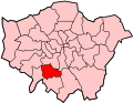
Pollards Hill is a small residential district straddling the south London boroughs of Croydon and Merton between Mitcham, Norbury and Thornton Heath. The boundary of the two boroughs is a street named Recreation Way. No roads directly cross the Croydon/Merton divide, and streets were planned according to each borough, leading to differing architectural or building schemes. Pollards Hill lends its name to a ward of the London Borough of Merton.

Contents

History

Mitcham Borough Council (MBC) dissolved in 1965 on incorporation into London. It helped to meet the post-World War II housing shortage, wrought by the London Blitz, by building prefabricated ‘Arcon’ bungalows at Pollards Hill. The first were ready by January 1946, meant to last about 10 years. Many remained until the mid-1960s. The pre-fabs were mostly demolished in the 1960s, to make way for a new, high density, low-rise scheme that was constructed by Merton London Borough Council and Wimpey Homes between 1967 and 1971.

Separately, four landmark maisonette blocks were built by MBC in the 1950s on Yorkshire Road: Westmorland Square (1950), Castleton Road (1956) and between those years Hertford Way and Berkshire Way.

A branch library and community centre were built, which received a design award.[ further explanation needed ]

Governance

Councillors

Both sides of Pollards Hill elected Labour Party councillors at the last Council elections in May 2022. At present in the local government re-warding process used nationally for the regular election of a delegation of councillors, it lends its name to a ward of the Merton.

UK elections (general elections and by-elections)

East and west have, since 1992 and 1997, respectively seen their relevant two seats in London, locally dependent wholly on borough, return Labour MPs. The seats are Croydon North and Mitcham and Morden. The narrower majority, narrowly, is in the latter; at all elections since 1997 the two seats have seen a greater than 28% Labour majority.

Geography

To the east (in Croydon), covering the sides of the hill, are larger houses, stretching towards central Norbury. The roads are lined with pollarded lime trees.

To the west (in Merton), at the foot of the hill, is the Pollards Hill estate stretching to Broad Green and Purley Way. A section of the estate was transferred to the ownership of Moat Homes housing association in 1998 under a stock transfer from the local authority. Moat has since demolished four maisonette blocks dating from the 1950s and is undertaking a wider regeneration of the stock.

Covering the crown of the hill is Pollards Hill Park, an open area of 7.75 acres (3.14 hectares), managed by Croydon Council, to whom it was donated in 1913. The park is the highest point in the Norbury area and can give views as far as Windsor Castle. A viewpoint at the top of the park indicates the direction of various landmarks. [2]

Education

In September 2006, Harris Academy Merton opened on the former site of Tamworth Manor High School. The academy is on the Merton side but right on the Croydon border. Tamworth Manor High School was originally Pollards Hill Secondary Modern School built in the 1950s, which became a comprehensive school, Pollards Hill High School, in 1968.

Transport

The nearest railway stations are Norbury railway station and Streatham Common railway station & Thornton Heath railway station. Bus routes 60, 255 serve the eastern Croydon area & Buses 152, 463 serve the western merton area.

Demography

Pollards Hill is home to the largest Ghanaian British community in the UK on the Merton side according to the 2011 census, with 6% of the population and over 600 people born in Ghana. It has a large British Asian population on the Croydon side, and the area is home to many other different nationalities.

Culture and community

Pollards Hill on the Merton side also contains a wide range of community facilities including a library, community centre, youth centre and a neighbourhood police station, the first in Merton.

In 2005, a community cycling club was set up with help from the Commonside Trust. It won the London Cycling Campaigns' award for Best Community Cycling Initiative in 2006.

See also

Related Research Articles

<span class="mw-page-title-main">London Borough of Croydon</span> London borough in United Kingdom

The London Borough of Croydon is a London borough in south London, part of Outer London. It covers an area of 87 km2 (33.6 sq mi). It is the southernmost borough of London. At its centre is the historic town of Croydon from which the borough takes its name; while other urban centres include Coulsdon, Purley, South Norwood, Norbury, New Addington, Selsdon and Thornton Heath. Croydon is mentioned in Domesday Book, and from a small market town has expanded into one of the most populous areas on the fringe of London. The borough is now one of London's leading business, financial and cultural centres, and its influence in entertainment and the arts contribute to its status as a major metropolitan centre. Its population is 390,719, making it the largest London borough and sixteenth largest English district.

<span class="mw-page-title-main">Mitcham</span> Human settlement in England

Mitcham is an area within the London Borough of Merton in Southwest London, England. It is centred 7.2 miles (11.6 km) southwest of Charing Cross. Originally a village in the county of Surrey, today it is mainly a residential suburb, and includes Mitcham Common. It has been a settlement throughout recorded history.

<span class="mw-page-title-main">Morden</span> Human settlement in England

Morden is a district and town in south London, England, within the London Borough of Merton, in the ceremonial county of Greater London. It adjoins Merton Park and Wimbledon to the north, Mitcham to the east, Sutton to the south and Worcester Park to the west, and is around 8 miles (13 km) south-southwest of Charing Cross. Prior to the creation of Greater London in 1965, for local government purposes, Morden was in the administrative and historic county of Surrey.

<span class="mw-page-title-main">Thornton Heath</span> Human settlement in England

Thornton Heath is a district of South London, England, within the London Borough of Croydon. It is around 1.5 miles (2.4 km) north of the town of Croydon, and 7.2 miles (11.6 km) south of Charing Cross. Prior to the creation of Greater London in 1965, Thornton Heath was in the County Borough of Croydon.

<span class="mw-page-title-main">Waddon</span> Human settlement in England

Waddon is a neighbourhood in the London Borough of Croydon, at the western end of the town of Croydon. The area borders the London Borough of Sutton.

<span class="mw-page-title-main">London Borough of Merton</span> London borough in United Kingdom

The London Borough of Merton is a borough in Southwest London, England.

<span class="mw-page-title-main">Merton Park</span> Human settlement in England

Merton Park is a suburb in the London Borough of Merton. It is situated in Wimbledon. Bordering areas are Colliers Wood, Morden, South Wimbledon and Raynes Park. It is 7.25 miles (11.7 km) southwest of Charing Cross.It lies 2.8 miles east of Kingston upon Thames, 3 miles west of Mitcham and 4.5 miles north of Sutton.

London Road is a popular road name in the United Kingdom. Roads called London Road include:

<span class="mw-page-title-main">Norbury</span> Area of south London, England

Norbury is an area of south London. It shares the postcode London SW16 with neighbouring Streatham. Norbury is 6.7 miles (10.8 km) south of Charing Cross.

<span class="mw-page-title-main">Wimbledon (UK Parliament constituency)</span> Parliamentary constituency in the United Kingdom, 1885 onwards

Wimbledon is a constituency in Greater London represented in the House of Commons of the UK Parliament. Since 2005, the seat has been held by Stephen Hammond of the Conservative Party.

<span class="mw-page-title-main">Parks and open spaces in the London Borough of Croydon</span>

The London Borough of Croydon has over 120 parks and open spaces within its boundaries, ranging from the 200 acre (80ha) Selsdon Wood Nature Reserve to many recreation grounds and sports fields scattered throughout the Borough. Croydon covers an area of 86.52 km², the 256th largest district in England. Croydon's physical features consist of many hills and rivers that are spread out across the borough and into the North Downs, Surrey and the rest of South London. Some of the open spaces in Croydon form part of the well-known London LOOP walks where the first section was opened on 3 May 1996 with a ceremony on Farthing Downs in Coulsdon. As a borough in Outer London it also contains some open countryside in the form of country parks. Croydon Council is associated with several other boroughs who are taking part in the Downlands Countryside Management Project. These boroughs are Sutton; and by Surrey County Council; the City of London Corporation; the Surrey districts of Reigate and Banstead and Tandridge; and the Countryside Agency. An additional partner is Natural Britain.

<span class="mw-page-title-main">A217 road</span> Road in England

The A217 is a road in London and Surrey in England. It runs north–south. It runs from Kings Road in Fulham, London, crosses the Thames at Wandsworth Bridge, then passes through Wandsworth, Earlsfield, Summerstown, Tooting, Mitcham, Rosehill and Sutton Common in Sutton, then Cheam. Then, widened as a dual carriageway, comes Belmont, a suburban district built on a slope rising southward. On the North Downs in Surrey the road then skirts past Banstead and through its late 19th century offspring villages particularly Burgh Heath and Kingswood, Surrey. It then crosses the M25 motorway at Junction 8, then, returning to single carriageways, passes through the castle town of Reigate. It then cuts through the green buffer farmland of two rural villages and terminates at the road network at Gatwick Airport's northern perimeter.

<span class="mw-page-title-main">Merton, London (parish)</span>

Merton is an ancient parish historically in Surrey, but which has since 1965 been part of Greater London. It is bounded by Wimbledon to the north, Mitcham to the east, Morden, Cheam and Cuddington to the south and (New) Malden to the west. The 1871 Ordnance Survey map records its area as 1,764.7 acres (7.1 km2).

Harris Academy Merton is a secondary school and sixth form located in the London Borough of Merton district of Mitcham. When inspected by Ofsted in both 2012 and 2022, it was judged to be outstanding.

Eastfields is an area of South London situated between Mitcham and Streatham. The area is home to St Mark's Academy secondary school and to Mitcham Eastfields railway station, which opened on 2 June 2008. The area has two council estates, Laburnum and Eastfields Estate, 5 minutes away from each other. The area is covered by the postcodes CR4 and SW16.

<span class="mw-page-title-main">Merton London Borough Council elections</span> Political party in the United Kingdom

Merton London Borough Council in London, England is elected every four years; it has administrative control over the London Borough of Merton.

Elections for the London Borough of Merton were held on 7 May 1998 to elect members of Merton London Borough Council in London, England. This was on the same day as other local elections in England and a referendum on the Greater London Authority; in the latter, Merton voted in favour of creating the Greater London Authority by 72.2% on a 37.6% turnout.

<span class="mw-page-title-main">2018 Merton London Borough Council election</span> 2018 local election in England

Elections for the London Borough of Merton were held on 3 May 2018 to elect members of Merton London Borough Council in England. This was on the same day as other local elections in England.

<span class="mw-page-title-main">2022 Croydon London Borough Council election</span> 2022 local election in Croydon

In the 2022 Croydon London Borough Council election, on 5 May 2022, all 70 members of Croydon London Borough Council, and the Mayor of Croydon, were up for election. The elections took place alongside the local elections in the other London boroughs and elections to local authorities across the United Kingdom. Jason Perry of the Conservative Party narrowly won the mayoral election.

References

  1. "Merton Ward population 2011". Neighbourhood Statistics. Office for National Statistics. Retrieved 11 October 2016.
  2. Winterman, M.A. (1988). Croydon's Parks: An illustrated history. London Borough of Croydon, Parks and Recreation Department. pp. 70–71. ISBN   0951348108.