Merton Abbey, London

Last updated

Merton Abbey
Greater London UK location map 2.svg
Red pog.svg
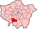
Merton Abbey
Location within Greater London
OS grid reference TQ265697
London borough
Ceremonial county Greater London
Region
Country England
Sovereign state United Kingdom
Post town London
Postcode district SW19
Dialling code 020
Police Metropolitan
Fire London
Ambulance London
UK Parliament
London Assembly
List of places
UK
England
London
51°24′45″N0°10′53″W / 51.41243°N 0.18142°W / 51.41243; -0.18142

Merton Abbey is an area in southwest London, England. It lies between South Wimbledon and Colliers Wood in the London Borough of Merton. Merton Abbey takes its name from Merton Priory, which once stood on the northern edge of the district. The area is bounded by Merton High Street to the north, the River Wandle to the west, Christchurch Road to the east and Deen City Farm to the south.

Contents

Despite the area being considered by many to be part of neighbouring Colliers Wood, most of Merton Abbey falls within Merton's "Lavender Fields" ward. The area is within the SW postcode area.

History

Most of what is now the Merton Abbey residential area fell within the grounds of Merton Priory. The priory was founded by Gilbert Norman, the Sheriff of Surrey in 1114 and was built on the southern edge of the Roman Road known as Stane Street. Merton Priory remained an important centre of learning in the area until it was sacked by King Henry VIII in 1538. Surviving sections of the old priory wall can still be found in many of the area's gardens, especially near Liberty Avenue.

During the 17th and 18th centuries, the ruins of the sacked priory were gradually replaced by mills as heavy industry developed along the River Wandle. The south of the neighbourhood consisted mainly of lavender fields.

In the 18th century, the river itself was diverted from its original course and many waterways were created to drive the multitude of silk mills and bleaching works that had sprung up along this portion of the Wandle Valley.

To assist the local industries, the world's first railway line, the Surrey Iron Railway opened in 1803 and ran up what is now Christchurch Road. The line closed in 1838.

Merton Abbey, as a residential suburb, was developed in the 1930s, sitting to the south of the Liberty Print Works and Merton Board Mills. The neighbourhood was extended to the south with the addition of Brangwyn Crescent and neighbouring cul-de-sacs in the 1980s. This period also witnessed the demolition of Merton Board Mills, which was replaced by the Sainsbury's Savacentre. Merton Abbey station and railway line were also removed at this time and the line was replaced by the Merton relief road, Merantun Way. Liberty Print Works were eventually refurbished and converted into the Merton Abbey Mills craft village. In recent years, the remainder of the brownfield site to the east of Merton Abbey Mills has been developed into a residential complex which includes luxury apartments, a hotel, a gymnasium and several restaurants.

Transport

The area sits equidistantly between Colliers Wood and South Wimbledon stations on the London Underground Northern line. Frequent buses connect the neighbourhood to Wimbledon town centre, as well as Morden, Mitcham, Richmond, Tooting and Clapham. Wimbledon station's District line, National Rail and Tramlink services are located a mile and a half to the northwest.

Until it was closed in 1929 the area was served by Merton Abbey railway station on the now defunct 'Merton Branch Line' between Merton Park railway station and Tooting Junction.

Neighbouring areas

Trivia

Related Research Articles

<span class="mw-page-title-main">Mitcham</span> Human settlement in England

Mitcham is an area within the London Borough of Merton in Southwest London, England. It is centred 7.2 miles (11.6 km) southwest of Charing Cross. Originally a village in the county of Surrey, today it is mainly a residential suburb, and includes Mitcham Common. It has been a settlement throughout recorded history.

<span class="mw-page-title-main">Morden</span> Human settlement in England

Morden is a district and town in south London, England, within the London Borough of Merton, in the ceremonial county of Greater London. It adjoins Merton Park and Wimbledon to the north, Mitcham to the east, Sutton to the south and Worcester Park to the west, and is around 8 miles (13 km) south-southwest of Charing Cross. Prior to the creation of Greater London in 1965, for local government purposes, Morden was in the administrative and historic county of Surrey.

<span class="mw-page-title-main">London Borough of Merton</span> London borough in United Kingdom

The London Borough of Merton is a borough in Southwest London, England.

<span class="mw-page-title-main">Colliers Wood</span> Human settlement in England

Colliers Wood is an area in south west London, England, in the London Borough of Merton. It is a mostly residential area, but has a busy high street around Colliers Wood tube station on London Underground's Northern line. The high street is part of the A24, a major road route roughly following the Northern Line, running from London through Tooting and other areas. The Colliers Wood ward had a population of 10,712 in 2011.

<span class="mw-page-title-main">Merton Park</span> Human settlement in England

Merton Park is a suburb in the London Borough of Merton. It is situated between Colliers Wood, Morden, South Wimbledon and Raynes Park. It is 11 miles (11.7 km) southwest of Charing Cross. The area is part of the historic parish of Merton in West Surrey.

<span class="mw-page-title-main">A24 road (England)</span> Major road in southern England

The A24 is a major road in England that runs for 53.2 miles (85.6 km) from Clapham in south-west London to Worthing on the English Channel in West Sussex via the suburbs of south-west London, as well as through the counties of Surrey and West Sussex.

<span class="mw-page-title-main">River Wandle</span> Tributary of the River Thames, England

The River Wandle is a right-bank tributary of the River Thames in south London, England. With a total length of about 9 miles (14 km), the river passes through the London boroughs of Croydon, Sutton, Merton and Wandsworth, where it reaches the Thames. A short headwater – the Caterham Bourne – is partially in Surrey, the historic county of the river's catchment. Tributaries of the Wandle include Carshalton Ponds and Norbury Brook.

<span class="mw-page-title-main">South Wimbledon tube station</span> London Underground station

South Wimbledon is a London Underground station in South Wimbledon, a suburb of Wimbledon in south-west London. The station is on the Northern line, situated between Colliers Wood and Morden stations. It is located on the corner of Merton High Street (A238) and Morden Road (A219). South Wimbledon is on the boundary between Travelcard Zone 3 and Zone 4.

<span class="mw-page-title-main">Tooting Broadway tube station</span> London Underground station

Tooting Broadway is a London Underground station in Tooting in the London Borough of Wandsworth, South London. The station is on the Northern line, between Tooting Bec and Colliers Wood stations and is in Travelcard Zone 3.

<span class="mw-page-title-main">Colliers Wood tube station</span> London Underground station

Colliers Wood is a London Underground station in South London. The station is on the Northern line, between Tooting Broadway and South Wimbledon stations. It is located at the corner of Merton High Street (A24) and Christchurch Road. The station is in Travelcard Zone 3.

<span class="mw-page-title-main">Merton Priory</span> Former priory in Merton, Surrey, England

Merton Priory was an English Augustinian priory founded in 1114 by Gilbert Norman, Sheriff of Surrey under King Henry I (1100–1135). It was situated within the manor of Merton in the county of Surrey, in what is today the Colliers Wood area in the London Borough of Merton.

<span class="mw-page-title-main">St Helier, London</span> Housing estate in London

St Helier is a residential cottage estate in the London boroughs of Merton and Sutton. The portion of the estate north of Green Lane and Bishopsford Road is in Merton, the remainder is in Sutton.

<span class="mw-page-title-main">A217 road</span> Road in England

The A217 is a road in London and Surrey in England. It runs north–south. It runs from Kings Road in Fulham, London, crosses the Thames at Wandsworth Bridge, then passes through Wandsworth, Earlsfield, Summerstown, Tooting, Mitcham, Rosehill and Sutton Common in Sutton, then Cheam. Then, widened as a dual carriageway, comes Belmont, a suburban district built on a slope rising southward. On the North Downs in Surrey the road then skirts past Banstead and through its late 19th century offspring villages particularly Burgh Heath and Kingswood, Surrey. It then crosses the M25 motorway at Junction 8, then, returning to single carriageways, passes through the castle town of Reigate. It then cuts through the green buffer farmland of two rural villages and terminates at the road network at Gatwick Airport's northern perimeter.

<span class="mw-page-title-main">Merton, London (parish)</span>

Merton is an ancient parish historically in Surrey, but which has since 1965 been part of Greater London. It is bounded by Wimbledon to the north, Mitcham to the east, Morden, Cheam and Cuddington to the south and (New) Malden to the west. The 1871 Ordnance Survey map records its area as 1,764.7 acres (7.1 km2).

<span class="mw-page-title-main">Merton Abbey railway station</span> Former railway station in England

Merton Abbey was a railway station in Merton on the Tooting, Merton and Wimbledon Railway. It was opened in 1868 and closed on 1 January 1917. It was reopened by the Southern Railway (SR) on 27 August 1923.

<span class="mw-page-title-main">Wandle Trail</span> Trail in London

The Wandle Trail is a 12.5-mile (20 km) walking and cycling trail that follows the River Wandle from Croydon to Wandsworth in south-west London.

<span class="mw-page-title-main">Wimbledon–West Croydon line</span>

The Wimbledon–West Croydon line was a railway line in south London. It was opened in 1855 by the Wimbledon and Croydon Railway (W&CR) over part of the trackbed of the Surrey Iron Railway. It closed in May 1997 and now forms part of the Tramlink network.

<span class="mw-page-title-main">The Wrythe</span>

The Wrythe is a district of Carshalton, South London, located in the London Borough of Sutton. The area is located 9.3 miles South of Charing Cross and is surrounded by the adjacent areas of Hackbridge and Croydon to the east, Morden and Mitcham to the north, Sutton to the west. The area is commonly referred to as Wrythe Green which is located at the centre of the neighbourhood. It is thought that the name derives from a spring which is related to the River Wandle which runs through the east of the area from the Carshalton ponds. The Wrythe had a population of 10,163 in the 2011 Census.

<span class="mw-page-title-main">Tooting, Merton and Wimbledon Railway</span>

The Tooting, Merton and Wimbledon Railway (TM&WR) was a railway company jointly operated by the London and South Western Railway (LSWR) and the London, Brighton and South Coast Railway (LBSCR) in Surrey.

Bishopsford Road Bridge is a bridge in London that carries a road over the River Wandle.