Surrey Quays

Last updated

Surrey Quays
SurreyQuayssign.jpg
Greenland Dock in the early 1990s
Greater London UK location map 2.svg
Red pog.svg
Surrey Quays
Location within Greater London
OS grid reference TQ356789
London borough
Ceremonial county Greater London
Region
Country England
Sovereign state United Kingdom
Post town LONDON
Postcode district SE16
Dialling code 020
Police Metropolitan
Fire London
Ambulance London
London Assembly
List of places
UK
England
London
51°29′31″N0°02′40″W / 51.492°N 0.0445°W / 51.492; -0.0445

Surrey Docks is a largely residential area of Rotherhithe in south-east London, occupied until 1970 by the Surrey Commercial Docks. The precise boundaries of the area are somewhat amorphous, but it is generally considered to comprise the southern half of the Rotherhithe peninsula from Canada Water to South Dock; electorally, Surrey Docks is the eastern half of the peninsula. The area is served by Surrey Quays railway station on the London Overground route. Surrey Docks are so called because the borders of Surrey and Kent met in this area until 1889.

Contents

History

After the closure of the docks, the area remained derelict for over a decade; much of the warehousing was demolished and over 90% of the docks filled in. The only surviving areas of open water were Greenland Dock, South Dock, part of Canada Dock (renamed Canada Water), remnants of Norway Dock and a basin renamed Surrey Water.

In 1981, the Conservative government of Prime Minister Margaret Thatcher established the London Docklands Development Corporation to redevelop the former dockyard areas of east London, including the Surrey Docks.

Surrey Quays shopping centre was opened in 1988 [1] and Surrey Docks underground station was renamed Surrey Quays. A massive building programme took place in the area during the late 1980s and early 1990s, with 5,500 new homes being built; this ranged from individual detached housing to large apartment complexes, such as Baltic Quay. South Dock was converted into a marina – now the largest in London – and a sailing facility (named Surrey Docks Watersports Centre) was constructed on Greenland Dock. The northern part of Canada Water and the infilled Russia Dock became wildlife reserves. Leisure facilities and a number of light industrial plants were also built, notably a new printing works for Associated Newspapers, the publisher of the London Evening Standard and the Daily Mail. This site was the headquarters of Metro (British newspaper) from its launch in 1999 until 2006, when the newspaper's production was relocated to Kensington, west London. [2] A further phase of development at Canada Water began around 2005 and is still underway. The location of Canada Water Surrey Quays lends its name to local property developer CWSQ. [3]

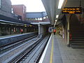
Since 2007, there have been campaigns to change the name of the railway station back to Surrey Docks. [1] [4] [5]

Transport

Surrey Quays station Surrey Quays station.jpg
Surrey Quays station

The area is served by Surrey Quays railway station on the London Overground route. The nearest London Underground station is at Canada Water, on the Jubilee line.

Surrey Quays is served by Transport for London bus services 1, 47, 188, 199, 225, 381, C10 and P12; night buses N1, N199 and N381 also call here. [6]

Greenland Dock Pier is the nearest place for boarding London River Services, operated by Thames Clippers.

View in June 2016 Greenland Dock Pier - June 2016.jpg
View in June 2016
View in June 2016 Greenland Dock Pier Walkway.jpg
View in June 2016
Entrance to Canada Water station Canada Water Station.jpg
Entrance to Canada Water station

Related Research Articles

<span class="mw-page-title-main">London Docklands</span> Area by the Thames in London, England

London Docklands is the riverfront and former docks in London. It is located in inner east and southeast London, in the boroughs of Southwark, Tower Hamlets, Lewisham, Newham, and Greenwich. The docks were formerly part of the Port of London, at one time the world's largest port. After the docks closed, the area had become derelict and poverty-ridden by the 1980s. The Docklands' regeneration began later that decade; it has been redeveloped principally for commercial and residential use. The name "London Docklands" was used for the first time in a government report on redevelopment plans in 1971 and has since been almost universally adopted. The redevelopment created wealth, but also led to some conflict between the new and old communities in the area.

<span class="mw-page-title-main">East London line</span> London Overground line

The East London line is part of the London Overground, running north to south through the East, Docklands and South areas of London. It was previously a line of the London Underground.

<span class="mw-page-title-main">Bermondsey</span> District in the London Borough of Southwark

Bermondsey is a district in southeast London, part of the London Borough of Southwark, England, 2.5 miles (4.0 km) southeast of Charing Cross. To the west of Bermondsey lies Southwark, to the east Rotherhithe and Deptford, to the south Walworth and Peckham, and to the north is Wapping across the River Thames. It lies within the historic county boundaries of Surrey. During the Industrial Revolution Bermondsey became a centre for manufacturing, particularly in relation to tanning. More recently it has experienced regeneration including warehouse conversions to flats and the provision of new transport links.

<span class="mw-page-title-main">London Borough of Southwark</span> London borough in United Kingdom

The London Borough of Southwark in South London forms part of Inner London and is connected by bridges across the River Thames to the City of London and London Borough of Tower Hamlets. It was created in 1965 when three smaller council areas amalgamated under the London Government Act 1963. All districts of the area are within the London postal district. It is governed by Southwark London Borough Council.

<span class="mw-page-title-main">Rotherhithe</span> Residential district in south-east London, England

Rotherhithe is a district of south-east London, England, and part of the London Borough of Southwark. It is on a peninsula on the south bank of the Thames, facing Wapping, Shadwell and Limehouse on the north bank, with the Isle of Dogs to the east. It borders Bermondsey to the west and Deptford to the south-east. The district is a part of the Docklands area.

<span class="mw-page-title-main">South London line</span> Railway line in inner south London

The South London line is a railway line in inner south London, England. The initial passenger service on the route was established by the London, Brighton & South Coast Railway on 1 May 1867 when the central London terminal stations of Victoria and London Bridge were connecting to the inner south London suburbs of Clapham, Brixton, Camberwell and Peckham. Since 2012 passenger services have been part of London Overground and run between Clapham Junction and Peckham Rye continuing toward Highbury & Islington via the East London line. The line is 8.5 miles (13.7 km) long and consists of seven stations, one of which marks the crossover into the East London line network. Most of the line was built on a high level viaduct above other transport infrastructure. Interchanges with the London Underground are at Clapham High Street and the closest on its London Overground extension is Canada Water. The line is in Travelcard Zone 2.

<span class="mw-page-title-main">Canada Water station</span> London Underground and London Overground station

Canada Water is a London Underground and London Overground station located in Canada Water, in south London, England. It takes its name from Canada Water, a lake which was created from a former dock in the Port of London.

<span class="mw-page-title-main">Rotherhithe railway station</span> London Overground station

Rotherhithe is a station on the East London Line located on the southern bank of the River Thames at Rotherhithe within the London Borough of Southwark, Greater London and is served by London Overground services. The station is between Wapping and Canada Water, and is in fare zone 2. The station re-opened for a preview service on 27 April 2010 to New Cross / New Cross Gate and 23 May 2010 for full service to New Cross / West Croydon / Crystal Palace. On 9 December 2012, the line was extended to serve Clapham Junction via Peckham Rye.

<span class="mw-page-title-main">Surrey Quays railway station</span> London Overground station

Surrey Quays is a station on the East London Line of the London Overground. It is located in Rotherhithe, part of London Borough of Southwark; it is in Zone 2. The next station to the north is Canada Water; to the south, it splits into branches to Clapham Junction, New Cross and Crystal Palace/West Croydon. Closed in late 2007 as an underground station, it was refurbished and reopened as part of the London Overground network on 27 April 2010.

<span class="mw-page-title-main">Surrey Commercial Docks</span>

The Surrey Commercial Docks were a large group of docks in Rotherhithe, South East London, located on the south bank of the River Thames.

<span class="mw-page-title-main">South Bermondsey railway station</span> National Rail station in London, England

South Bermondsey railway station is on the South London line, serving the district of South Bermondsey in the London Borough of Southwark and managed and operated by Southern. It is 1 mile 63 chains (2.9 km) down the line from London Bridge; the following station on the line is Queens Road Peckham. The station is the principal stop for Millwall F.C.'s The Den.

<span class="mw-page-title-main">Greenland Dock</span> Dock in Rotherhithe, London

Greenland Dock is the oldest of London's riverside wet docks, located in Rotherhithe in the area of the city now known as Docklands. It used to be part of the Surrey Commercial Docks, most of which have by now been filled in. Greenland Dock is now used purely for recreational purposes; it is one of only two functioning enclosed docks on the south bank of the River Thames, along with the smaller South Dock, to which it is connected by a channel now known as Greenland Cut.

South Dock is one of two surviving docks in the former Surrey Commercial Docks in Rotherhithe, London, England. It was built in 1807–1811 just south of the larger Greenland Dock, to which it is connected by a channel now known as Greenland Cut; it also has a lock giving access to the River Thames. Originally named the East Country Dock, it was renamed in 1850 when the Surrey Commercial Dock Company purchased and enlarged it. Timber and grain were the main products imported and exported in the dock.

<span class="mw-page-title-main">Canada Water</span> Area in south-east London

Canada Water is an area of the Docklands in south-east London. It is named after a freshwater lake and wildlife refuge. Canada Water tube, Overground and bus station is immediately north of the lake, along with Canada Water Library which overhangs the lake and Deal Porter Square. Surrey Quays Shopping Centre is also adjacent, sitting immediately to the south. The surrounding area, which forms the town centre of Rotherhithe, is now increasingly known as Canada Water, after the transport interchange as much as the lake itself.

<span class="mw-page-title-main">Surrey Canal railway station</span> Planned railway station in South East London

Surrey Canal railway station is a proposed station on the South London Line of the London Overground network. It is on its main line.

<span class="mw-page-title-main">Southwark Park</span>

Southwark Park is located in Rotherhithe, in central South East London, England, and is managed by the London Borough of Southwark. It first opened in 1869 by the Metropolitan Board of Works as one of its first parks. It was designed by Alexander McKenzie and covers 63 acres (250,000 m2). It takes its name from being in what was the old Parliamentary constituency of Southwark at the time of its opening.

<span class="mw-page-title-main">Surrey Docks Farm</span> City farm in London, England

Surrey Docks Farm is a working city farm in the heart of London. It occupies a 2.2-acre (8,900 m2) site on the south bank of the River Thames in Rotherhithe.

<span class="mw-page-title-main">Canada Water bus station</span>

Canada Water bus station serves the Surrey Quays area of the London Borough of Southwark, London, England. The station is owned and maintained by Transport for London.

<span class="mw-page-title-main">Surrey Quays Shopping Centre</span> Shopping mall in London

Surrey Quays Shopping Centre is located in Rotherhithe, London. It is currently owned by British Land.

Surrey Docks North was an authorised underground railway station planned by London Underground but never built. It was to be located in Rotherhithe and named after the Surrey Commercial Docks in the London Borough of Southwark, in east London as a station on an unbuilt extension of the Jubilee line to Woolwich Arsenal.

References

  1. 1 2 "Calls to replace Surrey Quays name with historic name for docks area - Southwark News" . Retrieved 3 October 2022.
  2. "Metro at ten". Campaign Magazine. London. 6 March 2009.
  3. "CWSQ Limited". Companies House. 3 May 2017. Retrieved 4 May 2021.
  4. "TEN YEARS AGO: Campaign to renamed Surrey Quays Station back to Surrey Docks was rejected - Southwark News" . Retrieved 3 October 2022.
  5. Anonymous (21 January 2008). "Rename Surrey Quays Station". Mayor's Question Time. Retrieved 3 October 2022.
  6. "Stops in Surrey Quays". Bus Times. 2023. Retrieved 31 May 2023.