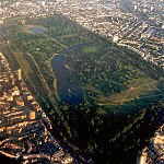
Tabard Gardens

Last updated

Tabard Gardens
Tabard Gardens - geograph.org.uk - 190491.jpg
Southwark London UK location map.svg
Red pog.svg
Location within the London Borough of Southwark
Location London
OS grid TQ327794 [1]
Coordinates 51°29′55″N0°05′21″W / 51.4986082°N 0.0890381°W / 51.4986082; -0.0890381 Coordinates: 51°29′55″N0°05′21″W / 51.4986082°N 0.0890381°W / 51.4986082; -0.0890381 [2]
Area1.762 hectares (4.354 acres) [3]
Opened1929 [4]
EtymologyFrom Tabard Street or the former Tabard public house
Managed by Southwark Council [5]
OpenDaily from 7:30am until around sunset [6]
Awards Green Flag Award [7]
FacilitiesChildren’s play area, outdoor gym, table tennis tables, artificial grass pitches, multi-use sports pitches [8]
Website www.southwark.gov.uk/parks-and-open-spaces/parks/tabard-gardens

Tabard Gardens is a small park in Southwark, London. It is located on Tabard Street [9] (itself named after the former Tabard public house) and gives its name to the surrounding Tabard Gardens Estate. [10] The park was created as part of a slum clearance programme by the London County Council [11] and opened in 1929. [4] It is owned and managed by Southwark Council. [12] [5]

Contents

Facilities and features

David Idowu memorial bench Photograph of a bench (OpenBenches 7088).jpg
David Idowu memorial bench

Tabard Gardens, which holds a Green Flag Award, [7] has large grassed areas, a wildlife area and a children's play area. [8]

An artificial grass football pitch is available to book for a fee. [13] Either the full pitch or half the pitch can be booked for an hour at a time. [14] Built in 2000 and refurbished in 2008, [15] the pitch won the MyLocalPitch (now Playfinder) outstanding London sports venue award for August 2016. [16] [17]

There are also multi-use sports pitches [8] for games like basketball, [18] which are free to use and do not require booking. [19] A free outdoor gym [20] was installed in 2013. [21] It is situated next to three outdoor table tennis tables. [22] The park hosts boot camp training. [23]

A mosaic memorial bench created by Arthur de Mowbray and Jay James was installed in 2011 to commemorate David Idowu, who was murdered in the park in 2008. [24] A peace event is held in the park most years to mark the anniversary of Idowu's death. [25] [26] [27]

The surrounding Tabard Gardens Estate, but not the park itself, has some of the last remaining stretcher fences in London – these are fences re-purposed from metal stretchers used by Air Raid Precautions wardens to carry Blitz casualties during World War II. [28] The Tabard Gardens Community Allotments [29] are on the surrounding estate, rather than within the park itself. [30]

History

The Tabard inn shortly before its demolition in the 1870s Tabard Inn.JPG
The Tabard inn shortly before its demolition in the 1870s

The Tabard was an inn on Borough High Street [31] established in about 1306 [32] [33] or 1307. [34] It is best known for being a meeting place for pilgrims to the shrine of Thomas à Becket in Canterbury and appears in The Canterbury Tales written by Chaucer in the late 14th century. [35] [36] Around the 17th century it was renamed the Talbot [37] [38] and was probably rebuilt at least twice, including after the 1676 Southwark fire. [39] [40] [41] The replacement building, which may have resembled Chaucer's inn, [42] was demolished in 1874 [43] or 1875, [44] [45] amid protests due to its literary associations. [46]

Tabard Street, renamed after the inn in 1877, was the northern end of Kent Street [47] (the southern portion is now Old Kent Road [48] ). Kent Street had been part of the main route between London and the port of Dover until it was supplanted by newer roads. [49] The section that is now Tabard Street was bypassed by the turnpike development of Great Dover Street in about 1814. [50] [51] [52]

By the 20th century Tabard Street was surrounded by notorious slums. [53] The London County Council razed the majority of the eastern side of the street as part of a major slum clearance programme in 1910. [54] [55] From then until 1933 the LCC rebuilt the area as the Tabard Gardens Estate, [55] with large blocks of flats replacing the previous buildings. [54] Of the 1012 acres (4.2 hectares) of the development site, 5 acres (2 hectares) were set aside as a park for the estate, which was called Tabard Gardens and opened in 1929. [4] [54]

On 8 March 1968, a 5-year-old boy, David Lawrence, was found murdered in the toilets in the park. The killer was never found. [56]

On 17 June 2008, David Idowu, 14, was stabbed in the park while playing football. [57] [58] He died at the Royal London Hospital three weeks later on 7 July. [59] [60] 16-year-old Elijah Dayoni was sentenced on 16 January 2009 to life imprisonment with a minimum term of 12 years for Idowu's murder. [58] [61] [62]

Tabard Gardens first won a Green Flag Award in 2013, [63] [64] which it has retained in each subsequent year of the competition up to and including 2022. [65] [66] [67] [68]

An air ambulance landed in Tabard Gardens on 31 October 2014 to treat an 18-year-old man who was stabbed to death outside an off-licence in nearby Pilgrimage Street. [69] [70] Less than a year later, on 29 June 2015, an air ambulance again landed in the park after Lorraine Barwell, a 54-year-old Serco prisoner custody officer, was fatally assaulted at Blackfriars Crown Court. [71] [72]

A large gathering promoted as an "Afro Vibe BBQ" on Saturday 20 June 2020 left the park covered with litter. The following weekend, the police issued an authorisation under the Anti-Social Behaviour, Crime and Policing Act 2014, temporarily allowing them to direct people to leave the area if necessary. [73]

Related Research Articles

<span class="mw-page-title-main">Southwark</span> District of Central London, England

Southwark is a district of Central London situated on the south bank of the River Thames, forming the north-western part of the wider modern London Borough of Southwark. The district, which is the oldest part of South London, developed due to its position at the southern end of the early versions of London Bridge, the only crossing point for many miles.

<span class="mw-page-title-main">London Borough of Southwark</span> Borough in United Kingdom

The London Borough of Southwark in south London forms part of Inner London and is connected by bridges across the River Thames to the City of London and London Borough of Tower Hamlets. It was created in 1965 when three smaller council areas amalgamated under the London Government Act 1963. All districts of the area are within the London postal district. It is governed by Southwark London Borough Council.
<span class="mw-page-title-main">Walworth</span> Human settlement in England

Walworth is a district of south London, England, within the London Borough of Southwark. It adjoins Camberwell to the south and Elephant and Castle to the north, and is 1.9 miles (3.1 km) south-east of Charing Cross.

<span class="mw-page-title-main">Elephant and Castle</span> Area in London, England

The Elephant and Castle is an area around a major road junction in London, England, in the London Borough of Southwark. The name also informally refers to much of Walworth and Newington, due to the proximity of the London Underground station of the same name. The name is derived from a local coaching inn. In the first half of the 20th century, because of its vitality, the area was known as "the Piccadilly of South London". In more recent years, it has been viewed as a part of Central London given its location in Zone 1 on the London Underground.

<span class="mw-page-title-main">New Kent Road</span> Road in Southwark, London, England

New Kent Road is a 1 kilometre (0.6 mi) road in the London Borough of Southwark. The road was created in 1751 when the Turnpike Trust upgraded a local footpath. This was done as part of the general road improvements associated with the creation of Westminster Bridge; in effect it was possible to travel from the West End/ Westminster to the south-east without having to go via the Borough of Southwark but could now cross St George's Fields to the junction of Newington Causeway and Newington Butts which is where New Kent Road starts at Elephant & Castle. The route runs eastward for a few hundred yards to the junction of Great Dover Street and Tower Bridge Road, known as Bricklayers Arms, where it joins the original route to the south-east Old Kent Road.

<span class="mw-page-title-main">Old Kent Road</span> Road in South East London, England

Old Kent Road is a major thoroughfare in South East London, England, passing through the London Borough of Southwark. It was originally part of an ancient trackway that was paved by the Romans and used by the Anglo-Saxons who named it Wæcelinga Stræt. It is now part of the A2, a major road from London to Dover. The road was important in Roman times linking London to the coast at Richborough and Dover via Canterbury. It was a route for pilgrims in the Middle Ages as portrayed in Chaucer's Canterbury Tales, when Old Kent Road was known as Kent Street. The route was used by soldiers returning from the Battle of Agincourt.

<span class="mw-page-title-main">Bankside</span> Human settlement in England

Bankside is an area of London, England, within the London Borough of Southwark. Bankside is located on the southern bank of the River Thames, 1.5 miles (2.4 km) east of Charing Cross, running from a little west of Blackfriars Bridge to just a short distance before London Bridge at St Mary Overie Dock. It is part of a business improvement district known as 'Better Bankside'.

<span class="mw-page-title-main">Borough High Street</span>

Borough High Street is a road in Southwark, London, running south-west from London Bridge, forming part of the A3 route which runs from London to Portsmouth, on the south coast of England.

<span class="mw-page-title-main">The Tabard</span>

The Tabard was an inn in Southwark established in 1307 that stood on the east side of Borough High Street, at the road's intersection with the ancient thoroughfare to Canterbury and Dover. It was built for the Abbot of Hyde, who purchased the land to construct a place for himself and his ecclesiastical brethren to stay when on business in London.

<span class="mw-page-title-main">The George Inn, Southwark</span> Public house established in the medieval period on Borough High Street in Southwark, London

The George Inn, or The George, is a public house established in the medieval period on Borough High Street in Southwark, London, owned and leased by the National Trust. It is located about 250 metres (820 ft) from the south side of the River Thames near London Bridge and is the only surviving galleried London coaching inn.

<span class="mw-page-title-main">River Neckinger</span> Subterranean river in London, United Kingdom

The River Neckinger is a reduced subterranean river that rises in Southwark and flows approximately 2.5 kilometres through that part of London to St Saviour's Dock where it enters the Thames. What remains of the river is enclosed and runs underground and most of its narrow catchment has been diverted into other combined and surface water sewers, flowing into the Southern Outfall Sewer and the Thames respectively.

<span class="mw-page-title-main">Parks and open spaces in the London Borough of Southwark</span>

The London Borough of Southwark, occupying a roughly triangular area south of Tower Bridge over the River Thames, considers itself to be one of the greenest boroughs in London, with its 245 hectares of public parkland. There are more than 130 such green areas, ranging from the large areas around Dulwich and Southwark Park in Rotherhithe to the many sports grounds and squares. The main ones are:
<span class="mw-page-title-main">Southwark Park</span>

Southwark Park is located in Rotherhithe, in central South East London, England, and is managed by the London Borough of Southwark. It first opened in 1869 by the Metropolitan Board of Works as one of its first parks. It was designed by Alexander McKenzie and covers 63 acres (250,000 m2). It takes its name from being in what was the old Parliamentary constituency of Southwark at the time of its opening.
<span class="mw-page-title-main">Bricklayers Arms</span>

Bricklayers Arms is the road intersection of the A2 and the London Inner Ring Road where Bermondsey meets Walworth and Elephant & Castle in south London. It is the junction of Tower Bridge Road, Old Kent Road, New Kent Road and Great Dover Street. It comprises a four-way green roundabout plus one-way flyover and one-way bypass lane.

<span class="mw-page-title-main">Long Lane (Southwark)</span> Main road in Southwark, Greater London, United Kingdom

Long Lane is a main east–west road in Southwark, south London, England.

<span class="mw-page-title-main">Geraldine Mary Harmsworth Park</span>

Geraldine Mary Harmsworth Park is a public park in Kennington, South London. Maintained by the London Borough of Southwark, it is bounded by Lambeth Road, Kennington Road, St George's Road and Brook Drive. It covers an area of 5.9 hectares. The grounds of the park surround its central feature, the Imperial War Museum London.
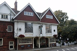
<span class="mw-page-title-main">The Tabard, Chiswick</span>

The block of three buildings containing The Tabard public house is a Grade II* listed structure in Chiswick, London. The block, with a row of seven gables in its roof, was designed by Norman Shaw in 1880 as part of the community focus of the Bedford Park garden suburb. The block contains the Bedford Park Stores, once a co-operative, and a house for the manager.

This is a list of the etymology of street names in the London district of Southwark. The area has no formally defined boundaries – those utilised here are: the river Thames to the north, Tower Bridge Road to the east, Bricklayers Arms/New Kent Road/Elephant and Castle to the south, and London Road/St George's Circus/Blackfriars Road to the west.

<span class="mw-page-title-main">Northbrook Park, London</span>

Northbrook Park is a public park located on Baring Road south of Lee Green and north of Grove Park in the London Borough of Lewisham, southeast London, England. It is roughly 9 acres (3.6 ha) in size, and contains a large central field bounded by trees, a children's playground, with a sandpit and splash pool, a multipurpose game court, two football pitches, outdoor gym equipment and a "legal" graffiti wall. The park was previously a field named Ten-Acre Field, despite actually being 7 acres (2.8 ha), and part of the Baring Estate of Lee. In 1898, Thomas Baring, 1st Earl of Northbrook gifted part of his family's estate to public use in commemoration of the Diamond Jubilee of Queen Victoria. The Park was designed by Lt Col J J Sexby, Chief Officer of the London County Council's Parks Department, then was officially opened on 14 March 1903. In the past the park contained a larger playground, a paddling pool, a pond, a bowling green and a tennis court.

<span class="mw-page-title-main">Brimmington Park</span> Park in Peckham, London

Brimmington Park is a small 1.79 hectares park in Peckham, London. It is located on Old Kent Road, Clifton Crescent and Culmore Road, London SE15 2RQ. It is also adjacent to the former Old Kent Road and Hatcham railway station, which closed temporarily in 1917 but which has never been re-opened.

References

  1. "Tabard Gardens". Parks & Gardens. The Hestercombe Gardens Trust. Retrieved 3 April 2022. OS Original: TQ327794
  2. "Tabard Gardens". Parks & Gardens. The Hestercombe Gardens Trust. Retrieved 3 April 2022. Latitude: 51.4986082, Longitude: -0.0890381
  3. "Tabard Gardens". London Gardens Trust. Retrieved 3 April 2022. Size in hectares: 1.762
  4. 1 2 3 Hannikainen, Matti O. (2016). The Greening of London, 1920–2000. Routledge. p. 39. doi:10.4324/9781315563145. ISBN   978-1138307186. 5 acres of the 10.5-acre area were developed as a new park, named Tabard Gardens that was opened in 1929
  5. 1 2 "Tabard Gardens". Green Flag Award. Retrieved 3 April 2022. Managing Organisation: London Borough of Southwark
  6. "Opening times". Southwark Council. Retrieved 4 October 2021.
  7. 1 2 "Tabard Gardens". Green Flag Award. Retrieved 8 October 2021.
  8. 1 2 3 "Tabard Gardens". Southwark Council. Retrieved 3 April 2022. The park includes large grassed areas, a wildlife area, a children's play area, an outdoor gym, table tennis tables, artificial grass pitches (available to book) and multi use sports pitches.
  9. "Tabard Gardens". Southwark Council. Retrieved 3 April 2022. Location: Tabard Street, SE1
  10. "Tabard Gardens". Southwark Council. Retrieved 3 April 2022. Tabard Gardens is a large local park set within the Tabard Gardens residential estate.
  11. "Tabard Gardens". Green Flag Award. Retrieved 3 April 2022. Tabard Gardens was formed as part of the London County Council's slum clearance scheme in the early twentieth century.
  12. "Tabard Gardens". London Gardens Trust. Retrieved 3 April 2022. Site ownership: LB Southwark
  13. "Tabard Gardens". Southwark Council. Retrieved 3 April 2022. football pitch – booking required (fees and charges apply)
  14. "Fees and charges for outdoor pitches (1 April 2022 to 31 March 2023)". Southwark Council. Retrieved 6 April 2022.
  15. "Tabard Gardens". Sports Facilities. Retrieved 3 April 2022. Year built: 2000 (Refurbished: 2008)
  16. "Tabard Gardens". Playfinder. Retrieved 3 April 2022. MyLocalPitch Outstanding London Sports Venue Award, August 2016
  17. Chrimes, Will (8 September 2016). "Tabard Gardens grabs 'Outstanding London Sports Venue Award' for August" (Press release). Playfinder. Retrieved 3 April 2022.
  18. "Tabard Gardens Basketball Court". Foursquare City Guide . Retrieved 3 April 2022.
  19. "Tabard Gardens". Everyone Active. Retrieved 10 October 2021. Multi Use Games Area – Free of charge and no booking required
  20. "Outdoor sport facilities". Southwark Council. Retrieved 10 October 2021. Tabard Gardens gym is located near the playground and astro pitch off Tabard Street
  21. "Outdoor gym installed in Tabard Gardens". London SE1. 8 June 2013. Retrieved 10 October 2021.
  22. "Tabard Gardens". Table Tennis England . Retrieved 6 April 2022. 3 tables located next to the outdoor gym and basketball courts
  23. "Tabard Gardens Boot Camp". Train Dirty London. Retrieved 5 June 2021.
  24. "David Idowu mosaic bench unveiled in Tabard Gardens". London SE1. 9 July 2011. Retrieved 5 June 2021.
  25. "One year on: Tabard Gardens community remembers David Idowu". London SE1. 12 July 2009. Retrieved 13 November 2021.
  26. "Peace Day in Tabard Gardens five years on from David Idowu murder". London SE1. 13 July 2013. Retrieved 13 November 2021.
  27. "Peace event to remember teenager David Idowu ten years after fatal stabbing". Southwark News . London. 6 July 2018. Retrieved 13 November 2021.
  28. Powell, Tom (13 August 2017). "Campaign launched to save South London's 'stretcher fences' once used to carry wounded civilians in the Blitz". Evening Standard . London. Retrieved 2 April 2022.
  29. "Tabard Gardens Community Allotments" . Retrieved 10 October 2021.
  30. Tabard Growers. "Tabard Growers 2" (Map). uMap. OpenStreetMap . Retrieved 2 April 2022.
  31. Roberts, Howard; Godfrey, Walter H., eds. (1950). "Borough High Street". Bankside (The Parishes of St. Saviour and Christchurch, Southwark). Survey of London. Vol. XXII. London County Council. p. 21. No. 85. The Tabard
  32. Rendle, William; Norman, Philip (1888). "The Tabard". The Inns of Old Southwark and Their Associations. London: Longmans, Green, and Co. pp. 169–170. This was the most celebrated, and, as far as I know, the most ancient of the Southwark hostelries, having been built probably about 1306
  33. LCC 1950 , p. 21: "The Tabard was probably one of the earliest inns in this street of inns, for there is mention of it in 1306 when the Abbot of Hyde had lodgings adjoining."
  34. Walford, Edward (1878a). "Southwark (continued). – Famous Inns of Olden Times". Old and New London: The Southern Suburbs. Vol. VI. Cassell, Petter & Galpin. p. 76. The land on which the old 'Tabarde' stood was purchased by the Abbot of Hyde in the year 1307, and he built on it ... an inn
  35. Walford 1878a , p. 76: "There can be no doubt that by the end of the fourteenth century the 'Tabard' was already one of the inns most frequented by 'Canterbury Pilgrims', or else Chaucer would scarcely have introduced it to us in that character."
  36. Rendle & Norman 1888 , pp. 170–171: "The Tabard owes all its fame to the fact that it was depicted by Chaucer as the place of assemblage for his Canterbury pilgrims."
  37. Rendle & Norman 1888 , pp. 184–185: "The name was changed to Talbot, perhaps by fancy, or because a word slips phonetically with such ease into another shape."
  38. Walford 1878a , pp. 77, 80: "[A]lthough ... it was for a time called, not the 'Tabard', but the 'Talbot', there can be no doubt that the inn ... was the immediate successor of the inn and hostelry commemorated by our great poet."
  39. LCC 1950 , p. 21: "Chaucer's inn was probably pulled down in 1629 ... After two rebuildings in the 17th century it is extremely unlikely that any of the mediaeval building survived."
  40. Rendle & Norman 1888 , pp. 190–191: "In their report of 1634 they say the Talbot was built of brick six years before ... Now comes the great fire of 1676, ... where it is said that 'the Talbot with its backhouses, stables, etc., was burnt down to the ground.'"
  41. Walford 1878a , p. 77: "The original 'Tabard' was in existence as late as the year 1602 ... In this fire [of 1676] ... as the 'Tabard' stood nearly in the centre of this area ... there can be little doubt that the old inn perished."
  42. Shelley, Henry C. (1909). "Famous Southwark Inns". Inns and Taverns of Old London. London: Sir Issac Pitman & Sons. p. 13. From the old foundations, however, a new Tabard arose, built on the old plan, so that the structure which was torn down in 1875 may have perpetuated the semblance of Chaucer's inn to modern times.
  43. Walford 1878a , p. 77: "No part of it, however, as it appeared at the time of its demolition in 1874, was of the age of Chaucer"
  44. LCC 1950 , p. 21: "The old Tabard Inn was pulled down in 1875, though a modern building bears the name."
  45. Malden, H. E., ed. (1912). "The borough of Southwark: Introduction". The Victoria History of the County of Surrey. Vol. 4. Victoria County History. pp. 125–135 via British History Online. The historic 'Tabard' was rebuilt after 1676 and gave place only in 1875 to the modern public-house of the same name.
  46. Shelley 1909 , pp. 12–13: "When, in 1875, the old Tabard ... was demolished ... many protests were made on the plea that it was sheer vandalism to destroy a building so intimately associated with the genius of Chaucer."
  47. Darlington, Ida (1955). "Tabard Street and the Old Kent Road, Formerly Kent Street". St. George's Fields (The Parishes of St. George the Martyr, Southwark, and St. Mary, Newington). Survey of London. Vol. XXV. London County Council. p. 121. It was re-named Tabard Street in 1877.
  48. Darlington 1955 , p. 122: "Early in the 19th century the part of Kent Street south of the Lock Hospital, or Stone's End as it was sometimes called, became known as the Old Kent Road to differentiate it from the New Kent Road."
  49. Walford, Edward (1878b). "Southwark (continued). – High Street, &c.". Old and New London: The Southern Suburbs. Vol. VI. Cassell, Petter & Galpin. p. 70. Until the formation of the Dover Road early in the present century, Kent Street ... was part of the great way from Dover and the Continent to the metropolis.
  50. Walford, Edward (1878c). "The Old Kent Road, &c.". Old and New London: The Southern Suburbs. Vol. VI. Cassell, Petter & Galpin. p. 253. Great Dover Street is of comparatively recent growth, having been formed since the commencement of the present century to supersede the old, narrow, and disreputable Kent Street, which runs parallel with it on the north side
  51. Darlington 1955 , p. 121: "After 1814 through traffic was diverted down Great Dover Street"
  52. "Turnpike Trusts in England". Turnpike Roads in England and Wales. Archived from the original on 7 July 2021. Retrieved 16 January 2022.
  53. Besant, Walter (1912). "Bermondsey". London South of the Thames. London: Adam & Charles Black. pp. 68–69.
  54. 1 2 3 Darlington 1955 , p. 121: "Most of the east side of the street was cleared in 1910 under a London County Council housing scheme; large blocks of dwellings were built and a small open space, Tabard Garden, was formed to give them breathing space."
  55. 1 2 Hannikainen 2016 , p. 39: "In 1910 the LCC had begun to construct the Tabard Garden estate (Southwark), one of the first and largest slum clearances in the city. The first house was completed in 1917 and the last in 1933."
  56. "Unsolved murder of David Francis LAWRENCE, aged five, found dead in the recreation ground toilets at Tabard Gardens, SE1 on 8 March 1968: Main file: reports and correspondence". The National Archives . MEPO 2/11359. Retrieved 6 April 2022.
  57. "Teenager in critical condition after Tabard Gardens stabbing". London SE1. 17 June 2008. Retrieved 9 April 2022.
  58. 1 2 "Life sentence for 16-year-old who killed Tabard Gardens boy David Idowu". London SE1. 16 January 2009. Retrieved 9 April 2022.
  59. "Tabard Gardens stabbing victim dies in hospital". London SE1. 7 July 2008. Retrieved 9 April 2022.
  60. "Youth dies weeks after stabbing". BBC News . London. 7 July 2008. Archived from the original on 13 November 2021. Retrieved 9 April 2022.
  61. "Youth detained for boy's murder". BBC News . London. 16 January 2009. Archived from the original on 19 January 2009. Retrieved 9 April 2022.
  62. Pallister, David (16 January 2009). "Teenager gets life sentence for murder of David Idowu". The Guardian . London. Retrieved 9 April 2022.
  63. "Tabard Gardens gains Green Flag award for first time". London SE1. 6 August 2013. Retrieved 10 October 2021.
  64. "Green flag raised at Tabard Gardens". London SE1. 17 September 2013. Retrieved 10 October 2021.
  65. "Green Flag Awards". Southwark Council. Retrieved 3 April 2022. The year the park won: 2013, 2014, 2015, 2016, 2017, 2018, 2019
  66. "Green Flag Award Winners 2020" (PDF). Green Flag Award. p. 24. Archived (PDF) from the original on 9 October 2021. Retrieved 22 October 2022.
  67. "Green Flag Award Winners 2021" (PDF). Green Flag Award. p. 21. Archived from the original (PDF) on 13 November 2021. Retrieved 14 November 2021.
  68. "Green Flag Award Winners 2022" (PDF). Green Flag Award. p. 25. Archived (PDF) from the original on 20 September 2022. Retrieved 22 October 2022.
  69. Blundy, Rachel (1 November 2014). "Teenager stabbed 'in front of aunt' outside south London off licence". Evening Standard . London. Retrieved 9 April 2022.
  70. "18-year-old man stabbed to death in Pilgrimage Street". London SE1. 31 October 2014. Retrieved 9 April 2022.
  71. "Police investigate attempted murder of custody officer at Blackfriars Crown Court". London SE1. 29 June 2015. Retrieved 14 April 2022.
  72. "Guard fatally wounded at Crown Court named as Lorraine Barwell". London SE1. 3 July 2015. Retrieved 14 April 2022.
  73. "Tabard Gardens: police impose dispersal zone to curb gatherings". London SE1. 26 June 2020. Retrieved 9 April 2022.