Bermondsey tube station

Last updated

Bermondsey Underground no-text.svg
Bermondsey station building.JPG
Entrance on Jamaica Road
Greater London UK location map 2.svg
Red pog.svg
Bermondsey
Location of Bermondsey in Greater London
Location Bermondsey
Local authority Southwark
Managed by London Underground
Number of platforms2
AccessibleYes [1]
Fare zone 2
London Underground annual entry and exit
2019Decrease2.svg 9.45 million [2]
2020Decrease2.svg 4.40 million [3]
2021Decrease2.svg 4.18 million [4]
2022Increase2.svg 6.68 million [5]
2023Increase2.svg 6.80 million [6]
Railway companies
Original company London Regional Transport
Key dates
17 September 1999Opened
Other information
External links
Coordinates 51°29′53″N0°03′50″W / 51.49806°N 0.06389°W / 51.49806; -0.06389
Underground sign at Westminster.jpg London transportportal

Bermondsey is a London Underground station. It is in the eastern part of Bermondsey in the London Borough of Southwark and also serves the western part of Rotherhithe, in south-east London.

Contents

The station itself was designed by Ian Ritchie Architects. Although it was originally intended to have a multi-storey office building on the top, London Underground have yet to realise the second phase of the scheme. [7]

It is on the Jubilee line, having been built as part of the Jubilee Line Extension between London Bridge and Canada Water stations. It is notable for its extensive use of natural light. The main station entrance is on the south side of Jamaica Road. The station is in Travelcard Zone 2.

History

The station was opened on 17 September 1999. [8]

In 2002, a plaque to Dr Alfred Salter - who worked to improve the "living conditions of the poor in the Bermondsey area" in the 20th century - was unveiled by local MP Simon Hughes. [9] The station had been built on the site of Salter's former doctors surgery. [9]

Station design

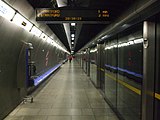
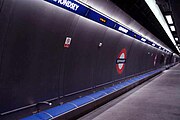
Like its extension counterparts, Bermondsey station was designed with a futuristic style in mind by Ian Ritchie Architects. [7] Extensively using natural light, it is built in both a cut-and-cover and tube design. [10] The cut-and-cover section is supported by latticed concrete beams allowing light to penetrate to the platform level. The escalators down to this area are lined by flat concrete with a high ceiling to give a feeling of spaciousness. [10] The bored section is encased with metal to keep in line the futuristic and metallic theme of the extension. As with all other deep level stations on the Jubilee Line Extension, Bermondsey station has platform screen doors for passenger safety and comfort.[ citation needed ]

Connections

London Buses routes 47, 188, 381 and C10 and night routes N199 and N381 serve the station.[ citation needed ]

Related Research Articles

<span class="mw-page-title-main">Waterloo tube station</span> London Underground station

Waterloo is a London Underground station located beneath Waterloo National Rail station. As of 2023, it is the 2nd busiest station on the London Underground, with 70.33 million users. It is served by four lines: Bakerloo, Jubilee, Northern and Waterloo & City.

<span class="mw-page-title-main">Bounds Green tube station</span> London Underground station

Bounds Green is a London Underground station, located at the junction of Bounds Green Road and Brownlow Road in Bounds Green in the London Borough of Haringey, North London. The station is on the Piccadilly line, between Wood Green and Arnos Grove stations, and is on the boundary between Zone 3 and Zone 4.

<span class="mw-page-title-main">Leicester Square tube station</span> London Underground station

Leicester Square is a London Underground station in the West End of London, within walking distance of Theatreland and Chinatown. It is located on Charing Cross Road, a short distance to the east of Leicester Square itself.
<span class="mw-page-title-main">Canary Wharf tube station</span> London Underground station

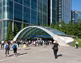
Canary Wharf is a London Underground station at Canary Wharf and is on the Jubilee line, between Canada Water and North Greenwich stations. The station is located in Travelcard Zone 2 and was opened on 17 September 1999 as part of the Jubilee Line Extension. Over 40 million people pass through the station each year, making it second busiest on the London Underground outside Central London after Stratford, and also the busiest that serves only a single line.

<span class="mw-page-title-main">North Greenwich tube station</span> London Underground station

North Greenwich is a London Underground station. Despite its name, it is not in the local area historically known as North Greenwich, on the Isle of Dogs, north of the River Thames, which used to be served by a completely different North Greenwich station from 1872 until 1926. The present station is actually closer to Charlton than to Greenwich, although it is at the northernmost tip of the Royal Borough of Greenwich.

<span class="mw-page-title-main">Westminster tube station</span> London Underground station

Westminster is a London Underground station in the City of Westminster. It is served by the Circle, District and Jubilee lines. On the Circle and District lines, the station is between St James's Park and Embankment, and on the Jubilee line it is between Green Park and Waterloo. It is in Travelcard Zone 1. The station is located at the corner of Bridge Street and Victoria Embankment and is close to the Houses of Parliament, Westminster Abbey, Parliament Square, Whitehall, Westminster Bridge, and the London Eye. Also close by are Downing Street, the Cenotaph, Westminster Millennium Pier, the Treasury, the Foreign and Commonwealth Office, and the Supreme Court.

<span class="mw-page-title-main">Bond Street station</span> London Underground and Elizabeth line station

Bond Street is an interchange station in Mayfair, in the West End of London for London Underground and Elizabeth line services. Entrances are on Oxford Street, near its junction with New Bond Street, and on Hanover Square.
<span class="mw-page-title-main">Southwark tube station</span> London Underground station

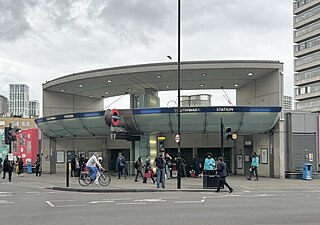
Southwark is a London Underground station in the London Borough of Southwark at the corner of Blackfriars Road and The Cut. It is between Waterloo and London Bridge stations on the Jubilee line, and is in Travelcard Zone 1. It was opened on 20 November 1999 as part of the Jubilee Line Extension. The station is somewhat west of historic Southwark, which is served by Borough and London Bridge stations. Its entrance is across the road from the disused Blackfriars Road railway station.
<span class="mw-page-title-main">Canada Water station</span> London Underground and London Overground station

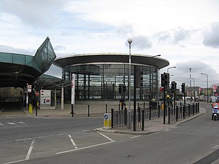
Canada Water is a London Underground and London Overground station located in Canada Water, in south London, England. It takes its name from Canada Water, a lake which was created from a former dock in the Port of London.

<span class="mw-page-title-main">Canning Town station</span> London Underground and Docklands Light Railway station

Canning Town is an interchange station located in Canning Town, London for London Underground, Docklands Light Railway (DLR) and London Buses services.

<span class="mw-page-title-main">West Ham station</span> London Underground, Docklands Light Railway and National rail station

West Ham is a London Underground, Docklands Light Railway (DLR) and National Rail intermodal interchange station in West Ham, London, United Kingdom. The station is served by London Underground's District, Hammersmith & City and Jubilee lines, the Stratford International branch of the DLR, and c2c National Rail services.

<span class="mw-page-title-main">Stanmore tube station</span> London Underground station

Stanmore is a London Underground station in Stanmore, north-west London. It is the northern terminus of the Jubilee line and the next station towards south is Canons Park. The station is on the south side of London Road and is in Travelcard Zone 5.

<span class="mw-page-title-main">Maida Vale tube station</span> London Underground station

Maida Vale is a London Underground station in Maida Vale in inner north-west London. The station is on the Bakerloo line, between Kilburn Park and Warwick Avenue stations, and is in Travelcard Zone 2.
<span class="mw-page-title-main">Kilburn Park tube station</span> London Underground station

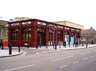
Kilburn Park is a London Underground station at Kilburn in the London Borough of Brent. The station is on the Bakerloo line, between Queen's Park and Maida Vale stations, and is in Travelcard Zone 2.
<span class="mw-page-title-main">Southgate tube station</span> London Underground station

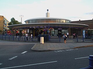
Southgate is a London Underground station in Southgate. It is on the Piccadilly line between Arnos Grove and Oakwood stations and is in Travelcard Zone 4.

<span class="mw-page-title-main">Alperton tube station</span> London Underground station

Alperton is a London Underground station in Alperton, north-west London. It is on the Uxbridge branch of the Piccadilly line between Sudbury Town and Park Royal stations, in Travelcard Zone 4. It is located on Ealing Road (A4089), a short distance from the junction with Bridgewater Road (A4005), and is close to the Paddington branch of the Grand Union Canal.

<span class="mw-page-title-main">Holloway Road tube station</span> London Underground station

Holloway Road is a station on the London Underground. It is on the Piccadilly line between Caledonian Road and Arsenal stations, and in Travelcard Zone 2. The station opened on 15 December 1906.

<span class="mw-page-title-main">Wanstead tube station</span> London Underground station

Wanstead is a London Underground station in Wanstead in the London Borough of Redbridge, east London. on the Hainault loop of the Central line. Towards Central London the next station is Leytonstone. Towards Woodford it is Redbridge. It is in Travelcard Zone 4. It opened on 14 December 1947 as an extension of the Central line to form the new part of the Hainault loop.
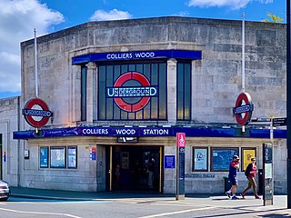
<span class="mw-page-title-main">Colliers Wood tube station</span> London Underground station

Colliers Wood is a London Underground station in South London. The station is on the Northern line, between Tooting Broadway and South Wimbledon stations. It is located at the corner of Merton High Street (A24) and Christchurch Road. The station is in Travelcard Zone 3.

<span class="mw-page-title-main">Paddington tube station (Bakerloo, Circle and District lines)</span> London Underground station

Paddington is a London Underground station served by the Bakerloo, Circle and District lines. It is located on Praed Street to the south of Paddington mainline station and has entrances from Praed Street and from within the mainline station. On the Bakerloo line the station is between Warwick Avenue and Edgware Road and on the Circle and District lines it is between Bayswater and Edgware Road. It is in London Fare Zone 1.
References

  1. "Step free Tube Guide" (PDF). Transport for London . April 2021. Archived (PDF) from the original on 15 May 2021.
  2. "Station Usage Data" (XLSX). Usage Statistics for London Stations, 2019. Transport for London. 23 September 2020. Archived from the original on 9 November 2020. Retrieved 9 November 2020.
  3. "Station Usage Data" (XLSX). Usage Statistics for London Stations, 2020. Transport for London. 16 April 2021. Retrieved 1 January 2022.
  4. "Station Usage Data" (XLSX). Usage Statistics for London Stations, 2021. Transport for London. 12 July 2022. Retrieved 7 September 2022.
  5. "Station Usage Data" (XLSX). Usage Statistics for London Stations, 2022. Transport for London. 4 October 2023. Retrieved 10 October 2023.
  6. "Station Usage Data" (XLSX). Usage Statistics for London Stations, 2023. Transport for London. 8 August 2024. Retrieved 16 September 2024.
  7. 1 2 "Bermondsey Station". Ian Ritchie Architects. Archived from the original on 9 May 2021. Retrieved 8 June 2020.
  8. Horne, M: The Jubilee Line, page 80. Capital Transport Publishing, 2000.
  9. 1 2 "Pioneering reformer is remembered at Bermondsey". The Tube. 13 December 2002. Archived from the original on 20 June 2003. Retrieved 21 May 2023.
  10. 1 2 Bermondsey Beacon – design of Bermondsey station of the London Underground Archived 16 February 2008 at the Wayback Machine The Architectural Review Retrieved 2007-12-01
Preceding station Underground no-text.svg London Underground Following station
London Bridge
towards Stanmore
Jubilee line Canada Water
towards Stratford