Neasden tube station

Last updated

Neasden Underground no-text.svg
Neasden station building 2012.JPG
Greater London UK location map 2.svg
Red pog.svg
Neasden
Location of Neasden in Greater London
Location Neasden
Local authority London Borough of Brent
Managed by London Underground
Number of platforms4 (2 in use)
Fare zone 3
London Underground annual entry and exit
2018Decrease2.svg 3.47 million [1]
2019Decrease2.svg 3.45 million [2]
2020Decrease2.svg 2.48 million [3]
2021Decrease2.svg 1.56 million [4]
2022Increase2.svg 2.49 million [5]
Key dates
2 August 1880Opened
April 1958Goods yard closed [6]
Other information
External links
WGS84 51°33′15″N0°15′01″W / 51.55417°N 0.25028°W / 51.55417; -0.25028
Underground sign at Westminster.jpg  London transportportal
Up London Transport Metropolitan line electric train in 1959 Neasden metropolitan line station geograph-2384536-by-Ben-Brooksbank.jpg
Up London Transport Metropolitan line electric train in 1959

Neasden is a London Underground station in Neasden. It is on the Jubilee line, between Wembley Park and Dollis Hill stations. Metropolitan line trains pass through the station but do not stop. The Chiltern Main Line/London to Aylesbury Line runs to the west of the station.

Contents

History

Kingsbury & Neasden in the 1890s Kingsbury and Neasden station.jpg
Kingsbury & Neasden in the 1890s

The station opened on 2 August 1880 as part of the ongoing extensions to the Metropolitan Railway (this time to Harrow), with the name Kingsbury and Neasden. The name was changed to Neasden and Kingsbury in 1910, and then changed again to its current name Neasden in 1932, the same year Kingsbury station opened. After the Metropolitan Railway was taken into public ownership in 1933, train services to Stanmore were transferred to the new eastern branch of the Bakerloo line in 1939 and Metropolitan line trains ceased to stop at the station the following year. In 1979, the main service was transferred to the Jubilee line.

The station's surface building is located in Neasden Lane. It has been extensively modified over the years, losing its original roof and high chimneys in the late 20th century, and a segment of the front was rebuilt around 1993 to remove a newsagent previously placed there. As well as the ticket office there are three ticket collection barriers and a single luggage gate (these were installed in the late 1990s; prior to this there were no barriers and just a gate), and the station also has a shop. The stairs from the surface building lead to four platforms. Platforms 1 and 4 are on the Metropolitan line, served on a few days a year for local events and when necessary due to disruptions to normal services. Platforms 2 and 3 were the northbound and southbound platforms for the Bakerloo line and since 1979 are now used by the Jubilee line. The platforms are constructed to "transition height" to allow regular use by tube trains of the Jubilee line and occasional (early morning, late night and during work on the line) use by the larger Metropolitan Line trains.

Platforms 1, 2 and 3 were built originally in 1880. Neasden had three platforms, which was unusual for a small station. The reason for three platforms was that Neasden was a terminus for many local Metropolitan trains from London and which would be stabled in the nearby depot. Platforms 4 and 5 were built in 1914 as a result of the quadrupling of the Metropolitan between Finchley Road and Harrow-on-the-Hill. Platform 5 was used as a bay platform for trains terminating at Neasden from stations north on the Met such as Stanmore. This platform was removed later on and the track is now used as a relief siding for the depot.

Neasden is one of the few stations on the southern section of the former Metropolitan Main line to still have its original platform buildings intact and its architecture is typical for a station serving a medium-sized village. Baker Street and Willesden Green are the other stations to have their platform buildings intact. The line between Finchley Road and Harrow-on-the-Hill was quadrupled between 1914 and 1916, and many intermediate stations had to be rebuilt to enable the fast lines to be built. Jubilee line trains sometimes terminate at Neasden.

It was proposed in 2008 that the North and West London Light Railway could serve the station. [7]

Nearby attractions

Connections

London Buses route 297 serve the station.

Related Research Articles

<span class="mw-page-title-main">Metropolitan line</span> London Underground line

The Metropolitan line, colloquially known as the Met, is a London Underground line between Aldgate in the City of London and Amersham and Chesham in Buckinghamshire, with branches to Watford in Hertfordshire and Uxbridge in Hillingdon. Printed in magenta on the tube map, the line is 41.4 miles (66.7 km) in length and serves 34 stations. Between Aldgate and Finchley Road, the track is mostly in shallow "cut and cover" tunnels, apart from short sections at Barbican and Farringdon stations. The rest of the line is above ground, with a loading gauge of a similar size to those on main lines. Just under 67 million passenger journeys were made on the line in 2011/12.

<span class="mw-page-title-main">Dollis Hill tube station</span> London Underground station

Dollis Hill is a London Underground station at Dollis Hill near to Willesden and Gladstone Park of the London Borough of Brent. It is on the Jubilee line, between Neasden and Willesden Green stations and is in Travelcard Zone 3. Metropolitan line trains pass through the station without stopping here.

<span class="mw-page-title-main">Baker Street tube station</span> London Underground station

Baker Street is a London Underground station at the junction of Baker Street and the Marylebone Road in the City of Westminster. It is one of the original stations of the Metropolitan Railway (MR), the world's first underground railway, opened on 10 January 1863.

<span class="mw-page-title-main">Kingsbury tube station</span> London Underground station

Kingsbury is a London Underground station in northwest London, England. It is on the Jubilee line between Queensbury and Wembley Park stations, in Zone 4, in the borough of Brent.

<span class="mw-page-title-main">Wembley Park tube station</span> London Underground station

Wembley Park is a London Underground station in Wembley Park, north west London. The station is served by the Jubilee and Metropolitan lines and is in Travelcard Zone 4. It is located on Bridge Road (A4089) and is the nearest Underground station to the Wembley Stadium and Wembley Arena complex. This is where the Jubilee line from Stanmore diverges from the Metropolitan line, which was formerly a branch of the Metropolitan Railway and was taken over by the Bakerloo line and today part of the Jubilee line.

<span class="mw-page-title-main">Willesden Green tube station</span> London Underground station

Willesden Green is a London Underground station on Walm Lane in Willesden. It is served by the Jubilee line and is between Dollis Hill and Kilburn stations. Metropolitan line trains also pass through the station, but do not stop. The station is in both Travelcard Zone 2 and Zone 3.

<span class="mw-page-title-main">Kilburn tube station</span> London Underground station

Kilburn is a London Underground station near Brondesbury Park in north-west London. It is on the Jubilee line, between Willesden Green and West Hampstead stations and is in Travelcard Zone 2. The station is on the A5 Kilburn High Road or Shoot-up Hill, approximately 0.1 miles (0.16 km) north of Brondesbury station. Metropolitan line trains typically bypass the station without stopping.

<span class="mw-page-title-main">West Hampstead tube station</span> London Underground station

West Hampstead is a London Underground station in West Hampstead. It is located on West End Lane between Broadhurst Gardens and Blackburn Road and is situated in Travelcard Zone 2. It is on the Jubilee line between Kilburn and Finchley Road stations. It is 100 m (110 yd) from West Hampstead station on the London Overground North London line and 200 m (220 yd) from West Hampstead Thameslink station. Metropolitan line trains also pass through the station, but do not stop.

<span class="mw-page-title-main">Finchley Road tube station</span> London Underground station

Finchley Road is a London Underground station at the corner of Finchley Road and Canfield Gardens in the London Borough of Camden, north London. It is on the Jubilee line, between West Hampstead and Swiss Cottage stations and on the Metropolitan line between Wembley Park and Baker Street stations. It is in Travelcard Zone 2.

<span class="mw-page-title-main">Swiss Cottage tube station</span> London Underground station

Swiss Cottage is a London Underground station at Swiss Cottage, north London. It is on the Jubilee line, between Finchley Road and St John's Wood stations. It lies in Travelcard Zone 2 and is located at the junction of Finchley Road, Avenue Road and College Crescent. The station is a local station, with the Metropolitan Line bypassing the station nearby.

<span class="mw-page-title-main">St John's Wood tube station</span> London Underground station

St. John's Wood is a London Underground station located in St John's Wood in the City of Westminster, north-west London. It was opened in 1939 as a stop on the Bakerloo line. Today St. John's Wood is served by the Jubilee line, between Swiss Cottage and Baker Street stations and is in Travelcard Zone 2. Essentially, St. John's Wood station is a local station with the nearby Metropolitan Line bypassing this station. A journey between St. John's Wood and Baker Street typically takes less than three minutes.

<span class="mw-page-title-main">Canons Park tube station</span> London Underground station

Canons Park is a London Underground station at Canons Park of the London Borough of Harrow, north London. It is on the Jubilee line, between Stanmore and Queensbury stations and is in Travelcard Zone 5. It is also the least used station on the Jubilee line with an average of 1.68 million passengers per year.

<span class="mw-page-title-main">Stanmore tube station</span> London Underground station

Stanmore is a London Underground station in Stanmore. It is the northern terminus of the Jubilee line and the next station towards south is Canons Park. The station is on the south side of London Road and is in Travelcard Zone 5.

<span class="mw-page-title-main">Kenton station</span> London Underground and railway station

Kenton is a railway station on the Watford DC line and the London Underground Bakerloo line, situated on Kenton Road in Kenton, north-west London. The station is served by London Overground and London Underground services. It has an out of station interchange (OSI) with Northwick Park station on the London Underground's Metropolitan line. In the Bakerloo line, the station is between Harrow & Wealdstone and South Kenton stations.

<span class="mw-page-title-main">Harrow & Wealdstone station</span> London Underground and railway station

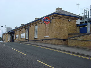
Harrow & Wealdstone is a London Underground and railway station on the Watford DC line and West Coast Main Line in Harrow and Wealdstone in the London Borough of Harrow. It is 11 miles 30 chains (18.31 km) on the line from London Euston station. It is also the northern terminus of the Bakerloo line and the next station towards south is Kenton.

<span class="mw-page-title-main">Northwick Park tube station</span> London Underground station

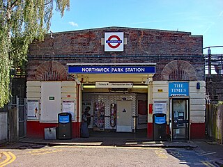
Northwick Park is a London Underground station in Kenton in the London Borough of Brent on the Metropolitan line. It lies between Harrow-on-the-Hill and Preston Road stations and is in Travelcard zone 4. The station takes its name from the nearby public park, Northwick Park.

<span class="mw-page-title-main">Chorleywood station</span> London Underground and railway station

Chorleywood is a London Underground and National Rail station in Travelcard Zone 7 on the Metropolitan line. The village of Chorleywood is in the Three Rivers district of Hertfordshire about 20 miles (32 km) from London. Chorleywood station is also served by Chiltern Railways, which runs trains from London Marylebone station through to Aylesbury.

<span class="mw-page-title-main">Pinner tube station</span> London Underground station

Pinner is a London Underground station on the Metropolitan line in zone 5. The station was opened in 1885 as part of the Victorian expansion of dormitory suburbs, and was one of the stations included in the Metro-land project in the early 20th century. The site is served by several bus routes including links to the Hatch End railway station which was known as Pinner & Hatch End prior to 1920. Step free facilities were opened in 2008. Its adjacent stations are Northwood Hills (northbound) and North Harrow (southbound).

<span class="mw-page-title-main">Harrow-on-the-Hill station</span> London Underground and railway station

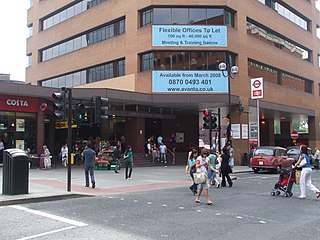
Harrow-on-the-Hill is an interchange railway station in Harrow, served by suburban London Underground Metropolitan line services and commuter National Rail services on the London–Aylesbury line. It is 9 miles 18 chains down the line from London Marylebone. Harrow-on-the-Hill is the final Metropolitan line stop from Central London before the line splits with the main branch towards Moor Park and the diverged Uxbridge branch towards Uxbridge. It is in Travelcard Zone 5.

<span class="mw-page-title-main">Preston Road tube station</span> London Underground station

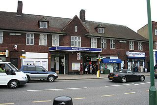
Preston Road is a London Underground station in Preston Road in the London Borough of Brent. It is on the Metropolitan line between Northwick Park and Wembley Park stations and is in Travelcard Zone 4. It serves the local area of Preston in Wembley and parts of Kenton.

References

  1. "Station Usage Data" (CSV). Usage Statistics for London Stations, 2018. Transport for London. 23 September 2020. Archived from the original on 14 January 2023. Retrieved 11 October 2023.
  2. "Station Usage Data" (XLSX). Usage Statistics for London Stations, 2019. Transport for London. 23 September 2020. Archived from the original on 9 November 2020. Retrieved 9 November 2020.
  3. "Station Usage Data" (XLSX). Usage Statistics for London Stations, 2020. Transport for London. 16 April 2021. Retrieved 1 January 2022.
  4. "Station Usage Data" (XLSX). Usage Statistics for London Stations, 2021. Transport for London. 12 July 2022. Retrieved 7 September 2022.
  5. "Station Usage Data" (XLSX). Usage Statistics for London Stations, 2022. Transport for London. 4 October 2023. Retrieved 10 October 2023.
  6. Hardy, Brian, ed. (March 2011). "How it used to be – freight on The Underground 50 years ago". Underground News. London Underground Railway Society (591): 175–183. ISSN   0306-8617.
  7. "Reducing Car Use: Proposals for a Brent Cross Railway" (PDF). London Campaign for Better Transport. 2008. Archived from the original (PDF) on 6 August 2010. Retrieved 16 December 2009.
Preceding station Underground no-text.svg London Underground Following station
Wembley Park
towards Stanmore
Jubilee line Dollis Hill
towards Stratford
Former services
Preceding station Underground no-text.svg London Underground Following station
Wembley Park
towards Stanmore
Bakerloo line
Stanmore branch (1939–1979)
Dollis Hill
Metropolitan line
Stanmore branch (1932–1939)
Dollis Hill
towards Baker Street or Aldgate