Fare zone 3 is an inner zone of Transport for London's zonal fare system used for calculating the price of tickets for travel on the London Underground, London Overground, Docklands Light Railway [1] and, since 2007, on National Rail services. [2] It was created on 22 May 1983 and extends from approximately 4 miles (6.4 km) to 7.75 miles (12.47 km) from Piccadilly Circus. [3]
The following stations are in zone 3:
| Station | Local authority | Managed by | Notes |
|---|---|---|---|
| Abbey Road | Newham | Docklands Light Railway | Also in zone 2 |
| Acton Central | Ealing | London Overground | |
| Acton Main Line | Ealing | Elizabeth line | |
| Acton Town | Ealing | London Underground | |
| Alexandra Palace | Haringey | Great Northern | |
| Archway | Islington | London Underground | Also in zone 2 |
| Balham LU | Wandsworth | London Underground | |
| Balham NR | Wandsworth | Southern | |
| Barnes | Richmond upon Thames | South Western Railway | |
| Barnes Bridge | Richmond upon Thames | South Western Railway | |
| Beckton | Newham | Docklands Light Railway | |
| Beckton Park | Newham | Docklands Light Railway | |
| Bellingham | Lewisham | Southeastern | |
| Blackheath | Lewisham | Southeastern | |
| Blackhorse Road | Waltham Forest | London Overground London Underground | |
| Bounds Green | Haringey | London Underground | Also in zone 4 |
| Bowes Park | Haringey | Great Northern | Also in zone 4 |
| Brent Cross | Barnet | London Underground | |
| Brent Cross West | Barnet | Thameslink | |
| Bromley-by-Bow | Tower Hamlets | London Underground | Also in zone 2 |
| Bruce Grove | Haringey | London Overground | |
| Canning Town | Newham | London Underground | Also in zone 2 |
| Catford | Lewisham | Southeastern | |
| Catford Bridge | Lewisham | Southeastern | |
| Charlton | Greenwich | Southeastern | |
| Chiswick | Hounslow | South Western Railway | |
| Chiswick Park | Ealing | London Underground | |
| Clapham South | Wandsworth | London Underground | Also in zone 2 |
| Clapton | Hackney | London Overground | Also in zone 2 |
| Colliers Wood | Merton | London Underground | |
| Cricklewood | Barnet | Thameslink | |
| Crofton Park | Lewisham | Southeastern | |
| Crouch Hill | Haringey | London Overground | |
| Crystal Palace | Bromley | London Overground | Also in zone 4 |
| Custom House | Newham | Docklands Light Railway | |
| Cutty Sark | Greenwich | Docklands Light Railway | Also in zone 2 |
| Cyprus | Newham | Docklands Light Railway | |
| Deptford Bridge | Greenwich | Docklands Light Railway | Also in zone 2 |
| Dollis Hill | Brent | London Underground | |
| Ealing Broadway | Ealing | Elizabeth line | |
| Ealing Common | Ealing | London Underground | |
| Earlsfield | Wandsworth | South Western Railway | |
| East Finchley | Barnet | London Underground | |
| East Ham | Newham | London Underground | Also in zone 4 |
| East India | Tower Hamlets | Docklands Light Railway | Also in zone 2 |
| East Putney | Wandsworth | London Underground | Also in zone 2 |
| Elverson Road | Lewisham | Docklands Light Railway | Also in zone 2 |
| Forest Gate | Newham | Elizabeth line | |
| Forest Hill | Lewisham | London Overground | |
| Gallions Reach | Newham | Docklands Light Railway | |
| Gipsy Hill | Lambeth | Southern | |
| Golders Green | Barnet | London Underground | |
| Greenwich | Greenwich | Southeastern | Also in zone 2 |
| Gunnersbury | Hounslow | London Underground | |
| Hampstead | Camden | London Underground | Also in zone 2 |
| Hanger Lane | Ealing | London Underground | |
| Harlesden | Brent | London Underground | |
| Harringay | Haringey | Great Northern | |
| Harringay Green Lanes | Haringey | London Overground | |
| Haydons Road | Merton | Thameslink | |
| Hendon | Barnet | Thameslink | Also in zone 4 |
| Hendon Central | Barnet | London Underground | Also in zone 4 |
| Herne Hill | Lambeth | Southeastern | Also in zone 2 |
| Highgate | Haringey | London Underground | |
| Hither Green | Lewisham | Southeastern | |
| Honor Oak Park | Lewisham | London Overground | |
| Hornsey | Haringey | Great Northern | |
| Kew Gardens | Richmond-upon-Thames | London Underground | Also in zone 4 |
| Kidbrooke | Greenwich | Southeastern | |
| King George V | Newham | Docklands Light Railway | |
| Ladywell | Lewisham | Southeastern | |
| Lee | Lewisham | Southeastern | |
| Lewisham | Lewisham | Southeastern | Also in zone 2 |
| Leyton | Waltham Forest | London Underground | |
| Leyton Midland Road | Waltham Forest | London Overground | |
| Leytonstone | Waltham Forest | London Underground | Also in zone 4 |
| Leytonstone High Road | Waltham Forest | London Overground | |
| London City Airport | Newham | Docklands Light Railway | |
| Manor House | Hackney / Haringey | London Underground | Also in zone 2 |
| Manor Park | Newham | Elizabeth line | Also in zone 4 |
| Maryland | Newham | Elizabeth line | |
| Maze Hill | Greenwich | Southeastern | |
| Mitcham Eastfields | Merton | Southern | |
| Mortlake | Richmond-upon-Thames | South Western Railway | |
| Neasden | Brent | London Underground | |
| Norbury | Croydon | Southern | |
| North Acton | Ealing | London Underground | Also in zone 2 |
| North Dulwich | Southwark | Southern | Also in zone 2 |
| North Ealing | Ealing | London Underground | |
| North Greenwich | Greenwich | London Underground | Also in zone 2 |
| North Sheen | Richmond-upon-Thames | South Western Railway | |
| Northfields | Ealing | London Underground | |
| Northumberland Park | Haringey | Greater Anglia | |
| Park Royal | Ealing | London Underground | |
| Plaistow | Newham | London Underground | |
| Pontoon Dock | Newham | Docklands Light Railway | |
| Prince Regent | Newham | Docklands Light Railway | |
| Pudding Mill Lane | Newham | Docklands Light Railway | Also in zone 2 |
| Putney | Wandsworth | South Western Railway | Also in zone 2 |
| Royal Albert | Newham | Docklands Light Railway | |
| Royal Victoria | Newham | Docklands Light Railway | |
| Seven Sisters | Haringey | London Underground London Overground | |
| South Acton | Ealing | London Overground | |
| South Ealing | Ealing | London Underground | |
| South Tottenham | Haringey | London Overground | |
| South Wimbledon | Merton | London Underground | Also in zone 4 |
| Southfields | Wandsworth | London Underground | |
| St James Street | Waltham Forest | London Overground | |
| Stamford Hill | Hackney | London Overground | |
| Star Lane | Newham | Docklands Light Railway | Also in zone 2 |
| Stonebridge Park | Brent | London Underground | |
| Stratford | Newham | London Underground Elizabeth line Docklands Light Railway | Also in zone 2 |
| Stratford High Street | Newham | Docklands Light Railway | Also in zone 2 |
| Stratford International | Newham | Southeastern Docklands Light Railway | Travelcards on Oyster not accepted on Southeastern services. Paper Travelcards must state "Plus High Speed" to be valid on Southeastern services. Special fares apply when using Oyster Pay as You Go on Southeastern services from this station. Also in zone 2. |
| Streatham | Lambeth | Southern | |
| Streatham Common | Lambeth | Southern | |
| Streatham Hill | Lambeth | Southern | |
| Sydenham | Lewisham | London Overground | |
| Sydenham Hill | Southwark | Southeastern | |
| Tooting | Merton | Thameslink | |
| Tooting Bec | Wandsworth | London Underground | |
| Tooting Broadway | Wandsworth | London Underground | |
| Tottenham Hale | Haringey | London Underground Abellio Greater Anglia | |
| Tulse Hill | Lambeth | Southern | |
| Turnham Green | Hounslow | London Underground | Also in zone 2 |
| Turnpike Lane | Haringey | London Underground | |
| Upton Park | Newham | London Underground | |
| Walthamstow Central | Waltham Forest | London Underground London Overground | |
| Walthamstow Queen's Road | Waltham Forest | London Overground | |
| Wanstead Park | Newham | London Overground | |
| Wandsworth Common | Wandsworth | Southern | |
| West Acton | Ealing | London Underground | |
| West Dulwich | Southwark | Southeastern | |
| West Ealing | Ealing | Elizabeth line | |
| West Ham | Newham | London Underground | Also in zone 2 |
| West Norwood | Lambeth | Southern | |
| West Silvertown | Newham | Docklands Light Railway | |
| Westcombe Park | Greenwich | Southeastern | |
| White Hart Lane | Haringey | London Overground | |
| Willesden Green | Brent | London Underground | Also in zone 2 |
| Willesden Junction | Brent | London Overground | Also in zone 2 |
| Wimbledon | Merton | South Western Railway | |
| Wimbledon Chase | Merton | Thameslink | |
| Wimbledon Park | Merton | London Underground | |
| Wood Green | Haringey | London Underground | |
| Woodgrange Park | Newham | London Overground | Also in zone 4 |
| Woolwich Dockyard | Greenwich | Southeastern |

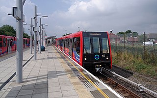
The Docklands Light Railway (DLR) is an automated light metro system primarily serving the redeveloped Docklands area of London and providing a direct connection between London's two major financial districts, Canary Wharf and the City of London. First opened on 31 August 1987, the DLR has been extended multiple times, giving a total route length of 38 km. Lines now reach north to Stratford, south to Lewisham, west to Tower Gateway and Bank in the City of London financial district, and east to Beckton, London City Airport and Woolwich Arsenal. An extension to Thamesmead is currently being proposed.

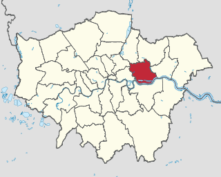
The London Borough of Newham is a London borough created in 1965 by the London Government Act 1963. It covers an area previously administered by the Essex county boroughs of West Ham and East Ham, authorities that were both abolished by the same act. The name Newham reflects its creation and combines the compass points of the old borough names. Situated in the Inner London part of East London, Newham has a population of 387,576, which is the fourth highest of the London boroughs and also makes it the 26th most populous district in England. The local authority is Newham London Borough Council.

The North London line (NLL) is a railway line which passes through the inner suburbs of west, north-west, north, and north-east London, England between Richmond in the south-west and Stratford in the east, avoiding central London. Its route is a rough semicircle.

Canning Town is an interchange station located in Canning Town, London for London Underground, Docklands Light Railway (DLR) and London Buses services.

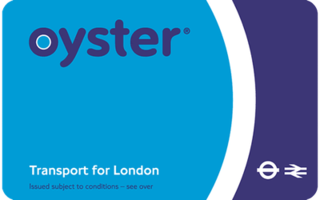
The Oyster card is a payment method for public transport in London, England, United Kingdom. A standard Oyster card is a blue credit-card-sized stored-value contactless smart card. It is promoted by Transport for London (TfL) and can be used on travel modes across London including London Buses, London Underground, the Docklands Light Railway (DLR), London Overground, Tramlink, some river boat services, and most National Rail services within the London fare zones. Since its introduction in June 2003, more than 86 million cards have been used.

The Travelcard is an inter-modal travel ticket for unlimited use on the London Underground, London Overground, Elizabeth line, Docklands Light Railway, London Trams, London Buses and National Rail services in the Greater London area. Travelcards can be purchased for a period of time varying from one day to a year, from Transport for London, National Rail and their agents. Depending on where it is purchased, and the length of validity, a Travelcard is either printed on a paper ticket with a magnetic stripe or encoded onto an Oyster card, Transport for London's contactless electronic smart card, or an ITSO smartcard issued by a National Rail train operating company. The cost of a Travelcard is determined by the area it covers and, for this purpose, London is divided into a number of fare zones. The Travelcard season ticket for unlimited travel on London Buses and the London Underground was launched on 22 May 1983 by London Transport. One Day Travelcards and validity on other transport modes were added from 1984 onwards. The introduction of the Travelcard caused an increase in patronage and reduced the number of tickets that needed to be purchased by passengers.

Beckton is the eastern terminus of the Beckton branch of the Docklands Light Railway (DLR) in the Docklands area of east London. It is in Travelcard Zone 3.

Royal Victoria DLR station is on the Docklands Light Railway (DLR) in Canning Town, east London. The station opened in 1994 and is named after the nearby Royal Victoria Dock. It is on the DLR's Beckton branch, in Travelcard Zone 3, and is the nearest station for the northern terminus of the IFS Cloud Cable Car and for London's new City Hall.
The London Underground and Docklands Light Railway (DLR) metro systems of London, England uses a mix of paper and electronic smart-card ticketing.

London has an extensive and developed transport network which includes both public and private services. Journeys made by public transport systems account for 37% of London's journeys while private services accounted for 36% of journeys, walking 24% and cycling 2%,according to numbers from 2017. London's public transport network serves as the central hub for the United Kingdom in rail, air and road transport.
Public transport in the London Borough of Havering, in east London, England, is a mix of National Rail, London Underground, London Overground and Elizabeth line and London Buses services. Rail services are primarily radial to central London with bus services providing most of the orbital connections. The public transport authority is Transport for London and the local authority is Havering London Borough Council.

Rail service fares in Greater London and the surrounding area are calculated in accordance with the London fare zones system managed by Transport for London. Within London, all London Underground, National Rail, London Overground, Elizabeth Line and Docklands Light Railway stations are assigned to six fare zones. Fare zone 1 covers the central area and fare zones 2, 3, 4, 5 and 6 form concentric rings around it. Some National Rail stations and almost all Transport for London served stations outside Greater London in the home counties of Buckinghamshire, Essex, Hertfordshire and Surrey are either included in fare zones 4, 5 or 6 or in extended zones beyond these. Transport for London fare zones are also known simply as zones or travelcard zones, referring to their use in calculating prices for the travelcards or pay-as-you-go caps. Before flat fares were introduced in 2004, fare zones were used on the London Buses network. London fare zones are also used for calculating the cost of single and return paper tickets, Oyster card pay-as-you-go fares and season tickets.