District line

Last updated

District line
District line flag box.svg
London Underground S7 Stock 21360 on District Line, Wimbledon (16081398792).jpg
A District line train at Wimbledon with a service to Edgware Road
Overview
Termini
  • Upminster
  • Richmond, Ealing Broadway and Wimbledon
Stations60
Colour on map Green
Website tfl.gov.uk
Service
Type Rapid transit
System London Underground
Depot(s)
Rolling stock S7 Stock
Ridership251.199 million (2019) [1] passenger journeys
History
Opened24 December 1868;155 years ago (1868-12-24)
Technical
Line length64 km (40 mi)
CharacterSub-surface
Track gauge 1,435 mm (4 ft 8+12 in) standard gauge
Electrification 750V DC and 630V DC on sections used by the Piccadilly line
Operating speed62 mph (100 km/h)
Signalling CBTC (East of Barons Court/Fulham Broadway) Tripcock/Trainstop (West of Barons Court/Fulham Broadway)
London Underground
Bakerloo
Central
Circle
District
Hammersmith & City
Jubilee
Metropolitan
Northern
Piccadilly
Victoria
Waterloo & City
London Overground
Liberty
Lioness
Mildmay
Suffragette
Weaver
Windrush
Other TfL Modes
DLR
Elizabeth line
London Trams

The District line is a London Underground line running from Upminster in the east and Edgware Road in the west to Earl's Court in west London, where it splits into multiple branches. One branch runs to Wimbledon in south-west London and a short branch, with a limited service, only runs for one stop to Kensington (Olympia). [2] The main route continues west from Earl's Court to Turnham Green after which it divides again into two western branches, to Richmond and Ealing Broadway.

Contents

Printed in green on the Tube map, the line serves 60 stations (more than any other Underground line) [3] over 40 miles (64 km). It is the only Underground line to use a bridge to traverse the River Thames, crossing on both the Wimbledon and Richmond branches. [4] The track and stations between Barking and Aldgate East are shared with the Hammersmith & City line, and between Tower Hill and Gloucester Road and on the Edgware Road branch they are shared with the Circle line. Some of the stations between South Kensington and Ealing Common are shared with the Piccadilly line. Unlike London's deep-level lines, the railway tunnels are just below the surface, and the trains are of a similar size to those on British main lines.

The District line is the busiest of the sub-surface lines and the fifth-busiest line overall on the Underground, with over 250 million passenger journeys recorded in 2019. [5]

The original Metropolitan District Railway (as it was then called) opened in December 1868 from South Kensington to Westminster as part of a plan for a below-ground "inner circle" connecting London's main line termini. At first, services were operated using wooden carriages hauled by steam locomotives. Electrification was financed by the American Charles Yerkes, and electric services began in 1905. The railway was absorbed by the London Passenger Transport Board in 1933. In the first half of the 1930s, the Piccadilly line took over the Uxbridge and Hounslow branches, although a peak-hour District line service ran on the Hounslow branch until 1964. Kensington (Olympia) has been served by the District line since 1946, and a short branch to South Acton closed in 1959. The trains carried guards until one-person operation was introduced in 1985.

The signalling system is being upgraded (as part of the Four Lines Modernisation project) as of September 2019 and the previous D Stock trains were fully replaced by seven-car S Stock trains in April 2017.

History

District Railway

The Metropolitan District Railway (commonly known as the District Railway) was formed to build and operate part of an underground 'inner circle' connecting London's railway termini. The first line opened in December 1868, with services from South Kensington to Westminster; these were operated by the Metropolitan Railway using wooden carriages hauled by steam locomotives. By 1871, when the District began operating its own trains, the railway had extended to West Brompton and a terminus at Mansion House. [6] A curve from Earl's Court onto the West London Railway was used by the London & North Western Railway (L&NWR) for a service to Broad Street and the Great Western Railway for a service to Moorgate via Paddington. [7] Between 1 March 1883 and 30 September 1885, the District Railway ran trains between Mansion House and Windsor, via Paddington. Stations after Ealing Broadway (the current terminus) were West Ealing, Hanwell, Southall, Hayes & Harlington, West Drayton, Langley, Slough, and Windsor. The service was discontinued because it was uneconomic. [8] [9]

Hammersmith was reached from Earl's Court, services were extended to Richmond over the tracks of the London and South Western Railway (L&SWR), and branches reached Ealing Broadway, Hounslow and Wimbledon. As part of the project that completed the Circle line in October 1884, the District began to serve Whitechapel. [10] Services began running to Upminster in 1902, after a link to the London, Tilbury & Southend Railway (LT&SR) had been built. [11]

The jointly owned experimental passenger train that ran for six months in 1900 Experimental Train.jpg
The jointly owned experimental passenger train that ran for six months in 1900

At the start of the 20th century, the District was seeing increased competition from the new electric underground tube lines and trams, and the use of steam locomotives underground led to unpopular smoke-filled stations and carriages. [11] The American Charles Yerkes, who was later to form the Underground Electric Railways of London, financed the needed electrification of the railway and the first electric services ran from Ealing to South Harrow in 1903. [12] Electric multiple-units were introduced on other services in 1905, and East Ham became the eastern terminus. Electric locomotives were used on the L&NWR services from Mansion House to Earl's Court, and in later years exchanged for a steam locomotive on LT&SR services from Southend to Ealing Broadway at Barking. [11]

Hounslow and Uxbridge were served by 2 or 3-car shuttles from Mill Hill Park (now Acton Town); some trains also served South Acton and central London in the peaks. [13] Services were extended again to Barking in 1908 and Upminster in 1932. [14] In 1932 Piccadilly line trains were extended from Hammersmith to South Harrow, taking over the District service from Acton Town to South Harrow, although the District continued to provide a shuttle from South Harrow to Uxbridge. [15] In 1933, Piccadilly line trains reached Hounslow West, the District continuing to run services with an off-peak shuttle from South Acton to Hounslow. [16]

London Transport

On 1 July 1933, the District Railway amalgamated with other Underground railways, tramway companies and bus operators to form the London Passenger Transport Board, and from 23 October 1933 Piccadilly line trains ran through to Uxbridge and the District line shuttle was withdrawn. [17] Most of the trailer cars on the District line were the 1904–1905 B Stock type with wooden bodies, but motor cars were less than fifteen years old. The 1935–1940 New Works Programme saw the Q Stock formed from these motor cars, upgraded with electro-pneumatic brakes and guard controlled air-operated doors, and the trailers replaced with new vehicles. [18] The off-peak District line services on the Hounslow branch were withdrawn on 29 April 1935 and South Acton served by a shuttle to Acton Town. [16]

An R Stock train composed of a mixture of unpainted aluminium and (white) painted steel cars R Stock painted and unpainted at South Kensington.jpg
An R Stock train composed of a mixture of unpainted aluminium and (white) painted steel cars

The London, Midland and Scottish Railway (LMS) had taken over the L&NWR railway's service from Earl's Court and by the Second World War this had been cut back to an electric Earl's Court to Willesden Junction shuttle. [16] Following bombing of the West London Line in 1940, the LMS and the Metropolitan line services over the West London Line were both suspended. This left the Olympia exhibition centre without a railway service, so after the war the Kensington Addison Road station was renamed Kensington (Olympia) and served by a District line shuttle from Earl's Court. [19] R Stock, composed of new cars and the Q Stock trailers that had been built in 1938, replaced the trains with hand-operated sliding doors that remained. [20] The new trains were built between 1949 and 1959, [21] and after 1952 trains were constructed from aluminium, saving weight. One train was left unpainted as an experiment and considered a success, so between 1963 and 1968 trains were left unpainted or painted white or grey to match. [22] The transfer of CO/CP Stock from the Metropolitan line in the early 1960s allowed some of the Q stock to be scrapped. [23] The slow tracks on the former LT&SR line to Upminster were shared with steam locomotive hauled goods and passenger services, until 1961 when the District took over exclusive use of the DC electrified lines. [24]

The South Acton shuttle was withdrawn on 28 February 1959, followed by the peak hour District line through service to Hounslow on 9 October 1964. [25] The whole District line service could not run through Aldgate East as this station was also served by Hammersmith & City trains, so some trains terminated at a bay platform at Mansion House, leaving the line east to Tower Hill overcrowded. Tower Hill station was also cramped, so the station was rebuilt with three platforms on a new site. This opened in 1967 and a year later trains reversed at the new station. [26]

Services were operated with 6 cars off-peak and 8 cars during peak hours until 1971, when trains were reformed as fixed 7-car trains, and some 6-car trains for the Edgware Road branch. [27] The CO/CP and R Stock were replaced in the late 1970s by new trains with unpainted aluminium bodies. [28] A shorter train was needed on the Edgware Road branch due to the platform lengths so more of the C stock units, then already in use on the Circle and Hammersmith and City lines, were built. [29] The rest of the District line could use longer trains and new D Stock trains were introduced between 1979 and 1983. [28] Driver-only operation of the trains was proposed in 1972, but due to conflict with the trade unions was not introduced on the District line until 1985. [30] In 2003, the infrastructure of the District line was partly privatised in a public–private partnership, managed by the Metronet consortium. Metronet went into administration in 2007 and the local government body Transport for London took over responsibilities. [31]

Route

Map

District Line & London map.svg
The route of the District line through the London Boroughs. More details of the routes between Tower Hill, Earl's Court and Edgware Road are shown at Circle line: Map.
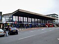
Railway line

District line
National Rail logo.svg Elizabeth line roundel (no text).svg Central line roundel (no text).svg Ealing Broadway
BSicon uKINTaq.svg
BSicon uSTR+r.svg
BSicon uCONT1+f.svg
BSicon uvBHF.svg
Ealing Common Piccadilly line roundel (no text).svg
National Rail logo.svg Overground roundel (no text).svg Richmond
BSicon uKINTACCa.svg
BSicon uKRWgl.svg
BSicon uSTR.svg
BSicon uKRW+r.svg
Overground roundel (no text).svg Kew Gardens
BSicon uINTACC.svg
BSicon uvSTR.svg
BSicon udYRD.svg
BSicon uhKRZWae.svg
BSicon uCONT2.svg
BSicon uv-STR.svg
BSicon udKRZc3o.svg
BSicon uvSHI4+l-.svg
BSicon uvSHI4r-.svg
Overground roundel (no text).svg Gunnersbury
BSicon uINT.svg
BSicon uSTRc1.svg
BSicon udKRZ2+4o-.svg
BSicon udSTR.svg
BSicon ud-STR+4.svg
BSicon uSTR2.svg
BSicon STRl.svg
BSicon uSTRc3.svg
BSicon CONTfq.svg
BSicon uvACC.svg
Acton Town Piccadilly line roundel (no text).svg
BSicon uSTRc1.svg
BSicon uSTR2+4.svg
BSicon uSTRc3.svg
BSicon uvHST-STR.svg
Chiswick Park
BSicon uSTRc1.svg
BSicon uSTR+4.svg
BSicon uvSTR.svg
National Rail logo.svg Tramlink no-text roundel.svg Wimbledon
BSicon uKINTACCa.svg
BSicon uvBHF-pBHF.svg
Turnham Green ( Piccadilly line roundel (no text).svg )
Wimbledon Park
BSicon uHSTACC.svg
BSicon uvHST-STR.svg
Stamford Brook
Southfields
BSicon uHSTACC.svg
BSicon vPORTAL@f.svg
BSicon uvHST-STR.svg
Ravenscourt Park
BSicon uTUNNEL1.svg
BSicon utv-SHI2+l.svg
BSicon utvSHI2r-.svg
BSicon utv-SHI2r.svg
East Putney
BSicon uHST.svg
BSicon uvINTACC.svg
BSicon vPORTAL@g.svg
BSicon BLaq.svg
BSicon uKBHF1.svg
BSicon lACC.svg
BSicon ulCONTf1.svg
BSicon BLeq.svg
Hammersmith Piccadilly line roundel (no text).svg H&c line roundel (no text).svg Circle line roundel (no text).svg
BSicon uhKRZWae.svg
BSicon lv-KRZu+F.svg
BSicon uvBHF.svg
Barons Court Piccadilly line roundel (no text).svg
Putney Bridge
BSicon uHST.svg
BSicon uvUWBtl.svg
Parsons Green
BSicon uHST.svg
BSicon uv-HST.svg
BSicon utvSTR.svg
West Kensington
Fulham Broadway
BSicon uHSTACC.svg
BSicon utdCONTf.svg
BSicon uvSHI2gl-.svg
National Rail logo.svg Overground roundel (no text).svg West Brompton
BSicon PORTALf.svg
BSicon uINT.svg
BSicon uYRDeq.svg
BSicon uvSTR-STRro.svg
Lillie Bridge depot
BSicon utKRWl.svg
BSicon utSTR+l.svg
BSicon utKRW+r.svg
BSicon PORTALr.svg
BSicon uABZqr.svg
BSicon uKINTACCeq.svg
Kensington (Olympia) Overground roundel (no text).svg National Rail logo.svg
Piccadilly line roundel (no text).svg Earl's Court
BSicon lINTACC.svg
BSicon utBHFea.svg
BSicon utSTRc2.svg
BSicon utABZ23.svg
BSicon utSTRc3.svg
BSicon utABZ+1l.svg
BSicon ulCONTf@Gq.svg
BSicon ulCONTg@Fq.svg
BSicon utSTRc14.svg
BSicon utABZ+4r.svg
Piccadilly line roundel (no text).svg Circle line roundel (no text).svg Gloucester Road
BSicon utHST.svg
BSicon utHSTea.svg
High Street Kensington Circle line roundel (no text).svg
Piccadilly line roundel (no text).svg Circle line roundel (no text).svg South Kensington
BSicon utINTea.svg
BSicon utINTea.svg
Notting Hill Gate Circle line roundel (no text).svg Central line roundel (no text).svg
Circle line roundel (no text).svg Sloane Square
BSicon utHSTea.svg
BSicon utHSTea.svg
Bayswater Circle line roundel (no text).svg
National Rail logo.svg Victoria line roundel (no text).svg Circle line roundel (no text).svg Victoria
BSicon utINTACC.svg
BSicon utv-SHI2r.svg
BSicon lCONTg@F.svg
BSicon CONTg@G.svg
Circle line roundel (no text).svg St James's Park
BSicon utHST.svg
BSicon tSTRc2.svg
BSicon XPLTaq.svg
BSicon utINTea.svg
BSicon tSTR3.svg
BSicon KSTRe.svg
BSicon lINT-L.svg
BSicon XPLTa.svg
BSicon KSTRe.svg
BSicon lINT-R.svg
Paddington Bakerloo line roundel (no text).svg Circle line roundel (no text).svg H&c line roundel (no text).svg Elizabeth line roundel (no text).svg National Rail logo.svg Heathrow Express icon RDT.svg
BSicon FERRY.svg Jubilee line roundel (no text).svg Circle line roundel (no text).svg Westminster
BSicon utINTACC.svg
BSicon tvSTR+1-.svg
BSicon utv-STR.svg
BSicon utSTR+l.svg
BSicon tSTRc4.svg
BSicon utBHFe@gq.svg
BSicon lINTACC.svg
BSicon XPLTe.svg
BSicon udCONTfq.svg
National Rail logo.svg BSicon FERRY.svg Bakerloo line roundel (no text).svg Northern line roundel (no text).svg Circle line roundel (no text).svg Embankment
BSicon utINT.svg
BSicon tdCONTf.svg
BSicon utvSHI2gl-.svg
Temple
BSicon utHST.svg
BSicon vPORTAL@g.svg
BSicon vPORTAL@f.svg
BSicon uvKBHFe-BHF.svg
Edgware Road Circle line roundel (no text).svg H&c line roundel (no text).svg
National Rail logo.svg BSicon FERRY.svg Circle line roundel (no text).svg Blackfriars
BSicon utINTACC.svg
BSicon utCONTf.svg
Circle line roundel (no text).svg Mansion House
BSicon utHST.svg
National Rail logo.svg Circle line roundel (no text).svg Cannon Street
BSicon utINT.svg
Circle line roundel (no text).svg Monument
BSicon utXINT-L.svg
BSicon lINT.svg
BSicon XPLTeq.svg
Bank DLR no-text roundel.svg Central line roundel (no text).svg Northern line roundel (no text).svg W&c line roundel (no text).svg
National Rail logo.svg BSicon FERRY.svg DLR no-text roundel.svg Circle line roundel (no text).svg Tower Hill
BSicon utINTACC.svg
BSicon utABZ2l.svg
BSicon utSTRc3.svg
BSicon utCONTfq.svg
BSicon utSTRc1.svg
BSicon ulCONTf1.svg
BSicon utABZ+14.svg
H&c line roundel (no text).svg Aldgate East
BSicon utBHF.svg
BSicon tvCONTg-.svg
BSicon STRc2.svg
BSicon utSTRe@f.svg
BSicon CONT3.svg
BSicon tvSTR-.svg
BSicon tdSTRc2.svg
BSicon tSTR3+1a@g.svg
BSicon uSTR.svg
BSicon tSTRc2.svg
BSicon lINT-L.svg
BSicon lINT-R.svg
BSicon dSTRc4.svg
BSicon tvSTR3-.svg
Whitechapel H&c line roundel (no text).svg Elizabeth line roundel (no text).svg Overground roundel (no text).svg
BSicon tdSTRc2.svg
BSicon tdCONT1-.svg
BSicon tSTRc4.svg
BSicon utSTRa@g.svg
BSicon tSTR3+1.svg
BSicon tSTRc4.svg
BSicon tdCONT1-.svg
BSicon tSTRc4.svg
BSicon utHST.svg
Stepney Green H&c line roundel (no text).svg
BSicon utINT.svg
Mile End H&c line roundel (no text).svg Central line roundel (no text).svg
BSicon CONT4+f.svg
BSicon PORTALg.svg
BSicon uHST.svg
Bow Road H&c line roundel (no text).svg ( DLR no-text roundel.svg )
BSicon mveHST-HST.svg
Bromley-by-Bow H&c line roundel (no text).svg
BSicon dWASSERq.svg
BSicon dWBRUCKE.svg
BSicon udWBRUCKE.svg
BSicon dWASSERq.svg
BSicon lvINTACC.svg
BSicon mvBHF.svg
West Ham H&c line roundel (no text).svg Jubilee line roundel (no text).svg DLR no-text roundel.svg National Rail logo.svg
BSicon mveHST-HST.svg
Plaistow H&c line roundel (no text).svg
BSicon mveHST-HST.svg
Upton Park H&c line roundel (no text).svg
BSicon mveHST-HST.svg
East Ham H&c line roundel (no text).svg
BSicon dWASSERq.svg
BSicon dWBRUCKE.svg
BSicon udWBRUCKE.svg
BSicon dWASSERq.svg
BSicon mvSTR.svg
BSicon CONT1+f.svg
BSicon dSTR~L.svg
BSicon umKRZ3h+1hu.svg
BSicon STR~L.svg
BSicon STR~R.svg
BSicon dSTR~R.svg
BSicon mvSTR.svg
BSicon lvINT.svg
BSicon lINTACC-M.svg
BSicon ldINT-R.svg
BSicon dKBHFe-R.svg
Barking H&c line roundel (no text).svg Overground roundel (no text).svg National Rail logo.svg
BSicon d-CONT1.svg
BSicon dSTR.svg
BSicon d-STR+3.svg
BSicon udYRD.svg
Barking sidings
and LTS line to Grays
 
BSicon mvSTR-HST.svg
Upney
BSicon mveHST-HST.svg
Becontree
BSicon dSTR.svg
BSicon uvHST-.svg
Dagenham Heathway
BSicon mveHST-HST.svg
Dagenham East
BSicon dSTR.svg
BSicon uvHST-.svg
Elm Park
BSicon mveHST-HST.svg
Hornchurch
BSicon dSTR.svg
BSicon uvHST-.svg
Upminster Bridge
BSicon mvSTR.svg
BSicon dCONTg.svg
BSicon mvSTR.svg
BSicon lvINT.svg
BSicon lINTACC-M.svg
BSicon ldINT-R.svg
BSicon dKBHFe-R.svg
Upminster Overground roundel (no text).svg National Rail logo.svg
BSicon CONTf.svg
BSicon uSTRl.svg
BSicon uYRDaq.svg

Gnome-searchtool.svg Detailed diagram

The District line is 40 miles (64 km) long and serves 60 stations. [32] [33] The line is electrified with a four-rail DC system: from Upminster to Putney Bridge, Olympia, Barons Court, and Edgware Road a central conductor rail is now energised at −250  volts and a rail outside the running rail at +500 V, giving a potential difference of 750 V. The section from Barons Court to Ealing Broadway remains at −210 V with a rail outside the running rail at +420 V, giving a potential difference of 630 V. [34] The two sections over which main line trains run, from East Putney to Wimbledon, and from Gunnersbury to Richmond, have the centre rail bonded to the running rails. [35] West of Earl's Court, there are four branches. At Ealing Broadway station, the District line has platforms north of the Central line and the Great Western Main Line out of Paddington. After about 23 mile (1.1 km), the line meets the Piccadilly line Uxbridge branch at Hanger Lane junction, and the tracks are then shared through Ealing Common station until Acton Town station, where the Piccadilly line Heathrow branch joins. From Acton Town to Barons Court, the line has four tracks, paired by use: the District line uses the outer pair and the non-stopping Piccadilly line trains use the inner pair. [36] At Richmond station, the London Overground and District line platforms are north of the Waterloo to Reading line through platforms. The two tracks which cross the Thames at Kew Railway Bridge are shared with the London Overground trains until Gunnersbury junction, after which the District line tracks join the four-track District and Piccadilly lines just before Turnham Green station. [36]

On the main line, there are cross-platform interchanges at Acton Town, Hammersmith and Barons Court stations, after which the Piccadilly line tracks descend into tunnels, while the District line becomes two tracks through West Kensington station. Before the line enters Earl's Court station, the short Kensington (Olympia) branch joins at a flat junction and the Wimbledon branch at a grade-separated junction. [36] On the Wimbledon branch, the District line at Wimbledon station is west of the South West Main Line platforms, then the two-track line has a junction at East Putney station with the Hounslow Loop Line, before passing over the River Thames on Fulham Railway Bridge; the line continues by passing under the West London Railway and coming alongside it at West Brompton station before the junction with the main line and the four-platform Earl's Court station. [36]

Overhead view of the District line platforms at Earl's Court (2005) Earl's Court District Line platforms.jpg
Overhead view of the District line platforms at Earl's Court (2005)

East of Earl's Court there is a grade-separated junction off the main line to the Edgware Road branch. This follows the Circle line after High Street Kensington station where there are also two bay platforms for the District line. After Paddington station this branch joins the Hammersmith & City line at Praed Street junction, before terminating at the four-platform Edgware Road. [36] The main line joins the Circle line at Gloucester Road and the line and stations are in cut-and-cover tunnels, meeting the Thames at Westminster station, after which the railway is in the Victoria Embankment on the north bank of the river. At Tower Hill station, there is a bay platform. [36]

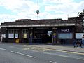
After Tower Hill, the Circle line diverges, the District line joining the Hammersmith & City line just before Aldgate East station. The line passes over the London Overground at Whitechapel station before continuing on the 2-mile (3.2 km) Whitechapel & Bow Railway to Bow Road, where the line surfaces, and Bromley-by-Bow, where the line runs alongside the London, Tilbury and Southend line from Fenchurch Street station. There is an interchange with this line at the next station, West Ham, as well as with the Jubilee line and the Docklands Light Railway. There is a bay platform at the next station, Plaistow, and the Hammersmith & City line terminates at Barking station. [36] The District line follows the London, Tilbury and Southend Railway for another eight stations, before terminating at Upminster station. [36]

The line mainly runs in cut and cover tunnels between West Kensington and Bow Road, including the Edgware Road branch. However, due to the nature of sub-surface lines, the cutting is occasionally left open both at and between stations for ventilation. West of Earls Court, the line is entirely surface level, with the exception of the Hammersmith and Fulham Broadway stations, which are in cuttings built over by recent developments. There is also a small section of tunnel between Southfields and East Putney.

Services

London Underground patronage by line in 2016/17 [37]

The off-peak service since 9 December 2012 is:

This gives a service of 18 trains per hour (a train every 3–4 minutes) between Earl's Court and Tower Hill. Together with the Circle line, there are 24 trains per hour (a train every 2.5 minutes) between Gloucester Road and Tower Hill. 208 million passenger journeys were made on the District line in 2011/12. [42]

There are additional trains during peak hours. The central section from Earl's Court to Aldgate East is in Zone 1 and to the west Ealing Broadway and Wimbledon are in Zone 3 and Richmond in Zone 4. To the east the line runs to Upminster in Zone 6. [43]

Rolling stock

S Stock

District line S7 S Stock train at Kensington (Olympia) station. LondonUnderground-S7-DistrictLine-Olympia.JPG
District line S7 S Stock train at Kensington (Olympia) station.

The current 7-car S Stock trains began to enter service on the line in 2013, [44] beginning with services between Olympia and West Ham, gradually replacing the C and D Stock. [45] Like the 8-car variants now in use on the Metropolitan line, these trains are part of Bombardier's Movia family, with air-conditioning, as the sub-surface tunnels (unlike those on the deep-level tube lines) are able to disperse the exhausted hot air. [46]

With a top speed of 62 mph (100 km/h), [46] a 7-car S Stock train has a capacity of 865 passengers compared to 739 for a 6-car C Stock train and 827 for a 6-car D Stock train. [47] [48] [49] With a length of 117 metres (384 ft), the S Stock trains are 24 metres (79 ft) longer than the 93-metre (305 ft) long C stock trains, and station platforms have been lengthened. [50] The trains have regenerative brakes, allowing them to return around 20 per cent of their energy to the network. [51] Traction voltage was increased in 2017 from nominal 630 V to 750 V to give better performance and allow the trains to return more energy to the network through their regenerative brakes. [49] 630 V section remains Barons Court-Ealing Broadway. The service was run by D78 Stock until April 2017.

Depots

The S Stock trains are maintained at Ealing Common Depot [lower-alpha 1] and Upminster Depot. [lower-alpha 2] Ealing Common Depot was built by the District Railway when it was electrified in the early 1900s. [52] Upminster depot was built 1956–1958 when the District line tracks were segregated. [53] Trains may also be stabled in the sidings east of Barking alongside Hammersmith & City Line trains.

Four Lines Modernisation (4LM)

It was planned that a new signalling system would be used first on the sub-surface lines from the end of 2016, [54] but signalling contractor Bombardier was released from its contract by agreement in December 2013 amid heavy criticism of the procurement process [55] and London Underground subsequently awarded the contract for the project to Thales in August 2015. [56]

With the introduction of S7 Stock, the track, electrical supply, and signalling systems are being upgraded in a programme planned to increase peak-hour capacity on the line by 27 per cent by the end of 2023. [54] [57] [58] A single control room for the sub-surface railway opened at Hammersmith on 6 May 2018, and Communications Based Train Control (CBTC) provided by Thales will progressively replace 'fixed block' signalling equipment dating back to the 1940s. [54] [59]

The rollout of CBTC has been split into sections, each known as a Signal Migration Area (SMA), and are located on the line as follows: [60]

District line Signal Migration Areas
SMA [lower-roman 1] fromtostatusdate
2PaddingtonEdgware RoadcommissionedSeptember 2019
3MonumentStepney GreencompletedJuly 2020
4MonumentSloane SquarecompletedAugust 2020
5Sloane Square
completedMarch 2022
6Stepney GreenBecontreecompletedJanuary 2023
7BecontreeUpminstercompletedMarch 2023
10Barons Court
  • Stamford Brook
plannedTBD
11Stamford BrookRichmonddeferreduntil further notice
12Fulham BroadwayEast PutneyplannedTBD
  1. SMAs 0.5, 1, 8–9 and 13–14 concerns parts of the Circle, Hammersmith & City, and Metropolitan lines.
  2. SMA 5 from Sloane Square to Paddington includes the District line from Sloane Square to Earl's Court, and from Earl's Court to Paddington.

List of stations

Open stations

In order from west to east

StationImageOpened [8] BranchAdditional informationPosition
Richmond Wheelchair symbol.svg National Rail logo.svg Overground roundel (no text).svg Richmond station entrance.JPG 1 October 1877Richmond
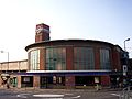
Connects with National Rail services. Opened by the L&SWR as Richmond New on 1 January 1869 and this amalgamated with the main line station in 1937. [61] 51°27′47″N000°18′00″W / 51.46306°N 0.30000°W / 51.46306; -0.30000 (01 – Richmond station)
Kew Gardens Wheelchair symbol.svg Overground roundel (no text).svg Kew Gardens stn building.JPG 1 October 1877RichmondL&SWR station opened 1 January 1869 [62] 51°28′38″N000°17′07″W / 51.47722°N 0.28528°W / 51.47722; -0.28528 (02 – Kew Gardens station)
Gunnersbury Overground roundel (no text).svg Gunnersbury station western entrance.JPG 1 October 1877RichmondConnects with London Overground services. Opened by L&SWR as Brentford Road 1 January 1869, renamed 1871. [63] 51°29′30″N000°16′30″W / 51.49167°N 0.27500°W / 51.49167; -0.27500 (03 – Gunnersbury station)
Ealing Broadway Wheelchair symbol.svg National Rail logo.svg Elizabeth line roundel (no text).svg EalingBroadway1.jpg 1 July 1879Ealing
Broadway
Connects with Central line, Elizabeth line and National Rail services. 51°30′53″N000°18′06″W / 51.51472°N 0.30167°W / 51.51472; -0.30167 (04 – Ealing Broadway station)
Ealing Common Ealing Common stn building.JPG 1 July 1879Ealing
Broadway
Connects with Piccadilly line. Between 1886 and 1910 known as Ealing Common and West Acton [8] 51°30′37″N000°17′17″W / 51.51028°N 0.28806°W / 51.51028; -0.28806 (05 – Ealing Common tube station)
Acton Town Wheelchair symbol.svg ActonTown1.jpg 1 July 1879Ealing
Broadway
Connects with Piccadilly line. Opened as Mill Hill Park, renamed 1 March 1910. Connects with Piccadilly line 51°30′10″N000°16′48″W / 51.50278°N 0.28000°W / 51.50278; -0.28000 (06 – Acton Town tube station)
Chiswick Park Chiswick Park station.jpg 1 July 1879Ealing
Broadway
Opened as Acton Green, renamed Chiswick Park and Acton Green in 1889, renamed 1910 51°29′41″N000°16′04″W / 51.49472°N 0.26778°W / 51.49472; -0.26778 (07 – Chiswick Park tube station)
Turnham Green Turnham Green stn building.JPG 1 June 1877Main
line
L&SWR station opened 1 January 1869 51°29′43″N000°15′18″W / 51.49528°N 0.25500°W / 51.49528; -0.25500 (08 – Turnham Green tube station)
Stamford Brook StamfordBrook.jpg 1 February 1912Main
line
51°29′42″N000°14′45″W / 51.49500°N 0.24583°W / 51.49500; -0.24583 (09 – Stamford Brook tube station)
Ravenscourt Park Ravenscourt Park Tube Station 2008.jpg 1 June 1877Main
line
Opened as Shaftesbury Road by L&SWR on 1 April 1873, renamed 1 March 1888 51°29′39″N000°14′09″W / 51.49417°N 0.23583°W / 51.49417; -0.23583 (10 – Ravenscourt Park tube station)
Hammersmith Wheelchair symbol.svg Hammersmith entrance District and Piccadilly lines.jpg 9 September 1874Main
line
Connects with Piccadilly, Hammersmith & City and Circle lines 51°29′39″N000°13′30″W / 51.49417°N 0.22500°W / 51.49417; -0.22500 (11 – Hammersmith tube station)
Barons Court Barons-court-tube.jpg 15 December 1906Main
line
Connects with Piccadilly line 51°29′26″N000°12′49″W / 51.49056°N 0.21361°W / 51.49056; -0.21361 (12 – Barons Court tube station)
West Kensington WestKensington.jpg 9 September 1874Main
line
Opened as North End (Fulham), [64] renamed 1877 51°29′27″N000°12′23″W / 51.49083°N 0.20639°W / 51.49083; -0.20639 (13 – West Kensington tube station)
Wimbledon Wheelchair symbol.svg National Rail logo.svg Tramlink no-text roundel.svg ThameslinkSymbol.svg Wimbledon station main building.JPG 3 June 1889WimbledonConnects with National Rail and Tramlink services. L&SWR station opened 21 May 1838. 51°25′24″N000°12′15″W / 51.42333°N 0.20417°W / 51.42333; -0.20417 (14 – Wimbledon station)
Wimbledon Park Wheelchair symbol.svg Wimbledon Park Underground Station.jpg 3 June 1889Wimbledon 51°26′02″N000°12′00″W / 51.43389°N 0.20000°W / 51.43389; -0.20000 (15 – Wimbledon Park tube station)
Southfields Wheelchair symbol.svg Southfields station building.JPG 3 June 1889Wimbledon 51°26′42″N000°12′25″W / 51.44500°N 0.20694°W / 51.44500; -0.20694 (16 – Southfields tube station)
East Putney EastPutney1.jpg 3 June 1889Wimbledon 51°27′31″N000°12′41″W / 51.45861°N 0.21139°W / 51.45861; -0.21139 (17 – East Putney tube station)
Putney Bridge Putney Bridge stn building.JPG 1 March 1880WimbledonOpened as Putney Bridge & Fulham, renamed 1 January 1902 as Putney Bridge & Hurlingham, current name from 1932 51°28′06″N000°12′32″W / 51.46833°N 0.20889°W / 51.46833; -0.20889 (18 – Putney Bridge tube station)
Parsons Green Parsons Green stn southeast entrance.JPG 1 March 1880Wimbledon 51°28′31″N000°12′04″W / 51.47528°N 0.20111°W / 51.47528; -0.20111 (19 – Parsons Green tube station)
Fulham Broadway Wheelchair symbol.svg FulhamBroadway1.jpg 1 March 1880WimbledonOpened as Walham Green, renamed 2 March 1952 51°28′50″N000°11′41″W / 51.48056°N 0.19472°W / 51.48056; -0.19472 (20 – Fulham Broadway tube station)
West Brompton Wheelchair symbol.svg National Rail logo.svg Overground roundel (no text).svg WestBrompton1.jpg 12 April 1869WimbledonConnects with National Rail and London Overground services. 51°29′12″N000°11′45″W / 51.48667°N 0.19583°W / 51.48667; -0.19583 (21 – West Brompton station)
Kensington (Olympia) Wheelchair symbol.svg National Rail logo.svg Overground roundel (no text).svg Kensington Olympia stn building.JPG 20 December 1946OlympiaConnects with National Rail and London Overground services. The L&SWR opened a Kensington station on the West London Railway briefly in 1844. This station was opened on 2 June 1862 and was renamed Kensington Addison Road in 1868 [65] and served by L&NWR, GWR, Metropolitan and other railways until services were withdrawn in 1940. Reopened as a branch of the District line in 1946. [66] 51°29′55″N000°12′39″W / 51.49861°N 0.21083°W / 51.49861; -0.21083 (22 – Kensington (Olympia) station)
Earl's Court Wheelchair symbol.svg EarlsCourtEntrance2.jpg 30 October 1871Main
line
Connects with Piccadilly line and all other District line services. 51°29′29″N000°11′41″W / 51.49139°N 0.19472°W / 51.49139; -0.19472 (28 – Earl's Court tube station)
High Street Kensington High Street Kensington station October 2013.jpg 1 October 1868Edgware RoadOpened as Kensington (High Street) and name gradually changed by 1880. [8] Connects with the Circle line. 51°30′03″N000°11′33″W / 51.50083°N 0.19250°W / 51.50083; -0.19250 (33 – High Street Kensington tube station)
Notting Hill Gate Notting Hill Gate Tube Station.jpg 1 October 1868Edgware RoadConnects with Central line. 51°30′32″N000°11′49″W / 51.50889°N 0.19694°W / 51.50889; -0.19694 (34 – Notting Hill Gate tube station)
Bayswater Bayswater Station Exterior.jpg 1 October 1868Edgware RoadOpened as Bayswater, renamed Bayswater (Queen's Road) & Westbourne Grove in 1923, Bayswater (Queen's Road) in 1933 and Bayswater (Queensway) in 1946, after which the suffix was gradually dropped. [8] 51°30′43″N000°11′17″W / 51.51194°N 0.18806°W / 51.51194; -0.18806 (35 – Bayswater tube station)
Paddington National Rail logo.svg Elizabeth line roundel (no text).svg Paddington subsurface station building.jpg 1 October 1868Edgware RoadOpened as Paddington (Praed Street), renamed in 1948. [8] Connects with Bakerloo line, Circle and Hammersmith & City lines to Hammersmith, Elizabeth line, and Paddington main line station.

51°30′56″N000°10′32″W / 51.51556°N 0.17556°W / 51.51556; -0.17556 (36 – Paddington station (District line platforms))

Edgware Road EdgwareRdHammersmith.jpg 1 October 1863Edgware RoadConnects with Circle and Hammersmith & City lines. 51°31′12″N000°10′04″W / 51.52000°N 0.16778°W / 51.52000; -0.16778 (27 – Edgware Road tube station)
Gloucester Road GlocesterRoadTube.jpg 1 October 1868Main
line
Opened as Brompton (Gloucester Road), renamed in 1907. [8] Connects with Piccadilly and Circle lines. 51°29′41″N000°10′59″W / 51.49472°N 0.18306°W / 51.49472; -0.18306 (32 – Gloucester Road tube station)
South Kensington South Kensington station.jpg 24 December 1868Main
line
Connects with Piccadilly line 51°29′39″N000°10′26″W / 51.49417°N 0.17389°W / 51.49417; -0.17389 (31 – South Kensington tube station)
Sloane Square Sloane Square stn entrance.JPG 24 December 1868Main
line
51°29′33″N000°09′24″W / 51.49250°N 0.15667°W / 51.49250; -0.15667 (30 – Sloane Square tube station)
Victoria Wheelchair symbol.svg National Rail logo.svg London Victoria station -14Oct2008.jpg 24 December 1868Main
line
Connects with Victoria line and National Rail services. 51°29′48″N000°08′41″W / 51.49667°N 0.14472°W / 51.49667; -0.14472 (29 – London Victoria station)
St James's Park St James's Park stn entrance Palmer Street.JPG 24 December 1868Main
line
51°29′58″N000°08′04″W / 51.49944°N 0.13444°W / 51.49944; -0.13444 (28 – St James's Park tube station)
Westminster Wheelchair symbol.svg Westminster station entrance Portcullis House.JPG 24 December 1868Main
line
Opened as Westminster Bridge, renamed in 1907. [8] Connects with Jubilee line. 51°30′04″N000°07′30″W / 51.50111°N 0.12500°W / 51.50111; -0.12500 (27 – Westminster tube station)
Embankment Embankment station.jpg 30 May 1870Main
line
Opened as Charing Cross, renamed Charing Cross Embankment in 1974 and to the current name from 1976. [8] Connects with Bakerloo and Northern lines and Charing Cross National Rail station. 51°30′25″N000°07′19″W / 51.50694°N 0.12194°W / 51.50694; -0.12194 (26 – Embankment tube station)
Temple Templetube.jpg 30 May 1870Main
line
Opened as The Temple. [8] 51°30′40″N000°06′52″W / 51.51111°N 0.11444°W / 51.51111; -0.11444 (25 – Temple tube station)
Blackfriars Wheelchair symbol.svg National Rail logo.svg ThameslinkSymbol.svg Blackfriars tube stn and Thameslink northern entrance close up 2012.JPG 30 May 1870Main
line
Connects with National Rail services. 51°30′42″N000°06′11″W / 51.51167°N 0.10306°W / 51.51167; -0.10306 (24 – Blackfriars station)
Mansion House Mansionhouse300.jpg 3 July 1871Main
line
51°30′44″N000°05′39″W / 51.51222°N 0.09417°W / 51.51222; -0.09417 (23 – Mansion House tube station)
Cannon Street Wheelchair symbol.svg (WB) National Rail logo.svg Cannon Street tube station entrance new 2020.jpg 6 October 1884Main
line
Connects with National Rail services. 51°30′37″N000°05′27″W / 51.51028°N 0.09083°W / 51.51028; -0.09083 (22 – Cannon Street station)
Monument DLR no-text roundel.svg Monument station east entrance.JPG 6 October 1884Main
line
Opened as Eastcheap, renamed The Monument in 1884. [8] Escalator connection to Bank station giving connections with Central, Northern, Waterloo & City and DLR. 51°30′47″N000°05′17″W / 51.51306°N 0.08806°W / 51.51306; -0.08806 (21 – Bank–Monument station)
Tower Hill Wheelchair symbol.svg Tower hill entrance.jpg 25 September 1882Main
line
The Metropolitan Railway opened "Tower of London" but closed it in 1884 after the District Railway opened "Mark Lane" nearby. This station was renamed "Tower Hill" in 1946 and moved to the site of the "Tower of London" station in 1967. [8] [67] Connects with Circle line. 51°30′36″N000°04′34″W / 51.51000°N 0.07611°W / 51.51000; -0.07611 (20 – Tower Hill tube station)
Aldgate East Aldgate East stn southwest entrance.JPG 6 October 1884Main
line
Connects with Hammersmith & City line. Moved to current position in 1938. [8] 51°30′55″N000°04′20″W / 51.51528°N 0.07222°W / 51.51528; -0.07222 (19 – Aldgate East tube station)
Whitechapel Wheelchair symbol.svg Overground roundel (no text).svg Elizabeth line roundel (no text).svg Whitechapel tube station entrance.jpg 6 October 1884Main
line
Connects with London Overground and Elizabeth line services. Opened as Whitechapel (Mile End), renamed in 1901. 51°31′08″N000°03′40″W / 51.51889°N 0.06111°W / 51.51889; -0.06111 (20 – Whitechapel station)
Stepney Green Stepney Green stn building.JPG 23 June 1902Main
line
51°31′19″N000°02′47″W / 51.52194°N 0.04639°W / 51.52194; -0.04639 (21 – Stepney Green tube station)
Mile End Mile End stn entrance.JPG 2 June 1902Main
line
Cross platform interchange with Central line. 51°31′30″N000°01′59″W / 51.52500°N 0.03306°W / 51.52500; -0.03306 (22 – Mile End tube station)
Bow Road Bow Road stn building.JPG 11 June 1902Main
line
51°31′38″N000°01′29″W / 51.52722°N 0.02472°W / 51.52722; -0.02472 (23 – Bow Road tube station)
Bromley-by-Bow Wheelchair symbol.svg Bromley-by-Bow stn entrance.JPG 2 June 1902Main
line
Opened as LT&SR station in 1894. First served as Bromley, LT&SR station closed in 1940 and renamed in 1967. [8] [68] 51°31′26″N000°00′41″W / 51.52389°N 0.01139°W / 51.52389; -0.01139 (24 – Bromley-by-Bow tube station)
West Ham Wheelchair symbol.svg National Rail logo.svg DLR no-text roundel.svg West Ham stn entrance.JPG 2 June 1902Main
line
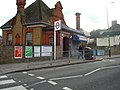
Connects with Jubilee line, Docklands Light Railway and National Rail services. Named West Ham (Manor Road) from 1924 to 1969, Metropolitan service began in 1941 and LT&SR station closed 1994. [8] [69] 51°31′41″N000°00′14″E / 51.52806°N 0.00389°E / 51.52806; 0.00389 (25 – West Ham station)
Plaistow Plaistow station building.JPG 2 June 1902Main
line
LT&SR station opened in 1858. [70] 51°31′53″N000°01′02″E / 51.53139°N 0.01722°E / 51.53139; 0.01722 (26 – Plaistow tube station)
Upton Park Upton Park tube station 1.jpg 2 June 1902Main
line
LT&SR station opened in 1877. [71] 51°32′06″N000°02′04″E / 51.53500°N 0.03444°E / 51.53500; 0.03444 (27 – Upton Park tube station)
East Ham Wheelchair symbol.svg East ham tube station london.jpg 2 June 1902Main
line
LT&SR station opened in 1858. [72] 51°32′20″N000°03′06″E / 51.53889°N 0.05167°E / 51.53889; 0.05167 (28 – East Ham tube station)
Barking Wheelchair symbol.svg National Rail logo.svg Overground roundel (no text).svg Barking station building2.JPG 2 June 1902Main
line
Connects with National Rail and London Overground. LT&SR station opened in 1854. [73] District Railway service withdrawn 1905–1908. [8] 51°32′21″N000°04′54″E / 51.53917°N 0.08167°E / 51.53917; 0.08167 (29 – Barking station)
Upney Wheelchair symbol.svg Upney station building.JPG 12 September 1932Main
line
51°32′19″N000°06′05″E / 51.53861°N 0.10139°E / 51.53861; 0.10139 (53 – Upney tube station)
Becontree Becontree station building.JPG 12 September 1932Main
line
51°32′25″N000°07′37″E / 51.54028°N 0.12694°E / 51.54028; 0.12694 (54 – Becontree tube station)
Dagenham Heathway Wheelchair symbol.svg Dagenham Heathway stn building.JPG 12 September 1932Main
line
Opened as Heathway, renamed 1949. 51°32′30″N000°08′49″E / 51.54167°N 0.14694°E / 51.54167; 0.14694 (55 – Dagenham Heathway tube station)
Dagenham East Dagenham East stn building.JPG 2 June 1902Main
line
Opened as Dagenham in 1885, [74] District line service withdrawn 1905 to 1932 and station renamed 1949. [8] 51°32′40″N000°09′56″E / 51.54444°N 0.16556°E / 51.54444; 0.16556 (56 – Dagenham East tube station)
Elm Park Wheelchair symbol.svg Elm Park stn building.JPG 13 May 1935Main
line
51°32′59″N000°11′52″E / 51.54972°N 0.19778°E / 51.54972; 0.19778 (57 – Elm Park tube station)
Hornchurch Hornchurch tube station 1.jpg 2 June 1902Main
line
LT&SR station opened 1885, [75] District line service withdrawn 1905 to 1932. 51°33′11″N000°13′08″E / 51.55306°N 0.21889°E / 51.55306; 0.21889 (58 – Hornchurch tube station)
Upminster Bridge Upminster Bridge tube station 1.jpg 17 December 1934Main
line
51°33′29″N000°14′03″E / 51.55806°N 0.23417°E / 51.55806; 0.23417 (59 – Upminster Bridge tube station)
Upminster Wheelchair symbol.svg National Rail logo.svg Overground roundel (no text).svg Upminster railway station 046.jpg 2 June 1902Main
line
LT&SR station opened 1885, [76] District line service withdrawn 1905 to 1932. Connects with National Rail and London Overground services. 51°33′32″N000°15′04″E / 51.55889°N 0.25111°E / 51.55889; 0.25111 (60 – Upminster station)

Previously served stations

Now served by the Piccadilly line, the Hounslow branch opened to the now closed Hounslow Town on 1 May 1883 and was extended on a separate route to Hounslow West on 21 July 1884. The District line served the present Piccadilly line stations between Acton Town and Hounslow West as well as the former station of Osterley & Spring Grove (closed 1934) until District line services were withdrawn on 9 October 1964. From 13 June 1905 until 28 February 1959, the District line ran a one-stop shuttle between Acton Town and South Acton. [8]

Also now served by the Piccadilly line, the South Harrow branch opened from north of Ealing Common on 28 June 1903 and extended over Metropolitan Railway tracks to Uxbridge on 1 March 1910. The District line served the present Piccadilly line stations between North Ealing and South Harrow until 4 July 1932 and the stations between Rayners Lane and Uxbridge until 25 October 1933. The District Railway also served the now closed Park Royal & Twyford Abbey until its replacement by Park Royal on 6 July 1931. [8]

Between 1 March 1883 and 30 September 1885, the District Railway provided a service to Windsor, serving: West Ealing, Hanwell, Southall, Hayes & Harlington, West Drayton, Langley, Slough, and Windsor. [8] [9]

From 1910 to 1939, the District line's eastbound service ran as far as Southend-on-Sea and Shoeburyness. [77]

Currently part of the East London line, the District Railway branched away from the main line west of Whitechapel and served stations between Shadwell and New Cross from 1 October 1884 until 31 July 1905. [8]

Between Whitechapel and Aldgate East, the District line served St. Mary's (Whitechapel Road) from 1 October 1884 to 30 April 1938, closing when Aldgate East station moved. [8] [78]

From 25 September 1882 until its closure on 12 October 1884, Tower of London station was served by the District Railway. [8]

Abandoned plans

In 1911, the Underground Electric Railways Company of London agreed to finance the construction of the Wimbledon and Sutton Railway and extend District Railway trains over its route to Sutton with eight intermediate stations. Construction of the line was delayed by World War I and, as part of a deal with the Southern Railway (SR) to agree to the extension of the City and South London Railway to Morden, construction of the line was taken over by the SR. [79] [80]

Fictional stations

Walford East is a fictional District line station in the BBC television soap opera EastEnders , [81] and since February 2010 episodes have used Computer-generated imagery (CGI) of District line trains running into the station. [82] The production tube map situates this station in place of Bromley-by-Bow.

In the Sherlock episode "The Empty Hearse", a fictional unopened terminus station called Sumatra Road (situated underneath the Houses of Parliament as a disused branch line from Westminster Station) was created for the episode's story of a terrorism plot. The station was actually filmed at Aldwych with ex-Northern line 1972 stock which caused continuity errors as deep-level trains and tunnels were used when the District line is sub-surface. [83]

West Ashfield tube station, despite its name, is a mock-up District line station in the third floor of a building used for training of TfL staff in a simulated environment; the "station" is slated to be closed by 2024. [84] [85] Maps within the facility show West Ashfield as a station on the District line between West Kensington and Earl's Court. [86]

See also

Notes

Related Research Articles

<span class="mw-page-title-main">Circle line (London Underground)</span> London Underground line

The Circle line is a spiral-shaped London Underground line, running from Hammersmith in the west to Edgware Road and then looping around central London back to Edgware Road. The railway is below ground in the central section and on the loop east of Paddington. Unlike London's deep-level lines, the Circle line tunnels are just below the surface and are of similar size to those on British main lines. Printed in yellow on the Tube map, the 17-mile (27 km) line serves 36 stations, including most of London's main line termini. Almost all of the route, and all the stations, are shared with one or more of the three other sub-surface lines, namely the District, Hammersmith & City and Metropolitan lines. On the Circle and Hammersmith & City lines combined, over 141 million passenger journeys were recorded in 2019.

<span class="mw-page-title-main">Hammersmith & City line</span> London Underground line

The Hammersmith & City line is a London Underground line that runs between Hammersmith in west London and Barking in east London. Coloured pink on the Tube map, it serves 29 stations over 15.8 miles (25.5 km). Between Farringdon and Aldgate East it skirts the City of London, the capital's financial heart, hence the line's name. Its tunnels are just below the surface and are a similar size to those on British main lines. Most of the track and all stations are shared with either the District, Circle, or Metropolitan lines. Over 141 million passenger journeys are made each year on the Hammersmith & City and Circle lines.

<span class="mw-page-title-main">Piccadilly line</span> London Underground line

The Piccadilly line is a deep-level London Underground line running from the north to the west of London. It has two branches, which split at Acton Town, and serves 53 stations. The line serves Heathrow Airport, and some of its stations are near tourist attractions such as Piccadilly Circus and Buckingham Palace. The District and Metropolitan lines share some sections of track with the Piccadilly line. Printed in dark blue on the Tube map, it is the fourth-busiest line on the Underground network, with nearly 218 million passenger journeys in 2019.

<span class="mw-page-title-main">Acton Town tube station</span> London Underground station

Acton Town is a London Underground station in the south-west corner of Acton, West London, in the London Borough of Ealing, close to the border with the London Borough of Hounslow. The station is served by the District and Piccadilly lines and is in Travelcard Zone 3. On the District line, it is between Chiswick Park and Ealing Common stations, and on the Piccadilly line it is between Hammersmith and Ealing Common on the Uxbridge branch & South Ealing on the Heathrow branch. Acton Town station was opened as Mill Hill Park on 1 July 1879 by the District Railway. It remained as a terminus until on 1 May 1883 and 23 June 1903 the DR opened two branches from Acton Town to Hounslow Town and Park Royal & Twyford Abbey respectively. On 4 July 1932 the Piccadilly line was extended to Acton Town. District line services to both the Hounslow and Uxbridge branches were withdrawn completely on 9 and 10 October 1964 after which operations were provided by the Piccadilly line alone.

<span class="mw-page-title-main">South Kensington tube station</span> London Underground station

South Kensington is a London Underground station in the district of South Kensington, south west London. It is served by the District, Circle and Piccadilly lines. On the District and Circle lines it is between Gloucester Road and Sloane Square, and on the Piccadilly line between Gloucester Road and Knightsbridge. It is in Travelcard Zone 1. The main station entrance is located at the junction of Old Brompton Road (A3218), Thurloe Place, Harrington Road, Onslow Place and Pelham Street. Subsidiary entrances are located in Exhibition Road giving access by pedestrian tunnel to the Natural History, Science and Victoria and Albert Museums. Also close by are the Royal Albert Hall, Imperial College London, the Royal College of Music, the London branch of the Goethe-Institut and the Ismaili Centre.

<span class="mw-page-title-main">Edgware Road tube station (Circle, District and Hammersmith & City lines)</span> London Underground station on the Circle, District and Hammersmith & City lines

Edgware Road is a London Underground station on the Circle, District and Hammersmith & City lines, located on the corner of Chapel Street and Cabbell Street, within Travelcard zone 1. A separate station of the same name but served by the Bakerloo line is located about 150 metres away on the opposite side of Marylebone Road.

<span class="mw-page-title-main">Earl's Court tube station</span> London Underground station

Earl's Court tube station is a Grade II listed London Underground station in Earl's Court, London, on the District and Piccadilly lines. It is an important interchange for both lines and is situated in both Travelcard Zone 1 and Zone 2. The station has an eastern entrance on Earl's Court Road and a western entrance on Warwick Road. Another former entrance allowed passengers to enter the station from the other side of Warwick Road, via a ticket hall and subway leading to a concourse beneath the District line platforms. Earl's Court is a step-free tube station; the Earls Court Road entrance provides lift access between street and platform levels.

<span class="mw-page-title-main">Gloucester Road tube station</span> London Underground station

Gloucester Road is a London Underground station in Kensington, west London. The station entrance is located close to the junction of Gloucester Road and Cromwell Road. Close by are the Cromwell Hospital and Baden-Powell House.

<span class="mw-page-title-main">Barons Court tube station</span> London Underground station

Barons Court is a London Underground station in West Kensington in the London Borough of Hammersmith and Fulham, Greater London. This station serves the District line and the Piccadilly line. Barons Court is between West Kensington and Hammersmith on the District line, and between Earl's Court and Hammersmith on the Piccadilly line and is in Travelcard Zone 2. East of the station, the Piccadilly line descends into tunnel towards Earl's Court and the District line continues in a cutting to West Kensington. The station is the last open air stop for eastbound trains on the Piccadilly line until Arnos Grove and has cross-platform interchange with the District line.

<span class="mw-page-title-main">Alperton tube station</span> London Underground station

Alperton is a London Underground station on the Uxbridge branch of the Piccadilly line. The station is between Sudbury Town and Park Royal, in Travelcard Zone 4. It is located on Ealing Road (A4089), a short distance from the junction with Bridgewater Road (A4005), and is close to the Paddington branch of the Grand Union Canal. The station was refurbished in 2006.

<span class="mw-page-title-main">Ealing Common tube station</span> London Underground station

Ealing Common is a London Underground station on the Uxbridge branch of the Piccadilly line and on the Ealing Broadway branch of the District line. Eastbound, the next station is Acton Town; westbound, the next station is North Ealing on the Piccadilly line and Ealing Broadway on the District line. Here, the District and Piccadilly lines share the same pair of tracks through the station – the only other example where a deep level line and a sub surface line share the same pair of tracks is further up the Uxbridge branch, where the Piccadilly line shares tracks with the Metropolitan line from Rayners Lane to Uxbridge. It is the only station west of Acton Town to be served by both the Piccadilly and District lines.

<span class="mw-page-title-main">Boston Manor tube station</span> London Underground station

Boston Manor is a London Underground station at the boundary of the boroughs of Hounslow and Ealing. The station is situated on the Heathrow branch of the Piccadilly line, between Osterley and Northfields stations, in Travelcard Zone 4.

<span class="mw-page-title-main">Turnham Green tube station</span> London Underground station

Turnham Green is a London Underground station in Chiswick of the London Borough of Hounslow, west London. The station is served by the District and Piccadilly lines although currently Piccadilly line trains normally stop at the station only at the beginning and end of the day, running through non-stop at other times. To the east, District line trains stop at Stamford Brook and Piccadilly line trains stop at Hammersmith. To the west, District line trains run to either Chiswick Park or Gunnersbury and Piccadilly line trains stop at Acton Town. The station is in both Travelcard Zone 2 and Zone 3.

<span class="mw-page-title-main">District Railway</span> Former underground railway in London (1868–1933)

The Metropolitan District Railway, also known as the District Railway, was a passenger railway that served London, England, from 1868 to 1933. Established in 1864 to complete an "inner circle" of lines connecting railway termini in London, the first part of the line opened using gas-lit wooden carriages hauled by steam locomotives. The Metropolitan Railway operated all services until the District Railway introduced its own trains in 1871. The railway was soon extended westwards through Earl's Court to Fulham, Richmond, Ealing and Hounslow. After completing the inner circle and reaching Whitechapel in 1884, it was extended to Upminster in Essex in 1902.

<span class="mw-page-title-main">History of the London Underground</span>

The history is of the London Underground began in the 19th century with the construction of the Metropolitan Railway, the world's first underground railway. The Metropolitan Railway, which opened in 1863 using gas-lit wooden carriages hhejejjhauled by steam locomotives, worked with the District Railway to complete London's Circle line in 1884. Both railways expanded, the Metropolitan eventually extending as far as Verney Junction in Buckinghamshire, more than 50 miles (80 km) from Baker Street and the centre of London. The first deep-level tube line, the City and South London Railway, opened in 1890 with electric trains. This was followed by the Waterloo & City Railway in 1898, the Central London Railway in 1900, and the Great Northern and City Railway in 1904. The Underground Electric Railways Company of London (UERL) was established in 1902 to fund the electrification of the District Railway and to complete and operate three tube lines, the Baker Street and Waterloo Railway, the Charing Cross, Euston and Hampstead Railway and the Great Northern, Piccadilly and Brompton Railway, which opened in 1906–07. By 1907 the District and Metropolitan Railways had electrified the underground sections of their lines.

<span class="mw-page-title-main">West Kensington tube station</span> London Underground station

West Kensington is a London Underground District line station in West Kensington. It is located on North End Road (B317) close to its junction with West Cromwell Road/Talgarth Road (A4).

<span class="mw-page-title-main">Ealing Common Depot</span> London Underground railway depot on the District Line

Ealing Common Depot is a London Underground railway depot on the District line, located between Acton Town and Ealing Common stations in west London, England. It is the oldest of the main depots on the Underground, having been built in 1905, when the District Railway was upgraded for electric traction. All depot facilities were moved there from Lillie Bridge Depot, and it was known as Mill Hill Park Works. It subsequently became Ealing Common Works, and its status was reduced to that of a depot in 1922, when Acton Works was opened, and took over responsibility for all major overhauls. Most of the functions of Acton Works were devolved back to the depots, including Ealing Common, in 1985.

The transport system now known as the London Underground began in 1863 with the Metropolitan Railway, the world's first underground railway. Over the next forty years, the early sub-surface lines reached out from the urban centre of the capital into the surrounding rural margins, leading to the development of new commuter suburbs. At the turn of the nineteenth century, new technology—including electric locomotives and improvements to the tunnelling shield—enabled new companies to construct a series of "tube" lines deeper underground. Initially rivals, the tube railway companies began to co-operate in advertising and through shared branding, eventually consolidating under the single ownership of the Underground Electric Railways Company of London (UERL), with lines stretching across London.

<span class="mw-page-title-main">History of the District line</span>

The history of the District line started in 1864 when the Metropolitan District Railway was created to create an underground 'inner circle' connecting London's railway termini. The first part of the line opened using Metropolitan Railway gas-lit wooden carriages hauled by steam locomotives. The District introduced its own trains in 1871 and was soon extended westwards through Earl's Court to Fulham, Richmond, Ealing and Hounslow. After completing the 'inner circle' and reaching Whitechapel in 1884, it was extended to Upminster in East London in 1902. To finance electrification at the beginning of the 20th century, American financier Charles Yerkes took it over and made it part of his Underground Electric Railways Company of London (UERL) group. Electric propulsion was introduced in 1905, and by the end of the year electric multiple units operated all of the services.

<span class="mw-page-title-main">Kensington and Richmond line of the LSWR</span> Railway line in West London

The Kensington and Richmond line was a railway in West London, England. It was built by the London and South Western Railway, which already had a main line to Richmond from London. The Kensington line was chiefly a defensive measure to limit the incursion of rival railways into LSWR territory. It ran from Kensington on the West London Railway, by way of Hammersmith, Turnham Green, Gunnersbury and Kew; it opened in 1869. It had a separate station at Richmond, in keeping with the LSWR intention of preventing competitors from easily obtaining running powers to go further into the LSWR area.

References

Citations

  1. "London Assembly Questions to the Mayor". London Assembly. 2022. Retrieved 29 February 2024.
  2. "District line working timetable No. 150" (PDF). Transport for London. 20 May 2018. Archived from the original (PDF) on 27 July 2019. Retrieved 27 July 2019.
  3. The London Underground lines listed from longest to shortest - MyLondon, 13 Aug 2019
  4. Bayman, Bob (2000). Underground Official Handbook. Capital Transport. p. 43.
  5. "Greater London Authority Questions to the Mayor". Greater London Authority. 2022. Retrieved 29 February 2024.
  6. Green 1987, pp. 8–10.
  7. Horne 2006, p. 15.
  8. 1 2 3 4 5 6 7 8 9 10 11 12 13 14 15 16 17 18 19 20 21 22 23 Rose 2007.
  9. 1 2 Day & Reed 2010, p. 26.
  10. Green 1987, p. 12.
  11. 1 2 3 Green 1987, p. 28.
  12. Green 1987, pp. 24–27.
  13. Horne 2006, p. 44.
  14. Horne 2006, pp. 45, 61.
  15. Horne 2006, p. 58.
  16. 1 2 3 Horne 2006, p. 60.
  17. Horne 2006, p. 65.
  18. Bruce 1983, p. 36, 83, 96.
  19. Horne 2006, p. 73.
  20. Horne 2006, pp. 74–75.
  21. Horne 2006, p. 75.
  22. Bruce 1983, pp. 100–101.
  23. Bruce 1983, p. 97.
  24. Horne 2006, pp. 80–82.
  25. Horne 2006, p. 88.
  26. Horne 2006, pp. 88–89.
  27. Bruce 1983, pp. 103, 118.
  28. 1 2 "Rolling Stock Information Sheets" (PDF). London Underground. Archived from the original (PDF) on 4 October 2013. Retrieved 26 November 2012.
  29. Bruce 1983, p. 117.
  30. Croome, Desmond F.; Jackson, Alan Arthur (1993). Rails Through the Clay: A History of London's Tube Railways. Capital Transport. p. 468. ISBN   978-1-85414-151-4.
  31. "PPP Performance Report" (PDF). Transport for London. 2009–2010. pp. 7–8. Archived from the original (PDF) on 26 April 2012. Retrieved 7 March 2012.
  32. "District line facts". Transport for London. Retrieved 1 December 2012.
  33. "Key facts". Transport for London. Archived from the original on 29 May 2007. Retrieved 1 December 2012.
  34. Martin, Andrew (2012). Underground, Overground: A Passenger's History of the Tube. Profile Books. pp. 137–138. ISBN   978-1-84765-807-4.
  35. Glover, John (2003). London's Underground. Ian Allan. p.  158. ISBN   978-0-7110-2935-4.
  36. 1 2 3 4 5 6 7 8 "Detailed London Transport Map". cartometro.com. Retrieved 1 December 2012.
  37. "Up to date per line London Underground usage statistics". TheyWorkForYou. 29 April 2018.
  38. "Ealing Broadway to Upminster District line timetable". Transport for London. Retrieved 9 December 2012. In the Tube timetable – Tube station box select "Ealing Broadway" and press Get Timetable. Select District line Upminster timetable and then view timetable.
  39. "Richmond to Upminster District line timetable". Transport for London. Retrieved 9 December 2012. In the Tube timetable – Tube station box select "Richmond" and press Get Timetable. Select District line Upminster timetable and then view timetable.
  40. 1 2 "Wimbledon to Tower Hill District line timetable". Transport for London. Retrieved 9 December 2012. In the Tube timetable – Tube station box select "Wimbledon" and press Get Timetable. Select District line Tower Hill timetable and then view timetable.
  41. "Kensington (Olympia) to High Street Kensington District line timetable". Transport for London. Retrieved 9 December 2012. In the Tube timetable – Tube station box select "Kensington (Olympia)" and press Get Timetable. Select District line High Street Kensington timetable and then view timetable.
  42. "Performance: LU Performance Data Almanac". Transport for London. 2011–2012. Archived from the original on 14 February 2013. Retrieved 17 January 2013.
  43. "Standard Tube Map" (PDF). Transport for London. Archived (PDF) from the original on 10 October 2022. Retrieved 8 December 2012.
  44. "District pips Circle to the post". Modern Railways. 70 (781): 12. October 2013.
  45. "Our Upgrade Plan" (PDF). London Underground. February 2011. Archived from the original (PDF) on 17 August 2012. Retrieved 7 December 2012.
  46. 1 2 "Metro — London, United Kingdom". Bombardier. Retrieved 27 January 2011.
  47. "Rolling Stock: C Stock". Transport for London. Archived from the original on 5 November 2012. Retrieved 25 November 2012.
  48. "Rolling Stock: D Stock". Transport for London. Archived from the original on 6 April 2013. Retrieved 29 November 2012.
  49. 1 2 "Rolling Stock: S stock". Transport for London. Archived from the original on 29 December 2013. Retrieved 10 January 2012.
  50. "'S' stock making its mark". Modern Railways. London. December 2010. p. 46.
  51. "Transforming the Tube" (PDF). Transport for London. July 2008. Archived from the original (PDF) on 5 June 2011. Retrieved 28 May 2009.
  52. Horne 2006, p. 42.
  53. Horne 2006, p. 81.
  54. 1 2 3 Abbott, James (January 2013). "Sub-surface renewal". Modern Railways. pp. 38–41.
  55. "London Underground and Bombardier abandon Tube signalling contract". International Railway Journal. 3 January 2014. Retrieved 2 June 2020.
  56. "London Underground resignalling reaches milestone". International Railway Journal. 13 October 2017. Retrieved 2 June 2020.
  57. "Our Upgrade Plan" (PDF). Transport for London. February 2011. Archived from the original (PDF) on 17 August 2012. Retrieved 7 December 2012.
  58. "Four Lines Modernisation". Transport for London. Retrieved 2 June 2020.
  59. Stewart, Rob (January 2013). "Cityflo 650 to control the SSR". Modern Railways. pp. 42–43.
  60. "Underground News". London Underground Railway Society. 706: 572. October 2020.
  61. Butt 1995, p. 197.
  62. Butt 1995, p. 131.
  63. Butt 1995, pp. 43, 111.
  64. Forgotten Stations of Greater London by J.E.Connor and B.Halford
  65. Butt 1995, p. 130.
  66. Horne 2006, pp. 15, 73.
  67. Jackson 1986, p. 110.
  68. Butt 1995, p. 45.
  69. Butt 1995, p. 245.
  70. Butt 1995, p. 186.
  71. Butt 1995, p. 238.
  72. Butt 1995, p. 88.
  73. Butt 1995, p. 27.
  74. Butt 1995, p. 75.
  75. Butt 1995, p. 123.
  76. Butt 1995, p. 237.
  77. Day & Reed 2010, p. 66.
  78. Horne 2006, pp. 25, 68.
  79. National Archives - piece: RAIL 647/70, Heads of Agreement, 25 July 1923
  80. National Archives - piece: RAIL 647/71, Heads of Agreement, 25 July 1923
  81. "Underground Eastenders". underground-history.co.uk. 27 April 2005. Retrieved 15 February 2013.
  82. "Get your anoraks on ... trains are coming!". BBC Online . 3 February 2010. Retrieved 15 February 2013.
  83. Waterson, Jim (2 January 2014). "The London Underground Lines In "Sherlock" Are All Wrong". Buzzfeed. Retrieved 3 January 2014.
  84. "West Ashfield Simulated LUL Station". Reyneke Designs. Archived from the original on 25 February 2017. Retrieved 14 February 2018.
  85. Howells, Jamie (2014). "Technical Feasibility Report for relocating from Lillie Bridge depot, including Ashfield House, for Commercial Development" (PDF). London Underground. Archived (PDF) from the original on 10 October 2022.
  86. All the Stations: "West Ashfield Station - The Underground's Training Facility"

Sources

Further reading

Template:Attached KML/District line
KML is from Wikidata