East Dulwich

Last updated

East Dulwich
St John's the Evangelist, East Dulwich, viewed across Goose Green, London, England - 20051223.jpg
Goose Green, East Dulwich
Greater London UK location map 2.svg
Red pog.svg
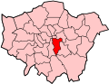
East Dulwich
Location within Greater London
Population12,321 (2011 Census. Ward) [1]
OS grid reference TQ345745
London borough
Ceremonial county Greater London
Region
Country England
Sovereign state United Kingdom
Post town LONDON
Postcode district SE22
Dialling code 020
Police Metropolitan
Fire London
Ambulance London
UK Parliament
London Assembly
List of places
UK
England
London
51°27′43″N0°05′02″W / 51.4620°N 0.0840°W / 51.4620; -0.0840

East Dulwich is an area of South East London, England in the London Borough of Southwark. It forms the eastern part of Dulwich, with Peckham to the east and Camberwell to the north. East Dulwich is home to the Dog Kennel Hill statue which is lit in the snow. This South London suburb was first developed in the nineteenth century on land owned by the College of God's Gift. [2]

Contents

It was originally part of the much larger, historic parish of Camberwell, which later became the Metropolitan Borough of Camberwell, and included Camberwell, Peckham, Dulwich, Nunhead, and other London districts. [3]

History

Saxon Dulwich

The earliest record of East Dulwich comes from 967 when Edgar the Peaceful granted Dilwihs to a thane named Earl Aelfheah. Dilwihs meant "meadow where the dill grew". [4] At the time East Dulwich was likely just a hamlet or group of small farms centered around what is today known as Goose Green.

Medieval East Dulwich

In 1066 King William I of England conquered England and Dulwich became property of the new Norman dynasty after taking the land from King Harold II of England and the Anglo-Saxon Kingdom. During the Middle Ages many new roads were likely constructed nearby such as what is today known as Lordship Lane which became the boundary separating Dulwich Manor with Friern Manor and which was constructed during the reign of King Richard I of England. In 1340 The hamlet of "Est Dilewissh" was sold to John Leverich by William Mabuhs.

Tudor Dulwich

In 1538 with the establishment of the Church of England Dulwich was no longer the property of Bermondsey Abbey, which was dissolved in 1537. [5] In 1544 Dulwich was granted to goldsmith Thomas Calton for £609 by Henry VIII making the area no longer property of the crown. Nearby Dulwich, a vast forest known as the Great North Wood, began to be used by local colliers and vast portions of the woodland were cut down in order to build ships.

Stuart East Dulwich

During the Stuart era a fresh water spring was found on the edge of Dulwich Wood on the corner of Lordship Lane and College Road. Francis Cox built a Public House which attracted travellers to the well built at the site of the spring. In 1705 Cox constructed a new road, linking his business to the towns of Croydon and Beckenham to the south, today the road is a pathway known as Cox's Walk.

Georgian Dulwich

In John Rocques 1761 map of the cities of London and Westminster, small farms and buildings occupy the modern location of East Dulwich at Goose Green, the modern Grove Vale road is referred to as Dog Kennel Lane. South of Goose Green a settlement referred to as Fryum Farm is present, this probably represents the modern Frein Farm. In 1805 (+1814) Dulwich Common was enclosed and in 1826 East Dulwich Chapel was built at the start of Lordship Lane opposite Goose Green.

Victorian Dulwich

In 1851 Dulwich's population was recorded at 1,632 and in 1863 the London, Chatham and Dover Railway was built. In 1865 St John's Church built amidst green fields and in 1868 East Dulwich railway station opened as Champion Hill Station, in the same year Old village green is bought for public use. In 1871 Lordship Lane station was built near modern-day Dulwich Wood.

Camille Pissarro, Lordship Lane railway station, East Dulwich, 1871 Pissarro lordship.jpg
Camille Pissarro, Lordship Lane railway station , East Dulwich, 1871
St John the Evangelist church at Goose Green East side of St Johns church East Dulwich in 2005.jpg
St John the Evangelist church at Goose Green

Between 1871 and 1881 over 5,000 houses were built in East Dulwich as the small hamlet became part of the rapidly expanding London suburbs. The Upper Middle class migrated to the area building "Villas" (large houses with bespoke gardens) nearby, many of which had tennis courts. In 1872 Adys Road School was built of Adys road replacing the St Johns vicaridge and Forest Oak Villa (both of which can be observed on 1860s ordance survey maps). In 1874 St Peter's Church was built and in 1877 Emmanuel Congregational Church opened on Barry Road. In 1882 Heber Road School opened and in 1885 horse-drawn trams arrived providing transport into london.

In 1887 Dulwich Hospital opened and in 1890 Dulwich Grove Congregational Church opened on Melbourne Grove. In the early 1890s Dulwich Park and Peckham Rye Park opened to the public as the area became more urban and densely populated, the old villas disappeared being replaced by smaller houses. In 1892 Dulwich Public Baths opened on East Dulwich Road and in 1893 Dulwich Fire Station opened on Lordship Lane (closed 1947 after war damage). Dulwich Library also opened in the 1890s. [6]

Dulwich Library Dulwichlibraryfront.jpg
Dulwich Library

1897 - Dulwich Library opened. [7]

Goose Green in snow

1897 - Enid Blyton was born on Lordship Lane.

Modern East Dulwich

It is a residential area which has undergone gentrification in recent years. [8] There is a shopping area along Lordship Lane which, in addition to several independent shops, has a variety of restaurants, butcher, fishmonger. On Saturdays there is a small market on North Cross Road with antiques, crafts and specialist food stalls. Some of the public houses in the area have been converted to gastropubs.

Dateline

1900 - Part of the Metropolitan Borough of Camberwell. Grove Vale School opened.

1901 - Dulwich's Population: 10,376

1902 - Imperial Hall opened in Grove Vale.

1906 - Horse-drawn trams were replaced by electrical ones. The route ran Dog Kennel Hill, Lordship Lane and East Dulwich Road.

1912 - Dulwich Hamlet FC moved to Dog Kennel Hill. Aquarius Golf Club opened.

1923 - Imperial Hall became Pavilion. Grove Tavern rebuilt.

1931 - New Dulwich Hamlet FC stadium opened.

1935 - St Thomas More Catholic Church officially named.

1938 - East Dulwich Odeon opened.

1940s - World War II: the Blitz and the V1 & V-2 rocket flying bombs caused widespread damage to East Dulwich.

1952 - End of electric trams.

1965 - Became part of new London Borough of Southwark.

1972 - East Dulwich Odeon closed. Later became London House.

1973 - Dawson's Heights by Kate Macintosh

1977 - East Dulwich Police Station opened.

1980 - AC/DC singer Bon Scott died in a car parked outside of an East Dulwich house.

1994 - St John's & St Clements school moved to Adys Road.

1998 - Commemorative blue plaque added to 36 Forest Hill Road, birthplace of Boris Karloff (William Henry Pratt)

2003 - London House (old East Dulwich Odeon) demolished.

2015 - East Dulwich Picturehouse opened.

2024 - Screwfix opened.

Geography

East Dulwich area map. East Dulwich.svg
East Dulwich area map.

Dulwich Plough

One area of East Dulwich is called Dulwich the Plough. [9] This was named after a pub, "The Plough" which had been there since 1830. The pub was taken over by Bass Taverns pub chain and changed its name in 1996 to the Goose and Granite. Despite the efforts of a "Save Dulwich Plough" campaign the new name was kept for almost ten years. The name reverted to The Plough in 2005.

Dulwich Library, which opened on 24 November 1897 is nearby.

The Concrete House on Lordship Lane House of Concrete.jpg
The Concrete House on Lordship Lane

549 Lordship Lane: the "Concrete House"

One of the most architecturally interesting buildings in the area is at 549 Lordship Lane. The so-called "Concrete House" is a former derelict grade II listed building, now restored and back in use, and is an example of 19th-century concrete house. It is believed that it is the only surviving example in England. [10]

The Concrete House was built in 1873 by Charles Drake of the Patent Concrete Building Company. In 1867 the builder had patented the use of iron panels for shuttering rather than timber.

It was on the Heritage at Risk Register from 1994 to 2013 when it was removed following its successful repair and conversion. Having fallen vacant in the 1980s and developing serious structural problems, it has been fully restored and converted to five flats in shared ownership. It then won an award from English Heritage, the Angel Commendation. [11]

Local government elections

Sport and leisure

East Dulwich is home to the non-league football club Dulwich Hamlet, who play at Champion Hill.

Transport

The area is served by East Dulwich railway station, for Southern train services between London Bridge and local south London destinations.

See also

Related Research Articles

<span class="mw-page-title-main">Bermondsey</span> District in the London Borough of Southwark

Bermondsey is a district in southeast London, part of the London Borough of Southwark, England, 2.5 miles (4.0 km) southeast of Charing Cross. To the west of Bermondsey lies Southwark, to the east Rotherhithe and Deptford, to the south Walworth and Peckham, and to the north is Wapping across the River Thames. It lies within the historic county boundaries of Surrey. During the Industrial Revolution Bermondsey became a centre for manufacturing, particularly in relation to tanning. More recently it has experienced regeneration including warehouse conversions to flats and the provision of new transport links.

<span class="mw-page-title-main">Camberwell</span> Area of South London

Camberwell is an area of South London, England, in the London Borough of Southwark, 2+34 miles southeast of Charing Cross.

<span class="mw-page-title-main">London Borough of Southwark</span> London borough in United Kingdom

The London Borough of Southwark in South London forms part of Inner London and is connected by bridges across the River Thames to the City of London and London Borough of Tower Hamlets. It was created in 1965 when three smaller council areas amalgamated under the London Government Act 1963. All districts of the area are within the London postal district. It is governed by Southwark London Borough Council.

<span class="mw-page-title-main">Dulwich</span> Human settlement in England

Dulwich is an area in south London, England. The settlement is mostly in the London Borough of Southwark, with parts in the London Borough of Lambeth, and consists of Dulwich Village, East Dulwich, West Dulwich, and the Southwark half of Herne Hill. Dulwich lies in a valley between the neighbouring districts of Camberwell, Crystal Palace, Denmark Hill, Forest Hill, Peckham, Sydenham Hill, and Tulse Hill.

<span class="mw-page-title-main">Peckham</span> District in London, England

Peckham is a district in south-east London, within the London Borough of Southwark. It is 3.5 miles (5.6 km) south-east of Charing Cross. At the 2001 Census the Peckham ward had a population of 14,720.

<span class="mw-page-title-main">Metropolitan Borough of Camberwell</span> Former Metropolitan Borough in England

Camberwell was a civil parish and metropolitan borough in south London, England. Camberwell was an ancient parish in the county of Surrey, governed by an administrative vestry from 1674. The parish was included in the area of responsibility of the Metropolitan Board of Works in 1855 and became part of the County of London in 1889. The parish of Camberwell became a metropolitan borough in 1900, following the London Government Act 1899, with the parish vestry replaced by a borough council. In 1965 the borough was abolished and its former area became part of the London Borough of Southwark in Greater London.

<span class="mw-page-title-main">Herne Hill</span> Suburb of London

Herne Hill is a district in south London, approximately four miles from Charing Cross and bordered by Brixton, Camberwell, Dulwich, and Tulse Hill. It sits to the north and east of Brockwell Park and straddles the boundary between the boroughs of Lambeth and Southwark. There is a road of the same name in the area, as well as a railway station.

<span class="mw-page-title-main">Nunhead</span> Suburb of London Borough of Southwark, London

Nunhead is a suburb in the London Borough of Southwark in London, England. It is an inner-city suburb located 4 miles (6.4 km) southeast of Charing Cross. It is the location of the 52-acre (0.21 km2) Nunhead Cemetery. Nunhead has traditionally been a working-class area and, with the adjacent neighbourhoods, is currently going through a lengthy process of gentrification. Nunhead is the location of several underground reservoirs, built by the Southwark and Vauxhall Waterworks Company.

<span class="mw-page-title-main">Lordship Lane, Southwark</span>

Lordship Lane is an ancient thoroughfare, once rural, in East Dulwich, a suburb of the London Borough of Southwark in southeast London, England, and forms part of the A2216.

<span class="mw-page-title-main">Denmark Hill</span> Area of south London

Denmark Hill is an area and road in Camberwell, in the London Borough of Southwark, London, England. It is a sub-section of the western flank of the Norwood Ridge, centred on the long, curved Ruskin Park slope of the ridge. The road is part of the A215 which north of its main foot, Camberwell Green, becomes Camberwell Road and south of Red Post Hill becomes named Herne Hill, another district.

<span class="mw-page-title-main">Camberwell and Peckham (UK Parliament constituency)</span> UK Parliament constituency since 1997

Camberwell and Peckham is a constituency represented in the House of Commons of the UK Parliament since its 1997 creation by Harriet Harman of the Labour Party. Harman had served for the previous constituency of Peckham since 1982. She is a former cabinet minister and the "Mother of the House of Commons", having the longest record of continuous service of any female MP.

<span class="mw-page-title-main">Parliamentary constituencies in London</span>

The region of Greater London, including the City of London, is divided into 73 parliamentary constituencies which are sub-classified as borough constituencies, affecting the type of electoral officer and level of expenses permitted.

<span class="mw-page-title-main">Bermondsey and Old Southwark (UK Parliament constituency)</span> UK Parliament constituency in England since 2010

Bermondsey and Old Southwark is a constituency in the House of Commons of the UK Parliament. Since 2015, it has been represented by Neil Coyle, who was elected as a Labour MP but was suspended from the party from 2022 to 2023 following an accusation of racism.

<span class="mw-page-title-main">Peckham (UK Parliament constituency)</span>

Peckham was a borough constituency in South London which returned one Member of Parliament (MP) to the House of Commons of the Parliament of the United Kingdom. Elections were held using the first-past-the-post voting system.

<span class="mw-page-title-main">Peckham Rye</span> Human settlement in England

Peckham Rye is an open space and road in the London Borough of Southwark, London, England. The roughly triangular open space lies to the south of Peckham and consists of two contiguous areas, Peckham Rye Common to the north and Peckham Rye Park to the south. The road forms the western and eastern perimeter of the open space.

<span class="mw-page-title-main">West Dulwich</span> Human settlement in England

West Dulwich is a neighbourhood in South London on the southern boundary of Brockwell Park, which straddles the London Borough of Lambeth and the London Borough of Southwark. Croxted Road and South Croxted Road mark the boundary between Southwark to the east and Lambeth to the west. The suburb of West Dulwich dates back to the 17th century when the often flooded land known as Dulwich Common was acquired and drained by Edward Alleyn's estate.

Lambeth was a constituency 1832—1885 loosely equivalent in area to the later administrative units: the London Borough of Lambeth and the south-west and centre of the London Borough of Southwark. It returned two members of parliament (MPs) to the House of Commons of the UK Parliament by the bloc vote version of the first-past-the-post system.

<span class="mw-page-title-main">A2216 road</span> Road in southeast London

The A2216 is an A road in south London, England suburbia. It runs from the A215 in Denmark Hill to the A212 in Sydenham. Part of the road is an ancient thoroughfare, Lordship Lane. In Dulwich, the road runs via the A205 South Circular Road.

<span class="mw-page-title-main">2018 Southwark London Borough Council election</span> 2018 local election in England

The election for Southwark London Borough Council took place on 3 May 2018, the same day as for other London Boroughs. All 63 seats were up for election.

References

Notes
  1. "Southwark Ward population 2011". Neighbourhood Statistics. Office for National Statistics. Retrieved 12 October 2016.
  2. The Dulwich Society: .
  3. "Camberwell", British History online
  4. Hibbert, Christopher; Booth, Pat; Weinreb, Ben (1983). The London encyclopedia. New York: Macmillan. ISBN   0-333-32556-7.
  5. "Bermondsey Square, History of Bermondsey Abbey" . Retrieved 7 March 2021.
  6. "Dulwich Fire Station c.1900. Built 1892". London Fire Brigade. 1900. Retrieved 2 May 2009.
  7. "Welcome to Southwark libraries". Southwark Council. Archived from the original on 15 November 2004. Retrieved 3 May 2009.
  8. "Good buy, Mr Chips". The Times. 11 June 2004.
  9. "Geograph:: The Plough, Dulwich © Alex McGregor cc-by-sa/2.0".
  10. "549 Lordship Lane, East Dulwich, Southwark, c.1930". Ideal Homes. Archived from the original on 14 September 2009. Retrieved 3 May 2009.
  11. Wilding, Mark (7 October 2013). "The Concrete House restoration wins English Heritage commendation". bdonline.co.uk. Retrieved 22 April 2014.
Bibliography