Upper Holloway

Last updated

Upper Holloway
St John's Church, Holloway Road, Upper Holloway - geograph.org.uk - 359088.jpg
Church of St John
Greater London UK location map 2.svg
Red pog.svg
Upper Holloway
Location within Greater London
OS grid reference TQ295869
  Charing Cross 3.75 mi (6.0 km)  N
London borough
Ceremonial county Greater London
Region
Country England
Sovereign state United Kingdom
Post town LONDON
Postcode district N19
Dialling code 020
Police Metropolitan
Fire London
Ambulance London
UK Parliament
London Assembly
List of places
UK
England
London
51°33′58″N0°07′52″W / 51.566°N 0.131°W / 51.566; -0.131

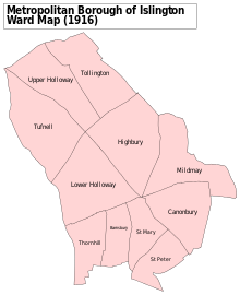
Upper Holloway is an area in the London Borough of Islington, London, centred on the upper part of Holloway Road and Junction Road, forming part of North London.

Contents

History

A map showing the Upper Holloway ward of Islington Metropolitan Borough as it appeared in 1916. Islington Met. B Ward Map 1916.svg
A map showing the Upper Holloway ward of Islington Metropolitan Borough as it appeared in 1916.

Toponymy

The part of the Great North Road through north of the parish of Islington was known as the Holloway by 1307, a name later applied to the communities that formed along it. [1] Upper Holloway is the original designation of the N19 postal district and the term is still used by the Royal Mail. [2]

Urban development

Upper Holloway was one of several hamlets within the ancient parish of St Mary Islington. [3] As the population of the parish was increasing, the Church of St John Upper Holloway was built to meet local need, using the provisions of the Church Building Act 1818. It was consecrated in 1828 and in 1830 a new ecclesiastical parish was created, beginning the subdivision of the parish of Islington for this purpose. [4] [5]

The area around Hornsey Road was traditionally known as "Tollington" and this name was used in the Domesday Book. This name has largely fallen out of use, but it remains as the name as an electoral ward on the local council and also of the parish of the Church of England in the area, and some local businesses still use the name in their name.

Media

The classic late Victorian comic novel Diary of a Nobody is set in Upper Holloway. The BBC's BBC Doomsday Project has some content for this area. [6]

See also

Related Research Articles

<span class="mw-page-title-main">London Borough of Islington</span> London borough in United Kingdom

The London Borough of Islington is a London borough which forms part of Inner London, England. Islington has an estimated population of 215,667. It was formed in 1965, under the London Government Act 1963, by the amalgamation of the metropolitan boroughs of Islington and Finsbury.

<span class="mw-page-title-main">Chalk Farm</span> Human settlement in England

Chalk Farm is a small urban district of north west London, lying immediately north of Camden Town, in the London Borough of Camden.

<span class="mw-page-title-main">Holloway, London</span> Human settlement in England

Holloway is an area of north London in the London Borough of Islington, England, 3.3 miles (5.3 km) north of Charing Cross, which follows the line of the Holloway Road (A1). At the centre of Holloway is the Nag's Head commercial area which sits between the more residential Upper Holloway and Lower Holloway neighbourhoods. Holloway has a multicultural population and includes the Emirates Stadium, home of Arsenal F.C.. Until 2016, it was the site of Holloway Prison, the largest women's prison in Europe. Before 1965, it was in the historic county of Middlesex.

<span class="mw-page-title-main">Stepney</span> Human settlement in England

Stepney is a district in the East End of London in the London Borough of Tower Hamlets. The district is no longer officially defined, and is usually used to refer to a relatively small area. However, for much of its history the place name applied to a much larger manor and parish. Stepney Green is a remnant of a larger area of Common Land formerly known as Mile End Green.

<span class="mw-page-title-main">Tufnell Park</span> Human settlement in England

Tufnell Park is an area in north London, England, in the London boroughs of Islington and Camden.

<span class="mw-page-title-main">King's Cross, London</span> Area of central London in England

King's Cross is a district on either side of Euston Road, in north London, England, 1.5 miles (2.4 km) north of Charing Cross. It is bordered by Barnsbury to the north, Clerkenwell and Islington to the east, Holborn to the south and Somers Town to the west. It is served by two major rail termini, St Pancras and King's Cross. King's Cross station is the terminus of one of the major rail routes between London and the North.

<span class="mw-page-title-main">Islington</span> District of London, England

Islington is a district in the north of Greater London, England, and part of the London Borough of Islington. It is a mainly residential district of Inner London, extending from Islington's High Street to Highbury Fields, encompassing the area around the busy High Street, Upper Street, Essex Road, and Southgate Road to the east.

<span class="mw-page-title-main">Metropolitan Borough of Islington</span> Former local authority of London, England

Islington was a civil parish and metropolitan borough in London, England. It was an ancient parish within the county of Middlesex, and formed part of The Metropolis from 1855. The parish was transferred to the County of London in 1889 and became a metropolitan borough in 1900. It was amalgamated with the Metropolitan Borough of Finsbury to form the London Borough of Islington in Greater London in 1965.

<span class="mw-page-title-main">Holloway Road</span> North London shopping street

Holloway Road is a road in London, 3 kilometres (1.9 mi) in length. It is one of the main shopping streets in North London, and carries the A1 road as it passes through Holloway, in the London Borough of Islington. The road starts in Archway, near Archway Underground station, then heads south-east, past Upper Holloway railway station, Whittington Park, past the North London campus of London Metropolitan University near Nag's Head, past Holloway Road Underground station, and the main campus of the university, and then becomes Highbury Corner, near Highbury & Islington station.

<span class="mw-page-title-main">Archway, London</span> Human settlement in England

Archway is an area of north London, England, in the London Borough of Islington 3.8 miles (6 km) north of Charing Cross. It straddles the A1 and is named after a local landmark, the high, single-arched Archway Bridge which crossed the road in a cutting to the north. It has a modern commercial hub around Vantage Point and Archway tube station.

<span class="mw-page-title-main">Bradfield, Berkshire</span> Village in England

Bradfield is a village and civil parish in Berkshire, England. Aside from farms and a smaller amount of woodland its main settlements are Bradfield Southend, its medieval-founded nucleus and the hamlet of Tutts Clump. Bradfield village is the home of the public school Bradfield College.

<span class="mw-page-title-main">Liverpool Road</span>

Liverpool Road is a street in Islington, North London. It covers a distance of 1+14 miles (2.0 km) between Islington High Street and Holloway Road, running roughly parallel to Upper Street through the area of Barnsbury. It contains several attractive terraces of Georgian houses and Victorian villas, many of which are listed buildings. There are a number of pubs, small businesses and restaurants along its route, as well as some secluded garden squares. The vast majority of the street is residential, with a bustling shopping and business area at the southern, Angel, end.

<span class="mw-page-title-main">Islington North (UK Parliament constituency)</span> Parliamentary constituency in the United Kingdom, 1885 onwards

Islington North is a constituency in Greater London represented in the House of Commons of the UK Parliament since 1983 by Jeremy Corbyn, who was Leader of the Labour Party and Leader of the Opposition from 2015 to 2020.

<span class="mw-page-title-main">Upper Street</span>

Upper Street is the main street of the Islington district of inner north London, and carries the A1 road. It begins at the junction of the A1 and Liverpool Road, continuing on from Islington High Street which runs from the crossroads at Pentonville Road/City Road and runs roughly northwards from outside the main entrance to Angel Underground station, then past the Business Design Centre, then splits at Islington Green, then past The Screen On The Green cinema, past Islington Town Hall, ending at Highbury & Islington tube station on Highbury corner, where the A1 carries on as Holloway Road.

<span class="mw-page-title-main">St Mary Magdalene Church, Holloway Road</span> Church in London, England

St Mary Magdalene Church is one of Hope Church Islington's places of worship, an Anglican church on Holloway Road in north London dedicated to Jesus' companion Mary Magdalene. It is located in St Mary Magdalene Gardens opposite Islington Central Library. St Mary Magdalene is part of the Parish of Hope Church Islington. In 2013 its sister church St David's on Westbourne road was reopened so St Mary Magdalene now functions as one of two worship sites of the Parish, with a single leadership and a staff team. The early 19th century building accommodates the activities of the church congregation, including church services, a winter night shelter, 'Mini Mags' – a toddlers group, and provides spaces to other users. Baptisms and confirmations, marriages and funerals are regularly held here. The building and its iron railings are both Grade II* listed structures, having first been listed in 1954.

Ruxley is a rural settlement of South East London, England that straddles the boundary of the London Boroughs of Bromley and Bexley. It is located 13 miles southeast of Charing Cross, the traditional centre of London, in the Metropolitan Green Belt between Sidcup and Swanley and is also adjacent to the Greater London border with the county of Kent.

<span class="mw-page-title-main">A1 in London</span> The section of A1 road in Greater London

The A1 in London is the southern part of the A1 road. It starts at Aldersgate in the City of London, passing through the capital to Borehamwood on the northern fringe of Greater London, before continuing to Edinburgh. The road travels through the City and three London boroughs: Islington, Haringey and Barnet, which include the districts of Islington, Holloway, Highgate, Hendon and Mill Hill, and travels along Upper Street and Holloway Road, crossing the North Circular Road in Hendon, a district in the London Borough of Barnet.

<span class="mw-page-title-main">Caledonian Road, London</span> Road in London Borough of Islington

Caledonian Road passes for about a mile and a half north–south through the London Borough of Islington. It connects North London, from Camden Road near its junction with Holloway Road, and central London's Pentonville Road in the south. It is known colloquially as the "Cally" and forms the entirety of the A5203.

<span class="mw-page-title-main">Angel, London</span> Human settlement in England

The Angel is an area on the northern fringes of Central London within the London Borough of Islington. It is 2 miles (3.2 km) north-northeast of Charing Cross on the Inner Ring Road at a busy transport intersection. The area is identified in the London Plan as one of 35 major centres in London. It is a significant commercial and retail centre, and a business improvement district. The Angel straddles the ancient boundary of the parishes of Clerkenwell and Islington that later became the metropolitan boroughs of Finsbury and Islington. It is named from the former Angel Inn which stood on the corner of Islington High Street and Pentonville Road. Since 1965 the whole area has formed part of the London Borough of Islington in Greater London.

<span class="mw-page-title-main">St James' Church, Islington</span> Church in London, England

St James' Church, Islington, is a parish church in the inner London borough of Islington. It is located on Prebend Street between Essex Road and the New North Road. The parish is bounded by Essex Road between the New North Road and Upper Street, Upper Street to The Angel, Islington, City Road to Wharf Road, Wharf Road to the Regent's Canal, and the Regent's Canal to the New North Road.

References

  1. "Islington: Growth, Holloway and Tollington | British History Online".
  2. "Archived copy" (PDF). www.royalmail.com. Archived from the original (PDF) on 20 January 2012. Retrieved 13 January 2022.{{cite web}}: CS1 maint: archived copy as title (link)
  3. "Islington: Introduction | British History Online". British-history.ac.uk.
  4. "Saint John the Evangelist, Upper Holloway: Pemberton Gardens, Islington". Archived from the original on 4 November 2016.
  5. "AIM25 collection description". Aim25.com.
  6. "BBC - Domesday Reloaded: GENERAL VIEW OF AREA, from 1986". www.bbc.co.uk. Archived from the original on 28 October 2011. Retrieved 13 January 2022.