Pentonville

Last updated

Pentonville
Calshot Street, Pentonville - geograph.org.uk - 1603724.jpg
Greater London UK location map 2.svg
Red pog.svg
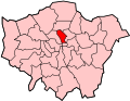
Pentonville
Location within Greater London
OS grid reference TQ315835
  Charing Cross 1.75 mi (2.8 km)  SSW
London borough
Ceremonial county Greater London
Region
Country England
Sovereign state United Kingdom
Post town LONDON
Postcode district N1
Dialling code 020
Police Metropolitan
Fire London
Ambulance London
UK Parliament
London Assembly
List of places
UK
England
London
51°31′55″N0°06′50″W / 51.532°N 0.114°W / 51.532; -0.114

Pentonville is an area in North London, located in the London Borough of Islington. It is located 1.75 miles (2.82 km) north-northeast of Charing Cross on the Inner Ring Road. Pentonville developed in the northwestern edge of the ancient parish of Clerkenwell on the New Road. It is named after Henry Penton, the developer of the area.

Contents

History

A map showing Pentonville ward of Finsbury Metropolitan Borough as it appeared in 1952. Finsbury Met. B Ward Map 1952.svg
A map showing Pentonville ward of Finsbury Metropolitan Borough as it appeared in 1952.

The area is named after Henry Penton, who developed a number of streets in the 1770s in what was open countryside adjacent to the New Road. [1] Pentonville was part of the ancient parish of Clerkenwell, and was incorporated into the Metropolitan Borough of Finsbury by the London Government Act 1899. It has been part of the London Borough of Islington since 1965. There was a Pentonville ward from 1965 to 1978, electing three councillors to Islington London Borough Council.

The church of St Silas (Church of England) St Silas, Penton Street London N1 - geograph.org.uk - 1074010.jpg
The church of St Silas (Church of England)
The church of St Mark the Evangelist, 1828 (Church of England) St Mark the Evangelist, Pentonville - Shepherd, Metropolitan Improvements (1828), p328.jpg
The church of St Mark the Evangelist, 1828 (Church of England)

Pentonville is the birthplace of John Stuart Mill (1806) and Forbes Benignus Winslow (1810), the noted psychiatrist. In 1902 Vladimir Lenin and his wife lived just off Pentonville Road, and it was at this time that he first met his fellow exile Leon Trotsky.

Geography

Nearby places include Islington, St. Pancras and Finsbury.

Pentonville is not the location of HM Prison Pentonville, which is located on Caledonian Road, some distance north in Barnsbury.

Transport

The closest tube stations are Angel and King's Cross St Pancras.

Related Research Articles

<span class="mw-page-title-main">London Borough of Islington</span> London borough in United Kingdom

The London Borough of Islington is a London borough which forms part of Inner London, England. Islington has an estimated population of 215,667. It was formed in 1965, under the London Government Act 1963, by the amalgamation of the metropolitan boroughs of Islington and Finsbury.

<span class="mw-page-title-main">Clerkenwell</span> Area of central London

Clerkenwell is an area of central London, England.

<span class="mw-page-title-main">Finsbury</span> District of Central London

Finsbury is a district of Central London, forming the southeastern part of the London Borough of Islington. It borders the City of London.

<span class="mw-page-title-main">Holborn</span> Human settlement in England

Holborn is a district in central London, which covers the south-eastern part of the London Borough of Camden and a part of the Ward of Farringdon Without in the City of London.

<span class="mw-page-title-main">St Pancras, London</span> Area of central London, England

St Pancras is a district in central London. It was originally a medieval ancient parish and subsequently became a metropolitan borough. The metropolitan borough then merged with neighbouring boroughs and the area it covered now forms around half of the modern London Borough of Camden. The area of the parish and borough includes the sub-districts of Camden Town, Kentish Town, Gospel Oak, Somers Town, King's Cross, Chalk Farm, Dartmouth Park, the core area of Fitzrovia and a part of Highgate.

<span class="mw-page-title-main">King's Cross, London</span> Area of central London in England

King's Cross is a district on either side of Euston Road, in north London, England, 1.5 miles (2.4 km) north of Charing Cross. It is bordered by Barnsbury to the north, Clerkenwell and Islington to the east, Holborn to the south and Somers Town to the west. It is served by two major rail termini, St Pancras and King's Cross. King's Cross station is the terminus of one of the major rail routes between London and the North.

<span class="mw-page-title-main">Islington</span> District of London, England

Islington is a district in the north of Greater London, England, and part of the London Borough of Islington. It is a mainly residential district of Inner London, extending from Islington's High Street to Highbury Fields, encompassing the area around the busy High Street, Upper Street, Essex Road, and Southgate Road to the east.

<span class="mw-page-title-main">Pentonville Road</span> Road in central London

Pentonville Road is a road in Central London that runs west to east from Kings Cross to City Road at The Angel, Islington. The road is part of the London Inner Ring Road and part of the boundary of the London congestion charge zone.

Farringdon is a small district in Central London, the southern part of the London Borough of Islington. The term is used to describe the area around Farringdon station. Historically the district corresponded to southern Clerkenwell and the small parish of St Sepulchre Middlesex.

<span class="mw-page-title-main">Metropolitan Borough of Finsbury</span>

The Metropolitan Borough of Finsbury was a metropolitan borough within the County of London from 1900 to 1965, when it was amalgamated with the Metropolitan Borough of Islington to form the London Borough of Islington.

<span class="mw-page-title-main">Metropolitan Borough of Islington</span> Former local authority of London, England

Islington was a civil parish and metropolitan borough in London, England. It was an ancient parish within the county of Middlesex, and formed part of The Metropolis from 1855. The parish was transferred to the County of London in 1889 and became a metropolitan borough in 1900. It was amalgamated with the Metropolitan Borough of Finsbury to form the London Borough of Islington in Greater London in 1965.

<span class="mw-page-title-main">The Angel, Islington</span> Historic landmark in Islington, London, England

The Angel, Islington, is a historic landmark and a series of buildings that have stood on the corner of Islington High Street and Pentonville Road in Islington, London, England. The land originally belonged to the Clerkenwell Priory and has had various properties built on it since the 16th century. An inn on the site was called the "Angel Inn" by 1614, and the crossing became generally known as "the Angel". The site was bisected by the New Road, which opened in 1756, and properties on the site have been rebuilt several times up to the 20th century. The corner site gave its name to Angel tube station, opened in 1901, and the surrounding Angel area of London.

<span class="mw-page-title-main">Islington South and Finsbury (UK Parliament constituency)</span> Parliamentary constituency in the United Kingdom, 1974 onwards

Islington South and Finsbury is a constituency created in 1974 and represented in the House of Commons of the UK Parliament since 2005 by Emily Thornberry of the Labour Party. Thornberry served as Shadow Foreign Secretary from 2016 until 2020 and is currently Shadow Attorney General for England and Wales.

<span class="mw-page-title-main">St Sepulchre (parish)</span> Ancient parish in England

St Sepulchre was an ancient parish which had its southern part within the boundaries of the City of London and its northern part outside. Its former area is now within the contemporary neighbourhoods of Smithfield, Farringdon and Clerkenwell.

The parliamentary borough of Finsbury was a constituency of the House of Commons of the UK Parliament from 1832 to 1885, and from 1918 to 1950. The constituency was first created in 1832 as one of seven two-seat "metropolis" parliamentary boroughs other than the two which already existed: Westminster and the City of London; the latter until 1885 retained an exceptional four seats. Finsbury was directly north of the City of London and was smaller than the Finsbury division of the Ossulstone hundred but took in land of Holborn division to its southwest in pre-introduction changes by Boundary Commissioners. It included Finsbury, Holborn, Moorfields, Clerkenwell, Islington, Stoke Newington and historic St Pancras. The 1918 constituency corresponded to the smaller Metropolitan Borough of Finsbury ; it was a seat, thus electing a single member, fulfilling a longstanding aim of Chartism which underscored the 1832 reforms.

<span class="mw-page-title-main">Old Street Roundabout</span> London interchange system

Old Street Roundabout is a road junction in Central London, England. Historically a square roundabout, it is now a three-way junction. It is among access points of the Inner Ring Road for the adjoining St Luke's south part of Islington and the City of London beyond, west and south, respectively. It is roughly on the western limit of Hoxton in the London Borough of Hackney which straddles both sides of the Ring Road, a road which after taking up a little of the eastern part of Old Street then veers south-east, taking Great Eastern Street, at Apex Junction.

<span class="mw-page-title-main">Angel, London</span> Human settlement in England

The Angel is an area on the northern fringes of Central London within the London Borough of Islington. It is 2 miles (3.2 km) north-northeast of Charing Cross on the Inner Ring Road at a busy transport intersection. The area is identified in the London Plan as one of 35 major centres in London. It is a significant commercial and retail centre, and a business improvement district. The Angel straddles the ancient boundary of the parishes of Clerkenwell and Islington that later became the metropolitan boroughs of Finsbury and Islington. It is named from the former Angel Inn which stood on the corner of Islington High Street and Pentonville Road. Since 1965 the whole area has formed part of the London Borough of Islington in Greater London.

Islington Local History Centre is a local studies centre and archive which holds material documenting the history of the London Borough of Islington.

This is a list of the etymology of street names and principal buildings in the London districts of Clerkenwell and Finsbury, in the London Borough of Islington. The Clerkenwell/Finsbury area has no formally defined boundaries - those used here are: Pentonville Road to the north, Goswell Road to the east, Clerkenwell Road to the south and Gray's Inn Road to the west. Finsbury was traditionally roughly the northern part of the area covered here, however in practice the name is rarely used these days.

<span class="mw-page-title-main">Finsbury Town Hall</span> Municipal building in London, England

Finsbury Town Hall is a municipal building in Finsbury, London. The structure is a Grade II* listed building.

References

  1. Pevsner, Nikolaus (1952). London except the Cities of London and Westminster. The Buildings of England. Harmondsworth: Penguin Books. pp. 232–233.