London Canal Museum

Last updated

London Canal Museum
London Canal Museum TQ3083.jpg
Open street map central london.svg
Red pog.svg
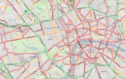
Location within Central London
Established1992;32 years ago (1992)
Location King's Cross, London, N1
England
Coordinates 51°32′02″N0°07′13″W / 51.5339°N 0.1204°W / 51.5339; -0.1204
Type Transport museum
Visitors20,000
ChairpersonMartin Sach
Public transit access Underground no-text.svg King's Cross St Pancras
National Rail logo.svg King's Cross
National Rail logo.svg St Pancras
Website canalmuseum.org.uk

London Canal Museum in the King's Cross area of London, England, is a regional museum devoted to the history of London's canals. The museum opened in 1992.

Contents

Exhibitions and activities

The museum covers all aspects of the UK's waterways. The main exhibitions in the museum cover the following topics:

The museum also hosts temporary exhibitions on canal related subjects.

The museum runs guided trips on its 12-seater trip boat Long Tom. These trips include 50 minute return trips through the Islington Tunnel and longer return trips to Little Venice and Victoria Park. [1]

History of the building

The museum is housed in a Victorian former ice warehouse that was used by Carlo Gatti. [2] The building was constructed between 1862 and 1863 to house ice imported from Norway by ship and canal barge. [2] The building was extensively rebuilt 1904 to 1906 when the existing ground and 1st floors and ramp were constructed and stables installed. The use of the ice wells to store ice finished prior to the First World War and Gatti's ceased to use the building as a transport depot around 1926. It was then used by various engineering firms before its conversion to a food importer's warehouse in 1956, when the stable fittings were stripped out and the lightwell was infilled with a staircase and toilets. The ice wells were filled with garden soil and miscellaneous debris around that time, according to the archaeological evidence of the fill materials, and were sealed up and forgotten until their accidental rediscovery in the 1980s.

Of the two partly excavated ice wells under the building, one may be viewed from the public area of the museum and the other using CCTV that can be viewed on the Museum web site. [3]

Location

The museum is situated in the King's Cross area of London, on the Regent's Canal. Battlebridge Basin is accessible from the rear of the museum. It is a five-minute walk to King's Cross St Pancras tube station. [4]

See also

Related Research Articles

<span class="mw-page-title-main">King's Cross, London</span> Area of central London in England

King's Cross is a district in the London Boroughs of Camden and Islington, located on either side of Euston Road, in the outskirts of north London and central London, England, 1.5 miles (2.4 km) north of Charing Cross. It is bordered by Barnsbury to the north, Clerkenwell to the southeast, Angel to the east, Holborn and Bloomsbury to the south, Euston to the west and Camden Town to the northwest. It is served by two major rail termini, St Pancras and King's Cross. King's Cross station is the terminus of one of the major rail routes between London and the North.

<span class="mw-page-title-main">Camden Town</span> Inner city district of London, England

Camden Town, often shortened to Camden, is an area in the London Borough of Camden, around 2.5 miles (4.1 km) north-northwest of Charing Cross. Historically in Middlesex, it is identified in the London Plan as one of 34 major centres in Greater London.

<span class="mw-page-title-main">West India Docks</span> Historic dock site, now part of Canary Wharf area.

The West India Docks are a series of three docks, quaysides, and warehouses built to import goods from, and export goods and occasionally passengers to the British West Indies. Located on the Isle of Dogs in London, the first dock opened in 1802. Following their commercial closure in 1980, the Canary Wharf development was built around the wet docks by narrowing some of their broadest tracts.

<span class="mw-page-title-main">Falkirk Wheel</span> Rotating boat lift in Scotland

The Falkirk Wheel is a rotating boat lift in Tamfourhill, Falkirk, in central Scotland, connecting the Forth and Clyde Canal with the Union Canal. It opened in 2002 as part of the Millennium Link project, reconnecting the two canals for the first time since the 1930s.

<span class="mw-page-title-main">Limehouse Basin</span> Canal basin in Tower Hamlets, London

Limehouse Basin is a body of water 2 miles east of London Bridge that is also a navigable link between the River Thames and two of London's canals. First dug in 1820 as the eastern terminus of the new Regent's Canal, its wet area was less than 5 acres originally, but it was gradually enlarged in the Victorian era, reaching a maximum of double that size, when it was given its characteristic oblique entrance lock, big enough to admit 2,000-ton ships.

<span class="mw-page-title-main">Regent's Canal</span> Canal in England

Regent's Canal is a canal across an area just north of central London, England. It provides a link from the Paddington Arm of the Grand Union Canal, 550 yards (500 m) north-west of Paddington Basin in the west, to the Limehouse Basin and the River Thames in east London. The canal is 8.6 miles (13.8 km) long.

<span class="mw-page-title-main">Ice house (building)</span> Building used for storing ice all year round, before refrigeration

An ice house, or icehouse, is a building used to store ice throughout the year, commonly used prior to the invention of the refrigerator. Some were underground chambers, usually man-made, close to natural sources of winter ice such as freshwater lakes, but many were buildings with various types of insulation.

<span class="mw-page-title-main">Canals of the United Kingdom</span> Network of inland waterways

The canals of the United Kingdom are a major part of the network of inland waterways in the United Kingdom. They have a varied history, from use for irrigation and transport, through becoming the focus of the Industrial Revolution, to today's role of recreational boating. Despite a period of abandonment, today the canal system in the United Kingdom is again increasing in use, with abandoned and derelict canals being reopened, and the construction of some new routes. Canals in England and Wales are maintained by navigation authorities. The biggest navigation authorities are the Canal & River Trust and the Environment Agency, but other canals are managed by companies, local authorities or charitable trusts.

<span class="mw-page-title-main">Bristol Harbour</span> Harbour in Bristol, England

Bristol Harbour is the harbour in the city of Bristol, England. The harbour covers an area of 70 acres. It is the former natural tidal river Avon through the city but was made into its current form in 1809 when the tide was prevented from going out permanently. A tidal by-pass was dug for 2 miles through the fields of Bedminster for the river, known as the "River Avon New Cut", "New Cut", or simply "The Cut". It is often called the Floating Harbour as the water level remains constant and it is not affected by the state of the tide on the river in the Avon Gorge, The New Cut or the natural river southeast of Temple Meads to its source.

<span class="mw-page-title-main">National Waterways Museum</span> Museum in Cheshire, England

The National Waterways Museum (NWM) is in Ellesmere Port, Cheshire, England, at the northern end of the Shropshire Union Canal where it meets the Manchester Ship Canal. The NWM's collections and archives focus on the Britain's navigable inland waterways, including its rivers and canals, and include canal boats, traditional clothing, painted canal decorative ware and tools. It is one of several museums and attractions operated by the Canal & River Trust, the successor to The Waterways Trust.

<span class="mw-page-title-main">Camden Lock</span> Grade II listed lock in London Borough of Camden, UK

Camden Lock is a small part of Camden Town, London Borough of Camden, England, which was formerly a wharf with stables on the Regent's Canal. It is immediately to the north of Hampstead Road Locks, a twin manually operated lock. The twin locks together are "Hampstead Road Lock 1"; each bears a sign so marked. Hawley Lock and Kentish Town Lock are a short distance away to the east; to the west is a long level pound — it is 27 miles (43 km) to the next lock.

<span class="mw-page-title-main">King's Cross Central</span> Large mixed-use development in central London

King's Cross Central (KXC) is a mixed-use development in the north-east of central London. The site is owned and controlled by the King's Cross Central Limited Partnership. It consists of approximately 67 acres (27 ha) of former railway lands to the north of King's Cross and St Pancras mainline railway stations. The site is largely determined by three boundaries: the existing East Coast Main Line railway leading out of King's Cross; York Way, a road marking the division between Camden and Islington boroughs; and the new railway line, High Speed 1 (HS1), formerly known as the Channel Tunnel Rail Link, which curves around the site to the north and west.

<span class="mw-page-title-main">Carlo Gatti</span> Swiss entrepreneur in England

Carlo Gatti (1817–1878) was a Swiss-born British restaurateur in the Victorian era. He came to England in 1847, where he established restaurants and an ice importing business. He is credited with first making ice cream available to the general public and he then moved into the music hall business. He returned to Switzerland in 1871, leaving his businesses in the hands of members of his family and he died a millionaire.

<span class="mw-page-title-main">Cumberland Basin (London)</span> Canal basin in London, England

Cumberland Basin was a canal basin near to Euston railway station in London, England and a part of the Regent's Canal. It was originally known as Jew's Harp Basin in the 1880s, after a nearby public house.

<span class="mw-page-title-main">Cumberland Market</span>

Cumberland Market was a London market between Regent's Park and Euston railway station. It was built in the early 19th century and was London's hay and straw market for a hundred years until the late 1920s. An arm of the Regent's Canal was built to the market. The market was surrounded by modest housing, and in the early 20th century became an artistic community. The original houses were demolished during and after World War II and it is now a housing estate, known as Regent's Park Estate.

<span class="mw-page-title-main">Maida Hill Tunnel</span> Tunnel on the Regents Canal, London

Maida Hill Tunnel is a canal tunnel on the Regent's Canal in London, England. The two other tunnels on the Regent's Canal are Islington Tunnel and Eyre's Tunnel.

<span class="mw-page-title-main">Frederiksholms Kanal</span> Canal in Denmark

Frederiksholms Kanal is a canal in central Copenhagen, Denmark, which runs along the south-west side of Slotsholmen, together with Slotsholmskanalen separating the island from Zealand. The name also applies to the continuation of Rådhusstræde which follows the canal for most of its course, first on its south side and for the last stretch, from Prinsens Bro and to the waterfront, on both sides of the canal. Several historic buildings face the canal, ranging in size from Prince's Mansion, now housing National Museum, and Christiansborg's riding grounds to the diminutive Stable Boy's House, part of Civiletatens Materialgård, a former storage facility now used by the Royal Danish Academy of Fine Arts's School of Sculpture.

<span class="mw-page-title-main">Battlebridge Basin</span>

Battlebridge Basin is a canal basin in King's Cross, in the London Borough of Islington. It is located off the Regent's Canal.

<span class="mw-page-title-main">Coal Drops Yard</span> Shopping complex in London, England

Coal Drops Yard is a shopping complex and privately owned public space that forms part of the King's Cross Central development scheme in London, England. The development was designed by Thomas Heatherwick and opened in October 2018.

The Park Crescent West ice well is a 9.5m deep underground brick structure in the City of Westminster, London, England. It was built by Samuel Dash in 1780 for the storage of ice gathered from local ponds and canals. The structure came into the ownership of William Leftwich, a leading figure in the London ice trade, who used it to store imported Norwegian ice which he sold to the food and drinks industry. The well was abandoned in the mid-to-late 19th century and covered over. It was rediscovered in good condition during development works in 2014. The well was listed as a scheduled monument in 2015 and there are plans to make it available for visits by the general public.

References

  1. "What's on". London Canal Museum. Retrieved 9 February 2014.
  2. 1 2 "The Canal Museum" . Retrieved 9 February 2014.
  3. "The Ice Wells: Underground ice storage wells". London Canal Museum. Retrieved 13 June 2018.
  4. "Find us". London Canal Museum. Retrieved 9 February 2014.