
The Piccadilly line is a deep-level London Underground line running from the north to the west of London. It has two branches, which split at Acton Town, and serves 53 stations. The line serves Heathrow Airport, and some of its stations are near tourist attractions such as Piccadilly Circus and Buckingham Palace. The District and Metropolitan lines share some sections of track with the Piccadilly line. Printed in dark blue on the Tube map, it is the sixth-busiest line on the Underground network, with nearly 218 million passenger journeys in 2019.

Holloway Road is a road in London, 3 kilometres (1.9 mi) in length. It is one of the main shopping streets in North London, and carries the A1 road as it passes through Holloway, in the London Borough of Islington. The road starts in Archway, near Archway Underground station, then heads south-east, past Upper Holloway railway station, Whittington Park, past the North London campus of London Metropolitan University near Nag's Head, past Holloway Road Underground station, and the main campus of the university, and then becomes Highbury Corner, near Highbury & Islington station.

Archway is an area of north London, England, in the London Borough of Islington 3.8 miles (6 km) north of Charing Cross. It straddles the A1 and is named after a local landmark, the high, single-arched Archway Bridge which crossed the road in a cutting to the north. It has a modern commercial hub around Vantage Point and Archway tube station.
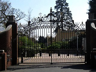
Tittenhurst Park is a Grade II listed early Georgian country house in Sunningdale near Ascot, Berkshire. It was famously the home of musicians John Lennon and Yoko Ono from 1969 until 1971, and then the home of Ringo Starr and family from 1973 until 1988. Starr sold the property to Sheikh Zayed bin Sultan Al Nahyan, the President of the United Arab Emirates, in 1989.

Beaconsfield Town Football Club is a football club based in Beaconsfield, Buckinghamshire, England. They are currently members of the Southern League Division One Central and play at Holloways Park.
The Hackney Brook is one of the subterranean rivers of London. Rising in Holloway, it crossed the northern parts of the current London boroughs of Islington and Hackney, before emptying into the River Lea at Old Ford.

Whittington Court is an Elizabethan manor house, five miles east of Cheltenham in Gloucestershire, England.

The A103 is an A road in London, England.

Downhills Park is a park in the West Green area of Haringey just on the edge of Wood Green and Tottenham.

Hornsey Road railway station was a station on Hornsey Road, near Finsbury Park, in the London Borough of Islington, which was opened in 1872 by the Tottenham and Hampstead Junction Railway. It was between Upper Holloway and Crouch Hill stations, on the line now known as the Gospel Oak to Barking line. It was closed in 1943, and demolished soon afterwards. Its closure was due to wartime constraints and its proximity to the neighbouring stations.
Whittington, Gloucestershire is a village and rural parish in the county of Gloucestershire in England, United Kingdom.

Dick Whittington and His Cat is the English folklore surrounding the real-life Richard Whittington, wealthy merchant and later Lord Mayor of London. The legend describes his rise from poverty-stricken childhood with the fortune he made through the sale of his cat to a rat-infested country. However, the real Whittington did not come from a poor family of common stock, and there is no compelling evidence supporting the stories about the cat, or even whether he owned one.

The Westgate area of Gloucester is centred on Westgate Street, one of the four main streets of Gloucester and one of the oldest parts of the city. The population of the Westgate ward in Gloucester was 6,687 at the time of the 2011 Census.

The Whittington Stone is an 1821 monumental stone and statue of a cat at the foot of Highgate Hill, a street, in Archway. It marks roughly where it is recounted that a forlorn character of Dick Whittington, loosely based on Richard Whittington, returning to his home from the city of London after losing faith as a scullion in a scullery, heard Bow Bells ringing from 4+1⁄2 miles (7.2 km) away, prophesying his good fortune leading to the homage "Turn again Whittington, thrice Lord Mayor of London!" This quotation and a short history of the man cover two faces of the stone. The pub next to it is of the same name.

The Suffragette Memorial is an outdoor sculpture commemorating those who fought for women's suffrage in the United Kingdom, located in the north-west corner of Christchurch Gardens, Victoria, London. The sculptors were Lorne McKean and Edwin Russell and the project was devised and supervised by the architect Paul Paget. The memorial was unveiled in 1970. It takes the form of a scroll in the shape of the letter S, created in fibreglass and finished in cold-cast bronze, placed on a conical plinth. The text of the scroll reads:
This tribute is erected by the Suffragette Fellowship to commemorate the courage and perseverance of all those men and women who in the long struggle for votes for women selflessly braved derision, opposition and ostracism, many enduring physical violence and suffering.

Bradenham Woods, Park Wood and The Coppice is a 129.1-hectare (319-acre) biological Site of Special Scientific Interest in Bradenham in Buckinghamshire. It is in the Chilterns Area of Outstanding Natural Beauty, and it is described in A Nature Conservation Review. The site is part of the Bradenham Estate, which is owned by the National Trust. It is also designated a Special Area of Conservation. Grim's Ditch, a Scheduled Monument, runs through the site.

The Poplar Rates Rebellion Mural is a mural in Hale Street, Poplar, London, London. It is painted on the wall of the depot of Tower Hamlets Parks Department.

There are no records to state that the house was built in the 1200's. It was in fact built in the 1400's.

Langdon Nature Reserve is a 210 hectare nature reserve west of Basildon in Essex. It is managed by the Essex Wildlife Trust, and forms part of the Langdon Ridge Site of Special Scientific Interest.

Hilltop Football Club is a football club based in Stonebridge, London, England. They are currently members of the Combined Counties League Premier Division North and groundshare with Beaconsfield Town FC at Holloways Park.


