Lower Holloway

Last updated

Lower Holloway
Greater London UK location map 2.svg
Red pog.svg
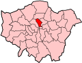
Lower Holloway
Location within Greater London
London borough
Ceremonial county Greater London
Region
Country England
Sovereign state United Kingdom
Post town London
Postcode district N7
Dialling code 020
Police Metropolitan
Fire London
Ambulance London
UK Parliament
London Assembly
List of places
UK
England
London
51°33′01″N0°07′05″W / 51.550151°N 0.118039°W / 51.550151; -0.118039
A map showing the Lower Holloway ward of Islington Metropolitan Borough as it appeared in 1916. Islington Met. B Ward Map 1916.svg
A map showing the Lower Holloway ward of Islington Metropolitan Borough as it appeared in 1916.

Lower Holloway is a district in the London Borough of Islington, London. The name has fallen out of common use and the area is now generally regarded as being a part of Holloway. The area of Lower Holloway stretches from the South of Holloway Road to the Central side of Holloway, Nags Head. It is wholly in the N7 postal district.


Related Research Articles

<span class="mw-page-title-main">London Borough of Islington</span> Borough in United Kingdom

The London Borough of Islington is a London borough which forms part of Inner London. Islington has an estimated population of 215,667. It was formed in 1965 under the London Government Act 1963, which simultaneously abolished the metropolitan boroughs of Islington and Finsbury.

<span class="mw-page-title-main">Highbury</span> Human settlement in England

Highbury is a district in North London and part of the London Borough of Islington, in Greater London, that was owned by Ranulf, brother of Ilger, and included all the areas north and east of Canonbury and Holloway Roads.

<span class="mw-page-title-main">Holloway, London</span> Human settlement in England

Holloway is an inner-city district of the London Borough of Islington, 3.3 miles (5.3 km) north of Charing Cross, which follows the line of the Holloway Road (A1). At the centre of Holloway is the Nag's Head commercial area which sits between the more residential Upper Holloway and Lower Holloway neighbourhoods. Holloway has a multicultural population. It is the home of Arsenal F.C., and was once home to the largest women's prison in Europe, Holloway Prison, until 2016. Prior to 1965, Holloway was in the historic county of Middlesex.

<span class="mw-page-title-main">Tufnell Park</span> Human settlement in England

Tufnell Park is an area in north London, England, in the London boroughs of Islington and Camden.

<span class="mw-page-title-main">Islington</span> District of London, England

Islington is a district in the north of Greater London, England, and part of the London Borough of Islington. It is a mainly residential district of Inner London, extending from Islington's High Street to Highbury Fields, encompassing the area around the busy High Street, Upper Street, Essex Road, and Southgate Road to the east.

<span class="mw-page-title-main">Scouting in Tennessee</span> Overview of scouting in Tennessee

Scouting in Tennessee has a long history, from the 1910s to the present day, serving thousands of youth in programs that suit the environment.

<span class="mw-page-title-main">Nag's Head, London</span> Human settlement in England

Nag's Head is a locality within the Holloway area of the London Borough of Islington.

<span class="mw-page-title-main">Metropolitan Borough of Islington</span> Former local authority of London, England

Islington was a civil parish and metropolitan borough in London, England. It was an ancient parish within the county of Middlesex, and formed part of The Metropolis from 1855. The parish was transferred to the County of London in 1889 and became a metropolitan borough in 1900. It was amalgamated with the Metropolitan Borough of Finsbury to form the London Borough of Islington in Greater London in 1965.

Moorgate was one of the City of London, England's northern gates in its defensive wall, the last to be built. The gate took its name from the Moorfields, an area of marshy land that lay immediately north of the wall.

<span class="mw-page-title-main">Archway, London</span> Human settlement in England

Archway is an area of north London, England, in the London Borough of Islington 3.8 miles (6 km) north of Charing Cross. It straddles the A1 and is named after a local landmark, the high, single-arched Archway Bridge which crossed the road in a cutting to the north. It has a modern commercial hub around Vantage Point and Archway tube station.

<span class="mw-page-title-main">Islington North (UK Parliament constituency)</span> Parliamentary constituency in the United Kingdom, 1885 onwards

Islington North is a constituency in Greater London represented in the House of Commons of the UK Parliament since 1983 by Jeremy Corbyn, who was Leader of the Labour Party and Leader of the Opposition from 2015 to 2020.

<span class="mw-page-title-main">Upper Holloway</span> Human settlement in England

Upper Holloway is a district in the London Borough of Islington, London, centred on the upper part of Holloway Road and Junction Road. It is served by the Overground at Upper Holloway Station and the Northern Line at Archway Station.

A hollow way is a sunken lane. Holloway may refer to:

<span class="mw-page-title-main">Royal Holloway, University of London</span> University in Surrey, England

Royal Holloway, University of London (RHUL), formally incorporated as Royal Holloway and Bedford New College, is a public research university and a constituent college of the federal University of London. It has six schools, 21 academic departments and approximately 10,500 undergraduate and postgraduate students from over 100 countries. The campus is located west of Egham, Surrey, 19 miles (31 km) from central London. Listed by The Sutton Trust as one of the 30 "most highly selective" British universities.

<span class="mw-page-title-main">Sunken lane</span> Road or track that is lower than the land on either side

A sunken lane is a road or track that is significantly lower than the land on either side, not formed by the (recent) engineering of a road cutting but possibly of much greater age.

The Surrey Premier County Football League is a regional English football league for teams in South-West London, Surrey and neighbouring areas. It was founded in 2008. The league is at the 11th level of the English football league system and was incorporated into the National League System as a Step 7 league by the Football Association in June 2012. It has a division for first teams and a reserve division.

<i>Ophyx</i> Genus of moths

Ophyx is a genus of moths of the family Erebidae.

<span class="mw-page-title-main">Angel, London</span> Human settlement in England

Angel is an area on the northern fringes of Central London within the London Borough of Islington. It is 2 miles (3.2 km) north-northeast of Charing Cross on the Inner Ring Road at a busy transport intersection. The area is identified in the London Plan as one of 35 major centres in London. It is a significant commercial and retail centre, and a business improvement district. Angel straddles the ancient boundary of the parishes of Clerkenwell and Islington that later became the metropolitan boroughs of Finsbury and Islington. It is named from the former Angel Inn which stood on the corner of Islington High Street and Pentonville Road. Since 1965 the whole area has formed part of the London Borough of Islington in Greater London.