| West Hampstead | |
|---|---|
 West Hampstead Location within Greater London | |
| Population | 33,751 |
| OS grid reference | TQ255855 |
| London borough | |
| Ceremonial county | Greater London |
| Region | |
| Country | England |
| Sovereign state | United Kingdom |
| Post town | LONDON |
| Postcode district | NW3, NW6 |
| Dialling code | 020 |
| Police | Metropolitan |
| Fire | London |
| Ambulance | London |
| UK Parliament | |
| London Assembly | |
West Hampstead is an area in the London Borough of Camden. Neighbouring areas includes Childs Hill to the north, Frognal to the east, Swiss Cottage to the south-east, South Hampstead to the south and Kilburn to the south-west.
Contents
- History
- West End hamlet
- West Hampstead
- Notable buildings and sites
- Transport links
- Notable residents
- Other notable people
- Location in context
- Gallery
- References
- External links
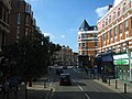
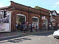
The neighbourhood is mainly residential, with several local amenities, including a range of independent shops, supermarkets, restaurants, bars, cafes and bakeries; most of these are concentrated in the northern section of West End Lane and around West End Green. Located in travel zone 2, West Hampstead is served by three stations: West Hampstead on the Jubilee line, West Hampstead Overground station and West Hampstead Thameslink station.