Figges Marsh

Last updated
The A217, London Road, passing Figges Marsh A217, passing Figges Marsh (geograph 3515432).jpg
The A217, London Road, passing Figges Marsh
Figges Marsh, looking north Figges Marsh, looking north - Dec 2020 (DD coord. 51.41388 -0.1604).jpg
Figges Marsh, looking north
Figges Marsh, looking south Figges Marsh, looking south - Dec 2020 (DD coord. 51.41388 -0.1604).jpg
Figges Marsh, looking south

Figges Marsh is a 25-acre [1] public park in the London Borough of Merton. It is in Mitcham, close to Tooting railway station. [2]

Contents

Originally, the park was next to a toll road into London, [3] which was turnpiked in 1745; [4] now known as London Road.

The Name

The park was named after William Figge who occupied the land from 1357. [5] In maps of 1750, it is referenced as Piggs Marsh; in 1800, as Pigs Marsh Common [see External Source, The Underground Map, for map extracts].

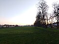
Signage, erected in 2012, at the southern end, recognises that Figges Marsh is protected in perpetuity as a Fields in Trust Queen Elizabeth II Field. [6] This was in celebration of HM Queen Elizabeth II's Diamond Jubilee & the 2012 London Olympics. The parks that participated in the scheme received a commemorative plaque, an oak sapling &, potentially, access to an improvement grant. [7] [8]

Surrounding Area

At the eastern boundary of Figges Marsh, during the medieval period, was the Biggin Farm estate.

Industry developed at the southern end of the park from 1800. The Pascall's confectionery factory was located here in 1888, built on land purchased from James Bridger's Manor Farm, [9] taking advantage of the locally grown peppermint oil. [10] [11] [12] [13]

However, the area to the east and west remained agricultural and open; Swain's & Tamworth farm, at the western boundary of Figges Marsh, are made reference to in the 1900 map [The Underground Map, as below]. That is, until the development of housing in the Victorian & Edwardian period.

Related Research Articles

Mitcham Human settlement in England

Mitcham is an area within the London Borough of Merton in South London, England. It is centred 7.2 miles (11.6 km) southwest of Charing Cross. Originally a village in the county of Surrey, today it is mainly a residential suburb, but includes Mitcham Common.

Morden Human settlement in England

Morden is a district and town in south London, England, within the London Borough of Merton. It adjoins Merton Park and Wimbledon to the north, Mitcham to the east, Sutton to the south and Worcester Park to the west, and is around 8 miles (13 km) south-southwest of Charing Cross. Prior to the creation of Greater London in 1965, Morden was in the administrative county of Surrey. It is in ceremonial county of Surrey.

London Borough of Merton London borough in United Kingdom

The London Borough of Merton is a borough in south-west London, England.

Mitcham Junction station Railway station and tram stop in Merton, London

Mitcham Junction is a National Rail station served by Southern and Thameslink trains, and a Tramlink stop. It is in the London Borough of Merton and is in Travelcard Zone 4.

Sutton Common railway station National Rail station in London, England

Sutton Common railway station is in Sutton Common in the London Borough of Sutton in South London. The station is served by Thameslink and Southern trains on the Sutton Loop Line. It is in Travelcard Zone 4. It has a single stepped entrance accessible from Sutton Common Road. It is the nearest rail station to the adjoining neighbourhood Benhilton via the footbridge at Angel Hill.

South Merton railway station National Rail station in London, England

South Merton railway station is located in Morden, the administrative centre of the London Borough of Merton in South London. The station is served by Thameslink trains on the Sutton Loop Line. It is in Travelcard Zone 4.

Mitcham and Morden (UK Parliament constituency) UK Parliamentary constituency, 1974 onwards

Mitcham and Morden is a constituency in Greater London represented in the House of Commons of the UK Parliament since 1997 by Siobhain McDonagh of the Labour Party.

The London Borough of Merton is an outer London borough in the south west of the conurbation. Merton's parks and open spaces range in size from Mitcham Common and a major part of Wimbledon Common to the smaller gardens, sports grounds and recreation grounds within its boundaries.

A217 road

The A217 is a road in London and Surrey in England. It runs north–south. It runs from Kings Road in Fulham, London, crosses the Thames at Wandsworth Bridge, then passes through Wandsworth, Earlsfield, Summerstown, Tooting, Mitcham, Rosehill and Sutton Common in Sutton, then Cheam. Then, widened as a dual carriageway, comes Belmont, a suburban district built on a slope rising southward. On the North Downs in Surrey the road then skirts past Banstead and through its late 19th century offspring villages particularly Burgh Heath and Kingswood, Surrey. It then crosses the M25 motorway at Junction 8, then, returning to single carriageways, passes through the castle town of Reigate. It then cuts through the green buffer farmland of two rural villages and terminates at the road network at Gatwick Airport's northern perimeter.

Merton (parish)

Merton is an ancient parish which was first in Surrey but since 1965 has been in London, bounded by Wimbledon to the north, Mitcham to the east, Morden, Cheam and Cuddington to the south and (New) Malden to the west. The 1871 Ordnance Survey map records its area as 1,764.7 acres (7.1 km2).

Norbury Brook

Norbury Brook is a tributary of the River Wandle that rises near Lower Addiscombe Road and flows north-west through Selhurst, Thornton Heath and Norbury to join the Wandle at south Wimbledon.

Turnpike trust Bodies established to run toll roads and improve transport routes

Turnpike trusts were bodies set up by individual acts of Parliament, with powers to collect road tolls for maintaining the principal roads in Britain from the 17th but especially during the 18th and 19th centuries. At the peak, in the 1830s, over 1,000 trusts administered around 30,000 miles (48,000 km) of turnpike road in England and Wales, taking tolls at almost 8,000 toll-gates and side-bars.

Knockentiber is a village in East Ayrshire, Parish of Kilmaurs, Scotland. Knockentiber is two miles west-northwest of Kilmarnock and 12 mile northeast of Crosshouse. Latitude:55.6193°N Longitude:4.5455°W and grid reference NS397392. The population was 359 in 1991, however the population is much higher following the construction of several housing estates (2007). In the 18th and 19th and mid 20th centuries the locality was a highly industrialised coal mining district. The settlement is on the Carmel Burn, which runs into the River Irvine, around one mile to the south.

Merton Abbey, London Area in London, England

Merton Abbey is an area in southwest London, England. It lies between South Wimbledon and Colliers Wood in the London Borough of Merton. Merton Abbey takes its name from Merton Priory, which once stood on the northern edge of the district. The area is bounded by Merton High Street to the north, the River Wandle to the west, Christchurch Road to the east and Deen City Farm to the south.

Merton London Borough Council elections Political party in the United Kingdom

Merton London Borough Council in London, England is elected every four years; it has administrative control over the London Borough of Merton.

Wimbledon–West Croydon line

The Wimbledon–West Croydon line is a railway line in south London. It was opened in 1855 by the Wimbledon and Croydon Railway (W&CR) over part of the trackbed of the Surrey Iron Railway. It closed in May 1997 and now forms part of the Tramlink network.

Sutton Common

Sutton Common is the name of former common land and a district and neighbourhood located in Sutton, London. The area is mostly located within the London Borough of Sutton, with some of the streets to the north and west of Sutton Common Park adjoining Lower Morden and Morden within the London Borough of Merton. Much of the area is taken up by the large Kimpton Park commercial and industrial estate, adjoining the A217. It is served by Sutton Common railway station. The area to the south and east of Oldfields Road uses an SM1 postcode and the area to the north and west uses SM3.

A3071 road

The A3071 is a minor 'A' road in the English county of Cornwall, which links St Just to Penzance and the A30. It is 6.2 miles long.

Rosehill, London Human settlement in England

Rosehill is a suburb of Sutton in south-west London. It lends its name to the Rose Hill roundabout, which connects the A217, A297 and B278. At the 2011 Census the population of the suburb was included in the Sutton North ward of the London Borough of Sutton.

Ravensbury Park

Ravensbury Park is a public park in Mitcham in the London Borough of Merton. An area of 7 hectares is designated a Local Nature Reserve. The River Wandle runs along the southern boundary of the park, which is also part of the Upper Wandle River Site of Metropolitan Importance for Nature Conservation.

References

  1. "Figges Marsh". www.merton.gov.uk. Retrieved 2021-07-31.
  2. "Figges Marsh". Merton Town Council. 2008-12-23. Retrieved 2009-07-28.
  3. Wade (2015-05-24). "Figges Marsh Toll Gate". Mitcham History Notes. Retrieved 2021-07-31.
  4. "Restoration and Early Georgian Mitcham". MERTON HISTORICAL SOCIETY. 2017-07-31. Retrieved 2021-07-31.
  5. "Figge's Marsh | Hidden London" . Retrieved 2021-07-31.
  6. Fields in Trust. "Figges Marsh" . Retrieved 18 February 2022.
  7. "Queen Elizabeth II Field - Wikishire". wikishire.co.uk. Retrieved 2021-07-31.
  8. "Figges Marsh | Fields in Trust". www.fieldsintrust.org. Retrieved 2021-10-17.
  9. Wade (2016-03-12). "James Pascall, Ltd". Mitcham History Notes. Retrieved 2021-07-31.
  10. Wade (2017-02-17). "Peppermint in 1875". Mitcham History Notes. Retrieved 2021-07-31.
  11. "Mentha". iwr.msu.edu. Retrieved 2021-07-31.
  12. "Farming mint". The Field. 2008-05-19. Retrieved 2021-07-31.
  13. "Sir Michael Colman, the man who is reviving the English mint crop". the Guardian. 2007-07-22. Retrieved 2021-07-31.

External Sources

Coordinates: 51°24′50″N0°09′36″W / 51.414°N 0.160°W / 51.414; -0.160