
The London Borough of Croydon is a London borough in south London, part of Outer London. It covers an area of 87 km2 (33.6 sq mi). It is the southernmost borough of London. At its centre is the historic town of Croydon from which the borough takes its name; while other urban centres include Coulsdon, Purley, South Norwood, Norbury, New Addington, Selsdon and Thornton Heath. Croydon is mentioned in Domesday Book, and from a small market town has expanded into one of the most populous areas on the fringe of London. The borough is now one of London's leading business, financial and cultural centres, and its influence in entertainment and the arts contribute to its status as a major metropolitan centre. Its population is 390,719, making it the most populous London borough and sixteenth largest English district.

Addiscombe is an area of south London, England, within the London Borough of Croydon. It is located 9.1 miles (15 km) south of Charing Cross, and is situated north of Coombe and Selsdon, east of Croydon town centre, south of Woodside, and west of Shirley.

Monks Orchard is a suburb on the edge of the London Borough of Croydon, in the ceremonial county of Greater London, England, prior to 1965 it was located in the historical county of Surrey. It is situated about 10 miles (16.1 km) south south-east of Charing Cross, south of Elmers End and Eden Park, west of West Wickham, and north and east of Shirley and Shirley Oaks.

South Norwood is a district of south-east London, England, within the London Borough of Croydon, Greater London and formerly in the historic county of Surrey. It is located 7.8 miles (12.5 km) south-east of Charing Cross, north of Woodside and Addiscombe, east of Selhurst and Thornton Heath, south of Crystal Palace/Upper Norwood and Anerley, and south-west of Penge.

Woodside is an area in south London, in the London Borough of Croydon. It is between Addiscombe and South Norwood. It is south of South Norwood, west of Shirley and Monks Orchard, north of Addiscombe, and east of Selhurst.

Woodside tram stop is a light rail stop situated between Woodside Green and Ashburton Park in the London Borough of Croydon in the southern suburbs of London. The stop is located on the site of the former Woodside railway station of the Woodside and South Croydon Railway; the old station buildings survive, though not used by Tramlink.

The A215 is an A road in south London, starting at Elephant and Castle and finishing around Shirley. It runs through the London Boroughs of Lambeth, Southwark and Croydon.

Brickfields Meadow is a meadow in Woodside in the London Borough of Croydon. It is located on the former site of a brickworks in Tennison Road and Dickensons Lane. The meadow covers an area of about 4.37 hectares. The meadow is not very well known to residents on Tennison Road, as the entrance is very secluded, beyond an EDF Energy transformer. The meadow includes: large pond where fishing is allowed, dipping platform, Buddleia Valley, grassland and woodland planting, small woodland area, and a children's play area which includes a mini maze and roundabout.

South Norwood Lake and Grounds is a park in South Norwood in the London Borough of Croydon. The main entrance is in Woodvale Avenue while other entrances are located in Auckland Road and Sylvan Road. The area measures up to 281⁄2 acres.

Ashburton Park is a park located in Woodside, in the London Borough of Croydon, and takes its name from nearby Ashburton.

Addington Hills is a park in Upper Shirley, London, England. It is managed by the London Borough of Croydon. It was part of the old parish of Addington before the suburb of Shirley was developed in the 1930s. The site consists largely of woodland on a gravel bed, with London's largest area of heathland at its heart. It is a Site of Metropolitan Importance. In the mid-18th century, it was a noted cricket venue used by the then-prominent Addington Cricket Club.

Addington Park is a park situated in Addington in the London Borough of Croydon. The park covers an area of 24.5 acres (9.9 ha).

Addiscombe Railway Park, also known as the Addiscombe Linear Park, is a 3.3 acres (1.3 ha) park in Addiscombe, South London, managed by the London Borough of Croydon.

Addiscombe Recreation Ground, commonly known as Bingham Park, is a park situated in Addiscombe, London. The park is managed by London Borough of Croydon. Addiscombe tram stop is located just next to the recreation ground and is served by Tramlink. The area covers 8 acres (3.2 ha).
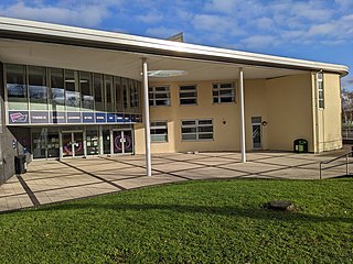
Ashburton Learning Village is a learning complex in Woodside, Greater London. It stands in the London Borough of Croydon, and is located near Ashburton Park. The village includes Ashburton Library, Oasis Academy Shirley Park, Croydon Music Service and a CALAT training centre. The complex was built after the old Ashburton Library was closed down.

Selsdon Wood is a woodland area located in the London Borough of Croydon. The park is owned by the National Trust but managed by the London Borough of Croydon. It is a Local Nature Reserve. The wood has a Friends group – the Friends of Selsdon Wood (FSW) – who have their own website.

The London Borough of Croydon has a wide variety of buildings mainly from post-war through to modern. Much of the modern architecture in the borough is centred on the commercial centre of the town, with much of the Victorian designs spread out on both the northern and southern corridors of the borough. Many former warehouses and factories have been converted for other uses changing the external appearance of Croydon erratically.

Lloyd Park is a 114 acres (46 ha) park on the outskirts of central Croydon, Greater London, managed by the London Borough of Croydon. It is bordered by Coombe Road to the south and Lloyd Park Avenue to the west. To the north, access is from Deepdene and Mapledale Avenue, and the park adjoins Grimwade Avenue and Addiscombe Cricket Club. To the east the park is bordered by Shirley Park Golf Course. It was created from land owned by Frank Lloyd a newspaper proprietor who died in 1927 which was bequeathed to the Borough of Croydon by his family, after his death.

Ashburton was a ward in the London Borough of Croydon, in London in the United Kingdom. The ward covered the Ashburton area, as well as covering the main retail area of Addiscombe, the Stroud Green, Tollgate and Longheath Garden estates, and large parts of northern Shirley. The population of the ward at the 2011 Census was 14,721.


