
Croydon is a large town in South London, England that gives its name to the London Borough of Croydon. It is one of the largest commercial districts in Greater London, with an extensive shopping district and night-time economy. The entire town had a population of 192,064 as of 2011, whilst the wider borough had a population of 384,837. It is 9.4 miles (15.1 km) south of Charing Cross.

Sanderstead is a village and medieval-founded church parish at the southern end of Croydon in south London, England, within the London Borough of Croydon and the historic county of Surrey. It takes in Purley Downs and Sanderstead Plantation, an area of woodland that includes the second-highest point in London. Sanderstead sits above a dry valley at the edge of the built-up area of Greater London. Cementing its secular identity from the late 19th century until abolition in 1965 it had a civil parish council. The community had a smaller farming-centred economy until the mid 19th century.
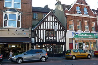
South Croydon in south London is the area surrounding the valley south of central Croydon and running as far south as the former Red Deer public house on the Brighton Road. It is bounded by Waddon to the West and Selsdon and Sanderstead to the East. It is part of the South Croydon (CR2) post town and in the London Borough of Croydon. It is essentially a dormitory suburb for Croydon and London.

The Old Palace of John Whitgift School is a selective independent school for girls in Croydon, London. The Old Palace is protected as a Grade I listed building.
The County Borough of Croydon was a local government district in and around the town of Croydon in north east Surrey, England from 1889 to 1965. Since 1965 the district has been part of the London Borough of Croydon within Greater London.

Bedfords Park is public open space of 215 acres or approximately 87½ hectares near Havering-atte-Bower in the London Borough of Havering in England. It is one of three large parklands around Havering-atte-Bower; the others are Havering Country Park and Pyrgo Park.

The Norwood Ridge is a 10-square-mile (26 km2) rectangular upland which occupies the geographical centre of south London, centred 5 miles (8 km) south of London Bridge. Beneath its topsoil it is a ridge of London Clay that is capped on all sides with remaining natural gravel deposits mixed with some sandy soil, which in the South Thames basin is a material known as the Claygate Beds.

Addington Hills is a park in Upper Shirley, London, England. It is managed by the London Borough of Croydon. It was part of the old parish of Addington before the suburb of Shirley was developed in the 1930s. The site consists largely of woodland on a gravel bed, with London's largest area of heathland at its heart. It is a Site of Metropolitan Importance. In the mid-18th century, it was a noted cricket venue used by the then-prominent Addington Cricket Club.
Croham Hurst School was a day independent school for junior and senior girls located in South Croydon, England. It was established in 1899, and closed in 2008 when it was absorbed into Old Palace School, Croydon.

Ruislip Woods is a Site of Special Scientific Interest and national nature reserve covering 726 acres (294 ha) in Ruislip in the London Borough of Hillingdon. The woods became the second national nature reserve in an urban area of England in May 1997, receiving the Green Flag Award in 2006. Ruislip Local Nature Reserve at TQ 090 899 is part of the national nature reserve.

Crofton Wood or Crofton Woods is Site of Metropolitan Importance for Nature Conservation and a Site of Special Scientific Interest in Crofton in the London Borough of Bromley. Kyd Brook goes through the Wood.

Old Park Wood is a 16.7-hectare (41-acre) Site of Special Scientific Interest in Harefield in the London Borough of Hillingdon. The south-east part is an 8-hectare (20-acre) nature reserve owned and managed by the Hertfordshire and Middlesex Wildlife Trust.

Happy Valley Park is a public park in Coulsdon in the London Borough of Croydon. It is owned and managed by Croydon Council. Located in the Green Belt, most of it forms part of the Farthing Downs and Happy Valley Site of Special Scientific Interest.
Elmstead Pit is a geological Site of Special Scientific Interest in Elmstead in the London Borough of Bromley. Formerly known as Rock Pits, it is a small area of 0.05 hectare. It is a Geological Conservation Review site.

Keston Common is a 55 hectare area of public open space in Keston in the London Borough of Bromley. Most of it is heathland and dry acid grassland on the Blackheath Pebble Beds. Almost all the common together with a small part of the neighbouring Hayes Common is a biological Site of Special Scientific Interest.

Gilbert's Pit is a 5.2-hectare (13-acre) geological Site of Special Scientific Interest in Charlton in the Royal Borough of Greenwich. It was notified in 1985 and was formerly known as Charlton Sand Pit. It is a Geological Conservation Review site. It is also part of the Maryon Wilson Park and Gilbert's Pit Local Nature Reserve. It adjoins Maryon Park and is close to Maryon Wilson Park.

Riddlesdown Common or Riddlesdown is a 43 hectare area of green space in Kenley, towards the northern end of the North Downs in the London Borough of Croydon. It is owned and maintained by the City of London Corporation, apart from two small areas, one of which is operated by the London Wildlife Trust and the other by Croydon Council. An area of 32 hectares is a biological Site of Special Scientific Interest. The name Riddlesdown also applies to the local district of residential housing. A trig point at the site indicates that it is 525 ft (160 m) above sea level.

Crickley Hill and Barrow Wake is a 56.8-hectare (140-acre) biological and geological Site of Special Scientific Interest in Gloucestershire, notified in 1974.

The coat of arms of the London Borough of Croydon is the official heraldic arms of the London Borough of Croydon, granted on 10 December 1965.

Wandle Park is an 8.5-hectare (21-acre) park located in the Broad Green Ward of Croydon, south London, England. It was opened in 1890 by the Mayor of Croydon. The site is protected by Fields in Trust through a legal "Deed of Dedication" safeguarding the future of the space as public recreation land for future generations to enjoy.

