
The London Borough of Croydon is a London borough in south London, part of Outer London. It covers an area of 87 km2 (33.6 sq mi). It is the southernmost borough of London. At its centre is the historic town of Croydon from which the borough takes its name; while other urban centres include Coulsdon, Purley, South Norwood, Norbury, New Addington, Selsdon and Thornton Heath. Croydon is mentioned in Domesday Book, and from a small market town has expanded into one of the most populous areas on the fringe of London. The borough is now one of London's leading business, financial and cultural centres, and its influence in entertainment and the arts contribute to its status as a major metropolitan centre. Its population is 390,719, making it the most populous London borough and sixteenth largest English district.

Waddon is a neighbourhood in the London Borough of Croydon, at the western end of the town of Croydon. The area borders the London Borough of Sutton.

The A23 road is a major road in the United Kingdom between London and Brighton, East Sussex, England. It is managed by Transport for London for the section inside the Greater London boundary, Surrey County Council and West Sussex County Council for the section shadowed by the M23 motorway, National Highways between the M23 and Patcham, and by Brighton and Hove Council from the A27 to the centre of Brighton.

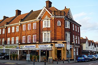
Croydon is a large town in South London, England, 9.3 miles (15.0 km) south of Charing Cross. Part of the London Borough of Croydon, a local government district of Greater London, it is one of the largest commercial districts in Greater London, with an extensive shopping district. The entire town had a population of 192,064 as of 2011, whilst the wider borough had a population of 384,837.

The River Wandle is a right-bank tributary of the River Thames in south London, England. With a total length of about 9 miles (14 km), the river passes through the London boroughs of Croydon, Sutton, Merton and Wandsworth, where it reaches the Thames. A short headwater – the Caterham Bourne – is partially in Surrey, the historic county of the river's catchment. Tributaries of the Wandle include Carshalton Ponds and Norbury Brook.
Norbury is an area of south London. It shares the postcode London SW16 with neighbouring Streatham. Norbury is 6.7 miles (10.8 km) south of Charing Cross.

South Croydon in south London is the area surrounding the valley south of central Croydon and running as far south as the former Red Deer public house on the Brighton Road. It is bounded by Waddon to the West and Selsdon and Sanderstead to the East. It is part of the South Croydon (CR2) post town and in the London Borough of Croydon.

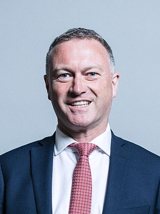
Croydon South is a constituency created in 1974 and represented in the House of Commons of the UK Parliament since 2015 by Chris Philp, a Conservative.

Coulsdon and Purley Urban District was a local government district in northeast Surrey from 1915 to 1965. The local authority was Coulsdon and Purley Urban District Council. The former area of the district is now mostly part of the London Borough of Croydon in Greater London, with parts in the Tandridge District and the Borough of Reigate and Banstead in Surrey.

The London Borough of Croydon has over 120 parks and open spaces within its boundaries, ranging from the 200 acre (80ha) Selsdon Wood Nature Reserve to many recreation grounds and sports fields scattered throughout the Borough. Croydon covers an area of 86.52 km2, the 256th largest district in England. Croydon's physical features consist of many hills and rivers that are spread out across the borough and into the North Downs, Surrey and the rest of South London. Some of the open spaces in Croydon form part of the well-known London LOOP walks where the first section was opened on 3 May 1996 with a ceremony on Farthing Downs in Coulsdon. As a borough in Outer London it also contains some open countryside in the form of country parks. Croydon Council is associated with several other boroughs who are taking part in the Downlands Countryside Management Project. These boroughs are Sutton; and by Surrey County Council; the City of London Corporation; the Surrey districts of Reigate and Banstead and Tandridge; and the Countryside Agency. An additional partner is Natural Britain.

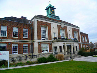
Elections for the Croydon London Borough Council are held every four years to elect 70 councillors. The last ward boundary changes came into force at the 2018 local elections.
Beddington and Wallington was, from 1915 to 1965, a local government district in north east Surrey, England. It formed part of the London suburbs, lying within the Metropolitan Police District and the London Passenger Transport Area. In 1965 it was abolished on the creation of Greater London.
On 29 November 2012, a by-election was held for the UK House of Commons constituency of Croydon North in the London Borough of Croydon. The by-election was caused by the death of its Member of Parliament Malcolm Wicks. It took place on the same day as by-elections in Middlesbrough and Rotherham. The by-election was won by Steve Reed of the Labour Party.

The coat of arms of the London Borough of Croydon is the official heraldic arms of the London Borough of Croydon, granted on 10 December 1965.
The 1964 Croydon Council election took place on 7 May 1964 to elect members of Croydon London Borough Council in London, England. The whole council was up for election and the council went into no overall control.

In the 2022 Croydon London Borough Council election, on 5 May 2022, all 70 members of Croydon London Borough Council, and the Mayor of Croydon, were up for election. The elections took place alongside the local elections in the other London boroughs and elections to local authorities across the United Kingdom. Jason Perry of the Conservative Party narrowly won the mayoral election.

The Croydon Fire Brigade was the fire and rescue service for the County Borough of Croydon. Established in 1867, it was absorbed into the London Fire Brigade in 1965.


