Topographical survey of St. Marylebone, St. Pancras and Paddington Parishes. Engraving by B.R. Davies, 1145 x 950mm, dated 1834.
The name is derived from a chapel, dedicated to St Mary, and founded by Barking Abbey, the holders of the Manor of Tyburn. The chapel was named St Mary-le-Bourne, for the bourne, or River Tyburn. In the borough's coat of arms, the blue and white waves represent this stream; the lily and rose, derived from Barking Abbey, represent the legend that when the Virgin's tomb was opened it was found to contain lilies and roses.
The motto: Fiat Secundum Verbatum Tuum, is from the Gospel of Luke Ch.I v.38 and translates as Be it according to Thy Word.[1]
Following a competition in 1911, Sir Edwin Cooper was commissioned to design Marylebone Town Hall.[3] The building, in Marylebone Road was built 1914–20. The building is faced with Portland stone and is an example of Edwardian Graeco-Roman classicism, with a tower in the style of Christopher Wren and fluted columns. Cooper also designed the 1938–39 extension in a simpler style to house the public library.[4][5]
Population and area
The borough covered an area of 1,473 acres (6.0km2). The population found in the Census was:
A map showing the wards of St Marylebone Metropolitan Borough as they appeared in 1916.
Under the Metropolis Management Act 1855 any parish that exceeded 2,000 ratepayers was to be divided into wards; as such the incorporated vestry of Marylebone was divided into eight wards (electing vestrymen): No. 1 or Hamilton Terrace (9), No. 2 or St Johns Wood Terrace (9), No. 3 or New Church Street (15), No. 4 or Dorset Square & Regents Park (15), No. 5 or Bryanstone (18), No. 6 or Portman (18), No. 7 or Portland Place (18) and No. 8 or Cavendish Square (18).[9][10]
The metropolitan borough was divided into nine wards for elections: Bryanston Square, Cavendish, Church Street, Dorset Square & Regent's Park, Hamilton Terrace, Langham, Park Crescent, Portman and St John's Wood Terrace.[11][12]
Borough council
Parliament constituency
For elections to Parliament, the borough was divided into two constituencies:
This page is based on this Wikipedia article Text is available under the CC BY-SA 4.0 license; additional terms may apply. Images, videos and audio are available under their respective licenses.

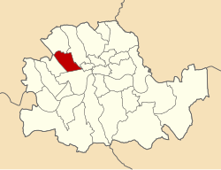

 Map of boundary


