
Kingston upon Thames is a town in the Royal Borough of Kingston upon Thames, southwest London, England. It is situated on the River Thames and 10 miles (16 km) southwest of Charing Cross. It is notable as the ancient market town in which Saxon kings were crowned and today is the administrative centre of the Royal Borough of Kingston upon Thames.

The Royal Borough of Kingston upon Thames is a borough in southwest London. The main town is Kingston upon Thames and it includes Chessington, Malden Rushett, New Malden, Surbiton and Tolworth. It is the oldest of the four royal boroughs in England. The others are the London boroughs of Greenwich and Kensington and Chelsea and Windsor and Maidenhead, the site of Windsor Castle. The local authority is Kingston upon Thames London Borough Council.
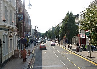
Surbiton is a suburban neighbourhood in South West London, within the Royal Borough of Kingston upon Thames (RBK). It is next to the River Thames, 11 miles (18 km) southwest of Charing Cross. Surbiton was in the historic county of Surrey and since 1965 it has been in Greater London. Surbiton comprises four of the RBK's wards: Alexandra, Berrylands, St. Mark's, and Surbiton Hill.

Barnes was a local government district in north west Surrey from 1894 to 1965, when its former area was absorbed into the London Borough of Richmond upon Thames.
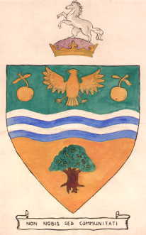
Bexley was a local government district in north west Kent from 1879 to 1965 around the town of Old Bexley.

Edmonton was a local government district in north-east Middlesex, England, from 1850 to 1965.

Uxbridge was a local government district in north west Middlesex, England, from 1849 to 1965, seated in the town of Uxbridge.

Twickenham was a local government district in Middlesex, England from 1868 to 1965.

Kingston-upon-Thames was a local government district in north east Surrey, England from 1835 to 1965 around the town now known as Kingston upon Thames. It was alternatively known as Kingston on Thames. It was a municipal borough and also held the rarer status of Royal borough. The district was abolished in 1965 and was replaced with the larger London Borough of Kingston upon Thames in Greater London, with the Royal borough status passed to the new district.
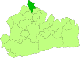
Staines was a local government district from 1894 to 1974 named after the English town of Staines.
The London Government Act 1963 is an Act of the Parliament of the United Kingdom, which created Greater London and a new local government structure within it. The Act significantly reduced the number of local government districts in the area, resulting in local authorities responsible for larger areas and populations. The upper tier of local government was reformed to cover the whole of the Greater London area and with a more strategic role; and the split of functions between upper and lower tiers was recast. The Act classified the boroughs into inner and outer London groups. The City of London and its corporation were essentially unreformed by the legislation. Subsequent amendments to the Act have significantly amended the upper tier arrangements, with the Greater London Council abolished in 1986, and the Greater London Authority introduced in 2000. As of 2016, the London boroughs are more or less identical to those created in 1965, although with some enhanced powers over services such as waste management and education.

Brentford and Chiswick was a local government district of Middlesex, England from 1927 to 1965.
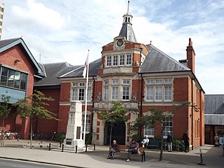
Malden and Coombe was a local government district in Surrey, England from 1866 to 1965.
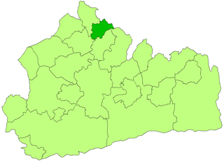
Sunbury on Thames Urban District, also known as Sunbury Urban District, was a local government district from 1894 to 1974 comprising the town and parish of Sunbury-on-Thames and from 1930 also the parishes of Littleton and Shepperton.

The Municipal Borough of Richmond or Richmond Municipal Borough was a municipal borough in Surrey, England from 1890 to 1965.

Hook is a suburban area in south west London, England. It forms part of the Royal Borough of Kingston upon Thames and is located 12 miles (19.3 km) south west of Charing Cross. Neighbouring settlements include Hinchley Wood, Long Ditton, Surbiton, Tolworth and Chessington.
Esher Urban District was an urban district in Surrey, England created by merging two urban districts and adding two parishes to the south-west. It existed from 1933 to 1974 and was governed by the elected Esher Urban District Council which shared local government functions with Surrey County Council. Its main building was the large town hall in Esher.
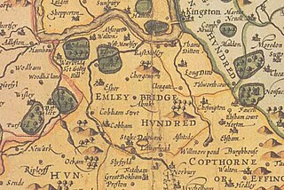
The Hundred of Elmbridge or Elmbridge/Emley Hundred was a geographic subdivision in the north of the county of Surrey, England. The majority of its area forms the modern Borough of Elmbridge, with the remainder forming part of the Royal Borough of Kingston upon Thames in Greater London.

Kingston upon Thames Crown Court is a Crown Court venue which deals with criminal cases at 6–8 Penrhyn Road, Kingston upon Thames, London.

The Sessions House is a municipal building in Ewell Road, Surbiton, London. It is a Grade II listed building.


