East Ham | |
---|---|
East Ham Town Hall | |
East Ham within Essex in 1961 | |
Area | |
• 1894 | 3,324 acres (13.5 km2) |
• 1965 | 3,324 acres (13.5 km2) |
Population | |
• 1901 | 96,008 |
• 1961 | 105,682 |
History | |
• Created | 1894 |
• Abolished | 1965 |
• Succeeded by | London Borough of Newham |
Status | Local government district (1878–1894) Urban district (1894–1904) Municipal borough (1904–1915) County borough (1915–1965) |
Government | |
• HQ | East Ham |
• Motto | Progressio cum Populo (Progress with the people) |
| |
Subdivisions | |
• Type | Parishes |
• Units | East Ham (1878–1965) Little Ilford (1886–1900) |
East Ham was a local government district in the far south west of Essex from 1878 to 1965. It extended from Wanstead Flats in the north to the River Thames in the south and from Green Street in the west to Barking Creek in the east. It was part of the London postal district and Metropolitan Police District.
East Ham Local Government District was created in 1878, when the parish of East Ham adopted the Local Government Act 1858, and formed a local board of nine members to govern the area. In 1886 the local government district was extended to include the civil parish of Little Ilford, and the board was increased to 12 in number. The Local Government Act 1894 reconstituted the area as an urban district, with an elected urban district council of 15 members replacing the board. In 1900 Little Ilford parish was abolished and its area absorbed into an enlarged East Ham.
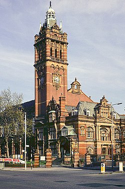
On 27 August 1904 East Ham was granted a charter of incorporation constituting the town as a municipal borough. [1] A new town council consisting of a mayor, six aldermen and eighteen councillors replaced the urban district council. [2] The four wards of the urban district were replaced by six new wards (Beckton & North Woolwich, Central East, Central West, Manor Park, Plashet East, Plashet West), each returning three councillors and one aldermen. [1]
In 1915 the borough gained independence from county administration as a county borough, against the objections of Essex County Council. [3] The size of the borough council was increased to ten alderman and thirty councillors in 1920, representing ten wards: Castle, Central, Greatfield, Kensington, Little Ilford, Manor Park, Plashet, South, Wall End and Woodgrange. [2] [4]
The borough included most of the current-day London Borough of Newham east of Green Street including Little Ilford, Manor Park, East Ham and Beckton. The borough formed part of London's built-up area, was part of the London postal district and the Metropolitan Police District. It excluded North Woolwich, as historically this was part of the Metropolitan Borough of Woolwich, in the County of London.
The borough ran its own tram services until they became the responsibility of the London Passenger Transport Board in 1933. [5] The borough ran its own fire brigade which was absorbed into the London Fire Brigade in 1965. East Ham's Town Hall now serves as Newham Town Hall. [6]
The borough did not have an official coat of arms, but used a device designed by the surveyor to the urban district council in 1896. [7] In a 1916 book on the arms of Essex boroughs the "pseudo-heraldic device" was dismissed as "a somewhat obvious imitation of the arms of West Ham". [8] The official explanation of the device was that the crosier stood for Stratford Langthorne Abbey, established by William de Montfichet in the 12th century; the burning torches stood for the Beckton gasworks; the sailing ship for the docks and the rising sun for "the ascending of East Ham, which within a few years developed with such marvellous rapidity." [7]
In common with most boroughs, early elections were officially non-political and were often uncontested. In 1906 a Labour Representation Committee was formed in East Ham, and it affiliated with the national Labour Party in 1908. [4] In response, and in imitation of the highly successful London Municipal Reform Party, the local Conservative and Liberal organisations formed an anti-Labour Municipal Alliance. [9]
The Alliance, which also embraced independent and ratepayer candidates, secured a large majority at the municipal elections of 1907, with Labour forming the opposition on the council. [10]
In 1928 the elections produced a hung council, with Labour and the Municipal Alliance each having 20 members. In the following year a single gain saw Labour take control, which they were to retain for the remainder of the borough's existence. [11] The defeated opposition group stood as "Anti-Labour" from the next elections in 1929 and were retitled as the Civic Party in 1933. [4]
When local elections were resumed after the Second World War, Labour faced official Conservative candidates for the first time. [12] Conservatives formed a small opposition group, later supplanted by Independents. After the final municipal elections in 1963, Labour held 30 seats and Independents 10. [13]
The county borough, along with the County Borough of West Ham, was abolished and became part of the London Borough of Newham in 1965 when Greater London was created. Although the County Borough was administratively independent from Essex, it did form part of the county, and so like the other Essex authorities incorporated into Greater London, the majority of its public records up to 1965 are held in the Essex County Record Office in Chelmsford. Discussions are continuing between county and London Borough archivists which may lead to the return of records to their originating districts.
Population of East Ham from 1801 to 1911
Year [14] | 1801 | 1851 | 1861 | 1881 | 1891 | 1901 | 1911 |
---|---|---|---|---|---|---|---|
Population | <2000 | <2000 | 2,858 | 10,706 | 32,713 | 96,018 | 133,487 |
Dwellings | n/a | n/a | 497 | 1,930 | 5,818 | 17,937 | 25,694 |
Stratford is a town in East London, England, in the London Borough of Newham. Part of the Lower Lea Valley, it is 6 miles (9.7 km) northeast of Charing Cross, and includes Maryland and East Village.
West Ham is a district in East London, England and is in the London Borough of Newham. It is an inner-city suburb located 6.1 mi (9.8 km) east of Charing Cross.
The London Borough of Newham is a London borough created in 1965 by the London Government Act 1963. It covers an area previously administered by the Essex county boroughs of West Ham and East Ham, authorities that were both abolished by the same act. The name Newham reflects its creation and combines the compass points of the old borough names. Situated in the Inner London part of East London, Newham has a population of 387,576, which is the fourth highest of the London boroughs and also makes it the 26th most populous district in England. The local authority is Newham London Borough Council.
East Ham is a district of the London Borough of Newham, England, 8 miles (12.8 km) east of Charing Cross. Within the boundaries of the historic county of Essex, East Ham is identified in the London Plan as a Major Centre. The population is 76,186.
The Metropolitan Borough of Greenwich was a metropolitan borough in the County of London between 1900 and 1965. It bordered the boroughs of Woolwich, Lewisham and Deptford and, across the River Thames, the borough of Poplar and the County Borough of West Ham in Essex. Within the area of the borough were the Royal Naval College, the Royal Observatory and Greenwich Park.
North Woolwich is an area in the London Borough of Newham in East London, England, on the northern bank of the River Thames, across the river from Woolwich. It is connected to Woolwich by the Woolwich Ferry and Woolwich foot tunnel.
Canning Town is a district in the London Borough of Newham, East London, England, north of the Royal Victoria Dock. Its urbanisation was largely due to the creation of the dock. The area was part of the ancient parish and County Borough of West Ham, in the historic county of Essex. It forms part of the London E16 postcode district.
Beckton is a suburb in east London, England, located 8 miles (12.9 km) east of Charing Cross and part of the London Borough of Newham. Adjacent to the River Thames, the area consisted of unpopulated marshland known as the East Ham Levels in the parishes of Barking, East Ham, West Ham and Woolwich. The development of major industrial infrastructure in the 19th century to support the growing metropolis of London caused an increase in population with housing built in the area for workers of the Beckton Gas Works and Beckton Sewage Treatment Works. The area has a convoluted local government history and has formed part of Greater London since 1965. Between 1981 and 1995 it was within the London Docklands Development Corporation area, which caused the population to increase as new homes were built and the Docklands Light Railway was constructed.
Little Ilford is a district of London, England in the London Borough of Newham. It gives its name to the Little Ilford ward.
East Ham is a constituency in the London Borough of Newham represented in the House of Commons of the UK Parliament since its creation in 1997 by Stephen Timms of the Labour Party.
The region of Greater London, including the City of London, is divided into 75 parliamentary constituencies which are sub-classified as borough constituencies, affecting the type of electoral officer and level of expenses permitted. Since the general election of July 2024, 59 are represented by Labour MPs, 9 by Conservative MPs, 6 by Liberal Democrat MPs, and 1 by an independent MP.
West Ham was a local government district in the extreme south west of Essex from 1886 to 1965, forming part of the built-up area of London, although outside the County of London. It was immediately north of the River Thames and east of the River Lea.
Barking was a local government district, and later civil parish and borough, in southwest Essex, England from 1882 to 1965. It was known as Barking Town from 1882 to 1931. The district included the town of Barking, eastern Beckton and the southwestern part of the Becontree estate. The district was within the Metropolitan Police District and experienced a steady increase in population during its existence. The area was suburban to London's conurbation region and was part of the Metropolitan Police District. It now forms the western part of the London Borough of Barking and Dagenham and the eastern extremity of the London Borough of Newham in Greater London.
Ilford was a civil parish and local government district in south west Essex, England from 1888 to 1965, covering the town Ilford. The district saw a considerable rise in population throughout its life, caused by the expansion of the built-up area of London, and became one of the most populous districts of its type in England. The district now corresponds to the greater part of the London Borough of Redbridge in Greater London.
The London Borough of Newham, in spite of being one of the more crowded areas of London, has over 20 parks within its boundaries, as well as smaller recreation grounds. The larger parks in the Borough include:
The London Government Act 1963 is an act of the Parliament of the United Kingdom, which created Greater London and a new local government structure within it. The Act significantly reduced the number of local government districts in the area, resulting in local authorities responsible for larger areas and populations. The upper tier of local government was reformed to cover the whole of the Greater London area and with a more strategic role; and the split of functions between upper and lower tiers was recast. The Act classified the boroughs into inner and outer London groups. The City of London and its corporation were essentially unreformed by the legislation. Subsequent amendments to the Act have significantly amended the upper tier arrangements, with the Greater London Council abolished in 1986, and the Greater London Authority introduced in 2000. As of 2024, the London boroughs are more or less identical to those created in 1965, although with some enhanced powers over services such as waste management and education.
Newham London Borough Council also known as Newham Council, is the local authority for the London Borough of Newham in Greater London, England. It is a London borough council, one of 32 in London. The council has been under Labour majority control since 1971. It has been led by a directly elected mayor since 2002. The council meets at Newham Town Hall in East Ham and at Stratford Town Hall, and has its main offices at 1000 Dockside Road, overlooking the Royal Albert Dock.
Elections to Newham London Borough Council in London, England was held on 6 May 2010. This was on the same day as other local elections and the general election to the UK Parliament.
The 1964 Newham London Borough Council election took place on 7 May 1964 to elect members of Newham London Borough Council in London, England. The whole council was up for election and the Labour Party gained control of the council.
The 2014 Newham London Borough Council election took place on 22 May 2014 to elect members of Newham London Borough Council in England. This was on the same day as other local elections.