North Woolwich

Last updated

North Woolwich
North Woolwich ferry terminal, side view - geograph.org.uk - 1736806.jpg
North Woolwich ferry terminal
Greater London UK location map 2.svg
Red pog.svg
North Woolwich
Location within Greater London
OS grid reference TQ435795
  Charing Cross 8 mi (12.9 km)  WNW
London borough
Ceremonial county Greater London
Region
Country England
Sovereign state United Kingdom
Post town London
Postcode district E16
Dialling code 020
Police Metropolitan
Fire London
Ambulance London
UK Parliament
London Assembly
List of places
UK
England
London
51°30′04″N0°03′29″E / 51.501°N 0.058°E / 51.501; 0.058

North Woolwich is an area in the London Borough of Newham in East London, England, on the northern bank of the River Thames, across the river from Woolwich. It is connected to Woolwich by the Woolwich Ferry and Woolwich foot tunnel.

Contents

Despite lying on the northern, Essex, side of the Thames, the area was within the historic county of Kent. It was part of the parish of Woolwich in the Blackheath hundred, but since 1965 has been in Greater London. Its position within Kent was an arrangement most likely imposed in the aftermath of the Norman Conquest of England from 1066.

History

Toponymy

The placename North Woolwich was probably taken from North Woolwich railway station which opened in 1847 and closed in 2006; before that, the area was referred to by terms such as "Woolwich in Essex", [1] "Kent in Essex" [2] and "detached Woolwich".

Local government

The area now called North Woolwich was originally in the eastern part of the Manor of Ham, in the Becontree hundred of Essex; a territory that was subsequently divided into the more familiar West and East Ham, sometime in the 12th century. North Woolwich appears to have been separated a century or so before that time, following the Norman conquest.

Having defeated the English, William the Conqueror rewarded his followers and consolidated his rule, by dividing the lands of his new Kingdom between them. Amongst the foremost of these was Hamo, Steward to the king and Sheriff of Kent, who was given manors in Essex, Kent and Surrey.

The Domesday Book of 1086 shows Hamo as holding land on both sides of the river as part of the manor of Woolwich. The widely-held view is that the upheaval of the conquest gave Hamo an opportunity to attach some of his land in Essex to his manor of Woolwich and by extension to his Sheriffdom of Kent. In so doing he became both lord of the manor and Sheriff on both sides of the ferry crossing, an arrangement that allowed him to more effectively tax the revenues of the ferry. This enhanced control of the crossing may also have given him personal military and political advantages.

The parish of Woolwich developed from the manor, and administered North Woolwich until 1888 when it was replaced by the Metropolitan Borough of Woolwich and made part of the new County of London. The neighbouring areas' local authorities of East Ham, West Ham and Barking, while also heavily urbanised, were excluded from the new London authority to remain in Essex; and so North Woolwich remained an anomaly at county level.

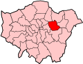
Local administration changed again in 1965, with the creation of the London Borough of Newham as part of a new Greater London area. North Woolwich joined West Ham, East Ham and other areas between the rivers Lea, Thames and Roding to form an authority which effectively reestablished the old area of Ham.

The administrative association with Woolwich ended at that time, and Woolwich itself became part of a new London Borough of Greenwich, whereas North Woolwich became part of the London Borough of Newham. [3]

Urban development

It appears that a hamlet in the area was destroyed by medieval floods and the area remained uninhabited from that time until the 19th century.

The area was formerly the site of industries including the cable works of W. T. Henley (later Associated Electrical Industries) and the Western Electric Company (later Standard Telephones and Cables) on the river to the west of the ferry, and a large Harland & Wolff ship building and repair shop at Gallions Point to the south of the King George V Dock entrance lock (not to be confused with their works at the western end of the dock). Often on the day of launch of a new ship, the company would invite children from the local primary school (Storey Street, now closed) to witness the event.

The population peaked just before the First World War, and reduced substantially in the Second World War when it was heavily bombed.

Geography

Unlike many areas of London, North Woolwich had formally-defined boundaries by which it comprised two separate tracts of riverside land. The smaller and more westerly part, containing 68 acres (28 ha), extended west for about 12 mile (800 m) from North Woolwich station. The larger detached part, further fragmented by dock facilities, extended east from the Royal Victoria Gardens. However as in many areas of London, informal local definitions of districts are more nuanced

The formal boundaries of North Woolwich about 1917. North Woolwich -Formal.jpg
The formal boundaries of North Woolwich about 1917.

Most of Pier Road and the Royal Victoria Gardens, as well as King George V DLR station, are, strictly speaking, in a finger of East Ham surrounded by North Woolwich. However, as is so often the case in London, formal boundaries have not proved the deciding factor in defining local areas, and this part of East Ham has also long been regarded[ by whom? ] as being part of North Woolwich.

Conversely, the area of the eastern part that lies north of the docks – an area of employment land, infrastructure facilities and post-industrial dereliction, with very few residents – is more usually seen[ citation needed ] as being part of Beckton, an area that has never had any formal definition.

In summary, the area now commonly[ vague ] considered as North Woolwich differs markedly from the two areas which formerly had the association with Woolwich, covering a smaller area but with a higher population. It could now be said[ by whom? ] to consist of the area to the south of King George V Dock and Lock, east of the boundary with the Silvertown area of West Ham.

Nearby places

The nearest Docklands Light Railway station is King George V.

Transport

The King George V DLR station is North Woolwich's principal public transport asset, offering direct links to the City, Canary Wharf (via Poplar), Stratford and Woolwich.

The extension of the Docklands Light Railway to the area opened in December 2005. Until 2009, this terminated at King George V; a further extension under the river to Woolwich Arsenal opened in 2009.

The disused North Woolwich railway station, which was closed in preparation for future transport developments which will use sections of the line, is situated adjacent to the ferry terminal. This situation means that North Woolwich now sports two old station buildings. The closed North London Line station is adjacent to an earlier station which closed in 1979; this housed the Old Station Museum from 1984 until it closed in 2008, which was devoted to the history of the Great Eastern and London and North Eastern railways.

North Woolwich is also linked to Woolwich, to its south, by the Woolwich Free Ferry (which connects the North Circular and South Circular roads) and the Woolwich foot tunnel.

Education

Related Research Articles

<span class="mw-page-title-main">Stratford, London</span> Human settlement in England

Stratford is a town in East London, England, within the London Borough of Newham. Part of the Lower Lea Valley, Stratford is situated 6 miles (9.7 km) east-northeast of Charing Cross, and includes the localities of Maryland and East Village.

<span class="mw-page-title-main">West Ham</span> District in East London, England

West Ham is an area in East London, located 6.1 mi (9.8 km) east of Charing Cross in the west of the modern London Borough of Newham.

<span class="mw-page-title-main">London Borough of Newham</span> Inner Borough of London, England

The London Borough of Newham is a London borough created in 1965 by the London Government Act 1963. It covers an area previously administered by the Essex county boroughs of West Ham and East Ham, authorities that were both abolished by the same act. The name Newham reflects its creation and combines the compass points of the old borough names. Situated in the Inner London part of East London, Newham has a population of 387,576, which is the third highest of the London boroughs and also makes it the 16th most populous district in England. The local authority is Newham London Borough Council.

<span class="mw-page-title-main">Silvertown</span> Human settlement in England

Silvertown is a district in the London Borough of Newham, in east London, England. It lies on the north bank of the Thames and was historically part of the parishes of West Ham and East Ham, hundred of Becontree, and the historic county of Essex. Since 1965, Silvertown has been part of the London Borough of Newham, a local government district of Greater London. It forms part of the London E16 postcode district along with Canning Town and Custom House.

<span class="mw-page-title-main">East Ham</span> Suburban district of London, England

East Ham is a district of the London Borough of Newham, England, 8 miles (12.8 km) east of Charing Cross. East Ham is identified in the London Plan as a Major Centre. The population is 76,186.

<span class="mw-page-title-main">Canning Town</span> District in East London (Newham), England

Canning Town is a district in the London Borough of Newham, East London. The district is located to the north of the Royal Victoria Dock, and has been described as the "Child of the Victoria Docks" as the timing and nature of its urbanisation was largely due to the creation of the dock. The area was part of the ancient parish of West Ham, in the hundred of Becontree, and part of the historic county of Essex. It forms part of the London E16 postcode district.

<span class="mw-page-title-main">Royal Docks</span> Area in Newham, London

Royal Docks is an area and a ward in the London Borough of Newham in the London Docklands in East London, England.

<span class="mw-page-title-main">Beckton</span> Area in East London, England

Beckton is a suburb in east London, England, located 8 miles (12.9 km) east of Charing Cross and part of the London Borough of Newham. Adjacent to the River Thames, the area consisted of unpopulated marshland known as the East Ham Levels in the parishes of Barking, East Ham, West Ham and Woolwich. The development of major industrial infrastructure in the 19th century to support the growing metropolis of London caused an increase in population with housing built in the area for workers of the Beckton Gas Works and Beckton Sewage Treatment Works. The area has a convoluted local government history and has formed part of Greater London since 1965. Between 1981 and 1995 it was within the London Docklands Development Corporation area, which caused the population to increase as new homes were built and the Docklands Light Railway was constructed.

<span class="mw-page-title-main">East London</span> Northeastern part of London, United Kingdom

East London is the northeastern part of London, England, east of the ancient City of London and north of the River Thames as it begins to widen. East London developed as London's docklands and the primary industrial centre. The expansion of railways in the 19th century encouraged the eastward expansion of the East End of London and a proliferation of new suburbs. The industrial lands of East London are today an area of regeneration, which are well advanced in places such as Canary Wharf and ongoing elsewhere.

<span class="mw-page-title-main">East Ham (UK Parliament constituency)</span> UK Parliament constituency since 1997

East Ham is a constituency in the London Borough of Newham represented in the House of Commons of the UK Parliament since its creation in 1997 by Stephen Timms of the Labour Party.

<span class="mw-page-title-main">Pontoon Dock DLR station</span> Docklands Light Railway station

Pontoon Dock is a station on the Docklands Light Railway (DLR) in Silvertown in east London, which is on the Woolwich Arsenal branch, opened on 2 December 2005. It is located in the east of Silvertown in the London Borough of Newham, in the redevelopment zone known as Silvertown Quays, and is in Travelcard Zone 3.

<span class="mw-page-title-main">County Borough of East Ham</span>

East Ham was a local government district in the far south west of Essex from 1878 to 1965. It extended from Wanstead Flats in the north to the River Thames in the south and from Green Street in the west to Barking Creek in the east. It was part of the London postal district and Metropolitan Police District.

<span class="mw-page-title-main">County Borough of West Ham</span> Historical local government district in the extreme south west of Essex

West Ham was a local government district in the extreme south west of Essex from 1886 to 1965, forming part of the built-up area of London, although outside the County of London. It was immediately north of the River Thames and east of the River Lea.

<span class="mw-page-title-main">Municipal Borough of Barking</span>

Barking was a local government district, and later civil parish and borough, in southwest Essex, England from 1882 to 1965. It was known as Barking Town from 1882 to 1931. The district included the town of Barking, eastern Beckton and the southwestern part of the Becontree estate. The district was within the Metropolitan Police District and experienced a steady increase in population during its existence. It now forms the western part of the London Borough of Barking and Dagenham and the eastern extremity of the London Borough of Newham in Greater London.

<span class="mw-page-title-main">Custom House, Newham</span> Area in London, England

Custom House is an area in the London Borough of Newham, in East London, England.

The Eastern Counties and Thames Junction Railway in east London connected the Royal Docks with the Eastern Counties Railway (ECR). Authorised in 1844, it opened in 1846, and was absorbed by the ECR in 1847. The ECR amalgamated with other railways to form the Great Eastern Railway in 1862.

<span class="mw-page-title-main">Silvertown (UK Parliament constituency)</span> Parliamentary constituency in the United Kingdom, 1918–1950

Silvertown was a borough constituency returning a single Member of Parliament (MP) to the House of Commons of the Parliament of the United Kingdom through the first-past-the-post voting system. The constituency was one of four divisions of the Parliamentary Borough of West Ham, which had at the time the same boundaries as the County Borough of West Ham. Although administratively separate since 1889, the area was formally part of the county of Essex; since 1965 it has been part of the London Borough of Newham in Greater London.

Becontree was an ancient hundred in the south west of the county of Essex, England. Its area has been entirely absorbed by the growth of London; with its name reused in 1921 for the large Becontree estate of the London County Council. Its former area now corresponds to the London Borough of Newham, the London Borough of Barking and Dagenham and parts of the London Borough of Waltham Forest and the London Borough of Redbridge. Its early extent also included parts of what is now the London Borough of Havering.

<span class="mw-page-title-main">Gallions Reach Crossing</span> Proposed bridge or ferry crossing the River Thames

The Gallions Reach Crossing was a proposed River Thames crossing close to Gallions Reach in East London, running between Beckton in the London Borough of Newham and Thamesmead in the Royal Borough of Greenwich. Originally a proposed ferry crossing replacing the Woolwich Ferry, later plans suggested either a bridge or a tunnel.

The Docklands Light Railway extension to Thamesmead is a proposed Docklands Light Railway (DLR) extension to serve the Beckton Riverside and Thamesmead redevelopment areas of East London.

References

  1. Powell WR ed. (1973) Becontree hundred: East Ham, in A History of the County of Essex: Volume 6, pp. 1–8. London: Victoria County History. (Available online at British History Online. Retrieved 2021-06-30.)
  2. The London Encyclopaedia, edited by Weinreb and Hibbert, 1983
  3. "Local Government". Act of 1963 . Retrieved 21 November 2022.