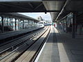
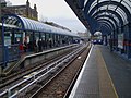
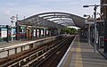
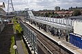
The Docklands Light Railway (DLR) is an automated lightmetro system that serves the London Docklands area of east and south-east London. First opened on 31 August 1987, the DLR was a key component in the regeneration of large areas of disused industrial land into valuable commercial and residential districts.[1]
Listed for each station is the branch or branches it is on, the local authority, the London Travelcard zone in which it is located, interchanges with other modes of transport, the opening date and any resiting.
The position planned before the railway originally opened was on the other side of Manchester Road.[23] The station was relocated underground with the opening of the Lewisham extension on 20 November 1999.[6]
Station safeguarded since original railway opening.[13] The station was resited and rebuilt on a new alignment on 28 April 2014 as the old site was required for a Crossrail tunnel portal.[31]
Between 12 February and 15 April 1996 there was no service south of Canary Wharf due to a bombing near South Quay.[6] The station was resited to make platform extensions easier as the previous site had tight curves at either end. It was resited on 26 October 2009.[32]
Safeguarded as part of the London City Airport extension,[37] the site is currently being used for Silvertown Tunnel construction. Following completion of the tunnel in 2025, 5,000 new homes and a DLR station will be built.[36]
A planned extension of the DLR to Thamesmead, first formally proposed in 2020. As of January2021[update], feasibility and technical work is underway.[38][40] Beckton Riverside was previously proposed as part of the cancelled Dagenham Dock extension.
As part of the development of the Docklands Light Railway, several sites were safeguarded for future station construction, some of which have been implemented.
Previously safeguarded
Two stations were safeguarded as part of the initial construction of the railway in the 1980s.[41]
Thames Wharf, located south of Canning Town, was safeguarded during the construction of the Beckton extension. Given construction of flying junctions for access to the Stratford International and Woolwich Arsenal branches of the DLR, construction of this station is no longer possible.[42] A new safeguarded site for a Thames Wharf station was constructed as part of the London City Airport extension.[36]
Connaught, located on a straight section of viaduct between Prince Regent and Royal Albert stations, was safeguarded during the construction of the Beckton extension in the 1990s.[43] The site was close to the long closed Connaught Road station.[44] Although a straight section of viaduct remains, the station is not currently proposed, despite recent development in the local area such as ExCeL London and London Regatta Centre.
Currently proposed
Thames Wharf was safeguarded as part of the London City Airport extension, with a straight section of viaduct.[45] The site is currently being used for Silvertown Tunnel construction. Following completion of the tunnel in 2025, 5,000 new homes and a DLR station will be built.[36]
Notes
↑ This only lists dates when the DLR stations or platforms opened.
↑ Names listed here are those that were proposed before opening and any renamings.
↑ Pearce, Alan (2006). Docklands Light Railway: official handbook. Brian Hardy, Colin Stannard, Capital Transport (5thed.). Harrow: Capital Transport. ISBN1-85414-298-4. OCLC137312784.
This page is based on this Wikipedia article Text is available under the CC BY-SA 4.0 license; additional terms may apply. Images, videos and audio are available under their respective licenses.