Blackwall, London

Last updated

Blackwall
Blackwall, Virginia Quay and the Greenwich Meridian - geograph.org.uk - 789437.jpg
Virginia Quay, the line that runs down the centre of the avenue marking the prime meridian
Tower Hamlets London UK location map.svg
Red pog.svg
Blackwall
Greater London UK location map 2.svg
Red pog.svg
Blackwall
Location within Greater London
Population19,461 (2011 Census. Blackwall and Cubitt Town Ward) [1]
OS grid reference TQ385805
London borough
Ceremonial county Greater London
Region
Country England
Sovereign state United Kingdom
Post town LONDON
Postcode district E14
Dialling code 020
Police Metropolitan
Fire London
Ambulance London
UK Parliament
London Assembly
List of places
UK
England
London
51°30′23″N0°00′12″W / 51.5063°N 0.0034°W / 51.5063; -0.0034

Blackwall is an area of Poplar, [2] in the London Borough of Tower Hamlets, East London. The neighbourhood includes Leamouth and the Coldharbour conservation area. [3]

Contents

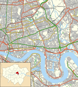
The area takes its name from a historic stretch of riverside wall built along an outside curve of the Thames, to protect the area from flooding. Along with the rest of Poplar, Blackwall has its origin in the Manor and Ancient Parish of Stepney. While mostly residential, the Poplar Dock and Blackwall Basin provide moorings for vessels.

Setting and administration

The area's significance derived from its position on an outside curve of the Thames, where currents slowed down, making it a sheltered spot useful to a range of shipping activities. This sheltered position was enhanced by the presence of the Blackwall Rock reef, though this could also be a danger to shipping. A further advantage of the area was that it lay east of the Isle of Dogs, so loading and unloading here avoided that time and effort of sailing round that peninsula to London, while still being very close to the City of London.

The area developed on the riverside, next to Poplar's East Marsh and was known as Blackwall by at least the 14th century; [4] taking its name from the colour of the river wall, built - with its stairs - in the Middle Ages. Having never been an administrative unit, the area lacks formal definition, but can be broadly described as the part of Poplar close to the Thames on the north-east part of the Isle of Dogs peninsula extending eastward to the confluence of the Thames and Lea.

Blackwall gives its name to Blackwall Reach, the stretch of the Thames east of the Isle of Dogs. [5] Blackwall Reach gives its name to Blackwall Point, the northern tip of the Greenwich Peninsula, south of the Thames in Greenwich (and not in Blackwall).

Blackwall was historically part of the Hamlet of Poplar, an autonomous area of the Manor and Ancient Parish of Stepney in Middlesex. The Hamlet of Poplar became an independent parish in 1817. The civil parish of Poplar had a vestry committee which organised services such as poor relief and road maintenance. [6] Indeed, the whole Isle of Dogs was until the late 20th century referred to as being in Poplar. [7] In 1965, the Metropolitan Borough of Poplar merged with its neighbours to form the new London Borough of Tower Hamlets.

History

This house at Blackwall, once owned by Sir Walter Raleigh, was demolished during construction of the Blackwall Tunnel. Sir Walter Raleigh's House at Blackwall.jpg
This house at Blackwall, once owned by Sir Walter Raleigh, was demolished during construction of the Blackwall Tunnel.

Blackwall Yard became a major sea hub, and the district was a significant part of the Port of London, and involved with important voyages for over 400 years. Shipfitting and repair was taking place by 1485 [9] and shipbuilding would take place in the area later too. In 1576, Martin Frobisher left Blackwall and landed at Frobisher Bay on Baffin Island, claiming it for England (its first overseas possession) in the name of Queen Elizabeth I. Frobisher was funded by the Muscovy Company seeking the North West Passage. [10] [11] In the early years of the 17th century the port was the main departure point of the English colonisation of North America and the West Indies launched by the London Company. On 20 December 1606, three ships, Susan Constant , Godspeed and Discovery , sailed from Blackwall, landing in Virginia on 26 April 1607 to establish the first permanent English settlement, Jamestown. [12]

The East and West India Docks were constructed at the beginning of the 19th century.

The earliest Thames Ironworks F.C. photo, taken in 1895. The club would be reformed as West Ham United. ThamesIronworksFC.gif
The earliest Thames Ironworks F.C. photo, taken in 1895. The club would be reformed as West Ham United.

Leamouth Wharf was the site of the Samuda Brothers, Orchard House Yard and Thames Iron Works shipyards which were major centres of employment. In 1895, Arnold Hills the owner of the Thames Iron Works and foreman Dave Taylor set up a works team, Thames Ironworks F.C. The club would later be reformed as West Ham United F.C. [13] [14]

Until 1987, Blackwall was a centre of shipbuilding and repair. This activity principally included Blackwall Yard, the Orchard House Yard and the Thames Ironworks and Shipbuilding Company which included land in both Blankwall and Canning Town, which is east of the Lea in the old parish and borough of West Ham. The Blackwall Yard (two of whose former dry docks can still be seen around the present-day Reuters building) built the first Blackwall Frigates.

The London and Blackwall Railway was one of the earliest railway systems in London, operating from 1840. it was also one of the smallest, running from Fenchurch Street Station in the city to Blackwall, a journey of less than twenty minutes, but which was very important to connect to Gravesend passenger boats. Near the Blackwall railway station was built the Brunswick Hotel, located on the Greenwich Meridian line. In its early years, it apparently attracted a fairly elegant crowd, including William IV on an occasion connected with the opening or expansion of the burgeoning docks in the area. Its prime customer base was emigrants (mostly to Australia) who would wait here until they could board small steamers to take them to the large sea-going liners at Gravesend. In the days of sail, these passengers might have to wait for days or weeks until the winds were favourable; but by the end of the century the substitution of steam power and rail links on the south bank of the Thames greatly reduced the viability of the hotel. No evidence remains of either the hotel (demolished in the 1920s) or the railway station (demolished 1946); they stood between Jamestown Way and the Thames.

The Blackwall Tunnel, opened in 1892–1897, carries road traffic under the Thames from Blackwall to the Greenwich Peninsula. [15] [16]

The Brunswick Wharf Power Station was built by Poplar Borough Council for the British Electricity Authority (BEA) in 1952, on the site of the former East India Export Dock. The power station was controversial due to potential air pollution in a densely populated part of London. [17]

Blackwall Yard from the Thames, by Francis Holman Blackwall Yard from the Thames.jpg
Blackwall Yard from the Thames, by Francis Holman

Built environment

Coldharbour Conservation Area

Coldharbour, looking north. The column of glazed bricks on the right marks the site of the Fishing Smack pub, linked to Charles Dickens. Coldharbour, London.jpg
Coldharbour, looking north. The column of glazed bricks on the right marks the site of the Fishing Smack pub, linked to Charles Dickens.

Coldharbour is said to be "the sole remaining fragment of the old hamlet of Blackwall" and "one of the last examples of the narrow streets which once characterised the river's perimeter". [18] It is today largely residential and no longer has any industrial and maritime activities. The Coldharbour Conservation Area, designated in 1975 and then expanded in 2008, has several listed historic buildings as well as engineering structures once part of the former docks. [19]

Economic activity

Northumberland Wharf is still retained as a working wharf, this has special status by the Mayor of London and the Port of London Authority (PLA) as a safeguarded wharf. It is run by Cory Riverside Energy who also managed the Reuse and Recycling Centre which is next to the wharf and for the transportation of waste by barge along the River Thames. [20] [21]

Housing developments

The 1980s, Blackwall saw the area first redevelopment project, a luxury housing complex called Jamestown Harbour over the Blackwall Basin, designed by WCEC Architects for the Wates Group and was completed by 1985. Jamestown Harbour was one of the first housing developments of the London Docklands. With its brick-built warehouse-style exteriors and distinctive blue and red balconies, it was designed to recreate the appearance of traditional river and dockside warehouses. [22]

In the 2000s, a residential development New Providence Wharf began to be built, which was designed and built by Skidmore, Owings & Merrill and Ballymore Group and saw the Ontario Tower and Providence Tower (now the Charrington Tower) completed in 2007 and 2016 respectively. [23] [24]

Transport

East India Dock Basin with a passing Docklands Light Railway train in the background in September 2012. Cmglee East India Dock Basin.jpg
East India Dock Basin with a passing Docklands Light Railway train in the background in September 2012.
Historic

The former London and Blackwall Railway ran from Minories to Blackwall by way of Stepney, a distance of three and half miles. This was authorised in 1836 as "The Commercial Railway", running close to Commercial Road in the East End of London to the Blackwall railway station. [25]

Contemporary

The areas major roads; the A1261 (Aspen Way) and the A102 Blackwall Tunnel Approach Road bring a significant degree of air pollution and community severance. [26]

London Buses routes D3 on west-east Blackwall Way, and D6, D7 and N550 on north-south Preston Road give local access to neighbouring Poplar, Leamouth, the Isle of Dogs and Canary Wharf.

The Thames Path (north bank) National Trail which opened in 1996 is connected to Blackwall, it enters the district at the South Dock Entrance and goes via Coldharbour and Blackwall Way and rejoins the River Thames at Virginia Wharf till the East India Dock at Blackwall Point. [27] [28]

Related Research Articles

<span class="mw-page-title-main">Isle of Dogs</span> Area in the East End of London, England

The Isle of Dogs is a large peninsula bounded on three sides by a large meander in the River Thames in East London, England, which includes the Cubitt Town, Millwall and Canary Wharf districts. The area was historically part of the Manor, Hamlet, Parish and, for a time, the wider borough of Poplar. The name had no official status until the 1987 creation of the Isle of Dogs Neighbourhood by Tower Hamlets London Borough Council. It has been known locally as simply "the Island" since the 19th century.

<span class="mw-page-title-main">Limehouse</span> District in Tower Hamlets, London

Limehouse is a district in the London Borough of Tower Hamlets in East London. It is 3.9 miles (6.3 km) east of Charing Cross, on the northern bank of the River Thames. Its proximity to the river has given it a strong maritime character, which it retains through its riverside public houses and steps, such as The Grapes and Limehouse Stairs. It is part of the traditional county of Middlesex. It became part of the ceremonial County of London following the passing of the Local Government Act 1888, and then part of Greater London in 1965.

<span class="mw-page-title-main">Poplar, London</span> Area of East London, England

Poplar is a district in East London, England, now part of the London Borough of Tower Hamlets. Five miles (8 km) east of Charing Cross, it is part of the East End.

<span class="mw-page-title-main">London Borough of Tower Hamlets</span> Borough in London, England

The London Borough of Tower Hamlets is a borough of London, England. Situated on the north bank of the River Thames and immediately east of the City of London, the borough spans much of the traditional East End of London and includes much of the regenerated London Docklands area. The 2019 mid-year population for the borough is estimated at 324,745.

<span class="mw-page-title-main">Bromley-by-Bow</span> Human settlement in England

Bromley, commonly known as Bromley-by-Bow, is a district in the London Borough of Tower Hamlets in East London, located on the western banks of the River Lea, in the Lower Lea Valley in East London.

<span class="mw-page-title-main">Metropolitan Borough of Poplar</span>

Poplar was a local government district in the metropolitan area of London, England. It was formed as a district of the Metropolis in 1855 and became a metropolitan borough in the County of London in 1900. It comprised Poplar, Millwall, Bromley-by-Bow and Bow as well as Old Ford, Fish Island and Cubitt Town.

<span class="mw-page-title-main">West India Docks</span> Historic dock site, now part of Canary Wharf area.

The West India Docks are a series of three docks, quaysides, and warehouses built to import goods from, and export goods and occasionally passengers to the British West Indies. Located on the Isle of Dogs in London, the first dock opened in 1802. Following their commercial closure in 1980, the Canary Wharf development was built around the wet docks by narrowing some of their broadest tracts.

<span class="mw-page-title-main">Millwall</span> Area of the Isle of Dogs in London, England

Millwall is a district on the western and southern side of the Isle of Dogs, in east London, England, in the London Borough of Tower Hamlets. It lies to the immediate south of Canary Wharf and Limehouse, north of Greenwich and Deptford, east of Rotherhithe, west of Cubitt Town, and has a long shoreline along London's Tideway, part of the River Thames. It was part of the County of Middlesex and from 1889 the County of London following the passing of the Local Government Act 1888, it later became part of Greater London in 1965.

<span class="mw-page-title-main">North Greenwich, Isle of Dogs</span> Human settlement in England

North Greenwich is a formal 19th century name for an area now in Millwall situated at the very southern tip of the Isle of Dogs, in the London Borough of Tower Hamlets. It lies to the south of the commercial estates of West India Docks including Canary Wharf and has a short shoreline along London's Tideway part of the River Thames.

<span class="mw-page-title-main">Cubitt Town</span> Area on the Isle of Dogs in London, England

Cubitt Town is a district on the eastern side of the Isle of Dogs in London, England. This part of the former Metropolitan Borough of Poplar was redeveloped as part of the Port of London in the 1840s and 1850s by William Cubitt, Lord Mayor of London (1860–1862), after whom it is named. It is on the east of the Isle, facing the Royal Borough of Greenwich across the River Thames. To the west is Millwall, to the east and south is Greenwich, to the northwest Canary Wharf, and to the north — across the Blue Bridge — is Blackwall. The district is situated within the Blackwall & Cubitt Town Ward of Tower Hamlets London Borough Council.

<span class="mw-page-title-main">Leamouth</span> Human settlement in England

Leamouth is a locality in the Blackwall area of the London Borough of Tower Hamlets. The area takes its name from the former Leamouth Wharf and lies on the west side of the confluence of the Bow Creek stretch of the Lea, at its confluence with the River Thames.

<span class="mw-page-title-main">Millwall Dock</span> Historic site in London

Millwall Dock is a dock at Millwall, London, England, located south of Canary Wharf on the Isle of Dogs.

<span class="mw-page-title-main">East London</span> Northeastern part of London, United Kingdom

East London is the northeastern part of London, England, east of the ancient City of London and north of the River Thames as it begins to widen. East London developed as London's docklands and the primary industrial centre. The expansion of railways in the 19th century encouraged the eastward expansion of the East End of London and a proliferation of new suburbs. The industrial lands of East London are today an area of regeneration, which are well advanced in places such as Canary Wharf and ongoing elsewhere.

<span class="mw-page-title-main">East India Docks</span> Historic docks in Blackwell, London

The East India Docks were a group of docks in Blackwall, east London, north-east of the Isle of Dogs. Today only the entrance basin and listed perimeter wall remain visible.

<span class="mw-page-title-main">Brunswick Wharf Power Station</span> Former coal and oil-fired power station

Brunswick Wharf Power Station was a coal- and oil-fired power station on the River Thames at Blackwall in London. The station was planned from 1939 by Poplar Borough Council but construction only started in 1947 after the Second World War. It was decommissioned in 1984, and the site was redeveloped.

<span class="mw-page-title-main">A1206 road (Great Britain)</span> Road around the Isle of Dogs, in the east of London, England

The A1206, also known as the Isle of Dogs Distributor Road, is a crescent-shaped ring road around the Isle of Dogs, in the East End of London. It is made up of Westferry Road, Manchester Road and Prestons Road and is the main road through the area, connecting parts of the London Docklands.

<span class="mw-page-title-main">Coldharbour, Tower Hamlets</span> Street and wider conservation area in Blackwall, London, England

Coldharbour is a street and wider conservation area in Blackwall, lying on the north bank of the River Thames, east of Canary Wharf. The area is said to be "[t]he sole remaining fragment of the old hamlet of Blackwall" and "one of the last examples of the narrow streets which once characterised the river's perimeter".

<span class="mw-page-title-main">Shipbuilding in Limehouse</span>

Shipbuilding in Limehouse started in the fourteenth century. Limehouse is a district located on the northern bank of the River Thames 3.9 miles (6.3 km) east of Charing Cross. Its name arose from the lime kilns established here around the same time. It became a centre for shipbuilding and related trades such as ropemaking, with some entrepreneurs shifting the focus of their activity through their careers.

<span class="mw-page-title-main">Cascades, Isle of Dogs</span> Residential building in London

Cascades Tower is a 20-storey residential building and a distinctive local landmark on the Isle of Dogs in East London. It was designed by Rex Wilkinson, a partner in the celebrated architectural firm CZWG, and built in 1987–88.

<span class="mw-page-title-main">Mulberry Place</span> Municipal building in London, England

Mulberry Place, formerly Tower Hamlets Town Hall, is a building in Nutmeg Lane, Blackwall, London. It was the headquarters of Tower Hamlets London Borough Council from 1992 to 2023, before their relocation to the new Tower Hamlets Town Hall in Whitechapel Road.

References

  1. "Tower Hamlets Ward population 2011". Neighbourhood Statistics. Office for National Statistics. Archived from the original on 21 October 2016. Retrieved 16 October 2016.
  2. "Description of Blackwall as part of Poplar, including the inclusion of Coldharbour and its eastern boundary at the Lea".
  3. "Description of Blackwall as part of Poplar, including the inclusion of Coldharbour and its eastern boundary at the Lea".
  4. Old Blackwall, Survey of London: volumes 43 and 44: Poplar, Blackwall and Isle of Dogs (1994), pp. 548-552 accessed: 5 November 2007
  5. "Reaches of the River Thames". On the Thames. 11 April 2016. Retrieved 5 November 2021.
  6. Church of England Website Poplar ecclesiastical parish map
  7. A Survey of London 1994, Hermione Hobhouse (Gen. Ed.)
  8. Photograph taken c. 1890, now in the National Maritime Museum, ID: H0657
  9. On the ship Margaret Cely recorded at Blackwall in 1485 https://www.british-history.ac.uk/survey-london/vols43-4/pp548-552
  10. The Nunavut Voyages of Martin Frobisher at web site of the Canadian Museum of Civilization, accessed 5 August 2011
  11. Cooke, Alan (1979) [1966]. "Frobisher, Sir Martin". In Brown, George Williams (ed.). Dictionary of Canadian Biography . Vol. I (1000–1700) (online ed.). University of Toronto Press.
  12. Old Blackwall', in Survey of London: Volumes 43 and 44, Poplar, Blackwall and Isle of Dogs, ed. Hermione Hobhouse (London, 1994), pp. 548-552. British History Online British History Online (accessed 24 September 2022).
  13. "East London History regarding Thames Ironworks". EastLondonHistory.com. Archived from the original on 13 February 2006.
  14. "Pg24, citing study into West Hams community ties" (PDF). Leeds Metropolitan University. Archived from the original (PDF) on 17 January 2005.
  15. Hermione Hobhouse, ed. (1994). Southern Blackwall: The Blackwall Tunnel. Vol. 43 and 44 : Poplar, Blackwall and Isle of Dogs. London. pp. 640–645. Retrieved 30 August 2017.{{cite book}}: |work= ignored (help)CS1 maint: location missing publisher (link)
  16. Smith, Denis (2001). London and the Thames Valley. Thomas Telford. p. 15. ISBN   978-0-7277-2876-0.
  17. Hobhouse, Hermione, ed. (1999) [1994]. "XXI Brunswick Wharf". volumes 43 and 44: Poplar, Blackwall and Isle of Dogs, the Parish of All Saints. Survey of London. London: Continuum International Publishing Group. pp. 593–600. ISBN   0-485-48244-4 . Retrieved 31 October 2011.
  18. LBTH. 2007. Coldharbour Conservation Area. Archived 19 August 2014 at the Wayback Machine London Borough of Tower Hamlets.
  19. London Borough of Tower Hamlets. 2009. Coldharbour Conservation Area. Archived 1 September 2012 at the Wayback Machine
  20. Christou, Marianna (19 September 2017). "Cory confirmed as preferred bidder for Tower Hamlets contract".
  21. "Cory Awarded 10-Year Tower Hamlets Waste Contract". 10 October 2017.
  22. "Jamestown Harbour". landonsclose.co.uk. Archived from the original on 10 August 2016. Retrieved 15 May 2018.
  23. "BALLYMORE ANNOUNCES THE LAUNCH OF PROVIDENCE TOWER, CANARY WHARF". knightfrank.co.uk. Retrieved 29 August 2014.
  24. "Ontario Tower & Radisson Hotel". Watts Group Ltd. Retrieved 27 June 2017.
  25. Awdry, Christopher (1990). Encyclopaedia of British Railway Companies. London: Guild Publishing. p. 144. CN 8983.
  26. On Severance - https://www.towerhamlets.gov.uk/Documents/Planning-and-building-control/Strategic-Planning/Local-Plan/Characterisation_Study_Addendum_2016.pdf
  27. "Thames Path_north bank_route_section-four" (PDF). Retrieved 29 August 2018.
  28. "Thames Path - Ramblers". ramblers.org.uk. Retrieved 24 November 2014.