Plashet

Last updated

Plashet
Western gate to Plashet Park with plane trees - geograph.org.uk - 289695.jpg
Western gate to Plashet Park
Greater London UK location map 2.svg
Red pog.svg
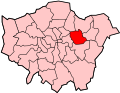
Plashet
Location within Greater London
London borough
Ceremonial county Greater London
Region
Country England
Sovereign state United Kingdom
Post town LONDON
Postcode district E6/E7
Dialling code 020
Police Metropolitan
Fire London
Ambulance London
London Assembly
List of places
UK
England
London
51°32′30″N0°02′45″E / 51.541638°N 0.045716°E / 51.541638; 0.045716 Coordinates: 51°32′30″N0°02′45″E / 51.541638°N 0.045716°E / 51.541638; 0.045716

Plashet is a locality of East Ham in the London Borough of Newham in East London located between West Ham (Upton Park) and Manor Park. It contains Plashet Jewish Cemetery, Plashet Park, and several places of worship. [1]

The area was home to prison reformer Elizabeth Fry, who lived in Plashet House from 1809 to 1829, and also her daughter Katherine who lived in Plashet Cottage. Both of these properties were demolished in the 1880s to make way for the terraced streets that now characterise the area. [1]

Steve Marriott lead singer of the Small Faces was born at East Ham Memorial Hospital located in the Plashet area.

The poet Benjamin Zephaniah has also lived in Plashet. [1]

Related Research Articles

<span class="mw-page-title-main">London Borough of Newham</span> Inner Borough of London, England

The London Borough of Newham is a London borough created in 1965 by the London Government Act 1963. It covers an area previously administered by the Essex county boroughs of West Ham and East Ham, authorities that were both abolished by the same act. The name Newham reflects its creation and combines the compass points of the old borough names. Situated in the East London part of Inner London, Newham has a population of 387,576, which is the third highest of the London boroughs and also makes it the 17th most populous district in England. The local authority is Newham London Borough Council.

<span class="mw-page-title-main">Plaistow, Newham</span> Town in East London, England

Plaistow is a suburban area of East London, England, within the London Borough of Newham. It adjoins Upton Park to the north, East Ham to the east, Beckton to the south, Canning Town to the south-west and West Ham to the west.

<span class="mw-page-title-main">East Ham</span> Suburban district of London, England

East Ham is a district of the London Borough of Newham, England, 8 miles (12.8 km) east of Charing Cross. East Ham is identified in the London Plan as a Major Centre. The population is 76,186.

<span class="mw-page-title-main">Beckton</span> Human settlement in England

Beckton is a suburb in east London, England, located 8 miles (12.9 km) east of Charing Cross and part of the London Borough of Newham. Adjacent to the River Thames, the area consisted of unpopulated marshland known as the East Ham Levels in the parishes of Barking, East Ham, West Ham and Woolwich. The development of major industrial infrastructure in the 19th century to support the growing metropolis of London caused an increase in population with housing built in the area for workers of the Beckton Gas Works and Beckton Sewage Treatment Works. The area has a convoluted local government history and has formed part of Greater London since 1965. Between 1981 and 1995 it was within the London Docklands Development Corporation area, which caused the population to increase as new homes were built and the Docklands Light Railway was constructed.

<span class="mw-page-title-main">Boleyn Ground</span> Former football stadium of West Ham United FC

The Boleyn Ground, often referred to as Upton Park, was a football stadium located in Upton Park, east London. It was the home of West Ham United from 1904 to 2016, and was briefly used by Charlton Athletic in the early 1990s during their years of financial difficulty. The seating capacity of the ground at closure was 35,016.

<span class="mw-page-title-main">West Ham (UK Parliament constituency)</span> Parliamentary constituency in the United Kingdom, 1997 onwards

West Ham is a constituency created in 1997 and represented in the House of Commons of the UK Parliament since 2005 by Lyn Brown, a member of the Labour Party.

<span class="mw-page-title-main">County Borough of West Ham</span> Historical local government district in the extreme south west of Essex

West Ham was a local government district in the extreme south west of Essex from 1886 to 1965, forming part of the built-up area of London, although outside the County of London. It was immediately north of the River Thames and east of the River Lea.

<span class="mw-page-title-main">Parks and open spaces in the London Borough of Newham</span>

The London Borough of Newham, in spite of being one of the more crowded areas of London, has over 20 parks within its boundaries, as well as smaller recreation grounds. The larger parks in the Borough include:

<span class="mw-page-title-main">Green Street, Newham</span> Road in Newham, East London

Green Street is a road in the London Borough of Newham, East London, which forms much of the boundary between East and West Ham.

Newham North West was a parliamentary constituency represented in the House of Commons of the Parliament of the United Kingdom, in the London Borough of Newham. It returned one Member of Parliament, elected by the first past the post system.

West Ham North was a borough constituency in the County Borough of West Ham, in what was then Essex but is now Greater London. It returned one Member of Parliament (MP) to the House of Commons of the Parliament of the United Kingdom, elected by the first-past-the-post voting system.

<span class="mw-page-title-main">East Ham North (UK Parliament constituency)</span> Parliamentary constituency in the United Kingdom, 1918–1974

East Ham North was a parliamentary constituency centred on the East Ham district of London, which was in Essex until 1965. It returned one Member of Parliament (MP) to the House of Commons of the Parliament of the United Kingdom, elected by the first past the post voting system.

Joseph Fry was a tea dealer and an unsuccessful banker. He was the husband of the prison reformer Elizabeth Fry.

Plashet School is a secondary girls school in East Ham, London with approximately 1,350 students. It was previously a grammar school. In 2009 Ofsted highlighted Plashet as one of 12 outstanding schools serving disadvantaged communities.

<span class="mw-page-title-main">Grangewood Independent School</span> Private school in Forest Gate, London, England

Grangewoood Independent School is an independent primary school situated in Chester Road, Forest Gate, in the London Borough of Newham, United Kingdom. It is a member of the Independent Schools Association and was last inspected by the Independent Schools Inspectorate in May 2016. The school provides Christian education for boys and girls aged 2–11 years.

<span class="mw-page-title-main">East Ham Baptist Church</span> Church in London, England

East Ham Baptist Church is situated in Plashet Grove, East Ham, a mainly residential area of the London Borough of Newham, United Kingdom.

Langdon Academy is a mixed all-through school with academy status, located on Sussex Road, East Ham in the London Borough of Newham, England.

Newham Collegiate Sixth Form Centre, also known as The NCS, is a free school sixth form college located in East Ham, London, England. Administered by the City of London Academies Trust, it was opened in 2014. The college is coeducational and is affiliated with University College London who is a strategic partner. It is rated “Outstanding” by Ofsted. It has an ALPS 1 score for value added.

Trebor is a brand of confectionery, originally a British company.

References

  1. 1 2 3 Willey, Russ. Chambers London Gazetter, p 389-90.