Limmo Peninsula

Last updated

Limmo Peninsula
Greater London UK location map 2.svg
Red pog.svg
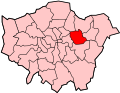
Limmo Peninsula
Location within Greater London
OS grid reference TQ394810
  Charing Cross 5.65 mi (9.1 km)  W
London borough
Ceremonial county Greater London
Region
Country England
Sovereign state United Kingdom
Post town LONDON
Postcode district E16
Dialling code 020
Police Metropolitan
Fire London
Ambulance London
UK Parliament
London Assembly
List of places
UK
England
London
51°30′39″N0°00′30″E / 51.5109032°N 0.0082751°E / 51.5109032; 0.0082751

The Limmo Peninsula is an area of Canning Town in the London Borough of Newham in London's East End. It lies on the east bank of Bow Creek at the mouth of the River Lea near Leamouth. [1] [2]

Contents

Etymology

Created in the 1990s, the nearby Bow Creek Ecology Park was formerly known as the Limmo Peninsula Ecological Park. [3]

History

It was the primary work site for the eastbound tunnel boring machines for Crossrail. [1] [2] Archaeologists working on the Crossrail site in 2012 uncovered remains of the Thames Ironworks and Shipbuilding Company. [4] [5]

In 2018, Sadiq Khan announced that, following the completion of Crossrail works in 2018, the 12-acre site would be developed for housing – with over 1,500 new homes. The site is currently owned by Transport for London, with income from the project reinvested into the transport system. [6] [7]

Geography

It is located to the west of Canning Town. The River Lea forms an 'S' shape bend with the Leamouth Peninsula surrounded by Newham on three sides and connected to Tower Hamlets to the south.

See also

Related Research Articles

<span class="mw-page-title-main">Stratford, London</span> Human settlement in England

Stratford is a town in East London, England, within the London Borough of Newham. Part of the Lower Lea Valley, Stratford is situated 6 miles (9.7 km) east-northeast of Charing Cross, and includes the localities of Maryland and East Village.

<span class="mw-page-title-main">West Ham</span> District in East London, England

West Ham is an area in East London, located 6.1 mi (9.8 km) east of Charing Cross in the west of the modern London Borough of Newham.

<span class="mw-page-title-main">London Borough of Newham</span> Inner Borough of London, England

The London Borough of Newham is a London borough created in 1965 by the London Government Act 1963. It covers an area previously administered by the Essex county boroughs of West Ham and East Ham, authorities that were both abolished by the same act. The name Newham reflects its creation and combines the compass points of the old borough names. Situated in the Inner London part of East London, Newham has a population of 387,576, which is the third highest of the London boroughs and also makes it the 16th most populous district in England. The local authority is Newham London Borough Council.

<span class="mw-page-title-main">Crossrail</span> Railway project in London, England

Crossrail was a railway construction project centred around London. It aimed to provide a high-frequency hybrid commuter rail and rapid transit system crossing the capital from suburbs on the west to east, by connecting two major railway lines terminating in London: the Great Western Main Line and the Great Eastern Main Line. The project was approved in 2007, and construction began in 2009 on the central section and connections to existing lines that became part of the route, which has been named the Elizabeth line in honour of Queen Elizabeth II who opened the line on 17 May 2022 during her Platinum Jubilee. The central section of the line between Paddington and Abbey Wood opened on 24 May 2022, with 12 trains per hour running in each direction through the core section in Central London.

<span class="mw-page-title-main">River Lea</span> River in the south east of England

The River Lea is in the East of England and Greater London. It originates in Bedfordshire, in the Chiltern Hills, and flows southeast through Hertfordshire, along the Essex border and into Greater London, to meet the River Thames at Bow Creek. It is one of the largest rivers in London and the easternmost major tributary of the Thames.

<span class="mw-page-title-main">Canning Town station</span> London Underground and Docklands Light Railway station

Canning Town is an interchange station located in Canning Town, London for London Underground, Docklands Light Railway (DLR) and London Buses services.

<span class="mw-page-title-main">Bromley-by-Bow</span> Human settlement in England

Bromley, commonly known as Bromley-by-Bow, is a district in the London Borough of Tower Hamlets in East London, located on the western banks of the River Lea, in the Lower Lea Valley in East London.

<span class="mw-page-title-main">Blackwall, London</span> Area of the East End of London, England

Blackwall is an area of Poplar, in the London Borough of Tower Hamlets, East London. The neighbourhood includes Leamouth and the Coldharbour conservation area.

<span class="mw-page-title-main">Canning Town</span> District in Newham, East London, England

Canning Town is a district in the London Borough of Newham, East London. The district is located to the north of the Royal Victoria Dock, and has been described as the "Child of the Victoria Docks" as the timing and nature of its urbanisation was largely due to the creation of the dock. The area was part of the ancient parish of West Ham, in the hundred of Becontree, and part of the historic county of Essex. It forms part of the London E16 postcode district.

<span class="mw-page-title-main">A13 road (England)</span> Major road in England

The A13 is a major road in England linking Central London with east London and south Essex. Its route is similar to that of the London, Tilbury and Southend line via Rainham, Grays, Tilbury, Stanford-Le-Hope & Pitsea,and runs the entire length of the northern Thames Gateway area, terminating on the Thames Estuary at Shoeburyness. It is a trunk road between London and the Tilbury junction, a primary route between there and Sadlers Hall Farm near South Benfleet, and a non-primary route between there and Shoeburyness.

<span class="mw-page-title-main">Leamouth</span> Human settlement in England

Leamouth is a locality in the Blackwall area of the London Borough of Tower Hamlets. The area takes its name from the former Leamouth Wharf and lies on the west side of the confluence of the Bow Creek stretch of the Lea, at its confluence with the River Thames.

<span class="mw-page-title-main">Bow Creek (London)</span> River in England

Bow Creek is a 2.25-mile (3.6 km) long tidal estuary of the English River Lea and is part of the Bow Back Rivers. Below Bow Locks the creek forms the boundary between the London Boroughs of Newham and Tower Hamlets, in East London.

<span class="mw-page-title-main">Lower Lea Valley</span> Southern end of the Lea Valley in Greater London

The Lower Lea Valley is the southern end of the Lea Valley which surrounds the River Lea in eastern Greater London. It is part of the Thames Gateway redevelopment area and was the location of the 2012 Summer Olympics.

<span class="mw-page-title-main">Thames Ironworks and Shipbuilding Company</span> Former shipbuilders in London

The Thames Ironworks and Shipbuilding Company, Limited was a shipyard and iron works straddling the mouth of Bow Creek at its confluence with the River Thames, at Leamouth Wharf on the west side and at Canning Town on the east side. Its main activity was shipbuilding, but it also diversified into civil engineering, marine engines, cranes, electrical engineering and motor cars.

<span class="mw-page-title-main">East London</span> Northeastern part of London, United Kingdom

East London is the northeastern part of London, England, east of the ancient City of London and north of the River Thames as it begins to widen. East London developed as London's docklands and the primary industrial centre. The expansion of railways in the 19th century encouraged the eastward expansion of the East End of London and a proliferation of new suburbs. The industrial lands of East London are today an area of regeneration, which are well advanced in places such as Canary Wharf and ongoing elsewhere.

<span class="mw-page-title-main">Parks and open spaces in the London Borough of Newham</span>

The London Borough of Newham, in spite of being one of the more crowded areas of London, has over 20 parks within its boundaries, as well as smaller recreation grounds. The larger parks in the Borough include:

<span class="mw-page-title-main">Bow Creek Ecology Park</span> Park in Newham, East London

Bow Creek Ecology Park is a small open space along Bow Creek tidal estuary of the River Lea in Canning Town in Newham, in east London. It is operated by the regional Lee Valley Park system.

<span class="mw-page-title-main">Cycleway 3</span> Long cycle path in London, England

Cycleway 3 (C3) is a cycle route in London, England. It is part of the Cycleway network coordinated by TfL. It runs from Barking in the east to Lancaster Gate in central London. It is a popular route with both commuter and leisure cyclists, passing a number of major destinations in London along its route. For almost the entire route, cyclists are separated from other traffic in segregated cycle lanes, and cycling infrastructure has been provided at major interchanges. The cycleway, originally called Cycle Superhighway 3, was renamed to Cycleway 3 in January 2023.

<span class="mw-page-title-main">Stepney Green cavern</span> Underground junction where Crossrail splits into two branches

Stepney Green cavern is an underground junction which contains the junction where Crossrail divides into two branches: one to Shenfield and one to Abbey Wood. It is located below Stepney Green Park.

<span class="mw-page-title-main">Leamouth Lifting Footbridge</span> Pedestrian bridge over Bow Creek

The Leamouth Lifting Footbridge or Leamouth North Bridge is a steel lifting arch bridge for pedestrians over Bow Creek, the estuary of the River Lea. It connects Leamouth in the Blackwall area of the London Borough of Tower Hamlets to Canning Town in the London Borough of Newham.

References

  1. 1 2 "Limmo Peninsula". Crossrail. Archived from the original on 17 October 2015. Retrieved 6 February 2018.
  2. 1 2 "'Places and Spaces: Property Development on the Crossrail Route" (PDF). Crossrail Ltd. Retrieved 26 December 2017. The Limmo site is located in the Canning Town area. It has a rich naval heritage with the historic Thames Ironworks operating on this site up until 100 years ago. This is Crossrail's primary work site for the eastbound tunnel boring machines. The Limmo site adjoins the Canning Town underground and Docklands Light Railway station ...
  3. "Leamouth, Tower Hamlets". Hidden London. Retrieved 7 February 2018. ... the Bow Creek ecology park (previously the Limmo Peninsula ecological park) is a wildlife haven...
  4. "Crossrail dig uncovers historic Limmo Peninsula shipyard remains". BBC. 23 March 2012. Retrieved 26 December 2017.
  5. "The Thames Iron Works 1837–1912: a major shipbuilder on the Thames investigated". Museum of London Archaeology (MOLA). Retrieved 8 August 2018. Several important components of the yard were investigated at a Crossrail site on the Limmo peninsula...
  6. "Mayor plans neighbourhood on tunnel site". BBC News. 6 February 2018. Retrieved 6 February 2018.
  7. "Mayor announces largest TfL site so far for major housing boost". London City Hall. Retrieved 6 February 2018.