
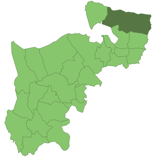
The London Borough of Bexley is a London borough in south-east London, forming part of Outer London. It has a population of 248,287. The main settlements are Sidcup, Erith, Bexleyheath, Crayford, Welling and Old Bexley. The London Borough of Bexley is within the Thames Gateway, an area designated as a national priority for urban regeneration. The local authority is Bexley London Borough Council.
Upton was a hamlet in the southwest of today's Bexleyheath in the London Borough of Bexley, in the historic county of Kent.

The Metropolitan Borough of Hackney was a metropolitan borough of the County of London from 1900 to 1965. Its area became part of the London Borough of Hackney.
South Bedfordshire was a local government district in Bedfordshire, in the East of England, from 1974 to 2009. Its main towns were Dunstable, Houghton Regis and Leighton Buzzard.
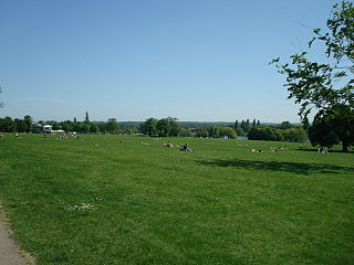
Danson Park is a public park in the London Borough of Bexley, South East London, located between Welling and Bexleyheath. At 75 hectares, it is the second largest public park in the borough, and the most used by the community. Opened in 1925, it is often considered the finest green open space in the borough, and is Grade II listed on the Register of Historic Parks and Gardens. The park also gives its name to the electoral ward that covers the park and the surrounding area. The park is located at grid reference TQ472752. The southern boundary of both the park and the ward is delineated by Rochester Way, the A2 road.

Bromley was a local government district in northwest Kent from 1867 to 1965 around the town of Bromley. The area was suburban to London, and formed part of the Metropolitan Police District and from 1933 was included in the area of the London Passenger Transport Board.
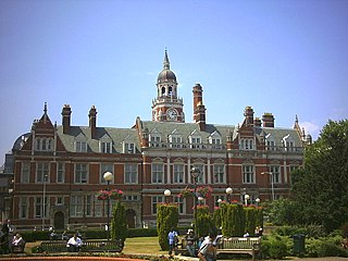
The County Borough of Croydon was a local government district in and around the town of Croydon in north east Surrey, England from 1889 to 1965. Since 1965 the district has been part of the London Borough of Croydon within Greater London.

Finchley, which is now in north London, was a local government district in Middlesex, England, from 1878 to 1965. Finchley Local Board first met in 1878. It became Finchley Urban District Council in 1895 and the Municipal Borough of Finchley in 1933. In 1965 Middlesex was abolished and Finchley became part of the London Borough of Barnet.
Erith was a local government district in north west Kent from 1876 to 1965 around the town of Erith. It also included the generally suburban areas of Northumberland Heath, Belvedere, and parts of Barnehurst, Bexleyheath, Crayford and the SE2 London Postal District of Abbey Wood.

Beckenham was a local government district in north west Kent from 1878 to 1965 around the town of Beckenham. The area was suburban to London, formed part of the Metropolitan Police District and from 1933 was included in the area of the London Passenger Transport Board.

Acton was a local government district in Middlesex, England from 1865 to 1965.
Enfield was a local government district in Middlesex, England from 1850 to 1965.

Southgate was a local government district of Middlesex from 1881 to 1965. It was part of the London postal district and Metropolitan Police District.

Twickenham was a local government district in Middlesex, England from 1868 to 1965.
Beddington and Wallington was, from 1915 to 1965, a local government district in north east Surrey, England. It formed part of the London suburbs, lying within the Metropolitan Police District and the London Passenger Transport Area. In 1965 it was abolished on the creation of Greater London.

Sale was, from 1867 to 1974, a district in Cheshire, England. The district had in turn the status of local government district, urban district and municipal borough. Its area now forms part of the Metropolitan Borough of Trafford, Greater Manchester.

Stretford was, from 1868 to 1974, a local government district coterminate with the town of Stretford, Lancashire, England.

The Municipal Borough of Heywood was, from 1881 to 1974, a local government district in the administrative county of Lancashire, England, with borough status and coterminate with the town of Heywood.

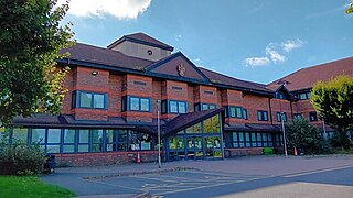
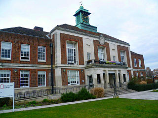
Bexley London Borough Council, also known as Bexley Council is the local authority for the London Borough of Bexley in Greater London, England. It is a London borough council, one of 32 in London. The council has been under Conservative majority control since 2006. It is based at Bexley Civic Offices in the Bexleyheath area of the borough.
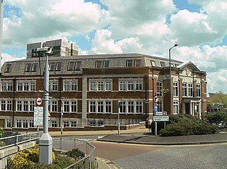
Erith Town hall is a municipal building in Walnut Tree Road, Erith, south east London. It is a locally listed building.

