The Royal Borough of Kingston upon Thames is a borough in southwest London. The main town is Kingston upon Thames and it includes Chessington, Malden Rushett, New Malden, Surbiton and Tolworth. It is the oldest of the four royal boroughs in England. The others are Windsor and Maidenhead, the site of Windsor Castle, and the London boroughs of Greenwich, and Kensington and Chelsea. The local authority is Kingston upon Thames London Borough Council.

Morden is a district and town in South London, England, now within the London Borough of Merton, in the ceremonial county of Greater London. It adjoins Merton Park and Wimbledon to the north, Mitcham to the east, Sutton to the south and Worcester Park to the west, and is around 8 miles (13 km) south-southwest of Charing Cross. Prior to the creation of Greater London in 1965, for local government purposes, Morden was in the administrative and historic county of Surrey.
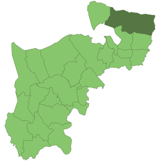
The London Borough of Merton is a London borough in London, England. The borough was formed under the London Government Act 1963 in 1965 by the merger of the Municipal Borough of Mitcham, the Municipal Borough of Wimbledon and the Merton and Morden Urban District, all formerly within Surrey.

Battersea was a civil parish and metropolitan borough in the County of London, England. In 1965, the borough was abolished and its area combined with parts of the Metropolitan Borough of Wandsworth to form the London Borough of Wandsworth. The borough was administered from Battersea Town Hall on Lavender Hill. That building is now Battersea Arts Centre.

Bromley was a local government district in northwest Kent from 1867 to 1965 around the town of Bromley. The area was suburban to London, and formed part of the Metropolitan Police District and from 1933 was included in the area of the London Passenger Transport Board.
The County Borough of Croydon was a local government district in and around the town of Croydon in north east Surrey, England from 1889 to 1965. Since 1965 the district has been part of the London Borough of Croydon within Greater London.

Coulsdon and Purley Urban District was a local government district in northeast Surrey from 1915 to 1965. The local authority was Coulsdon and Purley Urban District Council. The former area of the district is now mostly part of the London Borough of Croydon in Greater London, with parts in the Tandridge District and the Borough of Reigate and Banstead in Surrey.
Bexley was a local government district in north west Kent from 1880 to 1965 covering the parish of Bexley, which included both Bexley village and Bexleyheath.
Enfield was a local government district in Middlesex, England from 1850 to 1965.

Twickenham was a local government district in Middlesex, England from 1868 to 1965.

Surbiton was a local government district in northeast Surrey, United Kingdom, from 1855 to 1965.

Mitcham was a local government district in north east Surrey from 1915 to 1965 around the town of Mitcham.

The London Government Act 1963 is an act of the Parliament of the United Kingdom, which created Greater London and a new local government structure within it. The Act significantly reduced the number of local government districts in the area, resulting in local authorities responsible for larger areas and populations. The upper tier of local government was reformed to cover the whole of the Greater London area and with a more strategic role; and the split of functions between upper and lower tiers was recast. The Act classified the boroughs into inner and outer London groups. The City of London and its corporation were essentially unreformed by the legislation. Subsequent amendments to the Act have significantly amended the upper tier arrangements, with the Greater London Council abolished in 1986, and the Greater London Authority introduced in 2000. As of 2024, the London boroughs are more or less identical to those created in 1965, although with some enhanced powers over services such as waste management and education.
Merton Urban District (1907–1913) and Merton and Morden Urban District (1913–1965) was an urban district in Surrey, England. It was formed in 1907 from the parish of Merton and was expanded in 1913 to take in Morden. The district was abolished in 1965 and its former area now forms part of the London Borough of Merton in Greater London.
Croydon was a rural district in north east Surrey, England, United Kingdom, from 1894 to 1915. It was created by the Local Government Act 1894 and replaced the Croydon Rural Sanitary District. The district surrounded the County Borough of Croydon to the south, east and west.

Sutton and Cheam was a local government district in northeast Surrey, England from 1882 to 1965.
Malden and Coombe was a local government district in Surrey, England from 1866 to 1965.
Beddington and Wallington was, from 1915 to 1965, a local government district in north east Surrey, England. It formed part of the London suburbs, lying within the Metropolitan Police District and the London Passenger Transport Area. In 1965 it was abolished on the creation of Greater London.

The Municipal Borough of Richmond or Richmond Municipal Borough was a municipal borough in Surrey, England from 1890 to 1965.

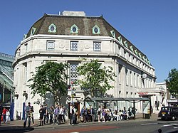
Wimbledon Town Hall is a municipal building in The Broadway, Wimbledon, London. It is a Grade II listed building.