Coulsdon and Purley Urban District

Last updated

Coulsdon and Purley
Urban district
Purley Council Office.jpg
Area
  19218,572 acres (34.69 km2)
  196111,143 acres (45.09 km2)
Area transferred
  192959 acres from Godstone Rural District
  19332,551 acres (net) from adjacent districts
  193639 acres (net) to County Borough of Croydon
Population
  192121,491
  196174,926
Density
  19212.5/acre
  19616.7/acre
History
  Created1915
  Abolished1965
  Succeeded by London Borough of Croydon
Status Urban district
GovernmentCoulsdon and Purley Urban District Council
   HQ Council Offices, Brighton Road, Purley
   Motto Animo et Fide (By Courage and Faith)
Couls purl.jpg
Coat of arms

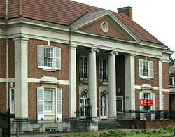
Coulsdon and Purley Urban District was a local government district in northeast Surrey from 1915 to 1965. The local authority was Coulsdon and Purley Urban District Council. The former area of the district is now mostly part of the London Borough of Croydon in Greater London, with parts in the Tandridge District and the Borough of Reigate and Banstead in Surrey.

Contents

Creation

The population of Croydon Rural District doubled from 1901 to 1911 as suburban house building took place, with 11,389 in Coulsdon and 2,853 in Sanderstead in 1911. [1] [2] In both cases, the population was much higher than would be typical for rural parishes. Surrey County Council made an order in 1914 to abolish the rural district and this was completed in 1915. The new Coulsdon and Purley Urban District consisted of the parish of Coulsdon, including the settlements of Coulsdon, Kenley and Purley, and the parish of Sanderstead. Coulsdon and Purley Urban District Council replaced Coulsdon Parish Council, Sanderstead Parish Council and Croydon Rural District Council. By 1921 the population was 18,140 in Coulsdon and 3,351 in Sanderstead, and the total population had risen to 21,491. [3]

Changes

On 1 October 1929, 59 acres were gained from Godstone Rural District, transferred from the parish of Warlingham to Sanderstead. The Local Government Act 1929 required county councils to review the districts within their areas. On 1 April 1933 as part of a county review order under the act, the parish of Farleigh was transferred from Godstone Rural District. The boundaries with Beddington and Wallington Urban District, Carshalton Urban District and Caterham and Warlingham Urban District were subject to minor adjustments. 1,421 acres were gained from the abolished Reigate Rural District, consisting of parts of the parishes of Chaldon, Chipstead and Merstham, included the village of Hooley. The boundary with the County Borough of Croydon was adjusted on 1 April 1933 and again on 1 April 1936. [3]

Governance

In 1915 the electoral wards were Coulsdon, Kenley, Purley, Sanderstead and Woodcote. [4]

The electoral wards in 1937 were Coulsdon East, Coulsdon West, Kenley, Purley, Sanderstead, Selsdon and Farleigh, and Woodcote. [5]

The rates charged for the district were one of the lowest in Outer London and below the average for the part of Surrey within the Metropolitan Police District. [6]

Coat of arms

The coat of arms were granted on 14 May 1952. [7] Some charges from these arms were used, together with some charges from the coat of arms of County Borough of Croydon, to form the new coat of arms of the London Borough of Croydon in 1965.

Abolition

The urban district was within the Metropolitan Police District and part of the review area of the Royal Commission on Local Government in Greater London. The commission proposed that it should form part of Greater London, to be combined with Caterham and Warlingham as a new borough. [8] The government broadly accepted the proposal, adding the County Borough of Croydon to the new borough. Caterham and Warlingham Urban District Council requested that their area be excluded from Greater London and this was accepted by the government. Coulsdon and Purley Urban District Council also requested to be excluded, but were turned down. [9] Charles Doughty, MP for Surrey East proposed an amendment to the London Government Bill to exclude Coulsdon and Purley but was defeated. [10] On 1 April 1965 the urban district was abolished and its former area became part of the London Borough of Croydon in Greater London.

Farleigh and Hooley transfers

It was anticipated that the practice of combining whole existing units of local government might provide an unsatisfactory boundary in some places. [11] The London Government Act 1963 Section 6 (4) provided a mechanism for communities on the edge of Greater London to petition for transfer to a neighbouring county. The legislation required the petition to be submitted between 1965 and 1970, to be signed by more than 300 local electors and for the area to be transferred to have no more than 10% of the borough's local electors. [12] Following this procedure, in 1969 Farleigh was transferred back to Surrey to form part of the Chelsham and Farleigh parish in Godstone Rural District and Hooley became part of Banstead Urban District. [13]

Notable former employee

In Peter Cushing's autobiography, (pp.35-37), he wrote that his father secured for him a surveyor's assistant post in the Drawing Department's Surveyor's Office, during the summer of 1933, and that he hated the job, but remained for three years without promotion or advancement due to his lack of ambition in the profession. The only enjoyment he received was drawing perspectives of proposed buildings, which were almost always rejected because they were too imaginative, and expensive and lacked strong foundations, which Cushing disregarded as a "mere detail."

Related Research Articles

<span class="mw-page-title-main">Coulsdon</span> Human settlement in England

Coulsdon, is a town in south London, England, within the London Borough of Croydon. Coulsdon was an ancient parish in the county of Surrey that included the settlements of Purley and Kenley. It was merged with Sanderstead in 1915 to form the Coulsdon and Purley Urban District and has formed part of Greater London since 1965.

<span class="mw-page-title-main">Purley, London</span> Human settlement in England

Purley is an area of the London Borough of Croydon in London, England, 11.7 miles (18.8 km) south of Charing Cross, with a history going back at least 800 years. It was originally granted as an estate from holdings at Sanderstead and until as a district of Surrey and then, with neighbouring Coulsdon, as an urban district that became an electoral ward of the London Borough of Croydon, becoming part of the ceremonial county of London, in 1965. In 2018 the Purley ward was divided into two: Purley and Woodcote, and Purley Oaks and Riddlesdown.

<span class="mw-page-title-main">Tandridge District</span> Non-metropolitan district in England

Tandridge is a local government district in east Surrey, England. Its council is based in Oxted, although the largest settlement is Caterham; other notable settlements include Warlingham, Godstone and Lingfield. In mid-2019, the district had an estimated population of 88,129.

<span class="mw-page-title-main">Warlingham</span> Village in Surrey, England

Warlingham is a village in the Tandridge district of Surrey, England, 14.2 miles (22.9 km) south of the centre of London and 22.3 miles (35.9 km) east of the county town, Guildford. Warlingham is the centre of a civil parish that includes Hamsey Green, a contiguous, smaller settlement to the north. Caterham is the nearest town, 2.0 miles (3.2 km) to the southwest.

<span class="mw-page-title-main">Kenley</span> Human settlement in England

Kenley is a residential suburb within the London Borough of Croydon. It is located 13 miles (21 km) south of Charing Cross and within the southern boundary of London, England. Surrounded by the Metropolitan Green Belt on three sides, it includes the large open spaces of Kenley Common and Kenley Aerodrome. Kenley was part of the ancient parish of Coulsdon in the county of Surrey and was connected to central London by rail in 1856. As the population of the area was growing, it became part of Coulsdon and Purley Urban District in 1915 and has formed part of Greater London since 1965. At the 2011 Census, Kenley had a population of 14,966.

<span class="mw-page-title-main">Sanderstead</span> Human settlement in England

Sanderstead is a village and medieval-founded church parish at the southern end of Croydon in south London, England, within the London Borough of Croydon, and formerly in the historic county of Surrey, until 1965. It takes in Purley Downs and Sanderstead Plantation, an area of woodland that includes the second-highest point in London. Sanderstead sits above a dry valley at the edge of the built-up area of Greater London. Cementing its secular identity from the late 19th century until abolition in 1965 it had a civil parish council. The community had a smaller farming-centred economy until the mid 19th century.

<span class="mw-page-title-main">Hamsey Green</span> Human settlement in England

Hamsey Green is a place on the plateau of the English North Downs between the villages of Sanderstead to the north and Warlingham to the south. It is split almost across the centre into north and south so is in part in the Tandridge district of Surrey and in part in the London Borough of Croydon.

<span class="mw-page-title-main">East Surrey (UK Parliament constituency)</span> UK Parliament constituency since 1918

East Surrey is a constituency represented in the House of Commons of the UK Parliament since 2019 by Claire Coutinho, a Conservative. The seat covers an affluent area in the English county of Surrey.

<span class="mw-page-title-main">Caterham</span> Town in Surrey, England

Caterham is a town in the Tandridge District of Surrey, England. The town is administratively divided into two: Caterham on the Hill, and Caterham Valley, which includes the main town centre in the middle of a dry valley but rises to equal heights to the south. The town lies close to the A22, 21 miles from Guildford and 6 miles south of Croydon, in an upper valley cleft into the dip slope of the North Downs. Caterham on the Hill is above the valley to the west.

<span class="mw-page-title-main">Hooley</span> Human settlement in England

Hooley is a village in the borough of Reigate and Banstead in Surrey, England. Within its small grid of streets is the 13th-century church of Chipstead which has been, since time immemorial, its ecclesiastical parish. Hooley is connected via paths and the A23 road to the larger community of Coulsdon, to the north, in the London Borough of Croydon.

<span class="mw-page-title-main">Metropolitan Police District</span> Police area in Police area

The Metropolitan Police District (MPD) is the police area which is policed by the Metropolitan Police Service in London. It currently consists of the Greater London region, excluding the City of London. The Metropolitan Police District was created by the Metropolitan Police Act 1829 as an ad hoc area of administration because the built-up area of London spread at the time into many parishes and counties without an established boundary. The district expanded as the built up area grew and stretched some distance into rural land. When county police forces were set up in England, those of Essex, Hertfordshire, Kent and Surrey did not cover the parts of the counties within the MPD, while Middlesex did not have a county force. Similarly, boroughs in the MPD that elsewhere would have been entitled to their own police force did not have them.

<span class="mw-page-title-main">Whyteleafe</span> Human settlement in England

Whyteleafe is a village in the district of Tandridge, Surrey, England, with a few streets falling inside the London Borough of Croydon. The village, in a dry valley of the North Downs, has three railway stations. Neighbouring villages and towns include Woldingham, Caterham, Coulsdon, Warlingham, and Kenley. To the west are Kenley Aerodrome, Kenley Common, Coxes Wood, and Blize Wood. To the east are Riddlesdown, the Dobbin and Marden Park.

<span class="mw-page-title-main">London Government Act 1963</span> United Kingdom legislation

The London Government Act 1963 is an Act of the Parliament of the United Kingdom, which created Greater London and a new local government structure within it. The Act significantly reduced the number of local government districts in the area, resulting in local authorities responsible for larger areas and populations. The upper tier of local government was reformed to cover the whole of the Greater London area and with a more strategic role; and the split of functions between upper and lower tiers was recast. The Act classified the boroughs into inner and outer London groups. The City of London and its corporation were essentially unreformed by the legislation. Subsequent amendments to the Act have significantly amended the upper tier arrangements, with the Greater London Council abolished in 1986, and the Greater London Authority introduced in 2000. As of 2016, the London boroughs are more or less identical to those created in 1965, although with some enhanced powers over services such as waste management and education.

<span class="mw-page-title-main">London Traffic Area</span>

The London Traffic Area was established by the London Traffic Act 1924 to regulate the increasing amount of motor traffic in the London area. The LTA was abolished in 1965 on the establishment of the Greater London Council.

<span class="mw-page-title-main">Chelsham and Farleigh</span> Human settlement in England

Chelsham and Farleigh is a civil parish in the Tandridge District of Surrey, England. The parish is high on the North Downs and centred 14 miles (23 km) south-southeast of central London and it adjoins the Greater London boundary; it is a predominantly rural/wooded parish aside from minority of land used for homes and gardens. Other than the villages of Chelsham and Farleigh, the parish also includes the hamlet of Fickleshole. The parish was created on 1 April 1969 as an amalgamation of its two named small villages.

The Royal Commission on Local Government in Greater London, also known as the Herbert Commission, was established in 1957 and published its report in 1960. The report made recommendations for the overhaul of the administration of the capital. They were modified and implemented by the London Government Act 1963.

Godstone Rural District was a rural district in Surrey, England from 1894 to 1974, covering an area in the south-east of the county.

<span class="mw-page-title-main">Coat of arms of the London Borough of Croydon</span>

The coat of arms of the London Borough of Croydon is the official heraldic arms of the London Borough of Croydon, granted on 10 December 1965.

References

  1. Great Britain Historical GIS / University of Portsmouth, Coulsdon AP/CP  population . Retrieved 21 February 2014.
  2. Great Britain Historical GIS / University of Portsmouth, Sanderstead CP/AP  population . Retrieved 21 February 2014.
  3. 1 2 Great Britain Historical GIS / University of Portsmouth, Coulsdon and Purley UD   population . Retrieved 21 February 2014.
  4. "Report of the Medical Officer of Health for Coulsdon: Coulsdon and Purley 1915". Wellcome Library. Retrieved 1 May 2020.
  5. "Report of the Medical Officer of Health for Coulsdon: Coulsdon and Purley 1937". Wellcome Library. Retrieved 1 May 2020.
  6. The Government and Misgovernment of London, William A. Robson, (1939)
  7. Coulsdon and Purley Urban District (Civic Heraldry). Retrieved 15 January 2008
  8. Royal Commission on Local Government in Greater London: 1957–1960: Report, 1960, HMSO
  9. HC Deb 18 May 1962 vol 659 cc156-7W
  10. HC Deb 20 February 1963 vol 672 cc445-599
  11. Sharpe, LJ (1961). The Report of The Royal Commission on Local Government in Greater London.
  12. London Government Act 1963 Section 6 (4)
  13. Greater London, Kent and Surrey Order 1968

Coordinates: 51°19′N0°07′W / 51.32°N 0.12°W / 51.32; -0.12