County Borough of West Ham

Last updated

West Ham
HE1080991 Old Town Hall Stratford (1).jpg
Stratford Town Hall
West ham essex 1961.png
West Ham within Essex in 1961
Area
  18614,667 acres (18.9 km2) [1]
  19114,683 acres (19.0 km2) [2]
  1931/19614,689 acres (19.0 km2) [2]
Population
  186138,331 [3]
  1911289,030 [2]
  1931294,278 [2]
  1961157,367 [2]
Density
  18618/acre
  191162/acre
  193163/acre
  196134/acre
History
  OriginWest Ham ancient parish
  Created1856
  Abolished1965
  Succeeded by London Borough of Newham
Status Civil parish (until 1965)
Local board of health district (1856–1886)
Municipal borough (1886–1889)
County borough (1889–1965)
GovernmentWest Ham Local Board (1856–1886)
West Ham Borough Council (1886–1965)
   HQ Town Hall, Broadway, Stratford (1869–1965)
   Motto Deo Confidimus (We trust in God)
West Ham arms.png
Arms of the county borough corporation

West Ham was a local government district in the extreme south west of Essex from 1886 to 1965, forming part of the built-up area of London; it was also referred to as one of the original areas of the East End of London although administratively it was just outside the County of London. It was immediately north of the River Thames and east of the River Lea.

Contents

Area and boundaries

The borough included Plaistow, West Ham, Stratford, Canning Town and Silvertown – all of the current-day London Borough of Newham west of Green Street. At the time of the 1901 census it was the ninth most populous town or district in England with a population of 267,308. [4] The borough formed part of London's built-up area, was part of the London postal district, the Metropolitan Police District and sometimes part of the ancient East End of London.

From 1934 to 1965 it was surrounded by the County Borough of East Ham to the east, the municipal boroughs of Wanstead and Woodford and Leyton to the north, and the metropolitan boroughs of Poplar to the west and Greenwich to the south.

Predecessors

West Ham underwent rapid growth from 1844 following the Metropolitan Building Act. The Act restricted dangerous and noxious industries from operating in the metropolitan area, the eastern boundary of which was the River Lea. Consequently, many of these activities were relocated to the other side of the river and to West Ham, then a parish in Essex centred on All Saints Church, West Ham. As a result, West Ham became one of Victorian Britain's major manufacturing centres for pharmaceuticals, chemicals, and processed foods. This rapid growth earned it the name "London over the border". [5] The growth of the town was summarised by The Times in 1886:

"Factory after factory was erected on the marshy wastes of Stratford and Plaistow, and it only required the construction at Canning Town of the Victoria and Albert Docks to make the once desolate parish of West Ham a manufacturing and commercial centre of the first importance and to bring upon it a teeming and an industrious population." [5]

Many workers lived in slum conditions close to where they worked, leading to periodic outbreaks of contagious diseases and severe poverty. It had become apparent that local government in the parish of West Ham was not adequate to meet the needs of the area which was divided between the parish vestry, highway board and the Havering and Dagenham Commissioners of Sewers. Problems centred on provision of adequate paving, water supply, fire fighting and control of development. In 1853 a group of ratepayers initiated moves to improve local administration. This led to a public enquiry by Charles Dickens' brother Alfred, a medical officer, who published a report in 1855 severely critical of conditions in the slum areas. [5]

Accordingly, the Public Health Act 1848 was applied to the parish, and a local board of health was formed in 1856. The board had 15 members: 12 elected and 3 nominated by the Commissioners of Sewers. [6]

West Ham received representation as a parliamentary borough as part of the Redistribution of Seats Act 1885, with one MP each for the West Ham North and West Ham South divisions.

Incorporation

A map showing the wards of West Ham Civil Parish as they appeared in 1867. West Ham CP Ward Map 1867.svg
A map showing the wards of West Ham Civil Parish as they appeared in 1867.

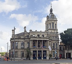
In November 1878 the inhabitants of the parish decided to petition the privy council for a charter, incorporating the town as a municipal borough. [7] This was in reaction to proposals to enlarge the area governed by the Metropolitan Board of Works to include adjoining districts with a population of 50,000 or more: the primary aim of incorporation was to prevent the inclusion of West Ham in an enlarged London municipality. [5] This initial application was unsuccessful. However, encouraged by the 1883 incorporation of Croydon, a second petition was submitted in May 1885. [8] Following an inquiry in October 1885, a scheme for the creation of the borough and dissolution of the board of health was made in June and the charter was granted in July 1886. [9] [10] A corporation consisting of a mayor, 12 aldermen and 36 councillors replaced the board, with the first elections held on 1 November. [5] The first mayor was John Meeson, head of a local lime burning and cement making firm, and a former chairman of West Ham Local Board. [11] The first female mayor was Daisy Parsons in 1937. [12]

County borough

The Local Government Act 1888 created elected county councils to administer services throughout England and Wales. Where a municipal borough had a population of more than 50,000 at the 1881 Census it was created a county borough, with the powers and duties of both a borough and county council.

As West Ham had an 1881 population of 128,953 it duly became a county borough on 1 April 1889. The borough, while independent of Essex County Council for local government, remained part of the county for purposes such as the administration of justice and lieutenancy. [13]

Utilities

The borough acquired the horse-drawn tram services in its area in 1898, electrified them in 1904, and extended the network. There was also through running of the corporation trams and those of the London County Council system. West Ham Corporation Tramways operated 134 tram cars on 16.27 miles (26.2 km) of tracks when they became the responsibility of the London Passenger Transport Board in 1933. [14] The borough ran its own fire brigade which was absorbed into the London Fire Brigade in 1965. The corporation's electricity generation and supply undertaking was nationalised in 1948, when it was transferred to the London Electricity Board.

Following the passing of the Local Government Act 1929 the Council took over responsibility for certain health services, such as the large Whipps Cross Hospital in neighbouring Leyton (now the Whipps Cross University Hospital) which they developed until it passed into the new National Health Service in 1946. [15]

Borough council

* Top row: Councillors W Crow, T Knight, T Anderson, A Govier, J H Pavitt, W Lewis, C Mansfield, H Wagstaff, J Cook * Second row:Councillors H Young, J Maw(?) E Fulcher, R Fielder, E Jex, S Vinicombe, E E Barnett, J H Bethell, F Hammersley * Third row: Councillors G H Courtney(?) W Hands, G W Kidd, R Wortlet, H Callaghan, R White, WH Medcalf, M Adamson, F Smith * Seated: Aldermen H Pillips, J Scully, W Deason(?) G Hay, J Meeson (Mayor) G Rivett, H Worland, C Stoner, H Barry(?), R L Curtis First West Ham Borough Council, 1886-7.jpg
* Top row: Councillors W Crow, T Knight, T Anderson, A Govier, J H Pavitt, W Lewis, C Mansfield, H Wagstaff, J Cook * Second row:Councillors H Young, J Maw(?) E Fulcher, R Fielder, E Jex, S Vinicombe, E E Barnett, J H Bethell, F Hammersley * Third row: Councillors G H Courtney(?) W Hands, G W Kidd, R Wortlet, H Callaghan, R White, WH Medcalf, M Adamson, F Smith * Seated: Aldermen H Pillips, J Scully, W Deason(?) G Hay, J Meeson (Mayor) G Rivett, H Worland, C Stoner, H Barry(?), R L Curtis

Wards

Under the original charter the borough was divided into four wards: Canning Town, Forest Gate, Plaistow and Stratford. Each ward returned nine councillors, with three councillors elected in each ward for a three-year term on 1 November each year. [16] In addition to the 36 directly-elected councillors there were also 12 aldermen, who were elected by the council itself, giving the town council a total membership of 48. [6]

In 1899 the wards were redrawn: the borough was divided into 12 wards, each returning 3 councillors. The number of councillors remained at 36. [6] The 1899 wards were as follows: No.1 or New Town, No.2 or Forest Gate, No.3 or High Street, No.4 or Broadway, No.5 or Park, No.6 or Upton, No.7 or West Ham, No.8 or Plaistow, No.9 or Hudsons, No.10 or Canning Town, No.11 or Tidal Basin and No.12 or Custom House & Silvertown. [17]

In 1922 the number of wards was increased to sixteen, each represented by three councillors and one alderman. The size of the council was thus increased to sixty-four members. The names of the wards, which continued in use until 1965, were: Beckton Road, Bemersyde, Broadway, Canning Town & Grange, Custom House & Silvertown, Forest Gate, High Street, Hudsons, Newtown, Ordnance, Park, Plaistow, Plashet Road, Tidal Basin, Upton and West Ham. [6]

Politics

The borough was notable for having the first Labour controlled council in England. Following the London Dock Strike of 1889, a number of Socialists and Progressives were elected to the council, formally becoming the Labour Group in 1897. The Group gained a majority on the town council in 1898. In reaction to this, a Municipal Alliance was formed by the West Ham Ratepayers Association and Chamber of Commerce to oppose the Labour Party. In 1900 they gained parity with Labour on the council and in the following year they took control. [18] The Municipal Alliance retained power until 1910 when a Labour-Progressive coalition replaced it. Two years later Municipal Alliance councillors regained a narrow majority, which they held at the 1913 election. [6] Elections were suspended for the duration of the First World War, and at the 1919 elections Labour won an overall majority which it retained for the rest of the borough's existence. The Labour majority was to increase over the years, with a small group of Ratepayers Association councillors supported by the Conservative Party forming the opposition group. From 1947 the Conservatives contested elections in their own name, but after 1954 had no councillors elected. From 1954 to 1960 Labour held all the seats on the council, after which a number of Liberal Party councillors formed a minority group. [6]

Coat of arms

The coat of arms displayed on a war memorial at East London Cemetery West Ham coat of arms, East London cemetery.jpg
The coat of arms displayed on a war memorial at East London Cemetery

The coat of arms was granted by the College of Arms on 14 January 1887. The chevrons on the lower portion represent Stratford, taken from the device of Stratford Langthorne Abbey. At the top right, there are crossed hammers, representing the Thames Ironworks and Shipbuilding Company – the borough's main employer. The ship is representative of the Royal Docks, and the area's long association with the sea. The Latin motto "Deo Confidimus" at the base translates as "In God We Trust." [19]

Abolition and inclusion in Greater London

The omission of West Ham from the London-administered metropolitan area, which took in nearby places such as Greenwich and Woolwich, was first commented on in 1855 and West Ham Council later considered the case for inclusion in the County of London in 1895 and 1907. [20] The reluctance to proceed with amalgamation was largely explained by lack of perceived support, fear of financial disadvantage caused by increased rates, the detrimental effect of London planning laws on industry, and the desire to retain the independent civic institutions and privileges attached to county borough status. [20]

The Royal Commission on Local Government in Greater London reviewed the local government arrangements of the Greater London Conurbation and in 1965 the county borough, and the County Borough of East Ham, were abolished and their former area was amalgamated with small parts of Barking and Woolwich to form the London Borough of Newham in Greater London.

Further reading

Related Research Articles

<span class="mw-page-title-main">Stratford, London</span> Human settlement in England

Stratford is a town in East London, England, within the London Borough of Newham. Part of the Lower Lea Valley, Stratford is situated 6 miles (9.7 km) east-northeast of Charing Cross, and includes the localities of Maryland and East Village.

<span class="mw-page-title-main">West Ham</span> District in East London, England

West Ham is an area in East London, located 6.1 mi (9.8 km) east of Charing Cross in the west of the modern London Borough of Newham.

<span class="mw-page-title-main">London Borough of Newham</span> Inner Borough of London, England

The London Borough of Newham is a London borough created in 1965 by the London Government Act 1963. It covers an area previously administered by the Essex county boroughs of West Ham and East Ham, authorities that were both abolished by the same act. The name Newham reflects its creation and combines the compass points of the old borough names. Situated in the Inner London part of East London, Newham has a population of 387,576, which is the third highest of the London boroughs and also makes it the 16th most populous district in England. The local authority is Newham London Borough Council.

<span class="mw-page-title-main">Plaistow, Newham</span> Town in East London, England

Plaistow is a suburban area of East London, England, within the London Borough of Newham. It adjoins Upton Park to the north, East Ham to the east, Beckton to the south, Canning Town to the south-west and West Ham to the west.

<span class="mw-page-title-main">East Ham</span> Suburban district of London, England

East Ham is a district of the London Borough of Newham, England, 8 miles (12.8 km) east of Charing Cross. Within the boundaries of the historic county of Essex, East Ham is identified in the London Plan as a Major Centre. The population is 76,186.

<span class="mw-page-title-main">Metropolitan Borough of Hackney</span>

The Metropolitan Borough of Hackney was a metropolitan borough of the County of London from 1900 to 1965. Its area became part of the London Borough of Hackney.

<span class="mw-page-title-main">Metropolitan Borough of Poplar</span>

Poplar was a local government district in the metropolitan area of London, England. It was formed as a district of the Metropolis in 1855 and became a metropolitan borough in the County of London in 1900. It comprised Poplar, Millwall, Bromley-by-Bow and Bow as well as Old Ford, Fish Island and Cubitt Town.

<span class="mw-page-title-main">Canning Town</span> District in Newham, East London, England

Canning Town is a district in the London Borough of Newham, East London. The district is located to the north of the Royal Victoria Dock, and has been described as the "Child of the Victoria Docks" as the timing and nature of its urbanisation was largely due to the creation of the dock. The area was part of the ancient parish of West Ham, in the hundred of Becontree, and part of the historic county of Essex. It forms part of the London E16 postcode district.

<span class="mw-page-title-main">Beckton</span> Area in East London, England

Beckton is a suburb in east London, England, located 8 miles (12.9 km) east of Charing Cross and part of the London Borough of Newham. Adjacent to the River Thames, the area consisted of unpopulated marshland known as the East Ham Levels in the parishes of Barking, East Ham, West Ham and Woolwich. The development of major industrial infrastructure in the 19th century to support the growing metropolis of London caused an increase in population with housing built in the area for workers of the Beckton Gas Works and Beckton Sewage Treatment Works. The area has a convoluted local government history and has formed part of Greater London since 1965. Between 1981 and 1995 it was within the London Docklands Development Corporation area, which caused the population to increase as new homes were built and the Docklands Light Railway was constructed.

<span class="mw-page-title-main">Little Ilford</span> Human settlement in England

Little Ilford is a district of London, England in the London Borough of Newham and the name of a ward in that borough.

<span class="mw-page-title-main">West Ham (UK Parliament constituency)</span> Parliamentary constituency in the United Kingdom, 1997 onwards

West Ham is a constituency created in 1997 and represented in the House of Commons of the UK Parliament since 2005 by Lyn Brown, a member of the Labour Party.

<span class="mw-page-title-main">County Borough of East Ham</span>

East Ham was a local government district in the far south west of Essex from 1878 to 1965. It extended from Wanstead Flats in the north to the River Thames in the south and from Green Street in the west to Barking Creek in the east. It was part of the London postal district and Metropolitan Police District.

<span class="mw-page-title-main">Municipal Borough of Barking</span>

Barking was a local government district, and later civil parish and borough, in southwest Essex, England from 1882 to 1965. It was known as Barking Town from 1882 to 1931. The district included the town of Barking, eastern Beckton and the southwestern part of the Becontree estate. The district was within the Metropolitan Police District and experienced a steady increase in population during its existence. It now forms the western part of the London Borough of Barking and Dagenham and the eastern extremity of the London Borough of Newham in Greater London.

<span class="mw-page-title-main">Municipal Borough of Leyton</span>

Leyton was a local government district in southwest Essex, England, from 1873 to 1965. It included the neighbourhoods of Leyton, Leytonstone and Cann Hall. It was suburban to London, forming part of the London postal district and Metropolitan Police District. It now forms the southernmost part of the London Borough of Waltham Forest in Greater London.

<span class="mw-page-title-main">Custom House, Newham</span> Area in London, England

Custom House is an area in the London Borough of Newham, in East London, England.

<span class="mw-page-title-main">Newham London Borough Council</span>

Newham London Borough Council is the local authority for the London Borough of Newham. It is a London borough council, one of 32 in the United Kingdom capital of London. The council is unusual in that its executive function is controlled by a directly elected mayor of Newham, currently Rokhsana Fiaz. The council was created by the London Government Act 1963 and replaced four local authorities: East Ham Borough Council, West Ham Borough Council, Barking Borough Council and Woolwich Metropolitan Borough Council.

The 1964 Newham London Borough Council election took place on 7 May 1964 to elect members of Newham London Borough Council in London, England. The whole council was up for election and the Labour Party gained control of the council.

<span class="mw-page-title-main">2014 Newham London Borough Council election</span> 2014 local election in England, UK

The 2014 Newham London Borough Council election took place on 22 May 2014 to elect members of Newham London Borough Council in England. This was on the same day as other local elections.

<span class="mw-page-title-main">Stratford Town Hall</span> Municipal building in London, England

Stratford Town Hall is a municipal building in Stratford, London. It is a Grade II listed building.

The 2022 Newham London Borough Council election took place on 5 May 2022. All 66 members of Newham London Borough Council were elected. The election took place alongside local elections in the other London boroughs and elections to local authorities across the United Kingdom.

References

  1. W R Powell, ed. (1973). "West Ham: Introduction". A History of the County of Essex, Vol.6. British History Online. Retrieved 5 November 2009.
  2. 1 2 3 4 5 Vision of Britain – West Ham population (area and density)
  3. Census of England and Wales 1871, Summary Tables VII: Inhabited Houses and Population in 1861 and 1871, of Cities, Municipal Boroughs, Parliamentary Boroughs, Local Board Districts, Improvement Commissioners' Districts, Paving Commissioners' Districts and Other Principal Towns in England and Wales
  4. Vision of Britain – 1901 Census: Preliminary Report
  5. 1 2 3 4 5 "The Incorporation of West Ham". The Times . 1 November 1886. p. 12.
  6. 1 2 3 4 5 6 W R Powell, ed. (1973). "West Ham – Local government and public services". A History of the County of Essex, Vol.6. Retrieved 22 June 2008.
  7. "No. 24651". The London Gazette . 29 November 1878. p. 6695.
  8. "No. 25472". The London Gazette . 22 May 1885. p. 2366.
  9. "No. 25596". The London Gazette . 11 June 1886. pp. 2797–2798.
  10. "The Incorporation Of West Ham". The Times . 23 June 1886. p. 6.
  11. "John Meeson, first Mayor of West Ham, 1886-7". The Newham Story. Newham Council. Archived from the original on 14 July 2011. Retrieved 3 November 2009.
  12. Tim Wales, 'Parsons , Marguerite Lena (1890–1957)', Oxford Dictionary of National Biography, Oxford University Press, 2004 accessed 21 Nov 2017
  13. Local Government Act 1888 (32 & 33 Vict. c.49) s.31 "Each of the boroughs named in the Third Schedule to this Act being a borough which on the first day of June one thousand eight hundred and eighty-eight, either had a population of not less than fifty thousand, or was a county of itself shall, from and after the appointed day, be for the purposes of this Act an administrative county of itself, and is in this Act referred to as a county borough. Provided that for all other purposes a county borough shall continue to be part of the county (if any) in which it is situate at the passing of this Act"
  14. London's Trams and Trolleybuses, John R Day, published by London Transport, 1979
  15. Victoria County History of Essex; Vol 4: OUP; 1973: p214
  16. Census of England and Wales, 1891, County of Essex
  17. Census of England and Wales, 1901, County of Essex
  18. Municipal Socialism VIII: A Socialist Régime in West Ham, The Times, 16 September 1902, p.12
  19. "The Newham story, Coat of Arms (3) – West Ham". Newham London. Archived from the original on 14 March 2013. Retrieved 5 March 2013.
  20. 1 2 Local administration and public services: Administrative bodies , A History of the County of Essex: Volume 5 (1966), pp. 32–37. Date accessed: 7 December 2007.

51°32′26″N0°00′06″E / 51.5406°N 0.0017°E / 51.5406; 0.0017