Ilford is a large town in East London, England, 9 miles (14 km) northeast of Charing Cross. Part of the London Borough of Redbridge, Ilford is within the ceremonial county of Greater London. It had a population of 168,168 in 2011, compared to 303,858 for the entire borough.

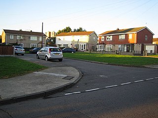
Becontree or is an area of approximately 4 square miles (10 km2) in the London Borough of Barking and Dagenham. It is located 11 miles (17.7 km) east-northeast of Charing Cross and was constructed in the interwar period as the largest public housing estate in the world. The Housing Act 1919 permitted the London County Council to build housing outside the County of London and Becontree was constructed between 1921 and 1935 to cottage estate principles in the parishes of Barking, Dagenham and Ilford, then in the administrative and ceremonial county of Essex. The official completion of the estate was celebrated in 1935, by which time the estate had a population of around 100,000 people in 26,000 homes.

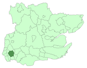
The London Borough of Redbridge is a London borough established in 1965.

The London Borough of Barking and Dagenham is a London borough in East London. It lies around 9 miles (14.4 km) east of Central London. The borough was created in 1965 as the London Borough of Barking; the name was changed in 1980. It is an Outer London borough and the south is within the London Riverside section of the Thames Gateway; an area designated as a national priority for urban regeneration. At the 2011 census it had a population of 187,000. The borough's three main towns are Barking, Chadwell Heath and Dagenham. The local authority is the Barking and Dagenham London Borough Council. Barking and Dagenham was one of six London boroughs to host the 2012 Summer Olympics.
Dagenham is a town in East London, England, within the London Borough of Barking and Dagenham. Dagenham is centred 11.5 miles (18.5 km) east of Charing Cross.
Hainault is a large suburban area in northeast London, England, in the London Borough of Redbridge, 12.5 miles (20.1 km) northeast of Charing Cross. Most of the housing in Hainault was built by the London County Council between 1947 and 1953. Originally spanning the parishes of Chigwell, Dagenham, and Ilford, in 1965 the estate was combined in a single London borough and became part of Greater London.

Chadwell Heath is an area of Dagenham in East London, England. It is split between the London Borough of Barking and Dagenham and the London Borough of Redbridge, around 2 miles (3.2 km) west of Romford and 4 miles (6.4 km) east of Ilford, and 12 miles (19 km) north-east of Charing Cross.

Seven Kings is an area of Ilford in Greater London, England, part of the London Borough of Redbridge. Situated approximately two miles from Ilford town centre, Seven Kings forms part of the Ilford post town. Historically part of Essex, it was part of the Municipal Borough of Ilford until 1965 when it was incorporated into Greater London.

Essex is a county in the East of England which originated as the ancient Kingdom of Essex and one of the seven kingdoms, or heptarchy, that went on to form the Kingdom of England.

East London is the northeastern part of London, England, east of the ancient City of London and north of the River Thames as it begins to widen. East London developed as London's docklands and the primary industrial centre. The expansion of railways in the 19th century encouraged the eastward expansion of the East End of London and a proliferation of new suburbs. The industrial lands of East London are today an area of regeneration, which are well advanced in places such as Canary Wharf and ongoing elsewhere.

Romford is a constituency in Greater London represented in the House of Commons of the UK Parliament since 2001 by Andrew Rosindell, a Conservative.

East Ham was a local government district in the far south west of Essex from 1878 to 1965. It extended from Wanstead Flats in the north to the River Thames in the south and from Green Street in the west to Barking Creek in the east. It was part of the London postal district and Metropolitan Police District.

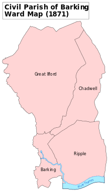
Barking was a local government district, and later civil parish and borough, in southwest Essex, England from 1882 to 1965. It was known as Barking Town from 1882 to 1931. The district included the town of Barking, eastern Beckton and the southwestern part of the Becontree estate. The district was within the Metropolitan Police District and experienced a steady increase in population during its existence. The area was suburban to London's conurbation region and was part of the Metropolitan Police District. It now forms the western part of the London Borough of Barking and Dagenham and the eastern extremity of the London Borough of Newham in Greater London.
Dagenham was a local government district in south west Essex, England from 1926 to 1965 covering the parish of Dagenham. Initially created as an urban district, it was incorporated as a municipal borough in 1938. It was established to deal with the increase in population and the change from rural to urban area caused by the building of the Becontree estate by the London County Council and the subsequent movement of people from Inner London. Peripheral to London, the district formed part of the Metropolitan Police District and London Traffic Area. It now forms the eastern sections of the London Borough of Barking and Dagenham and the London Borough of Redbridge in Greater London.

Hornchurch was a local government district in southwest Essex from 1926 to 1965, formed as an urban district for the civil parish of Hornchurch. It was greatly expanded in 1934 with the addition of Cranham, Great Warley, Rainham, Upminster and Wennington; and in 1936 by gaining North Ockendon. Hornchurch Urban District Council was based at Langtons House in Hornchurch from 1929. The district formed a suburb of London and with a population peaking at 131,014 in 1961, it was one of the largest districts of its type in England. It now forms the greater part of the London Borough of Havering in Greater London.

Walthamstow was a local government district in southwest Essex, England from 1873 to 1965, around the town of Walthamstow. It was within the London suburbs, forming part of the London postal district and Metropolitan Police District. Its former area now corresponds to the central part of the London Borough of Waltham Forest in Greater London. Its population and area grew rapidly as London continued to develop its suburbs.
Romford Rural District was a local government district in southwest Essex, England from 1894 to 1934. It surrounded, but did not include, Romford which formed a separate urban district. During the life of the district the area changed in use from rural farm land to sprawling London suburb and in 1926 much of it was removed to form new urban districts.
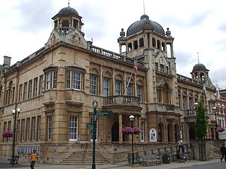
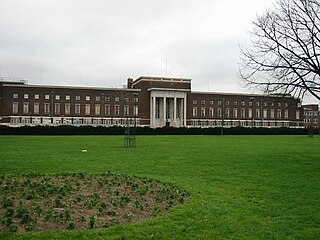
Barking and Dagenham London Borough Council, also known as Barking and Dagenham Council, is the local authority for the London Borough of Barking and Dagenham in Greater London, England. It is a London borough council, one of 32 in the United Kingdom capital of London. It provides a broad range of local government services including Council Tax billing, libraries, social services, processing planning applications, waste collection and disposal, and it is a local education authority. The council has been under Labour majority control since its creation in 1965. The council was created by the London Government Act 1963 as the Barking London Borough Council and replaced two local authorities: Barking Borough Council and Dagenham Borough Council. The council was renamed on 1 January 1980. It is based at Barking Town Hall in the centre of Barking.

Becontree was an ancient hundred in the south west of the county of Essex, England. Its area has been entirely absorbed by the growth of London; with its name reused in 1921 for the large Becontree estate of the London County Council. Its former area now corresponds to the London Borough of Newham, the London Borough of Barking and Dagenham and parts of the London Borough of Waltham Forest and the London Borough of Redbridge. Its early extent also included parts of what is now the London Borough of Havering.
Redbridge is an area of Ilford in East London, England. It gives its name to the London Borough of Redbridge, a local government district of Greater London, with which it should not be confused.