
London Wildlife Trust (LWT), founded in 1981, is the local nature conservation charity for Greater London. It is one of 47 members of the Royal Society of Wildlife Trusts, each of which is a local nature conservation charity for its area. The Trust aims to protect London's wildlife and wild spaces, and it manages over 40 nature reserves in Greater London. One of its campaigns is to turn London's gardens into mini-nature reserves, and it provides education services for schools. Local groups work on reserves and organise walks.

Barnsley Warren is a 61.3-hectare (151-acre) biological Site of Special Scientific Interest in Gloucestershire, notified in 1954 and renotified in 1984. The site is also a Nature Conservation Review site. It lies in a steep-sided dry valley, east of the A429, northeast of Cirencester in the Cotswolds. The site is listed in the 'Cotswold District' Local Plan 2001-2011 as a Key Wildlife Site (KWS).

East Blean Woods is a 151.4-hectare (374-acre) biological Site of Special Scientific Interest south of Herne Bay in Kent. It is also a National Nature Reserve a Special Area of Conservation and a Nature Conservation Review site. An area of 122 hectares is managed by the Kent Wildlife Trust.

Chiddingfold Forest is a 542.5-hectare (1,341-acre) biological Site of Special Scientific Interest in Chiddingfold in Surrey and West Sussex. One part of it, Fir Tree Copse, is a nature reserve which is managed by the Surrey Wildlife Trust

Lydden and Temple Ewell Downs is a 63.2-hectare (156-acre) biological Site of Special Scientific Interest north-west of Dover in Kent. It is a Special Area of Conservation and Nature Conservation Review site. It is also part of the 78.5-hectare (194-acre) Lydden Temple Ewell National Nature Reserve and the 90-hectare (220-acre) Lydden Temple Ewell nature reserve, which is managed by the Kent Wildlife Trust. It is in the South Downs Area of Outstanding Natural Beauty.

Hackhurst and White Downs is a 185.1-hectare (457-acre) biological Site of Special Scientific Interest west of Dorking in Surrey. White Downs is a Nature Conservation Review site, Grade 2, and part of it is in the 200-hectare (490-acre) White Downs nature reserve, which is owned by the Wotton Estate and managed by the Surrey Wildlife Trust (SWT). Hackhurst Downs is a 29.9-hectare (74-acre) Local Nature Reserve, which part of the 40-hectare (99-acre) Hackhurst Downs nature reserve, which is owned by Surrey County Council and also managed by the SWT.

Vann Lake and Ockley Woods is a 57.8-hectare (143-acre) biological Site of Special Scientific Interest south of Ockley in Surrey. Vann Lake is part of Vann Lake and Candy's Copse, a nature reserve managed by the Surrey Wildlife Trust.

Plashett Park Wood is a 157.6-hectare (389-acre) biological Site of Special Scientific Interest betwseen Lewes and Uckfield in East Sussex.
Combe Haven is a 153-hectare (380-acre) biological Site of Special Scientific Interest between Hastings and Bexhill-on-Sea in East Sussex. An area of 18.5 acres is Filsham Reedbed Local Nature Reserve, which is managed by the Sussex Wildlife Trust

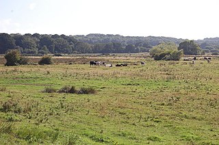
Frays Farm Meadows is a 28.2-hectare (70-acre) biological Site of Special Scientific Interest near Denham in the London Borough of Hillingdon. It was notified as an SSSI in 1981, and has been managed by the London Wildlife Trust on behalf of Hillingdon Council since 1999. It is part of the Colne Valley Regional Park.
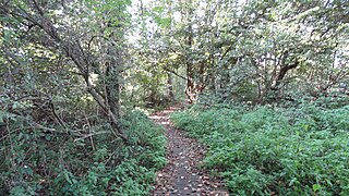
Denham Lock Wood is a 6.3-hectare (16-acre) biological Site of Special Scientific Interest (SSSI) next to the Grand Union Canal, and near Denham in the London Borough of Hillingdon. It was notified in 1986 and is managed by the London Wildlife Trust on behalf of Hillingdon Council. It lies within the Colne Valley Regional Park.

Wotton Hill is a hill on the edge of the Cotswold Hills in Gloucestershire, England, 0.5 miles (0.80 km) north of Wotton-under-Edge. The Cotswold Way passes over the hill.

Honeypot Wood is a 9.5-hectare (23-acre) biological Site of Special Scientific Interest west of Dereham in Norfolk. It is managed by the Norfolk Wildlife Trust

Ruxley Gravel Pits is an 18.7-hectare (46-acre) biological Site of Special Scientific Interest in Ruxley, Orpington, in the London Borough of Bromley, and originally dug between 1929 and 1951. It is also a Site of Metropolitan Importance for Nature Conservation. It is owned by the Environment Agency and managed by Kent Wildlife Trust. Natural England has assessed its condition as "unfavourable recovering".

Riddlesdown Common or Riddlesdown is a 43 hectare area of green space in Kenley, towards the northern end of the North Downs in the London Borough of Croydon. It is owned and maintained by the City of London Corporation, apart from two small areas, one of which is operated by the London Wildlife Trust and the other by Croydon Council. An area of 32 hectares is a biological Site of Special Scientific Interest. The name Riddlesdown also applies to the local district of residential housing.

Bacombe and Coombe Hills is a 76.4 hectare biological Site of Special Scientific Interest in Upper Bacombe in Buckinghamshire. Bacombe Hill was formerly owned by Buckinghamshire County Council, which transferred it to Berkshire, Buckinghamshire and Oxfordshire Wildlife Trust in 2014. Coombe Hill is owned by the National Trust.

Grangelands and Pulpit Hill is a 25.5 hectare biological Site of Special Scientific Interest in Cadsden in Buckinghamshire. It lies within the Chilterns Area of Outstanding Natural Beauty, and the planning authorities are Wycombe District Council and Buckinghamshire County Council. Pulpit Hill is a National Trust site, and Grangelands was formerly owned by Buckinghamshire County Council and was transferred to the Berkshire, Buckinghamshire and Oxfordshire Wildlife Trust in 2014.

Fackenden Down is a 14-hectare (35-acre) nature reserve north of Sevenoaks in Kent. It is managed by the Kent Wildlife Trust. It is part of the Kent Downs Area of Outstanding Natural Beauty and the Otford to Shoreham Downs Site of Special Scientific Interest

Wouldham to Detling Escarpment is a 311.2-hectare (769-acre) biological and geological Site of Special Scientific Interest which stretches from Wouldham to Detling, north of Maidstone in Kent. Part of it is a Geological Conservation Review site, and it is part of the North Downs Woodlands Special Area of Conservation and the Kent Downs Area of Outstanding Natural Beauty. It is a Nature Conservation Review site, Grade I and it includes three Kent Wildlife Trust nature reserves and a Local Nature Reserve,


