Gunnersbury Triangle

Last updated

Gunnersbury Triangle
IUCN category IV (habitat/species management area) [1]
GT acid grassland and birches in autumn sunshine.jpg
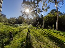
Acid grassland and birches on old railway track
Location Hounslow/Ealing
Nearest cityLondon, England
Coordinates 51°29′39.08″N-0°16′5.8″W / 51.4941889°N 0.268278°W / 51.4941889; -0.268278 Coordinates: 51°29′39.08″N-0°16′5.8″W / 51.4941889°N 0.268278°W / 51.4941889; -0.268278
Governing body London Wildlife Trust
www.wildlondon.org.uk/nature-reserves/gunnersbury-triangle

Gunnersbury Triangle is a 2.57-hectare (6.4-acre) local nature reserve in Chiswick, in the London boroughs of Ealing and Hounslow, [2] [3] immediately to the east of Gunnersbury. It was created in 1983 when, for the first time in Britain, a public inquiry ruled that a planned development of the land could not go ahead because of its value for nature. It opened as a nature reserve in 1985.

Contents

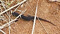
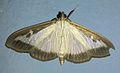
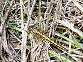
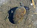
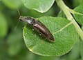
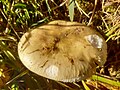
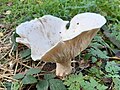
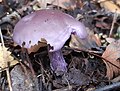
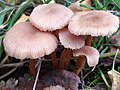
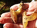
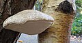
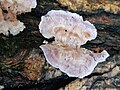
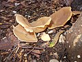
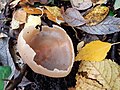
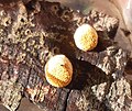
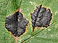
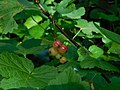
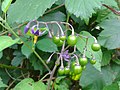
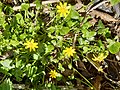
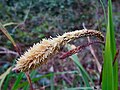
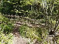
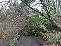
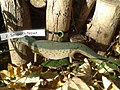
The area consists mainly of secondary birch woodland, with some locally uncommon willow carr or wet woodland and a small area of acid grassland along the track of the former Acton curve railway. The reserve supports a varied population of plants, birds, amphibians, insects and other wildlife. It is managed by the London Wildlife Trust. [4]

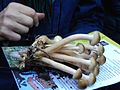
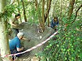
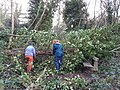
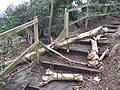
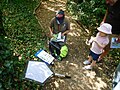
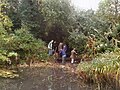
The reserve is maintained by London Wildlife Trust staff with the help of volunteers, and is open to the public. There is a varied programme of activities including wildlife walks, fungus forays, open days and talks. The reserve is used regularly by school and community groups, and for team-building work days by corporate groups. Its entrance, with a wooden five-bar gate flanked by hedges, is on the south of Bollo Lane, a few yards from Chiswick Park Underground station.

History

Old railway level indicator beside the former Acton Curve goods track GT Railway Level Indicator at top of Ramp Meadow.jpg
Old railway level indicator beside the former Acton Curve goods track

The area is shown on 19th-century maps as orchards and gravel quarries. The triangular area now occupied by the reserve was delineated by three railway lines, two belonging to the District Railway (now the District line of London Underground), and one to the now-defunct London and South Western Railway (LSWR). There was once a bridge into the triangle from the west, and in the 1940s it was used as railway allotments (vegetable gardens), but when London Transport's Acton Works was built, the bridge was abandoned. The area, thus disused, was colonised naturally by grasses and trees in a "secondary succession". [5] [6]

Gunnersbury Triangle local nature reserve campaign, 1988, showing children by the pond Gunnersbury Triangle Poster London Wildlife Trust 1988.jpg
Gunnersbury Triangle local nature reserve campaign, 1988, showing children by the pond

In 1981, the site was proposed for commercial development, provoking an energetic campaign by the Chiswick Wildlife Group, formed in March 1982, which became the local branch of the London Wildlife Trust. [7] The threat to the site was one of the first to be highlighted by the London Wildlife Trust on its formation in October 1981. [8] The campaign led to a Public Inquiry in July 1983, which determined that the site should be devoted to nature conservation. This was the first time anywhere in the United Kingdom that a Public Inquiry had ruled in favour of nature in a city, and the Gunnersbury Triangle example became a test case. [7] [9]

According to the New Scientist , writing in 1985, "the celebrated Gunnersbury Triangle – an undisturbed piece of woodland surrounded by railways including the District Line ... was bought and preserved by Hounslow borough from British Rail with a GLC grant of £58 000. [lower-alpha 1] The GLC also gave expert ecological advice when Hounslow council contested a public inquiry to save the Triangle." [10]

The London Wildlife Trust has managed the Gunnersbury Triangle on behalf of the London Borough of Hounslow since 1985. [7] The London Borough of Hounslow formally designated the Gunnersbury Triangle as a local nature reserve in 1987. [7] The London Borough of Ealing formally designated the part of the Gunnersbury Triangle that lies in Ealing as a local nature reserve in 1991. [7]

In 1993, recalling the dramatic events, the president of the London Natural History Society, David Bevan said:

On November 19th 1987,... The Gunnersbury Triangle was declared by Hounslow Council. The circumstances that led up to this important declaration are vividly described in David Goode's book. [11] This was emphatically not a rural site. It was surrounded on all three sides by railway lines and had only been in existence for a mere forty years." [12]

Bevan quoted Goode as saying "It had none of the features which, in traditional nature conservation terms, would make it a place worth preserving", going on to explain this remark as follows:

Nevertheless, the woodland that had grown up on it provided the only genuinely wild place for miles around and it was greatly cherished by local people. British Rail, who owned the site, had applied for planning permission to put up warehousing over the whole of the triangle. This was refused by Hounslow Council and a public inquiry followed in 1983. The Inspector ruled that the development should not be allowed because of the considerable local ecological value. [12]

In 2016, the Triangle's volunteers won an RE:LEAF Acorn Award for their "particular contribution to promoting or conserving trees". [13]

Reserve

The former badger signboard, 2012 Gunnersbury Triangle badger logo LWT signboard.jpg
The former badger signboard, 2012
The wet woodland "Mangrove Swamp" with willows in 2012 Gunnersbury Triangle 'Mangrove Swamp'.jpg
The wet woodland "Mangrove Swamp" with willows in 2012

Gunnersbury Triangle is a classic "railway triangle", the 2.57-hectare (6.4-acre) space in between three curving railway lines. To the west is the Richmond branch of the London Overground; to the south, the District line; and to the northeast, the disused track of the London and South Western Railway (there remains the Piccadilly line a little further north, crossing Bollo lane). Much of the area is now wooded. [7] It is a local nature reserve and a Site of Metropolitan Importance for Nature Conservation. [4]

Habitats

The following compartments are identified in the reserve's management plan: [14]

This covers most of the reserve. Silver birch is dominant, with a few crack willow, goat willow, some wild cherry and sycamore in the canopy. Shrubs include hawthorn, elder, holly, yew and rowan, with garden escapes like buddleia, Oregon grape, cotoneaster, privet. There are some saplings of pedunculate oak, mostly around the edge, and holm oak. The field layer is mainly thick bramble, with ivy in denser shade. Ferns include male fern, broad buckler fern and the less common lady fern. [14]
Willow carr (locally uncommon wet woodland including the "mangrove swamp") with goat willow, grey willow, and some crack willow, with hybrids. The shrubs and field layer are similar to compartment 1; there is some honeysuckle and common horsetail, hemlock water-dropwort, gypsywort, yellow flag, pendulous sedge. [14]
Rough grassland with false oat-grass, Yorkshire fog, yarrow, cat's ear, with bracken at the south end. There is an uneven hedge of hawthorn and buckthorn. The sunny south-west aspect encourages butterflies including holly blue, Essex skipper and small skipper. [14]
Very uneven meadow with mounds formed by the yellow meadow ant Lasius flavus , fox earths, and spoil dumped during former gravel works. Grasses especially false oat-grass, Yorkshire fog; also cock's-foot, common bent and sheep's fescue. Herbs include common vetch, meadow vetchling, white clover, yarrow, ribwort plantain. [14]
On the former Acton curve railway, with a substratum of gritty sand and ballast (hard acidic rock). Small fine grasses especially sheep's fescue, with fine-leaved sheep's fescue, hard fescue, squirrel-tail fescue, early hair-grass. Herbs include sheep's sorrel, mouse-eared hawkweed, cat's ear and yarrow. [14]
Coarse grasses such as cocksfoot, Yorkshire fog, false oat-grass, annual meadow-grass. Broom has colonised on the site of an accidental fire. [14]
Pond dippers on Frog Day Pond Dippers on Frog Day in Gunnersbury Triangle.JPG
Pond dippers on Frog Day
Main pond, dug in 1986, with seasonally fluctuating water levels. Most vegetation has colonised naturally, with among others common reed, purple loosestrife, yellow iris, water-plantain, water figwort, soft rush, gypsywort, water starwort, curled pondweed, common duckweed, water forget-me-not, water mint, brooklime. [14]
Six frogs spawning in the main pond Six frogs in amplexus diving and spawning in Gunnersbury Triangle pond.jpg
Six frogs spawning in the main pond
Seasonal pond with water plantain, celery-leaved crowfoot, bittersweet, water figwort, and introduced yellow iris. [14]
Small meadow of tall ruderal herbs, changing with natural succession, held back by cutting, with plants such as cow parsley, hogweed, stinging nettle, false oat-grass, garden escape daffodils and irises. [14]
Entrance yard gardens sown with wild flowers; hedge mustard, hoary mustard and other ruderal species invading; hedges with native trees and shrubs; hops scramble up the hedges. [14]
Hut, sheds. [14]

Usage

A painter at work on the boardwalk over the pond Miguel painting Gunnersbury Triangle pond.jpg
A painter at work on the boardwalk over the pond

The Gunnersbury Triangle is regularly visited by school parties, totalling some 1500 students per year, mainly in the summer when they can work outside. They study grassland, woodland and pond ecology. [15]

According to the TES magazine, "From April, holly blue, peacock and brimstone butterflies abound. Following the illustrated guide, you wind among wild cherry and rowan, under archways of hazel branches to a pond where damsel-flies dance in early summer. A sparrow-hawk nests in a silver birch, a jay comes visiting, bees and wood-mice also live here." [16] The TES continues: "There are open glades for picnics and, in autumn, blackberries to gather. The aim here is to manage the woodland as a natural piece of countryside in town, and if, from time to time, you glimpse a tube train, you hardly notice it, beyond the trees." [16]

The reserve is open to the public. The London Wildlife Trust runs guided visits such as Fungus Forays and wildlife walks every year. [17] [18] On open days, staff and volunteers organise activities to enable children and adults to learn more about nature conservation in a relaxed environment. [19]

Bumblebee in Gunnersbury Triangle's wildflower demonstration meadow planted with cornflowers and poppies Gunnersbury Triangle Wildflower Meadow with Bumblebee.JPG
Bumblebee in Gunnersbury Triangle's wildflower demonstration meadow planted with cornflowers and poppies

From time to time, companies provide teams of volunteers to work for a day on tasks such as clearing scrub and repairing paths and fences. [20]

The London Wildlife Trust's long-term management objective for the site is "to manage the nature reserve to conserve its natural biodiversity, and to conserve its matrix of woodland, wetland and grassland habitats through appropriate management", which includes coppicing, clearing scrub, mowing, and controlling invasion by non-native species, while "preserving the feeling of 'wilderness'". [7]

Value

The Mayor of London's 2002 Biodiversity Strategy comments "Over the last few decades, many exciting places have been established where city people are able to enjoy the natural world, often on sites which at the outset had seemingly little to offer. These include Camley Street Natural Park in King's Cross, Gillespie Park in Highbury, Gunnersbury Triangle in Chiswick, ..." and explains "The important message conveyed by these projects, regardless of their size, is that significant achievements for nature conservation are possible even in the most urban of settings, and often on modest budgets, provided there exists a cocktail of goodwill, optimism, commitment and professional back-up. Moreover such projects often yield social benefits, providing a community focus." [21]

Biodiversity

These photographs, all taken in the Gunnersbury Triangle nature reserve, illustrate a little of its biodiversity.

Animals

Fungi

Plants

Activities

These photographs illustrate some of the educational and conservation activity on the reserve.

Conservation

Education and public outreach

Notes

  1. The land was far from 'undisturbed', being entirely a secondary succession. It was not only woodland but acid grassland and other habitats. It was only partly surrounded by railways. The 'GLC' was the Greater London Council.

Related Research Articles

<span class="mw-page-title-main">Chiswick</span> Riverside district of London, England

Chiswick is a district of west London, England. It contains Hogarth's House, the former residence of the 18th-century English artist William Hogarth; Chiswick House, a neo-Palladian villa regarded as one of the finest in England; and Fuller's Brewery, London's largest and oldest brewery. In a meander of the River Thames used for competitive and recreational rowing, with several rowing clubs on the river bank, the finishing post for the Boat Race is just downstream of Chiswick Bridge.

Gunnersbury is an area of West London, England.

<span class="mw-page-title-main">Cotswold Water Park</span>

The Cotswold Water Park is the United Kingdom's largest marl lake system, straddling the Wiltshire–Gloucestershire border, northwest of Cricklade and south of Cirencester. There are 180 lakes, spread over 42 square miles (110 km2).

<span class="mw-page-title-main">Coombe Hill Canal</span> Canal in the United Kingdom

Coombe Hill Canal lies in the Vale of Gloucester, south west England, north of Leigh and runs west 2.75 miles (4.43 km) from Coombe Hill Basin to the River Severn near Wainlode Hill. It opened in 1796 and closed 80 years later in 1876, after the only lock was damaged by flooding. The Gloucestershire Wildlife Trust purchased the Coombe Hill Canal nature reserve in 1985 and the area is managed by the trust. Adjacent to the Coombe Hill Canal is a large area of wet meadowland situated midway between Gloucester and Tewkesbury to the west of the A38, which was purchased by the trust in 1999. There is a north and a south meadow. This land and the Canal itself often flood in winter, which attracts hundreds of wildfowl.

<span class="mw-page-title-main">Parks and open spaces in the London Borough of Hounslow</span>

The London Borough of Hounslow is a peripheral London borough in the south-west of the conurbation; as such part of the Metropolitan Green Belt lies within its boundaries. It has one of London's largest Nature reserves as well as many smaller gardens and sports grounds. The major areas are:

<span class="mw-page-title-main">Parks and open spaces in the London Borough of Ealing</span>

The London Borough of Ealing, one of the outer London boroughs although not on the periphery, has over 100 parks and open spaces within its boundaries. These include allotments, cemeteries, playgrounds, and golf courses in addition to the larger open spaces such as nature conservation areas.

<span class="mw-page-title-main">Camley Street Natural Park</span> Urban nature reserve in Kings Cross in central London

Camley Street Natural Park is an urban nature reserve in St Pancras in central London and within the London Borough of Camden. It is a local nature reserve.

Ashford Green Corridor is a green space that runs through the town of Ashford in Kent, England. The Green Corridor is made up of parks, recreation grounds and other green spaces alongside the rivers that flow through Ashford. It is a Local Nature Reserve.

<span class="mw-page-title-main">London Wildlife Trust</span> English nature conservation charity

London Wildlife Trust (LWT), founded in 1981, is a local nature conservation charity for Greater London. It is one of 46 members of the Royal Society of Wildlife Trusts, each of which is a local nature conservation charity for its area. The Trust aims to protect London's wildlife and wild spaces, and it manages over 40 nature reserves in Greater London. One of its campaigns is to turn London's gardens into mini-nature reserves, and it provides education services for schools. Local groups work on reserves and organise walks.

<span class="mw-page-title-main">Lower Woods</span>

Lower Woods is a 280.1-hectare (692-acre) biological and geological Site of Special Scientific Interest near the village of Wickwar, South Gloucestershire, notified in 1966 and renotified in 1985. The site area has increased at last revision in 1974 to a 284.1-hectare (702-acre) site. The site is a nature reserve managed by the Gloucestershire Wildlife Trust.

<span class="mw-page-title-main">The Riddy</span>

The Riddy is an 8.4 hectare flood meadow and Local Nature Reserve located in Sandy, Bedfordshire, United Kingdom, bordering the River Ivel. Owned by Sandy Town Council but managed by both the Wildlife Trust for Bedfordshire, Cambridgeshire and Northamptonshire and Bedfordshire Rural Communities Charity, the 7.7 hectares site gains its name from a small stream which flows through the eastern end of the reserve. The different habitats in the Riddy support a diverse range of species, including a multiplicity of grasses and flowering plants in the meadows, aquatic plants and water voles which inhabit the ditches, ponds and stream, and birds which feed and hunt across the reserve.

<span class="mw-page-title-main">Flora of Ireland</span>

Ireland is in the Atlantic European Province of the Circumboreal Region, a floristic region within the Holarctic.

<span class="mw-page-title-main">Daneway Banks SSSI</span> Biological Site of Special Scientific Interest in Gloucestershire, England

Daneway Banks is a 17-hectare (42-acre) biological Site of Special Scientific Interest in Gloucestershire, notified in 1954 and renotified in 1983. It lies half a mile west of Sapperton and is part of a group of wildlife sites in the Frome Valley that includes Siccaridge Wood and Sapperton Canal reserves. The site is in the Cotswold Area of Outstanding Natural Beauty.

Clarke's Pool Meadow is a 1.8-hectare (4.4-acre) biological Site of Special Scientific Interest in Gloucestershire, notified in 1997. It lies on the flat top of 'Old Hill' about half a mile south of Blakeney. The site consists of two fields which were purchased by the Gloucestershire Wildlife Trust in 1997. The site was designated an SSSI in the same year and it is one of the finest surviving traditional hay meadows in Gloucestershire.

<span class="mw-page-title-main">Wingmoor Farm Meadow</span>

Wingmoor Farm Meadow is a 3-hectare (7.4-acre) nature reserve in Gloucestershire. The site is listed in the ‘Tewkesbury Borough Local Plan to 2011’, adopted March 2006, Appendix 3 'Nature Conservation',' as a Key Wildlife Site (KWS).

<span class="mw-page-title-main">Lavender Pond</span> Nature reserve in Rotherhithe, London

Lavender Pond is a 2.5 acre local nature reserve in Rotherhithe in the London Borough of Southwark. It is owned by Southwark Council and managed by The Conservation Volunteers. The nature reserve has an area of woodland as well as the pond.

<span class="mw-page-title-main">Bramley Bank</span>

Bramley Bank is a 10.3 hectare local nature reserve in Upper Shirley in the London Borough of Croydon. It is owned by Croydon Council and managed by the London Wildlife Trust.

<span class="mw-page-title-main">Uxbridge Moor</span>

Uxbridge Moor is a nature reserve managed by the London Wildlife Trust in Uxbridge in the London Borough of Hillingdon. It is a Site of Metropolitan Importance for Nature Conservation.

<span class="mw-page-title-main">Thetford Heaths</span>

Thetford Heaths is a 270.6-hectare (669-acre) biological and geological Site of Special Scientific Interest in Suffolk. It is a Nature Conservation Review site, Grade I, and parts of it are a national nature reserve, and a Geological Conservation Review, It is part of the Breckland Special Area of Conservation, and Special Protection Area A large part of this dry heathland site is calcareous grassland, and some areas are grazed by sheep or rabbits. There are several nationally rare plants and an uncommon heathland bird, and many lichens and mosses.

<span class="mw-page-title-main">Ulverscroft Valley</span>

Ulverscroft Valley is a 110.8 hectares biological Site of Special Scientific Interest north-west of Markfield in Leicestershire. The site is in five separate blocks, and two areas are nature reserves managed by the Leicestershire and Rutland Wildlife Trust (LRWT). Lea Meadows is owned by the LRWT and it is also a scheduled monument. Part of Ulverscroft Nature Reserve is owned by the LRWT and part is owned by the National Trust and leased to the LRWT.

References

  1. "Gunnersbury Triangle". Protected Planet. Retrieved 30 December 2018.
  2. "Gunnersbury Triangle". Local Nature Reserves. Natural England. 18 December 2013. Retrieved 22 January 2014.
  3. "Map of Gunnersbury Triangle". Local Nature Reserves. Natural England. Retrieved 18 February 2014.
  4. 1 2 "Gunnersbury Triangle". London Wildlife Trust. Retrieved 30 March 2015.
  5. Geograph: Gunnersbury Triangle Nature Reserve. Alan Murray-Rust. 22 December 2010. Retrieved 17 January 2012.
  6. Goode 2014.
  7. 1 2 3 4 5 6 7 Gunnersbury Triangle Summary Management Plan 2005–2010. London Wildlife Trust. June 2008.
  8. Sands 2012.
  9. Goode 2014 , pp. 304–308
  10. Simons, Paul. "A city fit for wildlife". New Scientist. 28 March 1985. Pages 30–33.
  11. Goode, David. Wild in London. 1986
  12. 1 2 Bevan, David (1993). "The London Naturalist". Conserving Nature in London. London Natural History Society. pp. No. 72, 9–14. Archived from the original on 4 June 2011. Retrieved 17 January 2012.
  13. "Gunnersbury Triangle Volunteers Scoop Woodland Awards". Chiswick W4. 3 June 2016. Retrieved 7 June 2016.
  14. 1 2 3 4 5 6 7 8 9 10 11 12 Wileman 2014 , pp. 9–14, 64
  15. Wileman 2014, pp. 24–25.
  16. 1 2 "Inner-city sanctuaries". TES . 24 September 1999. Archived from the original on 21 April 2013. Retrieved 17 January 2012.
  17. "Fungal foray at Gunnersbury Triangle, Sun 6th Oct FREE!". Hammersmith Today. Retrieved 30 March 2015.
  18. "Gunnersbury Triangle Summer Wildlife Walk 6 July 2014 – 2:00pm – 4:00pm". The Wildlife Trusts . Retrieved 30 March 2015.
  19. "Gunnersbury Triangle Open Day 13 July 2014 – 12:00pm – 4:00pm". The Wildlife Trusts. Retrieved 30 March 2015.
  20. "EDF Energy". Historic woodland gets a helping hand thanks to EDF Energy volunteers. EDF Energy. 27 July 2011. Retrieved 20 January 2012.
  21. "The Mayor's Biodiversity Strategy" (PDF). Connecting with London's nature. Greater London Authority. July 2002. p. 79. Archived from the original (PDF) on 16 May 2012. Retrieved 2 February 2012.

Sources