List of local nature reserves in Greater London

Last updated • 2 min readFrom Wikipedia, The Free Encyclopedia

51°30′N0°5′W / 51.500°N 0.083°W / 51.500; -0.083 (_type:adm1st)

Contents

Brent Reservoir Brent Reservoir from Neasden Recreation Ground.JPG
Brent Reservoir

Greater London is one of the largest urban areas in Europe, with an area of 1,572 km2 (607 sq mi). [1] Its boundaries were set in 1965 when Greater London, which covers the 32 London boroughs and the City of London, was created. Almost two-thirds of it is green space and wetlands. [2] Its population according to the 2011 census was 8.17 million. [3]

Local nature reserve (LNR) is a statutory designation by local authorities which gives protection to wildlife habitats and natural features. It allows local authorities to apply local bye-laws to manage and protect sites. [4] The local authority must have a legal interest in the site, by owning or leasing it or having a nature reserve agreement with the owner. [5] As of January 2016, Natural England gives details of 144 local nature reserves declared by local authorities in Greater London, which are listed below. [6] [lower-alpha 1]

The largest site, at 97.31 hectares (240.5 acres), is Brent Reservoir, most of which is a Site of Special Scientific Interest for its breeding wetland birds, especially great crested grebes, and for its marsh plant life. [7] The smallest is Burnt Ash Pond at 0.13 hectares (0.32 acres), an old farm pond in the middle of a residential area. [8] The longest is Parkland Walk, a linear site of 7.2 kilometres (4.5 mi) along the route of an old railway line. [9] Perivale Wood is one of the oldest nature reserves in Britain. It has been managed by the Selborne Society since 1902, and was designated an LNR in 1974. [10] The newest LNRs are Coldfall Wood, Alexandra Palace and Park and Masons Field, all declared in 2013. [11] [12] [13] Several sites, including Camley Street Natural Park in Kings Cross and Frays Valley, are managed by the London Wildlife Trust. [14]

Sites

SitePhotographArea{{efn|Unless specified otherwise, the area is taken from the Natural England map of each site. (Click on the identify icon (i) in the "Feature Tools" and then click on the site.) [6] Location [lower-alpha 2] Map [lower-alpha 3] Details [lower-alpha 4] Other class­ific­ationsFree public access [lower-alpha 5] Description
Abney Park Cemetery Abney park cemetery 1.jpg 12.54 hectares (31.0 acres) Hackney
51°33′50″N0°04′37″W / 51.564°N 0.077°W / 51.564; -0.077 (Abney Park Cemetery)
TQ 334 868
Map Details YesThis is one of London's Magnificent Seven cemeteries. It was closed to burials in 1978 and is now managed as a nature reserve. [15]
Ackroyd Drive Greenlink Ackroyd Drive Greenlink 1.JPG 0.87 hectares (2.1 acres) Tower Hamlets
51°31′08″N0°01′23″W / 51.519°N 0.023°W / 51.519; -0.023 (Ackroyd Drive Greenlink)
TQ 368 818
Map Details YesThe Greenlink is a green corridor between Tower Hamlets Cemetery and Mile End Park. [16]
Adelaide Adelaide Nature Reserve 1.JPG 0.90 hectares (2.2 acres) [17] Camden
51°32′35″N0°09′40″W / 51.543°N 0.161°W / 51.543; -0.161 (Adelaide)
TQ 276 843
Map Details Public access at limited timesThis nature reserve slopes down to a railway line. It is mainly neutral grassland, with areas of scrub and woodland. [18]
Ainslie Wood Ainslie Wood 3.JPG 2.06 hectares (5.1 acres) Waltham Forest
51°36′40″N0°00′40″W / 51.611°N 0.011°W / 51.611; -0.011 (Ainslie Wood)
TQ 378 921
Map Details YesThis is ancient woodland which has mature oaks and wild service trees. It is known locally as Bluebell Wood on account of its spring display. [19]
Alexandra Palace and Park Alexandra Palace Park, path through long grass - geograph.org.uk - 823105.jpg 62.66 hectares (154.8 acres) Haringey
51°35′38″N0°07′48″W / 51.594°N 0.130°W / 51.594; -0.130 (Alexandra Palace and Park)
TQ 296 900
Map Details Archived 2014-04-13 at the Wayback Machine YesThe park has a wide range of habitats for an urban area, and is particularly noted for its varied bird species. [12]
Anton Crescent Wetland Anton Crescent Wetland 4.JPG 1.04 hectares (2.6 acres) Sutton
51°22′19″N0°12′11″W / 51.372°N 0.203°W / 51.372; -0.203 (Anton Crescent Wetland)
TQ 252 652
Map Details NoThe wetland is used as a flood storage area by the Environment Agency. It has open water, reed beds and willow trees. [20]
Barnes Common Broom on Barnes Common - geograph.org.uk - 789503.jpg 41.68 hectares (103.0 acres) Richmond
51°28′12″N0°14′17″W / 51.470°N 0.238°W / 51.470; -0.238 (Barnes Common)
TQ 225 760
Map Details YesThe common is mainly wooded, with areas of grassland. London Plane, lime and horse-chestnut trees were planted in the late nineteenth century [21]
Barnsbury Wood Barnsbury Wood 3.JPG 0.32 hectares (0.79 acres) Islington
51°32′31″N0°06′54″W / 51.542°N 0.115°W / 51.542; -0.115 (Barnsbury Wood)
TQ 308 842
Map Details Public access at limited timesThe wood was the garden of a vicarage. It is mainly sycamore, ash and lime. [22]
Battersea Park Nature Areas Battersea Park Nature Areas 5.JPG 2.90 hectares (7.2 acres) Wandsworth
51°28′48″N0°09′04″W / 51.480°N 0.151°W / 51.480; -0.151 (Battersea Park Nature Areas)
TQ 285 773
51°28′52″N0°08′56″W / 51.481°N 0.149°W / 51.481; -0.149 (Battersea Park Nature Areas)
TQ 286 774
Map Details YesThe nature areas have mixed woodland and scrub, four glades and a pond. There are twenty species of butterflies. [23]
Beam Valley River Beam in Beam Valley Country Park.JPG 39.29 hectares (97.1 acres) Barking and Dagenham
51°32′17″N0°10′23″E / 51.538°N 0.173°E / 51.538; 0.173 (Beam Valley)
TQ 508 844
Map Details YesA park on the bank the River Beam. Historic features include tanks traps and pillboxes. [24]
Beam Valley (Environment Agency) Beam Valley (Environment Agency).JPG 11.86 hectares (29.3 acres) Barking and Dagenham
51°32′17″N0°10′23″E / 51.538°N 0.173°E / 51.538; 0.173 (Beam Valley (Environment Agency))
TQ 508 844
Map Details YesPart of Beam Valley is owned by the Environment Agency, and it has been designated a separate LNR. [25]
Beckenham Place Park Beckenham Place Park.jpg 95.14 hectares (235.1 acres) Lewisham
51°25′05″N0°00′43″W / 51.418°N 0.012°W / 51.418; -0.012 (Beckenham Place Park)
TQ 383 707
Map Details YesThe park has extensive ancient woodland, diverse acid grassland, a natural stretch of river and an old pond. [26]
Bedfont Lakes Country Park Bedfont Lakes Country Park - geograph.org.uk - 93469.jpg 31.59 hectares (78.1 acres) Hounslow
51°26′35″N0°26′56″W / 51.443°N 0.449°W / 51.443; -0.449 (Bedfont Lakes Country Park)
TQ 079 727
Map Details YesThe park has lakes created from a former landfill site, together with areas of grass and woodland. [27]
Bedfords Park Sunset over Bedfords Park pond - geograph.org.uk - 1110486.jpg 106.35 hectares (262.8 acres) [28] [lower-alpha 6] Havering
51°36′29″N0°11′31″E / 51.608°N 0.192°E / 51.608; 0.192 (Bedfords Park)
TQ 519 922
Map [lower-alpha 6] Details Essex Wildlife Trust [30] YesThis site has wildflower meadows, diverse woodland, several ponds and a lake, as well as a herd of red deer. [31]
Belmont Pastures Belmont Pastures 1.JPG 1.26 hectares (3.1 acres) Sutton
51°20′46″N0°11′56″W / 51.346°N 0.199°W / 51.346; -0.199 (Belmont Pastures)
TQ 255 623
Map Details YesThe pastures are grassland and scrub, and they have a wide variety of crickets, butterflies and grasshoppers. [32]
Belsize Wood Belsize Wood south end 2.JPG 0.27 hectares (0.67 acres) Camden
51°33′11″N0°09′50″W / 51.553°N 0.164°W / 51.553; -0.164 (Belsize Wood)
TQ 274 854
Map Details Free public access to part of the siteThis is a sloping wooded site with mature oak trees. It has a wide variety of insect species. [33] [34]
Bennett's Hole Bennett's Hole and River Wandle 1.JPG 1.22 hectares (3.0 acres) Merton
51°23′28″N0°10′12″W / 51.391°N 0.170°W / 51.391; -0.170 (Bennett's Hole)
TQ 274 674
Map Details YesDiverse habitats including woodland, marsh and scrub. The north has a variety of tree species, and the south has mainly crack willows and oaks. [35]
Bentley Priory Bentley Priory Summerhouse Lake 2.jpg 59.25 hectares (146.4 acres) Harrow
51°37′16″N0°19′55″W / 51.621°N 0.332°W / 51.621; -0.332 (Bentley Priory)
TQ 156 927
Map Details SSSI [36] YesThis is a Site of Special Scientific Interest, principally for its meadows. It also has extensive woods and two ponds. [37]
Big Wood and Little Wood Big Wood, N2.JPG 8.29 hectares (20.5 acres) Barnet
51°34′59″N0°11′24″W / 51.583°N 0.190°W / 51.583; -0.190 (Big Wood)
TQ 255 887
51°35′10″N0°11′35″W / 51.586°N 0.193°W / 51.586; -0.193 (Little Wood)
TQ 253 890
Map Details YesThese two small woods are the remnants of the forest which once covered north London. It has birds rarely seen in London, such as the green woodpecker. [38]
Blondin Park, Northfields Blondin Park nature reserve 6.JPG 2.34 hectares (5.8 acres) Ealing
51°29′42″N0°19′12″W / 51.495°N 0.320°W / 51.495; -0.320 (Blondin Park)
TQ 167 787
Map Details YesThe nature area of this park has a pond, an orchard and a wildflower meadow. [39]
Bonesgate Open Space Bonesgate Open Space 6.JPG 5.07 hectares (12.5 acres) Kingston
51°21′40″N0°17′28″W / 51.361°N 0.291°W / 51.361; -0.291 (Bonesgate Open Space)
TQ 191 638
Map Details YesThis is a path along the bank of the Bonesgate Stream. It is parkland with areas of hazel, and has a wide variety of breeding birds. [40]
Bramley Bank Bramley Bank 7.JPG 10.30 hectares (25.5 acres) Croydon
51°21′14″N0°03′29″W / 51.354°N 0.058°W / 51.354; -0.058 (Bramley Bank)
TQ 353 634
Map Details Archived 2013-09-28 at the Wayback Machine London Wildlife Trust [41] YesBramley Bank has oak and ash woodland with a large pond, and areas of acidic grassland. [41]
Brent Reservoir/Welsh Harp Brent reservoir northern arm.jpg 97.31 hectares (240.5 acres) Barnet Brent
51°34′16″N0°14′42″W / 51.571°N 0.245°W / 51.571; -0.245 (Brent Reservoir)
TQ 217 873
Map Details SSSI [42] YesMost of the site is a Site of Special Scientific Interest, especially for its large number of breeding birds, including the great crested grebe. [43]
Brookmill Road Brookmill Road LNR 1.JPG 0.44 hectares (1.1 acres) Lewisham
51°28′05″N0°01′12″W / 51.468°N 0.020°W / 51.468; -0.020 (Brookmill Road)
TQ 376 762
Map Details Archived 2013-09-28 at the Wayback Machine NoA steeply sloping disused railway embankment. It is woodland, with the main trees being hornbeam and hazel. [44]
Burnt Ash Pond Burnt Ash Pond.JPG 0.13 hectares (0.32 acres) Lewisham
51°26′28″N0°01′12″E / 51.441°N 0.020°E / 51.441; 0.020 (Burnt Ash Pond)
TQ 405 733
Map Details NoA small pond in the middle of houses, which has an extensive variety of aquatic animals, including many breeding toads, and plants, including great and hoary willowherb. [8]
Camley Street Natural Park Pond in Camley Street Natural Park.jpg 0.84 hectares (2.1 acres) Camden
51°32′06″N0°07′44″W / 51.535°N 0.129°W / 51.535; -0.129 (Camley Street Natural Park)
TQ 299 834
Map Details London Wildlife Trust [45] YesThis nature reserve on the bank of Regents Canal in Kings Cross has ponds and areas of meadows and woodland, with birds such as reed warblers and kingfishers. [45]
Cannon Hill Common Morden 4 Autumn colours on Cannon Hill Common geograph-2376006-by-Ben-Brooksbank.jpg 14.16 hectares (35.0 acres) Merton
51°24′00″N0°13′19″W / 51.400°N 0.222°W / 51.400; -0.222 (Cannon Hill Common)
TQ 238 683
Map Details YesThe common has meadows with plants such as meadow barley and meadow foxtail, and woodland dominated by ancient oak trees. [46]
Castle Hill Castle Hill, Chessington 3.JPG 3.48 hectares (8.6 acres) Kingston
51°21′29″N0°17′28″W / 51.358°N 0.291°W / 51.358; -0.291 (Castle Hill)
TQ 191 635
Map Details Scheduled monument [47] YesThis is the site of a medieval hunting lodge. It is woodland mainly of oak and hazel, with varied ground flora, including wood anemone and hairy St John's-wort. [40]
The Chase - Barking River Rom in The Chase Nature Reserve 3.JPG 44.15 hectares (109.1 acres) Barking and Dagenham
51°33′00″N0°11′02″E / 51.550°N 0.184°E / 51.550; 0.184 (The Chase - Barking)
TQ 515 857
Map Details YesThe Chase is a footpath along the River Rom. It has diverse habitats and wildlife includes water voles. [48]
The Chase - Havering The Chase Nature Reserve, Havering.JPG 1.39 hectares (3.4 acres) Havering
51°33′29″N0°11′02″E / 51.558°N 0.184°E / 51.558; 0.184 (The Chase - Havering)
TQ 515 866
Map Details Archived 2013-09-28 at the Wayback Machine YesThis is a continuation of The Chase in Barking. It has black poplar trees. [49]
Cherry Wood Cherry Wood 3.JPG 1.76 hectares (4.3 acres) Merton
51°23′49″N0°12′54″W / 51.397°N 0.215°W / 51.397; -0.215 (Cherry Wood)
TQ 243 680
Map Details Archived 2013-10-19 at the Wayback Machine YesThe main trees are pedunculate oak, ash and horse chestnut. There are over twenty-five species of birds. [50]
Chiswick Eyot Chiswick Eyot channel at low tide.jpg 0.83 hectares (2.1 acres) Hounslow
51°29′13″N0°14′46″W / 51.487°N 0.246°W / 51.487; -0.246 (Chiswick Eyot)
TQ 219 779
Map Details Archived 2012-09-04 at the Wayback Machine NoThis is a small wooded island in the Thames. The main trees are willows, and the island is surrounded by reed beds. [51]
Coldfall Wood Coldfall Wood, London Borough of Haringey, N10 (3301020095).jpg 13.43 hectares (33.2 acres) Haringey
51°35′49″N0°09′43″W / 51.597°N 0.162°W / 51.597; -0.162 (Coldfall Wood)
TQ 274 903
Map Details YesThis is ancient woodland, mainly of hornbeam, oak, birch and sycamore. There are a number of ground plants which are rare in London, such as pale sedge, trailing St John's wort and lady-fern. [52]
Coombe Hill Wood Coombe Hill Wood 5.JPG 2.19 hectares (5.4 acres) Kingston
51°25′08″N0°15′04″W / 51.419°N 0.251°W / 51.419; -0.251 (Coombe Hill Wood)
TQ 217 703
Map Details Archived 2013-09-28 at the Wayback Machine YesThis wood is mainly oak, with an understorey of hazel coppice. [53]
Coppetts Wood and Glebelands Coppett's Wood 2.JPG 20.00 hectares (49.4 acres) Barnet
51°36′32″N0°09′32″W / 51.609°N 0.159°W / 51.609; -0.159 (Coppett's Wood)
TQ 276 916
51°36′14″N0°10′12″W / 51.604°N 0.170°W / 51.604; -0.170 (Glebelands)
TQ 268 910
Map Details YesCoppett's Wood is mainly oak and hornbeam, and has a number of rare insects. [54] Glebelands is a remnant of Finchley Common, and has woodland and ponds. [55]
Covert Way Covert Way, Enfield 2.JPG 6.77 hectares (16.7 acres) Enfield
51°39′36″N0°10′23″W / 51.660°N 0.173°W / 51.660; -0.173 (Covert Way)
TQ 265 973
Map Details YesCovert Way is deciduous woodland. Animals include muntjac deer, green and greater spotted woodpeckers, and white-letter and purple hair-streak butterflies. [56]
Crane Park Island Crane Park Island 4.JPG 2.67 hectares (6.6 acres) Richmond
51°26′31″N0°22′44″W / 51.442°N 0.379°W / 51.442; -0.379 (Crane Park Island)
TQ 128 727
Map Details London Wildlife Trust [57] YesThis is an island in the River Crane. It has wet woodland, grassland and reed beds and fauna include kingfishers and water voles. [58]
Cranebank, Hatton Cranebank meadow.JPG 6.69 hectares (16.5 acres) Hounslow
51°28′34″N0°24′58″W / 51.476°N 0.416°W / 51.476; -0.416 (Cranebank, Hatton)
TQ 101 764
Map Details YesCranebank is flood meadows by the River Crane, which are under water in winter. There are twenty-six species of butterflies and twelve of damselflies and dragonflies. [59]
Cranham Brickfields Cranham Brickfields pond.JPG 8.69 hectares (21.5 acres) Havering
51°33′50″N0°16′41″E / 51.564°N 0.278°E / 51.564; 0.278 (Cranham Brickfields)
TQ 580 875
Map Details YesCranham Brickfields has pasture, a pond, scrub and woodland. Invertebrates include the great crested newt and slowworm, and plants dyer's greenweed. [60]
Cranham Marsh Cranham Marsh 1.JPG 12.97 hectares (32.0 acres) Havering
51°32′49″N0°15′47″E / 51.547°N 0.263°E / 51.547; 0.263 (Cranham Marsh)
TQ 570 855
Map Details Essex Wildlife Trust [61] YesThis site's habitats include marshes, ponds and ancient woodland, and a tributary of the River Markyke runs through the site. [62]
Cranmer Green Cranmer Green 2.JPG 3.22 hectares (8.0 acres) Merton
51°23′53″N0°09′47″W / 51.398°N 0.163°W / 51.398; -0.163 (Cranmer Green)
TQ 279 681
Map Details Archived 2013-09-28 at the Wayback Machine YesThe green has a pond, woodland and grassland. [35] The pond is probably late eighteenth century in origin. [63]
Crossness Crossness Nature Reserve 6.JPG 25.50 hectares (63.0 acres) Bexley
51°30′04″N0°08′53″E / 51.501°N 0.148°E / 51.501; 0.148 (Crossness)
TQ 492 802
Map Details Archived 2013-10-19 at the Wayback Machine Free public access to part of the siteThis is a network of open water and ditches, with areas of rough grassland. There are over one hundred and thirty species of birds. [64]
Cuddington Meadows Cuddington Meadows 3.JPG 1.39 hectares (3.4 acres) Sutton
51°20′02″N0°12′50″W / 51.334°N 0.214°W / 51.334; -0.214 (Cuddington Meadows)
TQ 245 610
Map Details YesCuddington Meadows is chalk grassland, and its most important feature is the variety of flowering plants. Sixteen butterfly species have been recorded. [65]
Dacres Wood Dacres Wood 2.JPG 0.70 hectares (1.7 acres) Lewisham
51°25′55″N0°03′07″W / 51.432°N 0.052°W / 51.432; -0.052 (Dacres Wood)
TQ 355 721
Map Details Public access at limited timesThe wood has some massive turkey oaks, and ornamental shrubs which are probably inherited from a time when it was a Victorian garden. There are also marshes and a pond. [66]
Dagenham Village Churchyard Dagenham Village Churchyard.JPG 0.87 hectares (2.1 acres) Barking and Dagenham
51°32′20″N0°09′43″E / 51.539°N 0.162°E / 51.539; 0.162 (Dagenham Village Churchyard)
TQ 500 845
Map Details Archived 2013-10-19 at the Wayback Machine YesThe old gravestones and walls in the churchyard provide a habitat for lichens and mosses, and woodpeckers feed in an avenue of lime trees. [67]
Danson Park Bog Garden, Welling Bexley, footbridge at Danson Park - geograph.org.uk - 972265.jpg 1.07 hectares (2.6 acres) Bexley
51°27′14″N0°06′50″E / 51.454°N 0.114°E / 51.454; 0.114 (Danson Park Bog Garden)
TQ 470 749
Map Details YesDanson Park has a large lake, and a marshy area at its western end has been converted into a nature reserve. [68]
Denham Country Park River Colne in Denham Country Park.JPG 19.82 hectares (49.0 acres) Hillingdon Buckinghamshire
51°34′26″N0°29′06″W / 51.574°N 0.485°W / 51.574; -0.485 (Denham Country Park)
TQ 051 872
Map Details YesThree rivers go through the park, the Colne, the Misbourne and the Frays. Birds include herons and kingfishers. [69]
Derwent Floodwash Derwent Floodwash 1.JPG 1.83 hectares (4.5 acres) Merton
51°23′31″N0°13′34″W / 51.392°N 0.226°W / 51.392; -0.226 (Derwent Floodwash)
TQ 235 674
Map Details YesThis is designed to store water during flooding of Pyl Brook, to prevent flooding downstream. It is wet grassland with a number of uncommon plant species. [70]
Devonshire Avenue Nature Area Devonshire Avenue Nature Area 1.JPG 0.42 hectares (1.0 acre) Sutton
51°21′14″N0°11′20″W / 51.354°N 0.189°W / 51.354; -0.189 (Devonshire Avenue Nature Area)
TQ 262 632
Map Details YesThis is mainly chalk grassland. It has the locally rare small blueall blue butterfly, and the butterfly's food plant, kidney vetch. [71]
Downham Woodland Walk Downham Woodland Walk 2.JPG 2.82 hectares (7.0 acres) Lewisham
51°25′48″N0°00′07″E / 51.430°N 0.002°E / 51.430; 0.002 (Downham Woodland Walk)
TQ 393 720
Map Details YesThe walk is ancient woodland. Trees include pedunculate oaks, hornbeams and field maples, and there are invertebrates such as stag and fungus beetles. [72]
Duke's Hollow Duke's Hollow.JPG 0.27 hectares (0.67 acres) Hounslow
51°28′23″N0°15′22″W / 51.473°N 0.256°W / 51.473; -0.256 (Duke's Hollow)
TQ 212 763
Map Details YesDuke's Hollow slopes steeply down towards the Thames. It is woodland mainly of willow. [73]
Dulwich Upper Wood Dulwich Upper Wood 3.JPG 1.74 hectares (4.3 acres) Southwark
51°25′26″N0°04′41″W / 51.424°N 0.078°W / 51.424; -0.078 (Dulwich Upper Wood)
TQ 337 712
Map Details YesThis is a remnant of the Great North Wood. It is mainly oak, and animals include stag beetles and bats. [74]
Eastbrookend Country Park Bardag Lake, Eastbrookend Country Park 2.JPG 67.39 hectares (166.5 acres) Barking and Dagenham
51°33′07″N0°10′37″E / 51.552°N 0.177°E / 51.552; 0.177 (Eastbrookend Country Park)
TQ 510 860
Map Details YesThe park is former derelict land planted with 50,000 small trees, and with grass and flower seeds suitable for poor soil. [75]
Edith Gardens Entrance to Edith Gardens Local Nature Reserve.JPG 0.44 hectares (1.1 acres) Kingston
51°23′20″N0°17′02″W / 51.389°N 0.284°W / 51.389; -0.284 (Edith Gardens)
TQ 195 669
Map Details NoThe site is abandoned allotments next to Tolworth Brook. Most of it is low diversity grassland, and there is also a thicket of young elms areas of brambles and some large mature trees. [76]
Elmbridge Open Space [lower-alpha 7] Elmbridge Meadows, Kingston.JPG 9.35 hectares (23.1 acres) Kingston
51°23′31″N0°16′26″W / 51.392°N 0.274°W / 51.392; -0.274 (Elmbridge Open Space)
TQ 202 673
Map Details YesThis is a green walk along the bank of the Hogsmill River. There are willow trees by the river bank and plants such as meadowsweet and comfrey. [78]
Fishpond Wood and Beverley Meads Fishpond Wood 1.JPG 5.92 hectares (14.6 acres) Merton
51°25′19″N0°14′53″W / 51.422°N 0.248°W / 51.422; -0.248 (Fishpond Wood and Beverley Meads)
TQ 219 707
Map Details London Wildlife Trust. [79] YesFishpond Wood has wetlands and oak and hazel woodlands, while Beverley Meads is a mosaic of woods and pastures. [80]
Foots Cray Meadows River Cray in Foots Cray Meadows.JPG 30.32 hectares (74.9 acres) Bexley
51°25′30″N0°07′26″E / 51.425°N 0.124°E / 51.425; 0.124 (Foots Cray Meadows)
TQ 478 717
Map Details YesThe River Cray runs through the meadows. They have a diverse landscape, including ancient woodlands and wildflower meadows. [81]
Fox Wood Fox Wood, Ealing 4.JPG 2.25 hectares (5.6 acres) Ealing
51°31′34″N0°17′56″W / 51.526°N 0.299°W / 51.526; -0.299 (Fox Wood)
TQ 181 822
Map Details YesFox Wood was a reservoir which was drained in World War II to stop it being used as a navigational aid by German bombers. It is now sloping woodland. [82]
Foxley Wood Foxley Wood 5.JPG 11.36 hectares (28.1 acres) Croydon
51°19′41″N0°06′50″W / 51.328°N 0.114°W / 51.328; -0.114 (Foxley Wood)
TQ 315 605
Map Details YesFoxley Wood has chalk grassland and woods. There are badgers and roe deer, and over forty species of birds have been observed. [83]
Frays Valley Frays River in Frays Farm Meadows.jpg 71.87 hectares (177.6 acres) Hillingdon
51°34′05″N0°28′44″W / 51.568°N 0.479°W / 51.568; -0.479 (Frays Valley)
TQ 055 865
Map Details Archived 2013-10-19 at the Wayback Machine London Wildlife Trust, [84] SSSI [85] YesThe Frays River goes through the wildlife rich valley. Flora include kingcups and ragged robin, and there are mammals such as harvest mice and water voles. [86]
Fryent Country Park Fryent Country Park Barn Hill Pond.JPG 106.97 hectares (264.3 acres) Brent
51°34′26″N0°16′37″W / 51.574°N 0.277°W / 51.574; -0.277 (Fryent Country Park)
TQ 195 875
Map Details YesThe park has a varied landscape, including lakes, woodland and meadows. Over 800 species have been recorded, including 80 birds and 21 butterflies. [87]
Gillespie Park Gillespie Park pond.JPG 3.03 hectares (7.5 acres) Islington
51°33′32″N0°06′25″W / 51.559°N 0.107°W / 51.559; -0.107 (Gillespie Park)
TQ 313 862
Map Details YesGillespie Park has an ecology centre, and it is mainly grassland. Bird species include reed bunting and song thrush, and there are also ponds with many invertebrates. [88]
Grove Farm Grove Farm, Ealing 1.JPG 8.07 hectares (19.9 acres) Ealing
51°33′14″N0°20′28″W / 51.554°N 0.341°W / 51.554; -0.341 (Grove Farm)
TQ 151 852
Map Details YesGrove Farm has ancient woodland with wild service trees and a variety of wild flowers. [89]
Grove Park Nature Reserve Grove Park Nature Reserve pond.jpg 2.74 hectares (6.8 acres) Lewisham
51°26′13″N0°00′58″E / 51.437°N 0.016°E / 51.437; 0.016 (Grove Park Nature Reserve)
TQ 402 729
map Details YesGrove Park Nature Reserve contains native woodland, calcareous grassland meadow, a small stream and pond, slow worms, stag beetles, Desmond Tutu Peace Pole
Gunnersbury Triangle Pond dipping at LWT Gunnersbury Triangle.JPG 2.57 hectares (6.4 acres) Hounslow Ealing
51°29′38″N0°16′16″W / 51.494°N 0.271°W / 51.494; -0.271 (Gunnersbury Triangle)
TQ 201 786
Map Details London Wildlife Trust [90] YesThis has a varied habitat, including woodland and marshes. It has amphibians such as toads, newts and frogs. [90]
Hainault Lodge Hainault Lodge.JPG 5.60 hectares (13.8 acres) Redbridge
51°36′25″N0°07′48″E / 51.607°N 0.130°E / 51.607; 0.130 (Hainault Lodge)
TQ 476 919
Map Details NoHainault Lodge is ancient woodland and pasture. Butterflies include orange tips and speckled woods, and birds long-tailed tits, robins. [91]
Ham Common Latchmere Stream - Ham Woods, Ham Common.jpg 40.27 hectares (99.5 acres) Richmond
51°25′55″N0°17′53″W / 51.432°N 0.298°W / 51.432; -0.298 (Ham Common)
TQ 184 718
Map Details YesThe main trees in Ham Common are birch and oak, and there are also areas of acid grassland. [92]
Ham Lands Ham Riverside Lands, Ham - geograph.org.uk - 991429.jpg 60.01 hectares (148.3 acres) Richmond
51°26′06″N0°19′30″W / 51.435°N 0.325°W / 51.435; -0.325 (Ham Lands)
TQ 165 720
Map Details YesThis is a former gravel quarry filled with soil types from across London, thus creating an unusual mosaic of habitats. [93]
High Elms High Elms Cuckoo Wood.jpg 102.33 hectares (252.9 acres) Bromley
51°20′46″N0°04′19″E / 51.346°N 0.072°E / 51.346; 0.072 (High Elms)
TQ 444 628
Map Details SSSI [94] YesMost of this country park is secondary woodland, but it retains much of the original ground flora with some rare species. [94]
Hogsmill River Park [lower-alpha 7] Hogsmill River Park 1.JPG 22.26 hectares (55.0 acres) [lower-alpha 7] Kingston
51°23′53″N0°16′34″W / 51.398°N 0.276°W / 51.398; -0.276 (Hogsmill River Park)
TQ 200 680
51°22′59″N0°15′50″W / 51.383°N 0.264°W / 51.383; -0.264 (Hogsmill River Park)
TQ 209 663
Map
Map [lower-alpha 7]
Details Archived 2013-09-28 at the Wayback Machine YesThis is a linear park along the Hogsmill River. The landscape is varied, with pasture and mature willow and oak woodland. [95]
Hounslow Heath Hounslow Heath 1.JPG 83.14 hectares (205.4 acres) Hounslow
51°27′25″N0°23′06″W / 51.457°N 0.385°W / 51.457; -0.385 (Hounslow Heath)
TQ 123 743
Map Details YesThe heath has extensive acid grassland with some hay meadows, marsh and woodland. [96]
Hutchinson's Bank Hutchinson's Bank 6.JPG 21.77 hectares (53.8 acres) Croydon
51°20′13″N0°01′08″W / 51.337°N 0.019°W / 51.337; -0.019 (Hutchinson's Bank)
TQ 381 616
Map Details London Wildlife Trust [97] YesHutchinson's Bank is a sloping meadow bank, with a diverse ecology including pyramidal and common spotted orchids and the rare greater yellow-rattle. [97]
Ingrebourne Valley Ingrebourne Valley south of Hornchurch - geograph.org.uk - 1037676.jpg 146.62 hectares (362.3 acres) Havering
51°32′06″N0°12′25″E / 51.535°N 0.207°E / 51.535; 0.207 (Ingrebourne Valley)
TQ 532 841
51°31′26″N0°11′49″E / 51.524°N 0.197°E / 51.524; 0.197 (Ingrebourne Valley)
TQ 525 828
Map Details Archived 2016-03-04 at the Wayback Machine Essex Wildlife Trust, [98] SSSI [99] YesThe site has a wide range of habitats, rough grassland, woodland, marshes, river, reedbeds and wet grazing. There are fauna such as great crested newts, slowworms and harvest mice. [99]
Isleworth Ait Isleworth Ait - geograph.org.uk - 1018958.jpg 3.49 hectares (8.6 acres) Hounslow
51°28′05″N0°19′12″W / 51.468°N 0.320°W / 51.468; -0.320 (Isleworth Ait)
TQ 168 757
Map Details Archived 2013-09-28 at the Wayback Machine London Wildlife Trust [100] NoThis is an island in the Thames. It has poplar and willow woodland on land which is often flooded. Rare species include the two-lipped door snail and the German hairy snail. [100]
Islip Manor Meadows Islip Manor Meadows 2.JPG 23.75 hectares (58.7 acres) Ealing
51°32′53″N0°23′17″W / 51.548°N 0.388°W / 51.548; -0.388 (Islip Manor Meadows)
TQ 119 845
Map Details Archived 2013-09-28 at the Wayback Machine YesThis is a diverse wet meadow site with over twenty grass and ten leguminous species. There are ponds with the protected great crested newt. [101]
Jubilee Country Park Jubilee Country Park path.JPG 28.67 hectares (70.8 acres) Bromley
51°23′35″N0°03′47″E / 51.393°N 0.063°E / 51.393; 0.063 (Jubilee Country Park)
TQ 436 680
Map Details YesThe park has chalk grassland and woods with oaks, hawthorns and field maples. Some species are rare in London. [102]
Jubilee Wood Jubilee Wood, Malden Rushett 8.JPG 2.24 hectares (5.5 acres) Kingston
51°20′35″N0°19′37″W / 51.343°N 0.327°W / 51.343; -0.327 (Jubilee Wood)
TQ 166 618
Map [lower-alpha 8] Details Archived 2013-10-19 at the Wayback Machine YesTrees in this wood include birch, pedunculate oak, field maple, goat willow and wych elm. [104]
Kempton Kempton Nature Reserve.JPG 22.80 hectares (56.3 acres) Hounslow
51°25′26″N0°23′35″W / 51.424°N 0.393°W / 51.424; -0.393 (Kempton)
TQ 118 707
Map Details SSSI [105] NoThis site is disused reservoirs which has many bird species. It is of national importance for wintering gadwall. It also has feeding bats and mammals include water voles. [106]
Lavender Pond Lavender Pond 1.JPG 0.70 hectares (1.7 acres) Southwark
51°30′18″N0°02′17″W / 51.505°N 0.038°W / 51.505; -0.038 (Lavender Pond)
TQ 363 803
Map Details Free public access to part of the siteThis used to be part of the Surrey Commercial Docks, now converted to a small wildlife pond. [107]
Lesnes Abbey Woods Lesnes Abbey Woods.JPG 73.13 hectares (180.7 acres) Bexley
51°29′10″N0°07′55″E / 51.486°N 0.132°E / 51.486; 0.132 (Lesnes Abbey Woods)
TQ 481 785
Map Details Archived 2016-03-15 at the Wayback Machine SSSI [108] YesThis site has ancient woodland, parkland, heath, wetland and hedgerows. A survey found 906 invertebrate species, 46 birds, 12 mammals, 59 fungi and 292 plants. [109]
Litten Litten Local Nature Reserve.JPG 10.7 hectares (26 acres) Ealing
51°31′55″N0°21′04″W / 51.532°N 0.351°W / 51.532; -0.351 (Litten)
TQ 145 827
Map Details YesLitten has a pond, woodland and a wildflower meadow. [110]
Long Wood Long Wood, Norwood Green 4.JPG 1.20 hectares (3.0 acres) Ealing
51°29′49″N0°20′17″W / 51.497°N 0.338°W / 51.497; -0.338 (Long Wood)
TQ 155 789
Map Details YesThis is ancient woodland which has varied tree and wildlife species. [111]
Lonsdale Road Reservoir (Leg of Mutton Reservoir) Lonsdale Road Reservoir 4.JPG 8.19 hectares (20.2 acres) Richmond
51°28′55″N0°14′49″W / 51.482°N 0.247°W / 51.482; -0.247 (Lonsdale Road Reservoir)
TQ 218 774
Map Details YesThis disused reservoir has a wide variety of water birds, including tufted ducks and wigeons. [112]
Lower Wandle Lower Wandle 1.JPG 2.52 hectares (6.2 acres) Merton
51°25′59″N0°11′31″W / 51.433°N 0.192°W / 51.433; -0.192 (Lower Wandle)
TQ 258 720
Map Details Archived 2013-10-19 at the Wayback Machine YesThis is a stretch of the River Wandle, which is lined with mature trees, grassland and patches of herbs. [113]
The Manor Dagnam Park, Harold Hill, Essex - geograph.org.uk - 23738.jpg 67.96 hectares (167.9 acres) Havering
51°36′50″N0°14′13″E / 51.614°N 0.237°E / 51.614; 0.237 (The Manor) TQ 550 930 51°36′29″N0°14′38″E / 51.608°N 0.244°E / 51.608; 0.244 (The Manor) TQ 555 923
Map Details YesThe Manor comprises several parks and diverse habitats. Plants include the common spotted-orchid and square stemmed St John's wort. [114]
Maryon Wilson Park and Gilbert's Pit (including Maryon Park) Maryon Park, Charlton, South East London.jpg 17.52 hectares (43.3 acres) Greenwich
51°29′13″N0°02′31″E / 51.487°N 0.042°E / 51.487; 0.042 (Maryon Wilson Park)
TQ 419 784
Map Details SSSI [115] YesGilbert's Pit is a geological SSSI. Maryon Wilson Park is a hilly wooded site, which has a stream with rare plants. Maryon Park is acid grassland, scrub and secondary woodland. [116]
Masons Field Masons Field 3.JPG 2.87 hectares (7.1 acres) Brent
51°35′00″N0°16′25″W / 51.5833°N 0.27367240°W / 51.5833; -0.27367240 (Masons Field)
TQ 197 886
Map Details YesThis is a former London Underground sports ground next to Fryent Country Park, which has been converted to a wildflower meadow. [117]
Mayesbrook Park South Mayesbrook Park 2.JPG 7.55 hectares (18.7 acres) Barking and Dagenham
51°32′24″N0°06′29″E / 51.540°N 0.108°E / 51.540; 0.108 (Mayesbrook Park)
TQ 463 844
Map Details YesThe park has a nature reserve with two large lakes, rough grassland and woodland. [118]
Merton Park Green Walks Merton Park Green Walks 5.JPG 1.49 hectares (3.7 acres) Merton
51°24′43″N0°12′00″W / 51.412°N 0.200°W / 51.412; -0.200 (Merton Park)
TQ 253 697
Map Details YesThis site has a variety of habitats, including grassland and an inaccessible area of elm scrub and brambles. [119]
Morden Park Morden 8 Trees in Morden Park geograph-2376588-by-Ben-Brooksbank.jpg 28.19 hectares (69.7 acres) Merton
51°23′35″N0°12′43″W / 51.393°N 0.212°W / 51.393; -0.212 (Morden Park)
TQ 245 675
Map Details YesThis park has woodland with 300-year-old oak trees. Birds include coal tits and spotted flycatchers. [120]
Mudchute Park and Farm Mudchute Park and Farm, London Borough of Tower Hamlets, E14 (2469279646).jpg 13.31 hectares (32.9 acres) Tower Hamlets
51°29′31″N0°00′43″W / 51.492°N 0.012°W / 51.492; -0.012 (Mudchute Park and Farm)
TQ 381 789
Map Details Archived 2016-03-16 at the Wayback Machine YesThis is a city farm and nature reserve, with varied habitats including wetlands. There are invertebrates such as smooth newts and slowworms. [121]
Myrna Close Myrna Close 6.JPG 0.75 hectares (1.9 acres) Merton
51°24′58″N0°10′26″W / 51.416°N 0.174°W / 51.416; -0.174 (Myrna Close)
TQ 271 701
Map Details Archived 2013-09-28 at the Wayback Machine YesThis is a linear park on the route of a former railway. It has a small stream and two ponds, and wetland plants include brooklime. [122]
New Cross Gate Cutting (Brockley Nature Reserve) Pond in Camley Street Natural Park.jpg 4.19 hectares (10.4 acres) Lewisham
51°28′12″N0°02′20″W / 51.470°N 0.039°W / 51.470; -0.039 (Brockley Nature Reserve)
TQ 363 764
Map Details London Wildlife Trust [123] NoThis sloping railway cutting is mainly woodland with some areas of grassland, reeds and herbs. There are over 170 plant species, some unusual in the area. [123]
Northolt Manor Northolt Manor House moat.JPG 1.79 hectares (4.4 acres) Ealing
51°32′38″N0°22′08″W / 51.544°N 0.369°W / 51.544; -0.369 (Northolt Manor)
TQ 132 841
Map Details Scheduled Monument [124] YesThis was a fourteenth century moated manor. It has wetland, scrub, woodland and grassland. The wetland has a wide range of species, such as thread-leaved water-crowfoot and narrow-fruited water-cress. [125]
Nunhead Cemetery Nunhead cemetery, main drive - geograph.org.uk - 779408.jpg 20.23 hectares (50.0 acres) Southwark
51°27′43″N0°03′07″W / 51.462°N 0.052°W / 51.462; -0.052 (Nunhead Cemetery)
TQ 354 755
Map Details YesThis is one of London's Magnificent Seven cemeteries. [126] It has a wide range of plants, and sixteen species of butterflies have been recorded. [127]
Oak Avenue, Hampton Oak Avenue Local Nature Reserve 4.JPG 1.85 hectares (4.6 acres) Richmond
51°25′41″N0°23′17″W / 51.428°N 0.388°W / 51.428; -0.388 (Oak Avenue, Hampton)
TQ 122 711
Map Details YesThis is former wasteland, where some new habitats have been created, including meadows and a pond, and others have grown up naturally. [128]
Oak Hill Wood Oak Hill Wood meadow and Oak Hill Park.JPG 9.88 hectares (24.4 acres) Barnet
51°38′24″N0°09′04″W / 51.640°N 0.151°W / 51.640; -0.151 (Oak Hill Wood)
TQ 280 951
Map Details Archived 2013-09-28 at the Wayback Machine London Wildlife Trust [129] YesThis medieval oak wood has wild service trees, woodland flowers such as wood anemones and yellow archangels, and pipistrelle and brown long-eared bats. [129]
Oakleigh Way Oakleigh Way 4.JPG 0.64 hectares (1.6 acres) Merton
51°24′43″N0°08′56″W / 51.412°N 0.149°W / 51.412; -0.149 (Oakleigh Way)
TQ 288 698
Map Details YesOakleigh Way is a former railway depot converted to a nature reserve, which has birch woodland and wildflower meadows. [130]
One Tree Hill The Honor Oak, One Tree Hill.JPG 6.95 hectares (17.2 acres) Southwark
51°27′04″N0°03′04″W / 51.451°N 0.051°W / 51.451; -0.051 (One Tree Hill)
TQ 355 743
Map Details YesQueen Elizabeth I is said to have picnicked under an oak at the top of the hill. It has many ancient trees. [131]
Oxleas/Shooters Hill Woodlands Oxleas Wood path 1.JPG 119.60 hectares (295.5 acres) Greenwich
51°28′08″N0°03′25″E / 51.469°N 0.057°E / 51.469; 0.057 (Oxleas/Shooters Hill Woodlands) TQ 430 764 51°27′36″N0°04′23″E / 51.460°N 0.073°E / 51.460; 0.073 (Oxleas/Shooters Hill Woodlands) TQ 441 755
Map Details SSSI [132] YesThe woods have a wide variety of fungi and invertebrates, including the rare palmate newt. Oxleas Wood is over 8,000 years old. [133]
Parkland Walk Parkland Walk - geograph.org.uk - 1586957.jpg 14.31 hectares (35.4 acres) Haringey Islington
51°34′26″N0°07′16″W / 51.574°N 0.121°W / 51.574; -0.121 (Parkland Walk)
TQ 303 878
Map Details YesThis is a 4.5 mile walk along the route of a former railway line. [9] It has an area of acidic grassland with rare plants and insects. [134]
Parsloes Park Squatts Parsloe Park Squatts 4.JPG 4.28 hectares (10.6 acres) Barking and Dagenham
51°32′42″N0°07′48″E / 51.545°N 0.130°E / 51.545; 0.130 (Parsloes Park Squatts)
TQ 478 851
Map Details YesThis is an area of neutral and acidic grassland in the park which has been set aside as a nature reserve. It has ancient hedgerows. [135]
Perivale Wood Perivale Wood.JPG 8.02 hectares (19.8 acres) Ealing
51°32′24″N0°19′44″W / 51.540°N 0.329°W / 51.540; -0.329 (Perivale Wood)
TQ 160 837
Map Details Archived 2013-09-28 at the Wayback Machine NoPerivale Wood is ancient woodland of oak and ash. It also has rough grassland, and ponds and streams. [136]
Pevensey Road Pevensey Road Nature Reserve 7.JPG 10.21 hectares (25.2 acres) Hounslow
51°26′53″N0°23′24″W / 51.448°N 0.390°W / 51.448; -0.390 (Pevensey Road)
TQ 120 733
Map Details YesThis is an area of scrub, woodland and wetland next to the River Crane. [137]
Pyl Brook Pyl Brook Local Nature Reserve 2.JPG 1.31 hectares (3.2 acres) Merton
51°23′13″N0°12′07″W / 51.387°N 0.202°W / 51.387; -0.202 (Pyl Brook)
TQ 252 669
Map Details YesThis is a stretch of Pyl Brook and adjacent land. It is mainly mature hawthorn and elm scrub. [138]
Queen's Wood Queens Wood - geograph.org.uk - 293888.jpg 21.07 hectares (52.1 acres) Haringey
51°34′52″N0°08′31″W / 51.581°N 0.142°W / 51.581; -0.142 (Queen's Wood)
TQ 288 885
Map Details Archived 2013-10-19 at the Wayback Machine YesThe wood is mainly oak and hornbeam. Over a hundred species of spider have been recorded. [139]
Raeburn Open Space Raeburn Open Space 5.JPG 5.00 hectares (12.4 acres) Kingston
51°23′35″N0°16′48″W / 51.393°N 0.280°W / 51.393; -0.280 (Raeburn Open Space)
TQ 198 674
Map Details YesThe Tolworth Brook flows through this site, which has young woodland, old hedgerows and rough grassland. [140]
Railway Fields Pond, Railway Fields Nature Reserve - geograph.org.uk - 1374244.jpg 0.87 hectares (2.1 acres) Haringey
51°34′34″N0°06′04″W / 51.576°N 0.101°W / 51.576; -0.101 (Railway Fields)
TQ 317 881
Map Details Public access at limited times [141] Railway Fields has varied habitats, including a pond, marshland, a meadow and woodland. Over 200 species of wild flowers have been recorded. [142]
Rainham Marshes Rainham Marshes LNR cows.JPG 79.19 hectares (195.7 acres) Havering
51°29′28″N0°13′26″E / 51.491°N 0.224°E / 51.491; 0.224 (Rainham Marshes)
TQ 545 792
Map Details RSPB, [143] SSSI [144] YesThe grasslands on this site have rare plants, insects and birds, and a large population of water voles. [145]
Ravensbury Park Ravensbury Park 4.JPG 7.04 hectares (17.4 acres) Merton
51°23′49″N0°10′48″W / 51.397°N 0.180°W / 51.397; -0.180 (Ravensbury Park)
TQ 267 680
Map Details Archived 2013-10-19 at the Wayback Machine YesThe park is next to the River Wandle and it has wetland bird species such as kingfishers and grey wagtails, together with woodland areas. [146]
Ripple Nature Reserve Ripple Nature Reserve 2.JPG 3.68 hectares (9.1 acres) Barking and Dagenham
51°31′16″N0°06′54″E / 51.521°N 0.115°E / 51.521; 0.115 (Ripple Nature Reserve)
TQ 468 824
Map Details YesMuch of the Ripple is damp grassland, while drier areas have rare species such as yellow vetchling. There are a number of scarce insect species including the emerald damselfly. [147]
Rose Walk Rose Walk 2.JPG 2.69 hectares (6.6 acres) Kingston
51°23′53″N0°16′41″W / 51.398°N 0.278°W / 51.398; -0.278 (Rose Walk)
TQ 199 680
Map Details YesRose Walk is unmanaged grassland with wild flowers. The main grasses are oat grass, tall fescue and rye-grass. [148]
Roundshaw Downs Roundshaw Downs 5.JPG 19.61 hectares (48.5 acres) Sutton
51°21′04″N0°07′26″W / 51.351°N 0.124°W / 51.351; -0.124 (Roundshaw Downs)
TQ 307 630
Map Details YesRoundshaw Downs is chalk downland and woodland which has a wide variety of bird species, including great spotted woodpeckers. [149]
Rowley Green Common Rowley Green Common.JPG 5.82 hectares (14.4 acres) Barnet
51°39′04″N0°14′38″W / 51.651°N 0.244°W / 51.651; -0.244 (Rowley Green Common)
TQ 216 961
Map Details YesThe common is mainly oak and birch woodland, with some grassland, but it also has a sphagnum bog, which is rare in south-east England. [150]
Ruffett and Big Woods Big Wood 5.JPG 7.01 hectares (17.3 acres) Sutton
51°19′34″N0°09′40″W / 51.326°N 0.161°W / 51.326; -0.161 (Ruffett and Big Woods)
TQ 282 602
Map Details Archived 2013-09-28 at the Wayback Machine YesRuffett Wood has many sycamores and some old wild cherries, while Big Wood is dominated by sycamores. The ground flora is diverse. [151]
Ruislip Local Nature Reserve Ruislip Local Nature Reserve 1.JPG 4.42 hectares (10.9 acres) [lower-alpha 9] Hillingdon
51°35′49″N0°25′41″W / 51.597°N 0.428°W / 51.597; -0.428 (Ruislip Local Nature Reserve)
TQ 090 899
Map [lower-alpha 9] Details Archived 2013-10-19 at the Wayback Machine National nature reserve, [153] SSSI [154] NoThe woods have a diverse mixture of woodland, willow carr and open heath. [155]
Scadbury Park Scadbury Park path.JPG 117.02 hectares (289.2 acres) Bromley
51°24′40″N0°05′38″E / 51.411°N 0.094°E / 51.411; 0.094 (Scadbury Park)
TQ 457 701
Map Details YesScadbury Park has extensive ancient woodland, neutral grassland, and pasture which is let to a tenant farmer. [156]
Scratchwood and Moat Mount Open Space Scratchwood pond.JPG 55.16 hectares (136.3 acres) Barnet
51°38′10″N0°15′36″W / 51.636°N 0.260°W / 51.636; -0.260 (Scratchwood and Moat Mount)
TQ 205 945
Map Details Archived 2013-10-19 at the Wayback Machine YesScratchwood has areas of ancient oak and hornbeam woodland. Moat Mount has open pasture and woodland. [157]
Scrattons Ecopark and extension Scrattons Eco Park 1.JPG 1.92 hectares (4.7 acres) Barking and Dagenham
51°31′44″N0°08′02″E / 51.529°N 0.134°E / 51.529; 0.134 (Scrattons Ecopark)
TQ 481 833
Map Details Free public access to part of the siteThis is former allotments converted to an ecopark to provide a range of habitats for plants and animals. [158]
Selsdon Wood Selsdon Wood Bird Sanctuary - geograph.org.uk - 931866.jpg 78.96 hectares (195.1 acres) Croydon
51°20′17″N0°02′35″W / 51.338°N 0.043°W / 51.338; -0.043 (Selsdon Wood)
TQ 364 617
Map Details YesSelsdon Wood is a former shooting estate, which is now open pasture and woodland with a Memorial Pond. [159]
Sir Joseph Hood Memorial Wood Sir Joseph Hood Memorial Wood 4.JPG 1.66 hectares (4.1 acres) Merton
51°23′24″N0°14′24″W / 51.390°N 0.240°W / 51.390; -0.240 (Sir Joseph Hood Memorial Wood)
TQ 226 671
Map Details Archived 2013-10-19 at the Wayback Machine YesThe wood has a varied range of birds and tree species. [160]
South Norwood Country Park South Norwood Country Park Lake.JPG 43.55 hectares (107.6 acres) Croydon
51°23′53″N0°03′25″W / 51.398°N 0.057°W / 51.398; -0.057 (South Norwood Country Park)
TQ 353 683
Map Details YesThe park has a lake and meadows. Over a hundred bird species have been recorded. [161]
Southwood Open Space [lower-alpha 7] Southwood Open Space 3.JPG 12.91 hectares (31.9 acres) Kingston
51°23′06″N0°16′12″W / 51.385°N 0.270°W / 51.385; -0.270 (Southwood Open Space)
TQ 205 665
Map Details YesThis is a linear park along the Hogsmill River. It is mainly meadow with elm scrub. [78]
Spencer Road Wetlands Spencer Road Wetlands.JPG 1.05 hectares (2.6 acres) Sutton
51°23′06″N0°09′47″W / 51.385°N 0.163°W / 51.385; -0.163 (Spencer Road Wetlands)
TQ 279 667
Map Details London Wildlife Trust [162] NoThe wetland is next to the River Wandle. Habitats include reed swamp, willow Carr, a sedge bed and a pond. [162]
The Spinney, Carshalton The Spinney, Carshalton 1.JPG 0.40 hectares (0.99 acres) Sutton
51°22′30″N0°09′43″W / 51.375°N 0.162°W / 51.375; -0.162 (The Spinney, Carshalton)
TQ 280 656
Map Details NoThis is mainly sycamore and London plane. Breeding birds include dunnocks and wrens. [163]
Springfield Park Springfield Park lake.JPG 13.59 hectares (33.6 acres) Hackney
51°34′12″N0°03′32″W / 51.570°N 0.059°W / 51.570; -0.059 (Springfield Park)
TQ 346 875
Map Details YesThe park is a Regionally Important Geological Site. It has diverse habitats and fifty-six species of birds. [164]
St. John's Wood Church Grounds St John's Wood Churchyard wildlife area.JPG 1.99 hectares (4.9 acres) Westminster
51°31′55″N0°10′08″W / 51.532°N 0.169°W / 51.532; -0.169 (St. John's Wood Church Grounds)
TQ 271 830
Map Details YesThis closed cemetery has a wildlife area, trees and a formal garden. [165]
Stanmore Common Stanmore Common - geograph.org.uk - 86005.jpg 49.2 hectares (122 acres) Harrow
51°37′55″N0°19′41″W / 51.632°N 0.328°W / 51.632; -0.328 (Stanmore Common)
TQ 158 939
Map Details Archived 2013-10-19 at the Wayback Machine YesThe common has heathland and woodland. It also has two former village ponds, one of which still has a pump. [166]
Stanmore Country Park Stanmore Country Park 5.JPG 30.73 hectares (75.9 acres) Harrow
51°37′19″N0°18′25″W / 51.622°N 0.307°W / 51.622; -0.307 (Stanmore Country Park)
TQ 173 928
Map Details YesThe park has large areas of acidic grassland, mainly common bent and Yorkshire fog. It also has woodland which is relatively young. [167]
Streatham Common Streatham Common (6) - geograph.org.uk - 1639440.jpg 13.77 hectares (34.0 acres) Lambeth
51°25′19″N0°07′08″W / 51.422°N 0.119°W / 51.422; -0.119 (Streatham Common)
TQ 309 709
Map Details Archived 2013-12-19 at the Wayback Machine YesThe common has woodland mainly of oak, with other trees such as sycamore and beech. A damp area has rare plants. [168]
Sue Godfrey Nature Park Sue Godfrey LNR 2.JPG 0.60 hectares (1.5 acres) Lewisham
51°28′44″N0°01′23″W / 51.479°N 0.023°W / 51.479; -0.023 (Sue Godfrey Nature Park)
TQ 374 774
Map Details YesThis site became a nature park in 1984 after a campaign by local residents. It has over two hundred species of flowers, trees and shrubs. [169]
Sutcliffe Park Sutcliffe Park lake 2.JPG 5.86 hectares (14.5 acres) Greenwich
51°27′18″N0°01′44″E / 51.455°N 0.029°E / 51.455; 0.029 (Sutcliffe Park)
TQ 411 748
Map Details Archived 2013-09-28 at the Wayback Machine YesThe River Quaggy flows through this park, which also has wetlands and a lake with extensive reed beds. [170]
Sutton Ecology Centre Grounds Sutton Ecology Centre Grounds 9.JPG 1.33 hectares (3.3 acres) Sutton
51°21′58″N0°09′58″W / 51.366°N 0.166°W / 51.366; -0.166 (Sutton Ecology Centre Grounds)
TQ 278 646
Map Details Archived 2013-09-28 at the Wayback Machine YesThe centre has a plane tree which is listed as one of the Great Trees of London. A pond has damselflies and dragonflies. [171]
Sydenham Hill Wood and Fern Bank Sydenham Hill Wood folly.jpg 28.17 hectares (69.6 acres) Southwark
51°26′06″N0°04′26″W / 51.435°N 0.074°W / 51.435; -0.074 (Sydenham Hill Wood and Fern Bank)
TQ 340 724
Map Details Archived 2013-10-19 at the Wayback Machine YesThis is a mixture of ancient and modern woodland, and Victorian garden plants including a monkey puzzle tree. [172]
Ten Acre Wood Burning Brash at Ten Acre Wood.JPG N/Av [lower-alpha 10] Hillingdon
51°32′31″N0°25′12″W / 51.542°N 0.420°W / 51.542; -0.420 (Ten Acre Wood)
TQ 097 838
Map [lower-alpha 10] Details Archived 2013-09-28 at the Wayback Machine London Wildlife Trust [173] YesThis is an oak plantation, with some hawthorns and blackthorns which provide a source of berries for birds. [173]
Tolworth Court Farm Fields Tolworth Court Farm Fields 2.JPG 43.31 hectares (107.0 acres) [174] Kingston
51°22′23″N0°16′44″W / 51.373°N 0.279°W / 51.373; -0.279 (Tolworth Court Farm Fields)
TQ 199 651
N/Av [lower-alpha 11] Details YesThe site has been farmed since Domesday, and is currently managed as neutral hay meadows. The damp northern field has plants typical of periodically waterlogged fields, such as creeping bent and marsh foxtail. [175]
Totteridge Fields Totteridge Fields.JPG 6.92 hectares (17.1 acres) Barnet
51°37′55″N0°14′02″W / 51.632°N 0.234°W / 51.632; -0.234 (Totteridge Fields)
TQ 223 940
Map Details Archived 2013-09-28 at the Wayback Machine London Wildlife Trust [176] YesThe fields are ancient hay meadows with hawthorn and blackthorn hedgerows, which provide nesting sites for birds. [176]
Tower Hamlets Cemetery Park Tower Hamlets Cemetery Park 5.JPG 11.60 hectares (28.7 acres) Tower Hamlets
51°31′23″N0°01′48″W / 51.523°N 0.030°W / 51.523; -0.030 (Tower Hamlets Cemetery Park)
TQ 368 823
Map Details YesThis closed nineteenth century cemetery has ancient woodland and pastures sown with wild flowers. [177]
Wandle Meadow Nature Park Wandle Meadow Nature Park 3.JPG 3.44 hectares (8.5 acres) Merton
51°25′26″N0°10′59″W / 51.424°N 0.183°W / 51.424; -0.183 (Wandle Meadow Nature Park)
TQ 264 710
Map Details YesThis site has woodland, wet grassland and temporary ponds. Breeding birds include bullfinches, whitethroats and reed buntings. [178]
Wandle Valley Wetland Wandle Valley Wetland 2.JPG 0.63 hectares (1.6 acres) Sutton
51°23′02″N0°09′54″W / 51.384°N 0.165°W / 51.384; -0.165 (Wandle Valley Wetland)
TQ 278 666
Map Details Archived 2013-09-28 at the Wayback Machine NoThe wetland has frogs, toads and newts, and brown hawker dragonflies. [179]
Westbere Copse Westbere Copse 3.JPG 0.39 hectares (0.96 acres) Camden
51°33′11″N0°12′25″W / 51.553°N 0.207°W / 51.553; -0.207 (Westbere Copse)
TQ 244 853
Map Details Public access at limited timesThe main trees in Westbere Copse are sycamore, oak, ash and aspen, with an understorey including snowberry, elder and elm. [180]
Wilderness Island Wilderness Island 10.JPG 2.73 hectares (6.7 acres) Sutton
51°22′19″N0°09′36″W / 51.372°N 0.160°W / 51.372; -0.160 (Wilderness Island)
TQ 282 653
Map Details London Wildlife Trust [181] YesThis is an island in the River Wandle. It has diverse habitats, with woods, ponds, wild flower meadows and wetlands. [181]
The Wood and Richard Jefferies Bird Sanctuary The Wood, Surbiton 5.JPG 1.46 hectares (3.6 acres) Kingston
51°23′24″N0°18′11″W / 51.390°N 0.303°W / 51.390; -0.303 (The Wood and Richard Jefferies Bird Sanctuary)
TQ 182 670
Map Details Free public access to part of the siteThis used to be the garden of a large Victorian house. It has ancient woodland, and insects including stag beetles. [182]
Wormwood Scrubs Martin Bell's Wood in Wormwood Scrubs Park in London, spring 2013 (6).JPG 13.40 hectares (33.1 acres) Hammersmith & Fulham
51°31′16″N0°14′13″W / 51.521°N 0.237°W / 51.521; -0.237 (Wormwood Scrubs)
TQ 223 817
Map Details Archived 2013-10-19 at the Wayback Machine YesThe nature area in the park has a wide variety of trees, including pedunculate oak and silver birch. Rare birds include marsh harrier and whinchat. There are also meadows with a large population of butterflies. [183]
Yeading Brook Meadows Yeading Brook in Yeading Brook Meadows 1.JPG 17.00 hectares (42.0 acres) [lower-alpha 12] Ealing Hillingdon
51°31′44″N0°24′40″W / 51.529°N 0.411°W / 51.529; -0.411 (Yeading Brook Meadows)
TQ 103 823
Map [lower-alpha 12] Details Archived 2013-09-28 at the Wayback Machine YesThis is a meadow site along the Yeading Brook managed by the London Wildlife Trust. Invertebrates include Roesel's bush-crickets and shield bugs. [184]
Yeading Woods (Gutteridge Wood and Meadows) Gutteridge Wood 2.JPG 25 hectares (62 acres) [lower-alpha 13] Hillingdon
51°32′42″N0°25′37″W / 51.545°N 0.427°W / 51.545; -0.427 (Yeading Woods)
TQ 092 841
Map [lower-alpha 13] Details London Wildlife Trust [186] YesThis site has ancient oak and hazel woodland and wildflower meadows. [186]

Map of London boroughs

London-boroughs.svgKensington and ChelseaHammersmith and FulhamWandsworthLambethSouthwarkTower HamletsHackneyIslingtonCamdenBrentEalingHounslowRichmond upon ThamesKingstonMertonSuttonCroydonBromleyLewishamGreenwichBexleyHaveringBarking and DagenhamRedbridgeNewhamWaltham ForestHaringeyEnfieldBarnetHarrowHillingdon
  1. City of London (not a London borough)
  2. City of Westminster
  3. Kensington and Chelsea
  4. Hammersmith and Fulham
  5. Wandsworth
  6. Lambeth
  7. Southwark
  8. Tower Hamlets
  9. Hackney
  10. Islington
  11. Camden
  12. Brent
  13. Ealing
  14. Hounslow
  15. Richmond upon Thames
  16. Kingston upon Thames
  17. Merton
  1. Sutton
  2. Croydon
  3. Bromley
  4. Lewisham
  5. Greenwich
  6. Bexley
  7. Havering
  8. Barking and Dagenham
  9. Redbridge
  10. Newham
  11. Waltham Forest
  12. Haringey
  13. Enfield
  14. Barnet
  15. Harrow
  16. Hillingdon

See also

Notes

  1. As of August 2024, there are 153 London LNRs, but the list has not been fully updated since 2016.
  2. The location is taken from the Natural England details page for the site
  3. Unless specified otherwise, the maps are on the Natural England database of local nature reserves.
  4. Details are on the pages on each site in the Natural England database of local nature reserves. [6]
  5. Free public access to all or most of the site
  6. 1 2 The map is missing for Bedfords Park. In this case the area and map is taken from the Greenspace Information for Greater London database. [29]
  7. 1 2 3 4 5 The coordinates and description in the details page for Hogsmill River Park in the Natural England database put it in the same location as Elmbridge Open Space (the northern half of Hogsmill River Park) and Southwood Open Space (the southern half). The map for Hogsmill River Park wrongly shows a small closed wood called Hogsmill Wood. [77] The two maps in this table for Hogsmill River Park are those of Elmbridge and Southwood, and area shown for Hogsmill is the total area of its two halves.
  8. Jubilee Wood is in two parts separated by an electricity substation. The Natural England map incorrectly shows the western wood as the LNR. Kingston Council's own map of LNRs [103] and a notice on the site shows the eastern wood as the LNR.
  9. 1 2 The Natural England details page gives the correct grid reference for Ruislip LNR, but the map wrongly shows Highgrove Wood. Ruislip Woods National Nature Reserve Management Plan gives the area and has maps of the site. [152]
  10. 1 2 Ten Acre Wood is described on the Natural England details page as part of Yeading Woods LNR, managed by the London Wildlife Trust. This page has a grid reference and map which is correct according to the LWT. However the separate Natural England map shows a different location, the southern half of Yeading Brook Meadows. The LWT gives a map but not the area for this site.
  11. There is no map of Tolworth Court Farm Fields on Natural England's Magic Map. There is a map on a noticeboard on the site, but none which can be copied under Wikimedia rules.
  12. 1 2 The Natural England details page for Yeading Brook Meadows describes the site as located in Hillingdon and Ealing and managed by the London Wildlife Trust. However the Natural England map shows a small area in Ealing which is not part of the reserve according to the LWT. The map and area for this site are taken from the LWT.
  13. 1 2 This site is described on the Natural England details page as including Gutteridge Wood. The Ten Acre Wood details page has a map of the site showing it in two adjoining blocks, and states that it is part of Yeading Woods. The Natural England map of Yeading Woods shows Gutteridge Wood and part of Ten Acre Wood. The map in this table is an LWT one, but the LWT does not show the area. The area is taken from the Natural England listing. [185]

Related Research Articles

<span class="mw-page-title-main">Essex Wildlife Trust</span> Wildlife conservation charity

The Essex Wildlife Trust (EWT) is one of 46 wildlife trusts which cover the United Kingdom. The EWT was founded in 1959, and it describes itself as Essex's leading conservation charity, which aims to protect wildlife for the future and the people of the county. As of January 2017, it has over 34,000 members and runs 87 nature reserves, 2 nature parks and 11 visitor centres.

<span class="mw-page-title-main">Ingrebourne Valley</span>

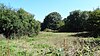
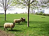
Ingrebourne Valley is a local nature reserve (LNR) in Hornchurch in the London Borough of Havering. It is owned and managed by Havering Council, and has a visitor centre managed by the Essex Wildlife Trust. Most of it is in Hornchurch Country Park west of the River Ingrebourne, but there are also areas north and south of the park which are part of the LNR. It has a wide range of habitats, including woodland, grassland, the river and marshes. It is an important site for a range of species of plants, animals and birds, including great crested newts, slow worms, the harvest mouse and the water vole.

<span class="mw-page-title-main">London Wildlife Trust</span> English nature conservation charity

London Wildlife Trust (LWT), founded in 1981, is a local nature conservation charity for Greater London. It is one of 46 members of the Royal Society of Wildlife Trusts, each of which is a local nature conservation charity for its area. The Trust aims to protect London's wildlife and wild spaces, and it manages 36 nature reserves in Greater London. The Trust provides education services for schools. Local groups work on reserves and organise walks.

<span class="mw-page-title-main">Totteridge Fields</span>

Totteridge Fields is a 97-hectare Site of Metropolitan Importance for Nature Conservation (SINC) in Totteridge in the London Borough of Barnet. The SINC includes the privately owned Highwood Hill, and at the western end is a seven-hectare Local Nature Reserve owned by Barnet Council and managed by the London Wildlife Trust.

<span class="mw-page-title-main">Coppetts Wood and Scrublands</span> Nature reserve in the London Borough of Barnet

Coppetts Wood and Scrublands is a 14.5-hectare (36-acre) Site of Borough Importance for Nature Conservation, Grade I, between Muswell Hill and Friern Barnet in the London Borough of Barnet. It is part of the Coppetts Wood and Glebelands Local Nature Reserve.

<span class="mw-page-title-main">Oak Hill Wood</span>

Oak Hill Wood is a 10-hectare Local Nature Reserve (LNR) and a Site of Borough Importance for Nature Conservation Grade I, in East Barnet, London. It is owned by the London Borough of Barnet, and part of it is a 5.5-hectare nature reserve managed by the London Wildlife Trust.

<span class="mw-page-title-main">Ainslie Wood, London</span>

Ainslie Wood is a 2.03 hectares Local Nature Reserve and a Grade I Site of Nature Conservation Interest surrounded by urban housing in Chingford in the London Borough of Waltham Forest in England. It is owned by Waltham Forest Borough Council and operated by the council with Friends of Ainslie and Larks Woods.

<span class="mw-page-title-main">Cranham Marsh</span>

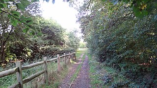
Cranham Marsh is a 15.3 hectare Local Nature Reserve and a Site of Metropolitan Importance for Nature Conservation in Cranham in the London Borough of Havering. It is owned by Havering Council and managed by the Essex Wildlife Trust.

<span class="mw-page-title-main">Beam Valley Country Park</span>

Beam Valley Country Park is a 74-hectare park in Dagenham in the London Borough of Barking and Dagenham. Most of it is designated as a Local Nature Reserve (LNR) called Beam Valley, but a narrow strip next to the River Beam south from Western Avenue is a separate LNR called Beam Valley. The park is also designated as two Sites of Borough Importance for Nature Conservation, Grade 1, one north and the other south of South Dagenham Road.

<span class="mw-page-title-main">Jubilee Wood, Malden Rushett</span> Natural area in the UK

Jubilee Wood is located in Malden Rushett in the Royal Borough of Kingston upon Thames in London. It is divided into two parts, separated by an electricity sub-station. They are part of the 22 hectare 'Sixty Acre Wood and Jubilee Wood' Site of Metropolitan Importance for Nature Conservation, and the two hectare eastern wood, which is the only part which is publicly accessible, is also a Local Nature Reserve.

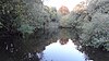
Hogsmill River Park or Hogsmill Valley is a linear park along the banks of the Hogsmill River in the Royal Borough of Kingston upon Thames in London. It stretches from the junction of Surbiton Hill Park and Elmbridge Avenue in Berrylands in the north to the junction between the river and a footpath to Manor Close in Old Malden in the south.

<span class="mw-page-title-main">Southwood Open Space</span>

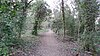
Southwood Open Space is a 12.9 hectare Local Nature Reserve (LNR) in Old Malden in the Royal Borough of Kingston upon Thames in London. It is a linear park along the Hogsmill River between the Kingston Bypass opposite Elmbridge Avenue and the junction between the Hogsmill and a footpath to Manor Drive North.

<span class="mw-page-title-main">Fox Wood</span>

Fox Wood is a 2.25 hectare Local Nature Reserve and Site of Borough Importance for Nature Conservation, Grade 1, in Ealing in the London Borough of Ealing. It is owned and managed by Ealing Council.

<span class="mw-page-title-main">Gutteridge Wood and Meadows</span>

Gutteridge Wood and Meadows is a Local Nature Reserve (LNR) in Yeading in the London Borough of Hillingdon, which is owned by Hillingdon Council and managed by the London Wildlife Trust (LWT). It is also part of the Yeading Brook Meadows Site of Metropolitan Importance for Nature Conservation, which includes two neighbouring reserves managed by the LWT, Ten Acre Wood and Yeading Brook Meadows LNRs.

<span class="mw-page-title-main">Ten Acre Wood</span>

Ten Acre Wood is a Local Nature Reserve (LNR) in Yeading in the London Borough of Hillingdon, which is owned by Hillingdon Council and managed by the London Wildlife Trust (LWT). It is also part of the Yeading Brook Meadows Site of Metropolitan Importance for Nature Conservation (SINC), which includes two neighbouring LNRs managed by the LWT, Gutteridge Wood and Meadows and Yeading Brook Meadows LNR.

References

  1. Watson, Jo (25 July 2009). "Access to Nature Regional Targeting Plan - LONDON" (PDF). Natural England. Archived from the original (PDF) on 14 July 2014. Retrieved 13 July 2014.
  2. "London". Natural England. Archived from the original on January 12, 2008. Retrieved 28 May 2014.{{cite web}}: CS1 maint: unfit URL (link)
  3. "2011 Census first results: London boroughs' populations by age by sex" (PDF). Greater London Authority. July 2012. Archived from the original (PDF) on 21 October 2014. Retrieved 6 June 2014.
  4. "Why declare Local Nature Reserves?". Natural England. Archived from the original on 30 August 2014. Retrieved 28 May 2014.
  5. "How are Local Nature Reserves declared?". Natural England. Archived from the original on 19 July 2014. Retrieved 28 May 2014.
  6. 1 2 3 "Local Nature Reserves: Search Results for Greater London". Natural England. Retrieved 14 August 2024.
  7. "Brent Reservoir citation" (PDF). Sites of Special Scientific Interest. Natural England. Archived (PDF) from the original on 24 September 2015. Retrieved 23 July 2014.
  8. 1 2 "Burnt Ash Pond". London Borough of Lewisham. Archived from the original on 10 June 2015. Retrieved 30 May 2014.
  9. 1 2 "Parkland Walk Local Nature Reserve". London Parks and Gardens Trust. Archived from the original on 19 October 2013. Retrieved 6 June 2014.
  10. Hall, Rae; Pedley, Andy. "The Selborne Society and Perivale Wood". London Parks Trust. Archived from the original on 6 June 2014. Retrieved 23 July 2014.
  11. "Coldfall Wood". Local Nature Reserves. Natural England. 20 March 2014. Archived from the original on 13 April 2014. Retrieved 23 July 2014.
  12. 1 2 "Alexandra Palace & Park". Local Nature Reserves. Natural England. 20 March 2014. Archived from the original on 13 April 2014. Retrieved 29 May 2014.
  13. "Masons Field". Local Nature Reserves. Natural England. 10 March 2015. Archived from the original on 4 March 2016. Retrieved 21 April 2015.
  14. "Find a nature reserve". London Wildlife Trust. Archived from the original on 23 July 2014. Retrieved 23 July 2014.
  15. "Abney Park Cemetery". London Parks and Gardens Trust. Archived from the original on 19 November 2013. Retrieved 29 May 2014.
  16. "Tower Hamlets Cemetery Park & Ackroyd Drive Green Link Nature Reserve". London Borough of Tower Hamlets. Archived from the original on 19 May 2014. Retrieved 29 May 2014.
  17. "Chalk Farm Embankment and Adelaide Nature Reserve". Greenspace Information for Greater London. 2013. Archived from the original on 18 December 2014. Retrieved 28 May 2014.
  18. "Chalk Farm Embankment and Adelaide Nature Reserve". Greenspace Information for Greater London. 2013. Archived from the original on 18 December 2014. Retrieved 29 May 2014.
  19. "Ainslie Wood". London Gardens Online. Archived from the original on 19 October 2013. Retrieved 29 May 2014.
  20. "Anton Crescent Wetland LNR". London Borough of Sutton. Archived from the original on 19 October 2013. Retrieved 29 May 2014.
  21. "Barnes Common". London Parks and Gardens Trust. Archived from the original on 19 October 2013. Retrieved 30 May 2014.
  22. "Barnsbury Wood". London Parks and Gardens Trust. Archived from the original on 19 October 2013. Retrieved 30 May 2014.
  23. "Battersea Park Nature Areas". Local Nature Reserves. Natural England. 1 March 2012. Archived from the original on 19 October 2013. Retrieved 30 May 2014.
  24. "Beam Valley". Local Nature Reserves. Natural England. 1 March 2013. Archived from the original on 19 October 2013. Retrieved 30 May 2014.
  25. "Beam Valley (Environment Agency)". Local Nature Reserves. Natural England. 1 March 2013. Archived from the original on 19 October 2013. Retrieved 30 May 2014.
  26. "Beckenham Place Park". Local Nature Reserves. Natural England. 1 March 2013. Archived from the original on 3 March 2016. Retrieved 30 May 2014.
  27. "Bedfont Lakes Country Park". London Parks and Gardens Trust. Archived from the original on 19 October 2013. Retrieved 30 May 2014.
  28. "Bedfords Park". Greenspace Information for Greater London. 2013. Archived from the original on 21 February 2014. Retrieved 28 May 2014.
  29. "iGiGL data portal (map)". Greenspace Information for Greater London. Archived from the original on 14 January 2014. Retrieved 2 February 2014.
  30. "Bedfords Park Visitor Centre". Essex Wildlife Trust. Archived from the original on 17 April 2016. Retrieved 19 May 2016.
  31. "Bedford's Park". Local Nature Reserves. Natural England. 18 December 2013. Archived from the original on 21 February 2014. Retrieved 30 May 2014.
  32. "Belmont Pastures". Local Nature Reserves. Natural England. 1 March 2013. Archived from the original on 19 October 2013. Retrieved 30 May 2014.
  33. "Belsize Wood". Local Nature Reserves. Natural England. 1 March 2013. Archived from the original on 19 October 2013. Retrieved 30 May 2014.
  34. "Belsize Wood Nature Reserve and Russell Nurseries". London Parks and Gardens Trust. Archived from the original on 19 October 2013. Retrieved 30 May 2014.
  35. 1 2 "Nature reserves". London Borough of Merton. Archived from the original on 2 May 2014. Retrieved 30 May 2014.
  36. "Bentley Priory citation" (PDF). Sites of Special Scientific Interest. Natural England. Archived from the original (PDF) on 24 October 2012. Retrieved 1 July 2016.
  37. "Bentley Priory". Local Nature Reserves. Natural England. 1 March 2013. Archived from the original on 19 October 2013. Retrieved 30 May 2014.
  38. "Big Wood & Little Wood". Local Nature Reserves. Natural England. 1 March 2013. Archived from the original on 19 October 2013. Retrieved 30 May 2014.
  39. "Blondin Park and Blondin Nature Area". London Parks and Gardens Trust. Archived from the original on 19 October 2013. Retrieved 30 May 2014.
  40. 1 2 "Castle Hill and Bonesgate Open Space". Greenspace Information for Greater London. 2013. Archived from the original on 22 October 2013. Retrieved 30 May 2014.
  41. 1 2 "Bramley Bank". London Wildlife Trust. Archived from the original on 13 March 2014. Retrieved 30 May 2014.
  42. "Brent Reservoir citation" (PDF). Sites of Special Scientific Interest. Natural England. Archived (PDF) from the original on 24 September 2015. Retrieved 1 July 2016.
  43. "Welsh Harp or Brent Reservoir". London Parks and Gardens Trust. Archived from the original on 19 October 2013. Retrieved 30 May 2014.
  44. "Brookmill Nature Reserve". London Borough of Lewisham. Archived from the original on 30 July 2013. Retrieved 30 May 2014.
  45. 1 2 "Camley Street Natural Park". London Wildlife Trust. Archived from the original on 9 June 2014. Retrieved 30 May 2014.
  46. "Cannon Hill Common". Local Nature Reserves. Natural England. 1 March 2013. Archived from the original on 19 October 2013. Retrieved 30 May 2014.
  47. "Castle Hill earthwork, Chessington". Historic England. Archived from the original on 11 August 2016. Retrieved 5 July 2016.
  48. "The Chase - Barking". Local Nature Reserves. Natural England. 7 March 2013. Archived from the original on 19 October 2013. Retrieved 4 June 2014.
  49. "The Chase - Havering". Local Nature Reserves. Natural England. 7 March 2013. Archived from the original on 28 September 2013.
  50. "Cherry Wood". Local Nature Reserves. Natural England. 1 March 2013. Archived from the original on 19 October 2013. Retrieved 30 May 2014.
  51. "Chiswick Eyot". Thames Wilderness. Archived from the original on 19 October 2013. Retrieved 30 May 2014.
  52. "Coldfall Wood". Greenspace Information for Greater London. 2013. Archived from the original on 13 April 2014. Retrieved 31 May 2014.
  53. "Coombe Hill Wood". Surrey County. Archived from the original on 19 October 2013. Retrieved 31 May 2014.
  54. "Coppett's Wood and Scrublands Local Nature Reserve". Greenspace Information for Greater London. 2013. Archived from the original on 22 October 2013. Retrieved 31 May 2014.
  55. "Coppetts Wood and Glebelands". Local Nature Reserves. Natural England. 4 March 2013. Archived from the original on 19 October 2013. Retrieved 31 May 2014.
  56. "Covert Way". Local Nature Reserves. Natural England. 4 March 2013. Archived from the original on 19 October 2013. Retrieved 31 May 2014.
  57. "Crane Park Island". London Wildlife Trust. Archived from the original on 4 April 2016. Retrieved 5 July 2016.
  58. "Crane Park Island". Local Nature Reserves. Natural England. 4 March 2013. Archived from the original on 28 September 2013. Retrieved 31 May 2014.
  59. "Cranebank, Hatton". Local Nature Reserves. Natural England. 4 March 2013. Archived from the original on 19 October 2013. Retrieved 31 May 2014.
  60. "Cranham Brickfields". Local Nature Reserves. Natural England. 4 March 2013. Archived from the original on 19 October 2013. Retrieved 31 May 2014.
  61. "Cranham Marsh". Essex Wildlife Trust. Archived from the original on 11 June 2016. Retrieved 5 July 2016.
  62. "Cranham Marsh". London Parks and Gardens Trust. Archived from the original on 19 October 2013. Retrieved 31 May 2014.
  63. "Mitcham Greens (Fair Green, Three Kings Piece, Cranmer Green/Piece, Cricket Green, Lower Green, Vestry Hall Green)". London Parks and Gardens Trust. Archived from the original on 28 March 2014. Retrieved 31 May 2014.
  64. "Crossness". Local Nature Reserves. Natural England. 4 March 2013. Archived from the original on 19 October 2013. Retrieved 31 May 2014.
  65. "Cuddington Meadows". Local Nature Reserves. Natural England. 4 March 2013. Archived from the original on 19 October 2013. Retrieved 31 May 2014.
  66. "Dacres Wood Nature Reserve". London Parks and Gardens Trust. Archived from the original on 19 October 2013. Retrieved 31 May 2014.
  67. "Dagenham Village Churchyard". Local Nature Reserves. Natural England. 4 March 2013. Archived from the original on 19 October 2013. Retrieved 31 May 2014.
  68. "Danson Park Bog Garden, Welling". Local Nature Reserves. Natural England. 4 March 2013. Archived from the original on 19 October 2013. Retrieved 31 May 2014.
  69. "Denham Country Park". Local Nature Reserves. Natural England. 4 March 2013. Archived from the original on 19 October 2013. Retrieved 31 May 2014.
  70. "Derwent Road Flood Wash". Greenspace Information for Greater London. 2013. Archived from the original on 7 April 2014. Retrieved 31 May 2014.
  71. "Devonshire Avenue Nature Area". Local Nature Reserves. Natural England. 4 March 2013. Archived from the original on 19 October 2013. Retrieved 31 May 2014.
  72. "Downham Woodland Walk". Local Nature Reserves. Natural England. 4 March 2013. Archived from the original on 19 October 2013. Retrieved 1 June 2014.
  73. "Duke's Hollow". Greenspace Information for Greater London. 2013. Archived from the original on 17 May 2014. Retrieved 1 June 2014.
  74. "Dulwich Upper Wood". Local Nature Reserves. Natural England. 4 March 2013. Archived from the original on 19 October 2013. Retrieved 1 June 2014.
  75. "Eastbrookend Country Park". London Borough of Barking and Dagenham Council. Archived from the original on 19 October 2013. Retrieved 1 June 2014.
  76. Swales, Sue; et al. (1992). Nature Conservation in Kingston upon Thames. London Ecology Unit. p. 78. ISBN   1-871045-13-4.
  77. "Map of Hogsmill River Park". Local Nature Reserves. Natural England. Archived from the original on 19 October 2013. Retrieved 26 May 2014.
  78. 1 2 "Thames Down Link" (PDF). Surrey County Council. pp. 1–2. Archived from the original (PDF) on 25 May 2013. Retrieved 1 June 2014.
  79. "Beverley Meads and Fishponds Wood". London Wildlife Trust. Archived from the original on 2016-03-26. Retrieved 5 July 2016.
  80. "Fishpond Wood and Beverley Meads". Local Nature Reserves. Natural England. 4 March 2013. Archived from the original on 19 October 2013. Retrieved 1 June 2014.
  81. "Foots Cray Meadows". Local Nature Reserves. Natural England. 4 March 2013. Archived from the original on 19 October 2013. Retrieved 1 June 2014.
  82. "Hanger Hill Park, including Fox Wood". London Parks and Gardens Trust. Archived from the original on 19 October 2013. Retrieved 1 June 2014.
  83. "Foxley Wood". Local Nature Reserves. Natural England. 4 March 2013. Archived from the original on 19 October 2013. Retrieved 1 June 2014.
  84. "Frays Farm Meadows SSSI". London Wildlife Trust. Archived from the original on 31 March 2016. Retrieved 8 July 2016.
  85. "Map of Frays Farm Meadows". Sites of Special Scientific Interest. Natural England. Archived from the original on 20 October 2016. Retrieved 8 July 2016.
  86. "Frays Valley". Local Nature Reserves. Natural England. 4 March 2013. Archived from the original on 19 October 2013. Retrieved 1 June 2014.
  87. "Fryent Country Park". Local Nature Reserves. Natural England. 5 March 2013. Archived from the original on 19 October 2013. Retrieved 1 June 2014.
  88. "Gillespie Park". Local Nature Reserves. Natural England. 5 March 2013. Archived from the original on 19 October 2013. Retrieved 1 June 2014.
  89. "Greenford parks". London Borough of Ealing. Archived from the original on 19 October 2013. Retrieved 1 June 2014.
  90. 1 2 "Gunnersbury Triangle". London Wildlife Trust. Archived from the original on 31 May 2014. Retrieved 1 June 2014.
  91. "Hainault Lodge". Local Nature Reserves. Natural England. 5 March 2013. Archived from the original on 19 October 2013. Retrieved 2 June 2014.
  92. "Ham Common, Richmond". Local Nature Reserves. Natural England. 5 March 2013. Archived from the original on 19 October 2013. Retrieved 2 June 2014.
  93. "Ham Lands". Local Nature Reserves. Natural England. 5 March 2013. Archived from the original on 2 February 2014. Retrieved 2 June 2014.
  94. 1 2 "Downe Bank and High Elms citation" (PDF). Sites of Special Scientific Interest. Natural England. Archived (PDF) from the original on 24 September 2015. Retrieved 2 June 2014.
  95. "Hogsmill River Park". London Parks and Gardens Trust. Archived from the original on 19 October 2013. Retrieved 2 June 2014.
  96. "Hounslow Heath". Local Nature Reserves. Natural England. 5 March 2013. Archived from the original on 19 October 2013. Retrieved 2 June 2014.
  97. 1 2 "Hutchinson's Bank, Chapel Bank & Threecorner Grove". London Wildlife Trust. Archived from the original on 14 March 2014. Retrieved 2 June 2014.
  98. "Ingrebourne Valley Visitor Centre". Essex Wildlife Trust. Archived from the original on 17 July 2016. Retrieved 12 July 2016.
  99. 1 2 "Ingrebourne Valley". Local Nature Reserves. Natural England. 25 March 2013. Archived from the original on 29 October 2013. Retrieved 12 July 2016.
  100. 1 2 "Isleworth Ait". London Wildlife Trust. Archived from the original on 4 October 2016. Retrieved 12 July 2016.
  101. "Islip Manor Meadows". London Borough of Ealing. Archived from the original on 19 October 2013. Retrieved 2 June 2014.
  102. "Jubilee Country Park". Local Nature Reserves. Natural England. 5 March 2013. Archived from the original on 19 October 2013. Retrieved 2 June 2014.
  103. "Map Tools". Royal Borough of Kingston upon Thames. Archived from the original on 2 May 2014. Retrieved 28 May 2014.
  104. "Jubilee Wood". Local Nature Reserves. Natural England. 5 March 2013. Archived from the original on 19 October 2013. Retrieved 3 June 2014.
  105. "Kempton Park Reservoirs citation" (PDF). Sites of Special Scientific Interest. Natural England. Archived from the original (PDF) on 24 October 2012. Retrieved 16 January 2016.
  106. "Kempton Nature Reserve". Thames Water. Archived from the original on 31 December 2013. Retrieved 3 June 2014.
  107. "Lavender Pond Nature Park". London Parks and Gardens Trust. Archived from the original on 19 October 2013. Retrieved 2 June 2014.
  108. "Abbey Wood citation" (PDF). Sites of Special Scientific Interest. Natural England. Archived from the original (PDF) on 24 October 2012. Retrieved 12 July 2016.
  109. "Lesnes Abbey Woods". Local Nature Reserves. Natural England. 24 March 2015. Archived from the original on 15 March 2016. Retrieved 12 July 2016.
  110. "Litten". Local Nature Reserves. Natural England. 5 March 2013. Archived from the original on 19 October 2013. Retrieved 2 June 2014.
  111. "Other parks in Southall". London Borough of Ealing. Archived from the original on 19 October 2013. Retrieved 2 June 2014.
  112. "Lonsdale Road Reservoir (Leg of Mutton Reservoir)". Local Nature Reserves. Natural England. 5 March 2013. Archived from the original on 19 October 2013. Retrieved 2 June 2014.
  113. "Lower Wandle". Local Nature Reserves. Natural England. 5 March 2013. Archived from the original on 19 October 2013. Retrieved 2 June 2014.
  114. "The Manor Nature Reserve". London Borough of Havering. Archived from the original on 10 April 2015. Retrieved 4 June 2014.
  115. "Gilbert's Pit (Charlton) citation" (PDF). Sites of Special Scientific Interest. Natural England. Archived from the original (PDF) on 3 March 2016. Retrieved 12 July 2016.
  116. "Maryon Wilson Park and Gilbert's Pit". Local Nature Reserves. Natural England. 6 March 2013. Archived from the original on 19 October 2013. Retrieved 2 June 2014.
  117. "Masons Field". Barn Hill Conservation Group. Archived from the original on 7 February 2016. Retrieved 23 April 2015.
  118. "Mayesbrook Park South". Local Nature Reserves. Natural England. 6 March 2013. Archived from the original on 19 October 2013. Retrieved 2 June 2014.
  119. "Merton Park Green Walks". Greenspace Information for Greater London. 2013. Archived from the original on 22 October 2013. Retrieved 2 June 2014.
  120. "Morden Park". Local Nature Reserves. Natural England. 6 March 2013. Archived from the original on 19 October 2013. Retrieved 2 June 2014.
  121. "Mudchute Farm and Park". Greenspace Information for Greater London. 2013. Archived from the original on 22 October 2013. Retrieved 2 June 2014.
  122. "Myrna Close Valley". Greenspace Information for Greater London. 2013. Archived from the original on 22 October 2013. Retrieved 3 June 2014.
  123. 1 2 "New Cross Gate Cutting". London Wildlife Trust. Archived from the original on 9 July 2014. Retrieved 27 March 2014.
  124. "Northolt Manor, moated site". Historic England. Archived from the original on 11 August 2016. Retrieved 12 July 2016.
  125. "Northolt Manor and Belvue Park". Greenspace Information for Greater London. 2013. Archived from the original on 22 October 2013. Retrieved 3 June 2014.
  126. "Nunhead Cemetery". London Parks and Gardens Trust. Archived from the original on 19 October 2013. Retrieved 3 June 2014.
  127. "Nunhead Cemetery". Local Nature Reserves. Natural England. 6 March 2013. Archived from the original on 19 October 2013. Retrieved 3 June 2014.
  128. "Oak Avenue Local Nature Reserve". Greenspace Information for Greater London. 2013. Archived from the original on 22 October 2013. Retrieved 3 June 2014.
  129. 1 2 "Oak Hill Wood". London Wildlife Trust. Archived from the original on 4 February 2014. Retrieved 3 June 2014.
  130. "Oakleigh Way Nature Area". Greenspace Information for Greater London. 2013. Archived from the original on 22 October 2013. Retrieved 3 June 2014.
  131. "One Tree Hill". Local Nature Reserves. Natural England. 6 March 2013. Archived from the original on 19 October 2013. Retrieved 3 June 2014.
  132. "Oxleas Woodlands citation" (PDF). Sites of Special Scientific Interest. Natural England. Archived (PDF) from the original on 24 October 2012. Retrieved 14 November 2013.
  133. "Oxleas/Shooters Hill Woodlands". Local Nature Reserves. Natural England. 6 March 2013. Archived from the original on 19 October 2013. Retrieved 3 June 2014.
  134. "Parkland Walk". Local Nature Reserves. Natural England. 6 March 2013. Archived from the original on 19 October 2013. Retrieved 6 June 2014.
  135. "Parsloes Park Squatts". Local Nature Reserves. Natural England. 6 March 2013. Archived from the original on 19 October 2013. Retrieved 3 June 2014.
  136. "Perivale Wood Local Nature Reserve". Greenspace Information for Greater London. 2013. Archived from the original on 22 October 2013. Retrieved 6 June 2014.
  137. "Pevensey Road". Local Nature Reserves. Natural England. 6 March 2013. Archived from the original on 19 October 2013. Retrieved 3 June 2014.
  138. "Pyl Brook". Local Nature Reserves. Natural England. 6 March 2013. Archived from the original on 19 October 2013. Retrieved 3 June 2014.
  139. "Queen's Wood". Local Nature Reserves. Natural England. 6 March 2013. Archived from the original on 19 October 2013. Retrieved 3 June 2014.
  140. "Raeburn Open Space". Greenspace Information for Greater London. 2013. Archived from the original on 22 October 2013. Retrieved 3 June 2014.
  141. "Railway Fields Local Nature Reserve | Haringey Council".
  142. "Railway Fields Local Nature Reserve". London Borough of Haringey. Archived from the original on 1 July 2014. Retrieved 3 June 2014.
  143. "Rainham Marshes". Royal Society for the Protection of Birds. Archived from the original on 4 July 2016. Retrieved 12 July 2016.
  144. "Inner Thames Marshes citation" (PDF). Sites of Special Scientific Interest. Natural England. Archived from the original (PDF) on 4 March 2016. Retrieved 12 July 2016.
  145. "Rainham Marshes". Local Nature Reserves. Natural England. 6 March 2013. Archived from the original on 19 October 2013. Retrieved 3 June 2014.
  146. "Ravensbury Park". Local Nature Reserves. Natural England. 6 March 2013. Archived from the original on 19 October 2013. Retrieved 3 June 2014.
  147. "The Ripple Nature Reserve". Greenspace Information for Greater London. 2013. Archived from the original on 25 December 2014. Retrieved 3 June 2014.
  148. Swales, Sue; et al. (1992). Nature Conservation in Kingston upon Thames. London Ecology Unit. p. 43. ISBN   1-871045-13-4.
  149. "Roundshaw Downs". Local Nature Reserves. Natural England. 7 March 2013. Archived from the original on 19 October 2013. Retrieved 3 June 2014.
  150. "Rowley Green Common". London Parks and Gardens Trust. Archived from the original on 19 October 2013. Retrieved 3 June 2014.
  151. "Ruffett, Big Wood and adjacent meadow". Greenspace Information for Greater London. 2013. Archived from the original on 22 October 2013. Retrieved 3 June 2014.
  152. "Ruislip Woods National Nature Reserve Management Plan 2003-2008" (PDF). London Borough of Hillingdon. pp. 7, 94, 154. Archived from the original (PDF) on 3 June 2012. Retrieved 27 May 2014.
  153. "London's National Nature Reserves". Natural England. Archived from the original on 17 September 2016. Retrieved 12 July 2016.
  154. "Ruislip Woods citation" (PDF). Sites of Special Scientific Interest. Natural England. Archived (PDF) from the original on 3 March 2016. Retrieved 12 July 2016.
  155. "Ruislip (now part of the NNR)". Local Nature Reserves. Natural England. 7 March 2013. Archived from the original on 19 October 2013. Retrieved 3 June 2014.
  156. "Scadbury Park, St Paul's Cray Common, Pett's Wood & Hawkwood Estate". Greenspace Information for Greater London. 2013. Archived from the original on 7 June 2014. Retrieved 4 June 2014.
  157. "Scratchwood and Moat Mount Open Spaces". Local Nature Reserves. Natural England. 7 March 2013. Archived from the original on 19 October 2013. Retrieved 4 June 2014.
  158. "Scrattons Farm Eco Park". London Borough of Barking and Dagenham. Archived from the original on 19 October 2013. Retrieved 4 June 2014.
  159. "Selsdon Wood Nature Reserve". London Parks and Gardens Trust. Archived from the original on 19 October 2013. Retrieved 3 June 2014.
  160. "Sir Joseph Hood Memorial Wood". Local Nature Reserves. Natural England. 7 March 2013. Archived from the original on 19 October 2013. Retrieved 3 June 2014.
  161. "South Norwood Country Park". Local Nature Reserves. Natural England. 7 March 2013. Archived from the original on 19 October 2013. Retrieved 3 June 2014.
  162. 1 2 "Spencer Road Wetlands". London Wildlife Trust. Archived from the original on 27 March 2014. Retrieved 3 June 2014.
  163. "The Spinney LNR". London Borough of Sutton. Archived from the original on 19 October 2013. Retrieved 4 June 2014.
  164. "Wild about Springfield Park" (PDF). London Borough of Hackney. Archived from the original (PDF) on 19 March 2013. Retrieved 3 June 2014.
  165. "St John's Wood Church Grounds". London Parks and Gardens Trust. Archived from the original on 19 October 2013. Retrieved 3 June 2014.
  166. "Stanmore Common". Local Nature Reserves. Natural England. 7 March 2013. Archived from the original on 19 October 2013. Retrieved 4 June 2014.
  167. "Stanmore Country Park". Local Nature Reserves. Natural England. 7 March 2013. Archived from the original on 19 October 2013. Retrieved 4 June 2014.
  168. "Streatham Common and The Rookery". Greenspace Information for Greater London. 2013. Archived from the original on 7 June 2014. Retrieved 4 June 2014.
  169. "Sue Godfrey Nature Park". London Borough of Lewisham. Archived from the original on 29 September 2014. Retrieved 4 June 2014.
  170. "Sutcliffe Park Flood Alleviation Scheme". Greenspace Information for Greater London. 2013. Archived from the original on 21 February 2014. Retrieved 4 June 2014.
  171. "Sutton Ecology Centre". Greenspace Information for Greater London. 2013. Archived from the original on 29 March 2014. Retrieved 4 June 2014.
  172. "Sydenham Hill Wood and Fern Bank". Local Nature Reserves. Natural England. 7 March 2013. Archived from the original on 19 October 2013. Retrieved 4 June 2014.
  173. 1 2 "Ten Acre Wood". London Wildlife Trust. Archived from the original on 12 May 2014. Retrieved 4 June 2014.
  174. "Tolworth Court Farm". Woodland Environmental. Archived from the original on 1 February 2016. Retrieved 24 January 2016.
  175. "Hogsmill / Watersedge River Development: Draft Feasibility Report". Halcrow Group Ltd. April 2003. Archived from the original on 31 January 2016. Retrieved 24 January 2016.
  176. 1 2 "Totteridge Fields". London Wildlife Trust. Archived from the original on 29 May 2014. Retrieved 5 June 2014.
  177. "Tower Hamlets Cemetery Park". Local Nature Reserves. Natural England. 31 July 2013. Archived from the original on 19 October 2013. Retrieved 7 June 2014.
  178. "Wandle Meadow Nature Park and the Lower River Wandle". Greenspace Information for Greater London. 2013. Archived from the original on 21 December 2013. Retrieved 7 June 2014.
  179. "Wandle Valley Wetland LNR". London Borough of Sutton. Archived from the original on 19 October 2013. Retrieved 7 June 2014.
  180. "West Hampstead Railsides, Medley Orchard and Westbere Copse". Greenspace Information for Greater London. 2013. Archived from the original on 21 December 2014. Retrieved 7 June 2014.
  181. 1 2 "Wilderness Island". London Wildlife Trust. Archived from the original on 27 March 2014. Retrieved 7 June 2014.
  182. "The Wood and Richard Jefferies Bird Sanctuary". Local Nature Reserves. Natural England. Archived from the original on 19 October 2013. Retrieved 3 June 2014.
  183. "Wormwood Scrubs Park". Greenspace Information for Greater London. 2013. Archived from the original on 7 June 2014. Retrieved 7 June 2014.
  184. "Yeading Brook Meadows". London Wildlife Trust. Archived from the original on 24 May 2014. Retrieved 7 June 2014.
  185. "Yeading Brook Meadows". London Wildlife Trust. Archived from the original on 24 May 2014. Retrieved 26 May 2014.
  186. 1 2 "Gutteridge Wood". London Wildlife Trust. Archived from the original on 25 May 2014. Retrieved 7 June 2014.