Sites
| Site | Photograph | Area [lower-alpha 1] | Location [lower-alpha 2] | District | Other | Map [lower-alpha 3] and details [lower-alpha 1] | Description |
|---|---|---|---|---|---|---|---|
| Abbey Fishponds | 5.6 hectares (14 acres) | Abingdon 51°40′41″N1°15′43″W / 51.678°N 1.262°W SU 511 980 | Vale of White Horse | Map and Details | |||
| Adderbury Lakes |  | 1.8 hectares (4.4 acres) | Adderbury 52°00′58″N1°18′22″W / 52.016°N 1.306°W SP 477 355 | Cherwell | Map and Details | The lakes were created by Capability Brown in about 1768 as part of the landscaping of the grounds of Adderbury House. [4] The reserve also includes woodland around the lakes and there is diverse wildlife. [5] | |
| Bure Park | 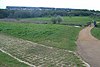 | 8.4 hectares (21 acres) | Bicester 51°54′32″N1°09′40″W / 51.909°N 1.161°W SP 578 237 | Cherwell | Map and Details | The River Bure runs through the park and supplies water to a pond which has great crested newts. Habitats include grassland, scrub, broadleaved woodland and hedges. [6] | |
| Crecy Hill |  | 0.8 hectares (2.0 acres) | Tackley 51°53′13″N1°13′48″W / 51.887°N 1.230°W SP 483 212 | West Oxfordshire | Map and Details | This steeply sloping limestone bank has a calcareous grassland habitat. More than 100 wild flower species and 15 grasses have been recorded. There are also more than 100 insect species, including 20 butterflies such as the small blue. [7] | |
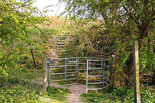
| Cuttle Brook |  | 13.0 hectares (32 acres) | Thame 51°44′42″N0°59′10″W / 51.745°N 0.986°W SP 701 056 | South Oxfordshire | Map and Details | There are seven entrances to this site close to Thame town centre. It has diverse habitats, including the brook and its banks, scrub, woodland, meadows, reed beds, hedges and sedge beds. [8] | |
| Ewelme Watercress Beds |  | 2.6 hectares (6.4 acres) | Wallingford 51°37′16″N1°04′41″W / 51.621°N 1.078°W SU 639 917 | South Oxfordshire | Map and Details | A stream runs through these former watercress beds, fed by a spring. [9] Wildlife includes water voles, together with diverse invertebrates and plants. [10] | |
| Kirtlington Quarry |  | 7.4 hectares (18 acres) | Kirtlington 51°52′30″N1°17′06″W / 51.875°N 1.285°W SP 493 198 | Cherwell | GCR, [11] [12] SSSI [13] | Map and Details | Britain has the only five Middle Jurassic mammal sites in the world, and this disused quarry has yielded the richest and most diverse assemblage. It dates to the Upper Bathonian, around 150 million years ago. There are nine therian and prototherians species, together with a tritylodontid. There are also fossils of theropod dinosaurs, crocodilians, pterosaurs, fishes and many shark teeth. [14] |
| Lye Valley |  | 4.5 hectares (11 acres) | Headington 51°44′53″N1°12′32″W / 51.748°N 1.209°W SP 547 058 | Oxford | SSSI [15] | Map and Details | This a calcareous valley fen, which is a nationally rare and threatened habitat. It is drained by the Lye Brook. There is a variety of moss species, such as Drepanocladus revolvens and Campylium stellatum . Invertebrates include the nationally rare soldier fly, Vanoyia tenuicornis and the uncommon spiders, Xysticus ulmi and Anistea elegans . [16] |
| Magdalen Quarry | 0.4 hectares (0.99 acres) | Oxford 51°45′36″N1°12′11″W / 51.760°N 1.203°W SP 551 071 | Oxford | GCR, [17] SSSI [18] | Map and Details | ||
| Mowbray Fields | 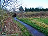 | 2.2 hectares (5.4 acres) | Didcot 51°35′42″N1°14′46″W / 51.595°N 1.246°W SU 523 887 | South Oxfordshire | Map and Details | This nature reserve next to the Hagbourne Brook has a wildflower meadow, a disused railway embankment, a pond and wetland. There are many common spotted and southern marsh orchids, and more than 200 species of invertebrates have been recorded. [19] | |
| Rock Edge | 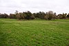 | 1.8 hectares (4.4 acres) | Oxford 51°45′14″N1°12′22″W / 51.754°N 1.206°W SP 549 064 | Oxford | GCR, [20] SSSI [21] | Map and Details | This site exposes limestone rich in coral called Coral rag, laid down when the area was under a warm, shallow sea, similar to the Bahama Banks today. It is rich in fossils derived from the coral reefs. It dates to the Upper Jurassic, around 145 million years ago. [22] |
| Saltway |  | 2.0 hectares (4.9 acres) | Chipping Norton 51°52′23″N1°26′38″W / 51.873°N 1.444°W SP 384 195 | West Oxfordshire | SSSI [23] | Map and Details | This is a stretch of an ancient track together with its species-rich grass verges and hedges. It has been designated an SSSI because it has the largest known British colony of the very rare downy woundwort, with more than 100 seedlings and 60 flowering stems. The plant is associated with hedges along Roman roads and ancient tracks on calcareous soils, and Salt Way may date to the Roman period. [24] |
| The Slade | 2.1 hectares (5.2 acres) | Bloxham 52°00′54″N1°23′17″W / 52.015°N 1.388°W SP 421 354 | Cherwell | Map and Details | |||
| Tuckmill Meadows | 5.7 hectares (14 acres) | Shrivenham 51°36′25″N1°39′22″W / 51.607°N 1.656°W SU 239 899 | Vale of White Horse | SSSI [25] | Map and Details | ||
| Watlington Chalk Pit | 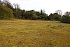 | 1.6 hectares (4.0 acres) | Watlington 51°38′24″N0°59′28″W / 51.640°N 0.991°W SU 699 940 | South Oxfordshire | SSSI [26] | Map and Details | This site has floristically rich chalk grassland and scrub. There are many lichens, mosses and liverworts, and twenty species of butterfly have been recorded. Wintering birds include fieldfares, redwings, yellowhammer and linnets. [27] |