List of local nature reserves in Hampshire

Last updated

Fleet Pond F08 Hemelite Aug.JPG
Fleet Pond

Local nature reserves (LNRs) in England are designated by local authorities under Section 21 of the National Parks and Access to the Countryside Act 1949. [1] LNRs are sites which have a special local interest either biologically or geologically. Local authorities have a duty to care for them, and must control the sites by owning or leasing them, or by having an agreement with the owners. The local authorities can apply local byelaws to manage and protect LNRs. [2]

Contents

As of April 2020, there are 65 LNRs in Hampshire, [3] of which 28 are Sites of Special Scientific Interest, 15 are Ramsar sites, 15 are Special Areas of Conservation, 16 are Special Protection Areas and one is a national nature reserve and one is a Nature Conservation Review site. Two sites are managed by the Hampshire and Isle of Wight Wildlife Trust.

Key

Map all coordinates using: OpenStreetMap  
Download coordinates as: KML

Other designations and wildlife trust management

Sites

SitePhotographArea [lower-alpha 1] Location [lower-alpha 2] BoroughOtherMap [lower-alpha 3] and
details [lower-alpha 4]
Description
Anton Lakes Charlton - Anton Lakes - geograph.org.uk - 890085.jpg 33.1 hectares
(82 acres)
Andover
51°13′12″N1°29′10″W / 51.220°N 1.486°W / 51.220; -1.486 (Anton Lakes)
SU 360 469
Test Valley Map

Details

The River Anton rises in the site and flows through former watercress beds into the lakes, which were created by gravel extraction. Another habitat is chalk grassland, which has butterflies such as marbled white and gatekeeper. There is also an area of wet meadow, and mammals include otters and water voles. [4]
Berry Coppice 3.0 hectares
(7.4 acres)
Winchester
50°52′16″N1°13′52″W / 50.871°N 1.231°W / 50.871; -1.231 (Berry Coppice)
SU 542 082
Winchester Map

Details

Bishops Waltham Branch Remains of Bishop's Waltham to Botley branch railway line - geograph.org.uk - 842720.jpg 1.6 hectares
(4.0 acres)
Bishop's Waltham
50°57′00″N1°13′23″W / 50.950°N 1.223°W / 50.950; -1.223 (Bishops Waltham Branch)
SU 547 170
Winchester Map

Details

This site is a 1 kilometre (0.62 miles) footpath along the former railway line from Bishop's Waltham to Botley. The path is lined by trees such as oaks and field maples, and flowering plants including wood avens and herb robert. [5]
Boldre Foreshore Boldre Foreshore, swans - geograph.org.uk - 1387677.jpg 193.3 hectares
(478 acres)
Boldre
50°45′07″N1°29′49″W / 50.752°N 1.497°W / 50.752; -1.497 (Boldre Foreshore)
SZ 356 948
New Forest HIWWT, [6] Ramsar, [7] SAC, [8] SPA, [9] SSSI [10] Map

Details

This large site has a vartiety of habitats, including saltmarsh, shingle, grassland, fresh and brackish pools and mudflats. It has breeding populations of gulls, terns and waders, together with many wintering waders and wildfowl. [11]
Brook Meadow (Emsworth) Emsworth, footpath (geograph 6189873).jpg 3.9 hectares
(9.6 acres)
Emsworth
50°50′56″N0°56′10″W / 50.849°N 0.936°W / 50.849; -0.936 (Brook Meadow (Emsworth))
SU 750 060
Havant Map

Details

Most of this site is grassland, which is surrounded by woodland and flanked by two streams. The diverse wildlife includes water voles. [12]
Broxhead Common, Bordon Broxhead Common - geograph.org.uk - 1411608.jpg 41.8 hectares
(103 acres)
Bordon
51°07′55″N0°50′56″W / 51.132°N 0.849°W / 51.132; -0.849 (Broxhead Common, Bordon)
SU 806 376
East Hampshire SPA, [13] SSSI [14] Map

Details

The common has dry heath and birch and oak woodland. Woodlarks and nightjars, which are rare and protected birds, breed on the site, and there is also a population of the nationally rare sand lizard. [15] [16]
Buriton Chalk Pit Buriton Chalk Pit 08.jpg 5.7 hectares
(14 acres)
Buriton
50°58′23″N0°57′18″W / 50.973°N 0.955°W / 50.973; -0.955 (Buriton Chalk Pit)
SU 735 198
East Hampshire Map

Details

This former chalk quarry was worked up to the end of World War II and it still has large heaps of spoil. It has gradually developed into a rich habitat with chalk loving plants. Many paths follow the routes of narrow gauge railway lines which were used to move chalk and lime. [17] [18]
Calshot Marshes Calshot Marshes nature reserve - geograph.org.uk - 306989.jpg 51.1 hectares
(126 acres)
Southampton
50°49′05″N1°18′58″W / 50.818°N 1.316°W / 50.818; -1.316 (Calshot Marshes)
SU 483 023
Southampton Ramsar, [7] SAC, [8] SPA, [9] SSSI [19] Map

Details

This saltmarsh site is internationally important for dark-bellied brent geese and nationally important for wigeon, teal, ringed plover, grey plover, black-tailed godwit, redshank and dunlin. [20]
Catherington Down Frost on the ground at Catherington Down - geograph.org.uk - 1098264.jpg 12.8 hectares
(32 acres)
Horndean
50°55′26″N1°01′05″W / 50.924°N 1.018°W / 50.924; -1.018 (Catherington Down, Horndean)
SU 691 143
East Hampshire SSSI [21] Map

Details

This western sloping site is chalk grassland with prominent lynchet strips dating to the Middle Ages. It is managed by grazing and has a variety of chalk herbs, such as pyramidal orchid, round-headed rampion and autumn lady's-tresses. There is also a narrow belt of woodland. [22]
Catherington Lith, Horndean 9.2 hectares
(23 acres)
Horndean
50°55′19″N1°00′14″W / 50.922°N 1.004°W / 50.922; -1.004 (Catherington Lith, Horndean)
SU 701 141
East Hampshire Map

Details

Chessel Bay Chessel Bay - geograph.org.uk - 320239.jpg 12.9 hectares
(32 acres)
Southampton
50°54′47″N1°22′34″W / 50.913°N 1.376°W / 50.913; -1.376 (Chessel Bay)
SU 440 128
Southampton Ramsar, [7] SPA, [9] SSSI [23] Map

Details

This is the last remaining stretch of undeveloped shoreline along the lower River Itchen. Most of it is mudflats, which provide feeding grounds for birds at low tide. There are also areas of saltmarsh, woodland and shingle. [24]
Chineham Woods 9.2 hectares
(23 acres)
Basingstoke
51°17′31″N1°03′32″W / 51.292°N 1.059°W / 51.292; -1.059 (Chineham Woods)
SU 657 552
Basingstoke and Deane Map

Details

Claylands Pond in Claylands Local Nature Reserve - geograph.org.uk - 841979.jpg 5.8 hectares
(14 acres)
Bishop's Waltham
50°57′32″N1°13′23″W / 50.959°N 1.223°W / 50.959; -1.223 (Claylands)
SU 547 180
Winchester Map

Details

This former clay working has woodland, ponds, meadows and scrub. The ponds have populations of great crested newts. [25] There are butterflies such as marbled white, common blue and green hairstreak. [26]
Crab Wood Bluebells in Crab Wood - geograph.org.uk - 628793.jpg 37.8 hectares
(93 acres)
Winchester
51°03′54″N1°22′41″W / 51.065°N 1.378°W / 51.065; -1.378 (Crab Wood)
SU 437 297
Winchester SSSI [27] Map

Details

This site has been wooded at least since the sixteenth century. It has a hazel layer which has been coppiced, large oaks and some beech, ash and birch trees. There is a rich butterfly fauna, including purple emperors. [28]
Danebury Hillfort Danebury Hill Fort entrance - panoramio.jpg 39.0 hectares
(96 acres)
Nether Wallop
51°08′13″N1°32′06″W / 51.137°N 1.535°W / 51.137; -1.535 (Danebury Hillfort)
SU 326 376
Test Valley SSSI [29] Map

Details

This Iron Age hillfort has been the subject of extensive research and excavation. It was occupied from the seventh to the first centuries BC, with many phases of development. [30] There are large beech around the perimeter. [31]
Daneshill Park Woods Path - Daneshill Parks Woods - geograph.org.uk - 863119.jpg 4.4 hectares
(11 acres)
Basingstoke
51°16′48″N1°03′32″W / 51.280°N 1.059°W / 51.280; -1.059 (Daneshill Park Woods)
SU 657 538
Basingstoke and Deane Map

Details

These woods have hazel coppice, an old orchard, scrub and a sunken lane. Ground flora include wood anemone, celandine and bluebells. [32]
Deadwater Valley Pond on Deadwater Valley LNR, Bordon, Hampshire - 170918 (geograph 5919327).jpg 35.9 hectares
(89 acres)
Bordon
51°06′25″N0°51′25″W / 51.107°N 0.857°W / 51.107; -0.857 (Deadwater Valley)
SU 801 348
East Hampshire SM [33] Map

Details

This site along the west bank of the River Deadwater has a pond, a meadow, wet and dry heath, alder carr and broadleaved and coniferous woodland. [34] There are Civil War earthworks in the south of the reserve. [33]
Dell Piece West 4.1 hectares
(10 acres)
Horndean
50°54′32″N1°00′22″W / 50.909°N 1.006°W / 50.909; -1.006 (Dell Piece West)
SU 700 126
East Hampshire Map

Details

Dundridge Meadows Dundridge Meadow - geograph.org.uk - 400724.jpg 7.5 hectares
(19 acres)
Bishop's Waltham
50°57′36″N1°12′00″W / 50.960°N 1.200°W / 50.960; -1.200 (Dundridge Meadows)
SU 563 181
Winchester Map

Details

These meadows are chalk grassland managed for hay. There are also two ponds, ancient woodlands and species-rich hedges. Flowering plants include cowslips and hayrattle. [35]
Elvetham Heath Elvetham Heath Nature Reserve - geograph.org.uk - 722746.jpg 20.0 hectares
(49 acres)
Fleet
51°17′42″N0°50′49″W / 51.295°N 0.847°W / 51.295; -0.847 (Elvetham Heath)
SU 805 557
Hart Map

Details

Typical heathland plants such as heather and gorse are regenerating naturally on the heath, and there are other habitats such as reedbeds and wet woodland, which has the rare plant bog myrtle. [36]
Farlington Marshes Farlington Marshes eastern side - geograph.org.uk - 422709.jpg 119.7 hectares
(296 acres)
Portsmouth
50°50′02″N1°01′44″W / 50.834°N 1.029°W / 50.834; -1.029 (Farlington Marshes)
SU 685 043
Portsmouth HIWWT [37] NCR, [38] Ramsar [39] SAC, [8] SPA, [40] SSSI [41] Map

Details

This area of flower-rich grazing marsh is internationally important for its bird population. Wintering wildfowl include dark bellied brent geese, wigeons, avocets, redshanks and dunlins. There are also spring and summer visitors such as Cetti's, reed and sedge warblers, skylarks and lapwings. [37] [42]
Fleet Pond Fleet Pond from Sandy Bay - geograph.org.uk - 714789.jpg 48.3 hectares
(119 acres)
Fleet
51°17′17″N0°49′26″W / 51.288°N 0.824°W / 51.288; -0.824 (Fleet Pond)
SU 821 550
Hart SSSI [43] Map

Details

This large and shallow lake is surrounded by reed beds, alder carr and oak and birch woodland. The lake has a rich aquatic flora and fauna, including large populations of reed warblers and other wetland birds. [44]
Gull Coppice 12.7 hectares
(31 acres)
Fareham
50°52′52″N1°15′18″W / 50.881°N 1.255°W / 50.881; -1.255 (Gull Coppice)
SU 525 093
Fareham Map

Details

Gutner Point View of Emsworth Channel from Hayling Island - geograph.org.uk - 321572.jpg 69.0 hectares
(171 acres)
Hayling Island
50°48′32″N0°57′14″W / 50.809°N 0.954°W / 50.809; -0.954 (Gutner Point)
SU 738 016
Basingstoke and Deane Ramsar [39] SAC [8] SPA, [40] SSSI [45] Map

Details

This site in Chichester Harbour has inter-tidal muds, grassland and saltmarsh. Flora includes sea-lavender. Many birds feed on invertebrates in the mud at low tide and rest on foreshore at high tide. [46]
Hackett's Marsh River Hamble (geograph 5436195).jpg 20.4 hectares
(50 acres)
Fareham
50°52′41″N1°18′29″W / 50.878°N 1.308°W / 50.878; -1.308 (Hackett's Marsh)
SU 488 089
Fareham Ramsar, [7] SAC, [8] SPA, [9] SSSI [47] Map

Details

This site has saltmarshes and species-rich grassland. Its diverse insects, which include some species which are nationally rare, provide an important source of food for waders, such as golden plovers, black-tailed godwits and curlews. [48]
Hayling Billy Hayling Billy Trail - geograph.org.uk - 371016.jpg 42.0 hectares
(104 acres)
Hayling Island
50°48′43″N0°59′13″W / 50.812°N 0.987°W / 50.812; -0.987 (Hayling Billy)
SU 715 019
Havant Ramsar, [39] SAC, [8] SPA, [40] SSSI [41] Map

Details

This is a footpath along the former Hayling Island branch railway line along the eastern shore of Langstone Harbour between Havant and South Hayling. [49]
Hazleton Common, Horndean Hazleton Common Local Nature Reserve (geograph 2448537).jpg 17.5 hectares
(43 acres)
Horndean
50°54′07″N1°00′04″W / 50.902°N 1.001°W / 50.902; -1.001 (Hazleton Common, Horndean)
SU 703 119
East Hampshire Map

Details

The common is mainly lowland heath, together with ponds and areas of woodland. Fauna include common lizards, adders, grass snake, slow worms, broad-bodied chaser dragonflies, green woodpeckers and partridges. [50]
Herbert Plantation Ford at Burghclere (geograph 5349512).jpg 25.6 hectares
(63 acres)
Newtown
51°21′25″N1°19′05″W / 51.357°N 1.318°W / 51.357; -1.318 (Herbert Plantation)
SU 476 622
Basingstoke and Deane Map

Details

The reserve is named after its former owner, Herbert Fox, who died in World War II. It has oak, birch, alder and pine, and ground flora includes some species typical of ancient woodland, such as common solomon's-seal and wood sorrel. Invertebrates include 22 species of butterfly, such as silver-washed fritillary and white admiral. [51]
Hocombe Mead Hocombe mead - geograph.org.uk - 393229.jpg 8.3 hectares
(21 acres)
Chandler's Ford
51°00′04″N1°23′20″W / 51.001°N 1.389°W / 51.001; -1.389 (Hocombe Mead)
SU 430 226
Eastleigh Map

Details

The site has two species-rich meadows. The north one, which is grazed by cattle, has a large colony of ringlet butterflies, while the south one is maintained by cutting. There are also woods, with some parts more than 400 years old. There are small areas of bog and heath. [52]
Holly Hill Woodland Park Pond in Holly Hill Woodland Park - geograph.org.uk - 755446.jpg 28.1 hectares
(69 acres)
Fareham
50°51′58″N1°17′49″W / 50.866°N 1.297°W / 50.866; -1.297
SU 496 076
Fareham Map

Details

The park has landscaped areas with lakes, waterfalls, islands and woods with exotic trees and flowers, as well as native trees such as oaks. There is also a less formal area of ancient semi-natural woodland. [53]
Hook with Warsash Hook with Warsash Nature Reserve - geograph.org.uk - 1181779.jpg 251.6 hectares
(622 acres)
Fareham
50°50′35″N1°18′00″W / 50.843°N 1.300°W / 50.843; -1.300 (Hook with Warsash)
SU 494 051
Fareham Ramsar, [7] SAC [8] SPA, [9] SSSI [23] Map

Details

This nature reserve on the banks of the River Hamble and Southampton Water has diverse habitats, intertidal mud, saltmarsh, grazing marsh, reedbed, scrapes, shingle and woodland. Flora include sea kale, yellow horned poppy, slender hare's ear, marsh marigold, English stonecrop and wild carrot. [54]
The Kench, Hayling Island Low tide at The Kench - geograph.org.uk - 378650.jpg 6.0 hectares
(15 acres)
Hayling Island
50°47′35″N1°01′12″W / 50.793°N 1.020°W / 50.793; -1.020 (The Kench, Hayling Island)
SZ 692 997
Havant Ramsar, [39] SAC, [8] SPA, [40] SSSI [41] Map

Details

This site on the south shore of Langstone Harbour is an area of saltmarsh and intertidal mud. Birds use the mud as a feeding area at low tide and roost on a shingle ridge during high tide. [55]
Kites Croft 17.0 hectares
(42 acres)
Fareham
50°51′22″N1°15′04″W / 50.856°N 1.251°W / 50.856; -1.251 (Kites Croft)
SU 528 065
Fareham Map

Details

Lepe Point 4.5 hectares
(11 acres)
Exbury
50°47′10″N1°21′25″W / 50.786°N 1.357°W / 50.786; -1.357 (Lepe Point)
SZ 454 987
New Forest SSSI [56] Map

Details

Liss Riverside Railway Walk North Footpath through meadow on Liss Riverside Railway Walk (geograph 6313252).jpg 6.9 hectares
(17 acres)
Liss
51°03′04″N0°53′24″W / 51.051°N 0.890°W / 51.051; -0.890 (Liss Riverside Railway Walk North)
SU 779 285
East Hampshire Map

Details

This footpath follows part of the route of the former Longmoor Military Railway from Liss to Liss Forest. The path goes through willow and alder woodland. [57]
Liss Riverside Railway Walk South Liss Riverside Railway Walk (geograph 6329599).jpg 1.6 hectares
(4.0 acres)
Liss
51°02′42″N0°53′35″W / 51.045°N 0.893°W / 51.045; -0.893 (Liss Riverside Railway Walk South)
SU 777 279
East Hampshire Map

Details

This footpath through woodland is the southern continuation of Liss Riverside Railway Walk North, following the route of the former Longmoor Military Railway. [58] [59]
Lymington-Keyhaven Marshes Keyhaven Marshes - geograph.org.uk - 145590.jpg 167.9 hectares
(415 acres)
Lymington
50°44′10″N1°32′31″W / 50.736°N 1.542°W / 50.736; -1.542 (Lymington-Keyhaven Marshes)
SZ 324 930
New Forest HIWWT, [6] Ramsar, [7] SAC, [8] SPA, [9] SSSI [10] Map

Details

This coastal site has saltmarshes and intertidal muds. Birds of prey include peregrine falcons, marsh harriers and merlins, while black-headed gulls and sandwich terns feed on fish in the marshes. Yellow-horned poppies, sea campions and sea aster grow in the salty mud. [6]
Manor Farm Manor Farm Country Park (486495766).jpg 144.1 hectares
(356 acres)
Botley
50°54′00″N1°17′20″W / 50.900°N 1.289°W / 50.900; -1.289 (Manor Farm)
SU 501 114
Eastleigh Ramsar, [7] SAC, [8] SPA, [9] SSSI [60] Map

Details

This large country park on the north bank of the River Hamble has woodland with roe deer and meadows with wild flowers and skylarks. [61]
Mercury Marshes Seat at the far end of mercury Marshes - geograph.org.uk - 1464729.jpg 6.4 hectares
(16 acres)
Hamble-le-Rice
50°51′58″N1°18′40″W / 50.866°N 1.311°W / 50.866; -1.311 (Mercury Marshes)
SU 486 076
Eastleigh Ramsar, [7] SAC, [8] SPA, [9] SSSI [23] Map

Details

This site on the west bank of the River Hamble has intertidal mud, reedbeds, islands, saltmarsh, creeks and woodland. The saltmarsh and islands are dominated by sea purslane, cordgrass, sea aster and glasswort. The reserve is important for invertebrates and waders. [62]
Milford on Sea LNR Milford on Sea, Studland Common - geograph.org.uk - 1753342.jpg 20.6 hectares
(51 acres)
Milford on Sea
50°43′41″N1°36′22″W / 50.728°N 1.606°W / 50.728; -1.606 (Milford on Sea LNR)
SZ 279 921
New Forest Map

Details

The Danes Stream runs through this nature reserve, which has ancient woodland, grassland and winding paths. [63]
The Mill Field View into the middle of Mill Field - geograph.org.uk - 1237672.jpg 11.7 hectares
(29 acres)
Basingstoke
51°16′34″N1°03′04″W / 51.276°N 1.051°W / 51.276; -1.051 (The Mill Field)
SU 663 534
Basingstoke and Deane Map

Details

The field has a large area of grassland together with scrub and hedgerows. There are water voles and dormice, while insects include waved black, lunar yellow underwing and water carpet moths and marbled white butterflies. [64]
Miller's Pond Itchen Way (4) (geograph 3353269).jpg 8.1 hectares
(20 acres)
Southampton
50°53′46″N1°21′36″W / 50.896°N 1.360°W / 50.896; -1.360 (Miller's Pond)
SU 451 109
Southampton Map

Details

he pond is managed for both angling and wildlife. [65] There are also areas of acid grassland and semi-natural woodland. [66]
The Moors, Bishop's Waltham Mill Pond - geograph.org.uk - 77170.jpg 14.5 hectares
(36 acres)
Bishop's Waltham
50°57′00″N1°12′14″W / 50.950°N 1.204°W / 50.950; -1.204 (The Moors, Bishops Waltham)
SU 560 170
Winchester SSSI [67] Map

Details

These unimproved wet meadows and alder carr drain into Mill Pond at the centre of the site. The meadows have a rich and diverse flora, dominated by greater pond sedge in wetter areas, while there are plants such as purple moor-grass and meadow foxtail in drier parts. [68]
Netley Common Part of Netley Common - geograph.org.uk - 1402757.jpg 12.8 hectares
(32 acres)
Southampton
50°54′11″N1°19′26″W / 50.903°N 1.324°W / 50.903; -1.324 (Netley Common)
SU 476 117
Southampton Map

Details

This lowland heath site also has areas of grassland, woods, scrub and gorse. Reptiles include common lizards and adders. A Roman road crosses the site, and there is also a Bronze Age barrow. [69]
Oxenbourne Down, Clanfield Winter scene at Butser Hill - geograph.org.uk - 404807.jpg 84.8 hectares
(210 acres)
Buriton
50°57′58″N0°59′10″W / 50.966°N 0.986°W / 50.966; -0.986 (Oxenbourne Down, Clanfield)
SU 713 190
East Hampshire SAC, [70] SSSI [71] Map

Details

This is part of Queen Elizabeth Country Park. It has unimproved grassland on low fertility soils, which is controlled by grazing. There are also areas of ancient semi-natural woodland. [72]
Pamber Forest Pamber Forest - geograph.org.uk - 63157.jpg 190.1 hectares
(470 acres)
Tadley
51°20′31″N1°07′05″W / 51.342°N 1.118°W / 51.342; -1.118 (Pamber Forest)
SU 615 607
Basingstoke and Deane HIWWT, [73] SSSI [74] Map

Details

Pamber Forest has hazel coppice dominated by oak standards. At the southern end are plants associated with ancient woodland, such as orpine, wood horsetail, lily of the valley, wild daffodil and the rare mountain fern. The woodland has over forty nationally rare or uncommon species. [75]
Popley Ponds Popley Ponds LNR (geograph 3692124).jpg 1.4 hectares
(3.5 acres)
Basingstoke
51°17′10″N1°05′13″W / 51.286°N 1.087°W / 51.286; -1.087 (Popley Ponds)
SU 638 545
Basingstoke and Deane Map

Details

This former quarry is now a pond which has a diverse range of amphibians, including great crested newts. There is also an area of woodland. [76]
Rotherlands Dead Fox in the bog in the Rotherlands Nature Reserve (geograph 6434047) cropped.jpg 7.6 hectares
(19 acres)
Petersfield
51°00′29″N0°54′40″W / 51.008°N 0.911°W / 51.008; -0.911 (Rotherlands)
SU 765 237
East Hampshire Map

Details

The River Rother and its tributary, Tilmore Brook, runs through this reserve, and it also has unmanaged grassland, wetland, woodland and scrub. Fauna include badgers, otters and crayfish. [77]
Round Coppice 6.4 hectares
(16 acres)
Winchester
50°52′52″N1°14′53″W / 50.881°N 1.248°W / 50.881; -1.248 (Round Coppice)
SU 530 093
Winchester Map

Details

Sandy Point 18.3 hectares
(45 acres)
Hayling Island
50°46′44″N0°56′24″W / 50.779°N 0.940°W / 50.779; -0.940 (Sandy Point)
SZ 748 982
Havant Ramsar [39] SPA, [40] SSSI [45] Map

Details

Shawford Down Shawford Down - geograph.org.uk - 448947.jpg 19.7 hectares
(49 acres)
Winchester
51°01′16″N1°19′52″W / 51.021°N 1.331°W / 51.021; -1.331 (Shawford Down)
SU 470 248
Winchester Map

Details

The down has strip lynchets, dating to the period in the Middle Ages when the area was cultivated as common land. The site has a range of chalk grassland habitats, with flora including wild parsnip, red bartsia, cowslip and common rock-rose. There are also areas of woodland and scrub. [78]
Shortheath Common Shortheath Pond - geograph.org.uk - 328674.jpg 57.8 hectares
(143 acres)
Whitehill
51°07′26″N0°53′38″W / 51.124°N 0.894°W / 51.124; -0.894 (Shortheath Common)
SU 775 367
East Hampshire SAC, [79] SSSI [80] Map

Details

The common has areas of bracken, woodland, heath and a pond, but its main ecological interest is a large valley mire. Much of it is covered by Sphagnum mosses, but there are also many vascular plants, such as velvet bent and the insectivorous round-leaved sundew. The invertebrates are also of particular interest, including 23 breeding species of dragonfly. [81]
Sturt Pond Milford on Sea , Sturt Pond - geograph.org.uk - 1721795.jpg 10.9 hectares
(27 acres)
Milford on Sea
50°43′16″N1°35′06″W / 50.721°N 1.585°W / 50.721; -1.585 (Sturt Pond)
SZ 294 913
New Forest Ramsar, [7] SAC, [8] SPA, [9] SSSI [10] Map

Details

Sturt Pond itself is tidal, and the reserve also includes Dane Stream, reedbeds, lagoons and saltmarsh. These habitats attract many birds, and there is also an area of grassland which is grazed by New Forest ponies. [82]
Tadburn Meadows Tadburn Meadows Sculpture Trail - geograph.org.uk - 690882.jpg 5.1 hectares
(13 acres)
Romsey
50°59′31″N1°28′34″W / 50.992°N 1.476°W / 50.992; -1.476 (Tadburn Meadows)
SU 369 215
Test Valley Map

Details

The Tadburn Stream runs through this valley site, which has wet willow and alder woodland lower down and dry habitats higher up. Fauna include green woodpeckers, kingfishers and water voles. There is grassland south of the stream. [83]
Titchfield Haven Titchfield Haven - geograph.org.uk - 1418094.jpg 93.0 hectares
(230 acres)
Fareham
50°49′23″N1°14′24″W / 50.823°N 1.240°W / 50.823; -1.240 (Titchfield Haven)
SU 536 029
Fareham NNR, [84] Ramsar, [7] SPA, [9] SSSI [85] Map

Details

This was formerly a tidal estuary, but one way valves block salt water and it is now freshwater river and marshes, wet meadows bisected by ditches, and fen. It is important for wetland breeding birds, such as bearded reedlings, sedge warblers and reed warblers. [86]
Up Nately LNR Basingstoke Canal, Up Nately 01.jpg 2.8 hectares
(6.9 acres)
Up Nately
51°15′50″N0°59′49″W / 51.264°N 0.997°W / 51.264; -0.997 (Up Nately)
SU 701 521
Basingstoke and Deane SSSI [87] Map

Details

This is a section of the Basingstoke Canal between Up Nately and the Greywell Tunnel. There is water in the canal and the towpath is a public footpath. [88]
Valley Park Woodlands Chandlers Ford - Zionshill Copse - geograph.org.uk - 677810.jpg 24.8 hectares
(61 acres)
Chandler's Ford
50°58′52″N1°24′22″W / 50.981°N 1.406°W / 50.981; -1.406 (Valley Park Woodlands)
SU 418 204
Eastleigh Map

Details

This site has ancient woods, coppice, glades, woodland rides, rough grassland and ponds. [89]
Warsash Common 23.4 hectares
(58 acres)
Warsash
50°51′00″N1°17′17″W / 50.850°N 1.288°W / 50.850; -1.288 (Warsash Common)
SU 502 058
Fareham Map

Details

Wealden Edge Hangers View from Ashford Hanger - geograph.org.uk - 955799.jpg 48.0 hectares
(119 acres)
Hawkley
51°03′00″N0°57′32″W / 51.050°N 0.959°W / 51.050; -0.959 (Wealden Edge Hangers)
SU 731 284
East Hampshire SAC [90] SSSI [91] Map

Details

Natural England describes this site as "arguably,... one of the ecologically most interesting and diverse series of chalk woodlands in Britain". The rich ground flora includes many rare species, and 289 species of vascular plants have been recorded. There are more than 111 species of bryophytes and the lichen flora is the second richest in the country with 74 species. [92]
West Hayling West Hayling Local Nature Reserve - geograph.org.uk - 1507529.jpg 76.2 hectares
(188 acres)
Bedhampton
50°49′34″N0°59′20″W / 50.826°N 0.989°W / 50.826; -0.989 (West Hayling)
SU 713 034
Havant Ramsar, [39] RSPB, [93] SAC, [8] SPA, [40] SSSI [41] Map

Details

This site has large areas of intertidal mudflats and lagoons with vast numbers of marine invertebrates, which provide food for tens of thousands of wintering and breeding birds. [94] [93]
West of the River Alver View from the top of Junkett Hill (geograph 5997379).jpg 11.6 hectares
(29 acres)
Gosport
50°47′53″N1°10′41″W / 50.798°N 1.178°W / 50.798; -1.178 (West of the River Alver)
SU 580 001
Gosport Map

Details

This site on the west bank of the River Alver has a reedbed which is one of the largest in England, and which is maintained by annual cutting. There are also three ponds and areas of grassland, some of which are kept short by rabbit grazing. Seventeen species of butterfly have been recorded. [95]
Westwood Woodland Park A Fancy Height Restriction Barrier into Westwood Woodlands Car Park - geograph.org.uk - 1652828.jpg 49.5 hectares
(122 acres)
Southampton
50°52′59″N1°21′22″W / 50.883°N 1.356°W / 50.883; -1.356 (Westwood Woodland Park)
SU 454 095
Southampton Map

Details

In the Middle Ages this park was part of the estate of Netley Abbey. Its habitats include ancient woodland, with haze coppice and oaks, streams, ponds, marshes and grassland. There are several rare beetles, and birds include barn owls, skylarks, linnets and meadow pipits. [96]
The Wild Grounds Open ground, Rowner - geograph.org.uk - 1093509.jpg 28.4 hectares
(70 acres)
Gosport
50°48′18″N1°10′41″W / 50.805°N 1.178°W / 50.805; -1.178 (The Wild Grounds)
SU 580 009
Gosport SSSI [97] Map

Details

This site was probably common land until around 1600, after which it developed into woodland dominated by oak trees. It is not rich in flora, but is of great interest ecologically and historically for its natural origin and its structure, being composed of old trees of uneven age which will be allowed to live their natural life span. [98]
Yoell's Copse Yoell's Copse - geograph.org.uk - 1585661.jpg 5.5 hectares
(14 acres)
Horndean
50°54′40″N1°01′16″W / 50.911°N 1.021°W / 50.911; -1.021 (Yoell's Copse)
SU 689 129
East Hampshire Map

Details

This ancient wood has coppiced mature oak trees and wild service trees. There are uncommon plants such as butcher's-broom and common cow-wheat. [99]
Zebon Copse 7.8 hectares
(19 acres)
Fleet
51°15′36″N0°51′18″W / 51.260°N 0.855°W / 51.260; -0.855 (Zebon Copse)
SU 800 518
Hart Map

Details

See also

Notes

  1. The area is taken from the Natural England map of each site. (Click on the identify icon (i) in the "Feature Tools" and then click on the site.)
  2. The location is taken from the Natural England details page for the site.
  3. The maps are on the Natural England database of local nature reserves.
  4. Details are on the pages on each site in the Natural England database of local nature reserves. [3]

Related Research Articles

<span class="mw-page-title-main">Chichester Harbour</span> Harbour & Site of Special Scientific Interest in Chichester, West Sussex

Chichester Harbour is a large natural harbour in West Sussex and Hampshire. It is situated to the south-west of the city of Chichester and to the north of the Solent. The harbour and surrounding land has been designated as an Area of Outstanding Natural Beauty (AONB) and a biological and geological Site of Special Scientific Interest (SSSI). The area is also part of the Solent Maritime Special Area of Conservation, Chichester and Langstone Harbours Ramsar site, Special Protection Area and Nature Conservation Review site, Grade I. Part of it is a Geological Conservation Review site and two areas are Local Nature Reserves.

<span class="mw-page-title-main">Hampshire and Isle of Wight Wildlife Trust</span> Wildlife and nature charity in the UK

Hampshire and Isle of Wight Wildlife Trust is a Wildlife Trust with 27,000 members across the counties of Hampshire and the Isle of Wight, England.

<span class="mw-page-title-main">Langstone Harbour</span> Site of Special Scientific Interest in Hampshire

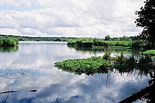
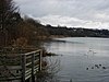
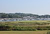
Langstone Harbour is a 2,085.4-hectare (5,153-acre) biological Site of Special Scientific Interest in Hampshire. It is an inlet of the English Channel in Hampshire, sandwiched between Portsea Island to the south and west, Hayling Island to the south and east, and Langstone to the north. It is part of Chichester and Langstone Harbours Ramsar site, Special Protection Area and Nature Conservation Review site, Grade I. Parts of it are in Solent Maritime and Solent and Isle of Wight Lagoons Special Areas of Conservation. Three areas are Local Nature Reserves, Farlington Marshes West Hayling and The Kench, Hayling Island. Two areas are nature reserves managed by the Hampshire and Isle of Wight Wildlife Trust, Farlington Marshes and Southmoor Nature Reserve

<span class="mw-page-title-main">Hayling Billy</span>

Hayling Billy is a 42-hectare (100-acre) Local Nature Reserve on Hayling Island in Hampshire. It is owned by Hampshire County Council and managed by Hampshire Countryside Service. It is part of Chichester and Langstone Harbours Ramsar site and Special Protection Area, Solent Maritime Special Area of Conservation and Langstone Harbour Site of Special Scientific Interest.

<span class="mw-page-title-main">Farlington Marshes</span>

Farlington Marshes is a 119.7-hectare (296-acre) Local Nature Reserve in Portsmouth in Hampshire. It is owned by Portsmouth City Council and managed by Hampshire and Isle of Wight Wildlife Trust. It is part of Langstone Harbour, which is a Site of Special Scientific Interest and a Nature Conservation Review site, Grade I. It is also part of Solent Maritime Special Area of Conservation and of Chichester and Langstone Harbours Ramsar site and Special Protection Area.

<span class="mw-page-title-main">Nutborne Marshes</span>

Nutborne Marshes is a 386.9-hectare (956-acre) Local Nature Reserve east of Thorney Island in West Sussex. It is owned and managed by Chichester Harbour Conservancy. It is part of the Chichester Harbour Site of Special Scientific Interest and Nature Conservation Review site, Grade I*, the Chichester and Langstone Harbours Ramsar site and Special Protection Area, and the Solent Maritime Special Area of Conservation.

<span class="mw-page-title-main">Hurst Castle and Lymington River Estuary</span>

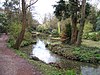
Hurst Castle and Lymington River Estuary is a 1,077.3-hectare (2,662-acre) biological and geological Site of Special Scientific Interest near Lymington in Hampshire. It is a Nature Conservation Review site and two areas are Geological Conservation Review sites. Three areas are local nature reserves, Boldre Foreshore, Sturt Pond and Lymington and Keyhaven Marshes; the latter site is managed by the Hampshire and Isle of Wight Wildlife Trust. Part of it is North Solent National Nature Reserve. It is part of Solent and Southampton Water Ramsar site and Special Protection Area. Parts of it are in Solent Maritime and Solent and Isle of Wight Lagoons Special Areas of Conservation.

<span class="mw-page-title-main">Hythe to Calshot Marshes</span>

Hythe to Calshot Marshes is a 591.8-hectare (1,462-acre) biological Site of Special Scientific Interest which stretches along the west bank of Southampton Water between Calshot and Marchwood in Hampshire. It is part of Solent and Southampton Water Ramsar site and Special Protection Area, and of Solent Maritime Special Area of Conservation. Calshot Marshes is a Local Nature Reserve and Hythe Spartina Marsh is a nature reserve managed by the Hampshire and Isle of Wight Wildlife Trust.

<span class="mw-page-title-main">Boldre Foreshore</span>

Boldre Foreshore is a 193.3-hectare (478-acre) Local Nature Reserve east of Lymington in Hampshire. It is owned by New Forest District Council and managed by the Hampshire and Isle of Wight Wildlife Trust. It is part of Solent and Southampton Water Ramsar site and Special Protection Area, Solent Maritime Special Area of Conservation, Hurst Castle and Lymington River Estuary Site of Special Scientific Interest and Lymington and Keyhaven Marshes, a nature reserve managed by the Hampshire and Isle of Wight Wildlife Trust.

<span class="mw-page-title-main">Calshot Marshes</span>

Calshot Marshes is a 51.1-hectare (126-acre) Local Nature Reserve near Calshot, at the junction of The Solent and Southampton Water in Hampshire. It is owned by Hampshire County Council and managed by Hampshire Countryside Service. It is part of Solent and Southampton Water Ramsar site and Special Protection Area, of Solent Maritime Special Area of Conservation and of Hythe to Calshot Marshes Site of Special Scientific Interest.

<span class="mw-page-title-main">Gutner Point</span>

Gutner Point is a 69-hectare (170-acre) Local Nature Reserve on Hayling Island in Hampshire. It is owned by Hampshire County Council and managed by Hampshire Countryside Service. It is part of Chichester and Langstone Harbours Ramsar site and Special Protection Area, of Solent Maritime Special Area of Conservation, and of Chichester Harbour Site of Special Scientific Interest.

<span class="mw-page-title-main">Hackett's Marsh</span> Nature reserve in Hampshire, England

Hackett's Marsh is a 20.4-hectare (50-acre) Local Nature Reserve in Bursledon in Hampshire. It is owned by Hampshire County Council and managed by Hampshire Countryside Service. It is part of Solent and Southampton Water Ramsar site and Special Protection Area, of Solent Maritime Special Area of Conservation and of Lincegrove and Hackett's Marshes Site of Special Scientific Interest.

<span class="mw-page-title-main">Hook with Warsash</span>

Hook with Warsash is a 251.6-hectare (622-acre) Local Nature Reserve west of Fareham in Hampshire. It is owned by Hampshire County Council and managed by Hampshire Countryside Service. It is part of Solent and Southampton Water Ramsar site and Special Protection Area, of Solent Maritime Special Area of Conservation, and of Lee-on-The Solent to Itchen Estuary Site of Special Scientific Interest.

<span class="mw-page-title-main">The Kench, Hayling Island</span>

The Kench, Hayling Island is a 6-hectare (15-acre) Local Nature Reserve on Hayling Island in Hampshire. It is owned by Hampshire County Council and managed by Hampshire Countryside Service. It is part of Chichester and Langstone Harbours Ramsar site and Special Protection Area, Solent Maritime Special Area of Conservation and Langstone Harbour Site of Special Scientific Interest.

<span class="mw-page-title-main">Lymington and Keyhaven Marshes</span> Hampshire nature reserve

Lymington and Keyhaven Marshes is a 738-hectare (1,820-acre) nature reserve which stretches from Keyhaven along the south coast across the Lymington River in Hampshire. It is managed by the Hampshire and Isle of Wight Wildlife Trust. It is part of Solent and Southampton Water Ramsar site and Special Protection Area. Some areas are part of two Special Areas of Conservation, Solent and Isle of Wight Lagoons and Solent Maritime and Solent. It is also part of Hurst Castle and Lymington River Estuary, which is a Site of Special Scientific Interest, and of North Solent Marshes Nature Conservation Review site, Grade 2. Two areas are Geological Conservation Review sites, and two are Local Nature Reserves, Boldre Foreshore and Lymington-Keyhaven Marshes.

<span class="mw-page-title-main">Mercury Marshes</span>

Mercury Marshes is a 6.4-hectare (16-acre) Local Nature Reserve in Hamble-le-Rice in Hampshire. It is owned by Hampshire County Council and managed by Hampshire Countryside Service. It is part of Solent and Southampton Water Ramsar site and Special Protection Area, of Solent Maritime Special Area of Conservation, and of Lee-on-The Solent to Itchen Estuary, which is a Site of Special Scientific Interest.

<span class="mw-page-title-main">West Hayling</span>

West Hayling is a 76.2-hectare (188-acre) Local Nature Reserve on Hayling Island in Hampshire. It is owned by Havant Borough Council and managed by the council and the Royal Society for the Protection of Birds. It is part of Langstone Harbour, which is a Site of Special Scientific Interest. It is also part of Solent Maritime Special Area of Conservation and of Chichester and Langstone Harbours Ramsar site and Special Protection Area.

<span class="mw-page-title-main">Southmoor Nature Reserve</span> Nature reserve in England

Southmoor Nature Reserve is a 11-hectare (27-acre) nature reserve in Havant in Hampshire. It is managed by the Hampshire and Isle of Wight Wildlife Trust. It is part of Langstone Harbour, which is a Site of Special Scientific Interest and a Nature Conservation Review site, Grade I. It is also part of Solent Maritime Special Area of Conservation and of Chichester and Langstone Harbours Ramsar site and Special Protection Area.

References

  1. "Local Nature Reserve". Peak District National Park Authority. 15 February 2017. Retrieved 3 February 2020.
  2. "Local nature reserves: setting up and management". Department for Environment, Food & Rural Affairs and Natural England. 2 October 2014. Archived from the original on 4 July 2015. Retrieved 29 July 2015.
  3. 1 2 "Designated Sites View: Hampshire". Natural England. Retrieved 26 April 2020.
  4. "Anton Lakes". Local Nature Reserves. Natural England. Retrieved 22 May 2020.
  5. "Bishop's Waltham Railway Line". Hampshire County Council. Retrieved 23 May 2020.
  6. 1 2 3 "Lymington and Keyhaven Marshes". Hampshire and Isle of Wight Wildlife Trust. Retrieved 24 April 2020.
  7. 1 2 3 4 5 6 7 8 9 10 "Designated Sites View: Solent and Southampton Water". Ramsar Site. Natural England. Retrieved 23 April 2020.
  8. 1 2 3 4 5 6 7 8 9 10 11 12 13 "Designated Sites View: Solent Maritime". Special Areas of Conservation. Natural England. Retrieved 23 April 2020.
  9. 1 2 3 4 5 6 7 8 9 10 "Designated Sites View: Solent and Southampton Water". Special Protection Areas. Natural England. Retrieved 23 April 2020.
  10. 1 2 3 "Designated Sites View: Hurst Castle and Lymington River Estuary". Sites of Special Scientific Interest. Natural England. Retrieved 27 April 2020.
  11. "Boldre Foreshore". Local Nature Reserves. Natural England. Retrieved 23 May 2020.
  12. "Brook Meadow (Emsworth)". Local Nature Reserves. Natural England. Retrieved 23 May 2020.
  13. "Designated Sites View: Wealden Heaths Phase II". Special Protection Areas. Natural England. Retrieved 6 April 2019.
  14. "Designated Sites View: Broxhead and Kingsley Commons". Sites of Special Scientific Interest. Natural England. Retrieved 27 April 2020.
  15. "Designated Sites View: Broxhead Common, Bordon". Local Nature Reserves. Natural England. Retrieved 21 April 2020.
  16. "Broxhead and Kingsley Commons citation" (PDF). Sites of Special Scientific Interest. Natural England. Retrieved 7 May 2020.
  17. "Buriton Chalk Pit". Local Nature Reserves. Natural England. Retrieved 23 May 2020.
  18. "Buriton Chalk Pits". Buriton Community Website. Retrieved 23 May 2020.
  19. "Designated Sites View: Hythe to Calshot Marshes". Sites of Special Scientific Interest. Natural England. Retrieved 27 April 2020.
  20. "Calshot Marshes". Local Nature Reserves. Natural England. Retrieved 23 May 2020.
  21. "Designated Sites View: Catherington Down". Sites of Special Scientific Interest. Natural England. Retrieved 27 April 2020.
  22. "Catherington Down citation" (PDF). Sites of Special Scientific Interest. Natural England. Retrieved 9 May 2020.
  23. 1 2 3 "Designated Sites View: Lee-on-The Solent to Itchen Estuary". Sites of Special Scientific Interest. Natural England. Retrieved 27 April 2020.
  24. "Chessel Bay". Local Nature Reserves. Natural England. Retrieved 23 May 2020.
  25. "Claylands". Local Nature Reserves. Natural England. Retrieved 23 May 2020.
  26. "Claylands". Hampshire County Council. Retrieved 23 May 2020.
  27. "Designated Sites View: Crab Wood". Sites of Special Scientific Interest. Natural England. Retrieved 27 April 2020.
  28. "Crab Wood citation" (PDF). Sites of Special Scientific Interest. Natural England. Retrieved 9 May 2020.
  29. "Designated Sites View: Danebury Hill". Sites of Special Scientific Interest. Natural England. Retrieved 27 April 2020.
  30. "Danebury". Pastscape. Retrieved 24 May 2020.
  31. "Danebury Hillfort". Local Nature Reserves. Natural England. Retrieved 24 May 2020.
  32. "Daneshill Park Woods". Local Nature Reserves. Natural England. Retrieved 24 May 2020.
  33. 1 2 "Walldown enclosures". Historic England. Retrieved 24 May 2020.
  34. "Deadwater Valley". Local Nature Reserves. Natural England. Retrieved 24 May 2020.
  35. "Dundridge Meadows". Local Nature Reserves. Natural England. Retrieved 24 May 2020.
  36. "Elvetham Heath". Local Nature Reserves. Natural England. Retrieved 24 May 2020.
  37. 1 2 "Farlington Marshes". Hampshire and Isle of Wight Wildlife Trust. Retrieved 24 April 2020.
  38. Ratcliffe, p. 3-4
  39. 1 2 3 4 5 6 "Designated Sites View: Chichester and Langstone Harbours". Ramsar Site. Natural England. Archived from the original on 1 April 2019. Retrieved 6 April 2019.
  40. 1 2 3 4 5 6 "Designated Sites View: Chichester and Langstone Harbours". Special Protection Areas. Natural England. Archived from the original on 1 April 2019. Retrieved 6 April 2019.
  41. 1 2 3 4 "Designated Sites View: Langstone Harbour". Sites of Special Scientific Interest. Natural England. Retrieved 27 April 2020.
  42. "Farlington Marshes". Local Nature Reserves. Natural England. Retrieved 1 May 2020.
  43. "Designated Sites View: Fleet Pond". Sites of Special Scientific Interest. Natural England. Retrieved 27 April 2020.
  44. "Fleet Pond citation" (PDF). Sites of Special Scientific Interest. Natural England. Retrieved 10 May 2020.
  45. 1 2 "Designated Sites View: Chichester Harbour". Sites of Special Scientific Interest. Natural England. Retrieved 27 April 2020.
  46. "Gutner Point". Hampshire County Council. Retrieved 24 May 2020.
  47. "Designated Sites View: Lincegrove and Hackett's Marshes". Sites of Special Scientific Interest. Natural England. Retrieved 28 April 2020.
  48. "Hackett's Marsh". Local Nature Reserves. Natural England. Retrieved 24 May 2020.
  49. "Hayling Billy". Local Nature Reserves. Natural England. Retrieved 24 May 2020.
  50. "Conservation Areas". Horndean Parish Council. Retrieved 24 May 2020.
  51. "Herbert Plantation Local Nature Reserve". Hampshire County Council. Retrieved 25 May 2020.
  52. "About Hocombe Mead". Friends of Hocombe Mead. Retrieved 25 May 2020.
  53. "Holly Hill Woodland Park". Local Nature Reserves. Natural England. Retrieved 25 May 2020.
  54. "Hook with Warsash". Local Nature Reserves. Natural England. Retrieved 25 May 2020.
  55. "The Kench, Hayling Island". Local Nature Reserves. Natural England. Retrieved 25 May 2020.
  56. "Designated Sites View: North Solent". Sites of Special Scientific Interest. Natural England. Retrieved 28 April 2020.
  57. "Liss Riverside Railway Walk North". Local Nature Reserves. Natural England. Retrieved 25 May 2020.
  58. "Liss Riverside Railway Walk South". Local Nature Reserves. Natural England. Retrieved 25 May 2020.
  59. "Map of Liss Riverside Railway Walk South". Local Nature Reserves. Natural England. Retrieved 25 May 2020.
  60. "Designated Sites View: Upper Hamble Estuary and Woods". Sites of Special Scientific Interest. Natural England. Retrieved 28 April 2020.
  61. "Manor Farm". Local Nature Reserves. Natural England. Retrieved 26 May 2020.
  62. "Mercury Marshes". Local Nature Reserves. Natural England. Retrieved 26 May 2020.
  63. "Milford on Sea". Local Nature Reserves. Natural England. Retrieved 26 May 2020.
  64. "The Mill Field". Local Nature Reserves. Natural England. Retrieved 26 May 2020.
  65. "Miller's Pond". Southampton City Council. Retrieved 26 May 2020.
  66. "Miller's Pond". Local Nature Reserves. Natural England. Retrieved 26 May 2020.
  67. "Designated Sites View: The Moors, Bishop's Waltham". Sites of Special Scientific Interest. Natural England. Retrieved 28 April 2020.
  68. "The Moors, Bishop's Waltham citation" (PDF). Sites of Special Scientific Interest. Natural England. Retrieved 15 May 2020.
  69. "Netley Common". Local Nature Reserves. Natural England. Retrieved 26 May 2020.
  70. "Designated Sites View: Butser Hill". Special Areas of Conservation. Natural England. Retrieved 28 April 2020.
  71. "Designated Sites View: Butser Hill". Sites of Special Scientific Interest. Natural England. Retrieved 28 April 2020.
  72. "Oxenbourne Down, Clanfield". Local Nature Reserves. Natural England. Retrieved 26 May 2020.
  73. "Pamber Forest and Upper Inhams Copse". Hampshire and Isle of Wight Wildlife Trust. Retrieved 28 April 2020.
  74. "Designated Sites View: Pamber Forest and Silchester Common". Sites of Special Scientific Interest. Natural England. Retrieved 28 April 2020.
  75. "Pamber Forest and Silchester Common citation" (PDF). Sites of Special Scientific Interest. Natural England. Retrieved 16 May 2020.
  76. "Popley Ponds". Local Nature Reserves. Natural England. Retrieved 26 May 2020.
  77. "Rotherlands". Local Nature Reserves. Natural England. Retrieved 27 May 2020.
  78. "Shawford Down". Local Nature Reserves. Natural England. Retrieved 27 May 2020.
  79. "Designated Sites View: Shortheath Common". Special Areas of Conservation. Natural England. Retrieved 28 April 2020.
  80. "Designated Sites View: Shortheath Common". Sites of Special Scientific Interest. Natural England. Retrieved 28 April 2020.
  81. "Shortheath Common citation" (PDF). Sites of Special Scientific Interest. Natural England. Retrieved 18 May 2020.
  82. "Sturt Pond". Local Nature Reserves. Natural England. Retrieved 27 May 2020.
  83. "Tadburn Meadows". Local Nature Reserves. Natural England. Retrieved 27 May 2020.
  84. "Designated Sites View: Titchfield Haven". National Nature Reserves. Natural England. Retrieved 24 April 2020.
  85. "Designated Sites View: Titchfield Haven". Sites of Special Scientific Interest. Natural England. Retrieved 28 April 2020.
  86. "Titchfield Haven citation" (PDF). Sites of Special Scientific Interest. Natural England. Retrieved 19 May 2020.
  87. "Designated Sites View: Butter Wood". Sites of Special Scientific Interest. Natural England. Retrieved 28 April 2020.
  88. "Up Nately". Local Nature Reserves. Natural England. Retrieved 27 May 2020.
  89. "Valley Park Woodlands". Local Nature Reserves. Natural England. Retrieved 27 May 2020.
  90. "Designated Sites View: East Hampshire Hangers". Special Areas of Conservation. Natural England. Retrieved 28 April 2020.
  91. "Designated Sites View: Wealden Edge Hangers". Sites of Special Scientific Interest. Natural England. Retrieved 28 April 2020.
  92. "Wealden Edge Hangers citation" (PDF). Sites of Special Scientific Interest. Natural England. Retrieved 20 May 2020.
  93. 1 2 "Langstone Harbour". Royal Society for the Protection of Birds. Retrieved 27 May 2020.
  94. "West Hayling". Local Nature Reserves. Natural England. Retrieved 27 May 2020.
  95. "West of the River Alver". Local Nature Reserves. Natural England. Retrieved 27 May 2020.
  96. "Westwood Woodland Park Local Nature Reserve". Hampshire County Council. Retrieved 27 May 2020.
  97. "Designated Sites View: The Wild Grounds". Sites of Special Scientific Interest. Natural England. Retrieved 28 April 2020.
  98. "The Wild Grounds citation" (PDF). Sites of Special Scientific Interest. Natural England. Retrieved 21 May 2020.
  99. "Yoell's Copse". Local Nature Reserves. Natural England. Retrieved 27 May 2020.

Sources

Coordinates: 51°03′28″N1°18′29″W / 51.0577°N 1.3081°W / 51.0577; -1.3081