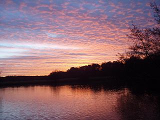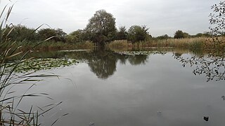
Fleet Pond is a 48.3-hectare (119-acre) biological Site of Special Scientific Interest in Fleet in Hampshire. It is also a Local Nature Reserve.

The Cotswold Water Park is the United Kingdom's largest marl lake system, straddling the Wiltshire–Gloucestershire border, northwest of Cricklade and south of Cirencester. There are 180 lakes, spread over 42 square miles (110 km2).

Cannon Hill Common is a public park in the London Borough of Merton. It is situated near Raynes Park and Morden. It is also the location of a Local Nature Reserve and the Paddock Allotments.

Earlswood Common is an 89.1-hectare (220-acre) Local Nature Reserve in Redhill in Surrey. It is owned and managed by Reigate and Banstead Borough Council.

Elmbridge Open Space or Elmbridge Meadows is a Local Nature Reserve in Berrylands in the Royal Borough of Kingston upon Thames in London. It is a linear open space along the western bank of the Hogsmill River which starts at Malden Way and ends at a path between Surbiton Hill Park to Green Lane.

Cranebank is a Local Nature Reserve on the east bank of the River Crane in Hatton in the London Borough of Hounslow. It is owned and managed by Hounslow Council. It is also part of The Crane Corridor Site of Metropolitan Importance for Nature Conservation.

The Chase is a nature reserve in Dagenham in London. Most of it is in the London Borough of Barking and Dagenham, with a small part in Havering. It is owned by the boroughs, and managed by London Borough of Barking & Dagenham - Parks & Countryside Ranger Service. The boroughs have designated the sections in their respective boroughs as Local Nature Reserves. The Chase, together with the neighbouring Eastbrookend Country Park, is also designated a Site of Metropolitan Importance for Nature Conservation.

Anton Crescent Wetland is a one hectare Local Nature Reserve in Sutton in the London Borough of Sutton. It is owned by Sutton Council and managed by the council together with Sutton Nature Conservation Volunteers.

The Wood is a public park in Surbiton in the Royal Borough of Kingston upon Thames in London. Part of it is a bird sanctuary named after the naturalist Richard Jefferies. According to Natural England it is managed by the London Wildlife Trust, but as of August 2015 it is not on the Trust's list of sites. The 1.5-hectare site is designated as a Local Nature Reserve called 'The Wood and Richard Jefferies Bird Sanctuary'.

Pevensey Road is a 10.2 hectare Local Nature Reserve in Hanworth in the London Borough of Hounslow. It is also part of the Crane Corridor Site of Metropolitan Importance for Nature Conservation. It is owned and managed by Hounslow Council.

Batford Springs is a 3.5-hectare (8.6-acre) Local Nature Reserve in Harpenden in Hertfordshire. It is owned and managed by Harpenden Town Council, and most work on the site is undertaken by the Batford Springs Volunteers. The declaring authority is St Albans City Council.

Rickmansworth Aquadrome is a 41 hectares public park and Local Nature Reserve in Rickmansworth in Hertfordshire. It is owned and managed by Three Rivers District Council.

Stodmarsh SSSI is a 623.2-hectare (1,540-acre) biological Site of Special Scientific Interest near Stodmarsh, north-east of Canterbury in Kent. Parts of it are a Nature Conservation Review site, Grade I, a National Nature Reserve, a Ramsar internationally important wetland site, a Special Area of Conservation and a Special Protection Area under the European Union Directive on the Conservation of Wild Birds.

Lakeside Park is a 14.7-hectare (36-acre) Local Nature Reserve west of Guildford in Surrey. It is owned and managed by Guildford Borough Council.

Herbert Plantation is a 25.6-hectare (63-acre) Local Nature Reserve north of Burghclere in Hampshire. It is owned by Hampshire County Council and managed by Hampshire Countryside Service.

Holly Hill Woodland Park is a 28.1-hectare (69-acre) Local Nature Reserve in Fareham in Hampshire. It is owned by Fareham Borough Council and managed by the Countryside Ranger Service.

Mercury Marshes is a 6.4-hectare (16-acre) Local Nature Reserve in Hamble-le-Rice in Hampshire. It is owned by Hampshire County Council and managed by Hampshire Countryside Service. It is part of Solent and Southampton Water Ramsar site and Special Protection Area, of Solent Maritime Special Area of Conservation, and of Lee-on-The Solent to Itchen Estuary, which is a Site of Special Scientific Interest.


