Gulaga National Park is a national park on the south coast of New South Wales, Australia, about 15 kilometres (9.3 mi) south of Narooma. The park is dominated by Gulaga, also known as Mount Gulaga. The former Wallaga Lake National Park, Goura Nature Reserve, and Mount Dromedary Flora Reserve were combined to form this park in 2001. The park features the southernmost subtropical rainforest in New South Wales.

Some statutory nature reserves are designated by national bodies in the United Kingdom, and are known as national nature reserves.
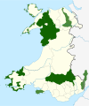
The Gloucestershire Wildlife Trust is the Gloucestershire local partner in a conservation network of 46 Wildlife Trusts. The Wildlife Trusts are local charities with the specific aim of protecting the United Kingdom's natural heritage. The Gloucestershire Wildlife Trust is managed by a board of trustees elected from its membership who provide overall direction for the development of the trust and there are advisory committees. The work of the trust is carried out through staff and volunteers.
Local nature reserve (LNR) is a statutory designation for certain nature reserves in Great Britain. The Wild Life Conservation Special Committee established them and proposed a national suite of protected areas comprising national nature reserves, conservation areas, national parks, geological monuments, local nature reserves and local educational nature reserves.

Barunguba / Montague Island is a continental island contained within the Montague Island Nature Reserve, a protected nature reserve that is located offshore from the South Coast region of New South Wales, in eastern Australia. The nearest town located onshore from the 81-hectare (200-acre) reserve and island is Narooma, situated approximately 9 kilometres (5.6 mi) to the northwest.
New Lambton is a suburb of Newcastle, in the Hunter Region of New South Wales, Australia. It is located about 6 km (4 mi) west of the Newcastle central business district. It includes two shopping districts, schools and other general facilities. At the 2016 Australian census it had a population of approximately 10,000.
Site of Nature Conservation Interest (SNCI), Site of Importance for Nature Conservation (SINC) and regionally important geological site (RIGS) are designations used by local authorities in the United Kingdom for sites of substantive local nature conservation and geological value. The Department for Environment, Food and Rural Affairs has recommended the generic term 'local site', which is divided into 'local wildlife site' and 'local geological site'.
The Muogamarra Nature Reserve is a protected nature reserve that is located in the Sydney region of New South Wales, in eastern Australia. The 2,274-hectare (5,620-acre) reserve is situated in the northern edge of Sydney and lies between the suburb of Cowan to the south, and the Hawkesbury River to the north.

Midger is a 65.7-hectare (162-acre) biological Site of Special Scientific Interest straddling the border of Gloucestershire and South Gloucestershire, notified in 1966 and renotified in 1984. Since the last revision in 1974, the size has been reduced to a 56-hectare (140-acre) site. It lies east of Hillesley, Gloucestershire and north of Hawkesbury Upton, South Gloucestershire. It is at the head of the Kilcott Valley.

The South Western Slopes, also known as the South West Slopes, is a region predominantly in New South Wales, Australia. It covers the lower inland slopes of the Great Dividing Range, extending from north of Dunedoo through central NSW and into northeast Victoria, meeting its southwestern end around Beechworth. More than 90% of the region is in the state of New South Wales and it occupies about 10% of that state.

The Bimberi Nature Reserve is a protected nature reserve located in the Brindabella Range of New South Wales, in eastern Australia. The 10,868-hectare (26,860-acre) reserve is situated approximately 30 km (19 mi) south west of Canberra, which is in the Australian Capital Territory.
The Barren Grounds Nature Reserve is a protected nature park located in the Southern Highlands region of New South Wales, Australia. The 2,024-hectare (5,000-acre) reserve is situated east of Budderoo National Park, and west of the city of Kiama. The reserve can also be accessed from the south, via a local road and a bush walk from the town of Berry. It is not far from the Nameless Sylvan Reserve owned by Bush Heritage Australia.

The Victoria Park Nature Reserve is a protected nature reserve that is located in the Northern Rivers region in the state of New South Wales, in eastern Australia. The sub-tropical jungle remnant is located an undulating high rainfall plain near Alstonville. The red-brown soil is derived from a basaltic flow from the nearby Mount Warning. Of the total land in the reserve, 8 hectares is original rainforest; and the other areas are being re-vegetated.

The Robertson Nature Reserve is a protected rainforest nature reserve that is located in the Southern Highlands region of New South Wales, in eastern Australia. The 5.3-hectare (13-acre) reserve is situated near Robertson on the edge of the Illawarra Escarpment and is a remnant of the Yarrawa Brush, once 2,450 hectares in size.

The Coocumbac Island Nature Reserve is a protected nature reserve located in the mid–north coast region of New South Wales, Australia. The 6-hectare (15-acre) reserve, situated on the Manning River near Taree, is a rare example of a subtropical lowland rainforest.

Upper Wye Gorge is a Site of Special Scientific Interest (SSSI), noted for its biological and geological characteristics, around Symonds Yat in the Wye Valley on the Wales–England border. The site is listed in the "Forest of Dean Local Plan Review" as a Key Wildlife Site (KWS).
The Little Llangothlin Nature Reserve is a protected wetland nature reserve that is located on the Northern Tablelands in the New England region of New South Wales, in eastern Australia. The 257-hectare (640-acre) reserve is situated approximately 10 kilometres (6.2 mi) north-east of the rural locality of Llangothlin, and some 20 kilometres (12 mi) north-east of Guyra.

Ngambaa Nature Reserve, including Red Cedar Park is a protected area of 10,560 hectares, situated in the Mid North Coast region of New South Wales. The nearest large town is Macksville. The reserve endeavours to protect many rare and threatened flora and fauna species, such as rainforest and four species of ironbark trees. An interesting local species is the small bolwarra, one of the most primitive of flowering plants. The landscapes are of significance to the local Aboriginal communities, and contain relics of historical use by non-Aboriginal people.

The High Conservation Value Old Growth forest is a heritage-listed forest located across twelve local government areas in the Northern Rivers, Mid North Coast, and New England regions of New South Wales, Australia. The conservation area is also known as Old Growth Forest; HCVOG Forest; and Upper North East NSW. Broadly speaking, the conservation area forms part of the much larger Gondwana Rainforests, a UNESCO World Heritage Site totalling more than 366,000 hectares. The conservation area is owned by the NSW Department of Primary Industries and the NSW Office of Environment and Heritage, both agencies of the Government of New South Wales. The conservation area was added to the New South Wales State Heritage Register on 22 December 2000.

Wallumatta Nature Reserve, also called the Macquarie Hospital Bushland, is a 6-hectare (15-acre) nature reserve bushland area, surrounded by the residential suburb of East Ryde, in suburban Sydney, Australia. Once part of the Field of Mars of 1804, the reserve is the largest surviving area of Sydney Turpentine-Ironbark Forest, an endangered ecosystem. Soils are based on Ashfield Shale and Hawkesbury Sandstone.