
Cytir Mawr (also written as Cyttir Mawr) is a local nature reserve in Llandegfan, Anglesey, Wales. [1]
Cytir Mawr (also written as Cyttir Mawr) is a local nature reserve in Llandegfan, Anglesey, Wales. [1]
In July 2006, the site was designated as a local nature reserve. The reserve had previously been owned by Cardiff University but had been donated back to Anglesey. [2]

Upper Bacombe and Lower Bacombe are two hamlets in the parish of Wendover, in Buckinghamshire, England. They are located to the south east of the main town, on and at the foot of Bacombe Hill, which is a Local Nature Reserve, and part of the Bacombe and Coombe Hills Site of Special Scientific Interest.
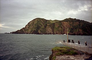
Abermenai Point is a headland in the southeast of the island of Anglesey in Wales. It is the southernmost point of the island and is the northern point of the western entrance of the Menai Strait.

(This islet is not to be confused with Ynys Benlas in the Menai Strait near Church Island, nor with Ynys-las near RAF Valley.)

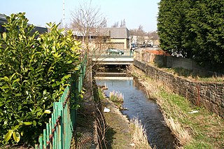
The River Hyndburn is a minor river in Lancashire, England. Beginning as Woodnook Water on the slopes of Goodshaw Hill, it passes through Stone Fold, Rising Bridge and Baxenden where it is augmented by streams from Thirteen Stone Hill and continues to the Woodnook area of Accrington. Near St James Church, it collects Broad Oak Water, becoming the River Hyndburn.
Newborough Warren near the village of Newborough (Niwbwrch) is a large dune and beach system of 2,269-hectare (23 km2), approximately half of which is a conifer plantation. The whole of the site is a Site of special scientific interest and all of the site except the forestry is a National nature reserve.

Lligwy Bay is a bay of the Welsh island of Anglesey.
Hillsborough is a local nature reserve in Ilfracombe, North Devon. It is known locally as the sleeping elephant. It was bought by the local council in the late nineteenth century to prevent development on the site. As well as a pleasant coastal area where visitors may roam, it includes the remains of an Iron Age hill fort.

Towan is found in many placenames in Cornwall. However, The Towans usually refers to the three-mile (5 km) stretch of coastal dunes which extends north-east from the estuary of the River Hayle to Gwithian beach with a midpoint near Upton.

Rhoscolyn is a village and community located on Holy Island, Anglesey, Wales. It is just over five miles south of Holyhead and is the most southerly settlement on the island. The name Rhoscolyn is said to mean "The Moor" (Rhos) of The Column (colyn), referring to a pillar which the Romans put up to mark the edge of their territories. The community population taken from the 2011 census was 542.

Rhosgoch is a small village in the north of the island of Anglesey, Wales, about 3.5 miles (5.6 km) to the south-west of Amlwch.

Kempton Park Reservoirs are a Site of Special Scientific Interest in the London Borough of Hounslow and Kempton Park in Surrey. It is owned by Thames Water. It is part of South West London Waterbodies Ramsar site and Special Protection Area Kempton Park East reservoir is also a local nature reserve.

Llanfairpwllgwyngyll or Llanfair Pwllgwyngyll is a large village and local government community on the island of Anglesey, Wales, on the Menai Strait next to the Britannia Bridge and across the strait from Bangor. Both shortened and lengthened (Llanfairpwllgwyngyllgogerychwyrndrobwllllantysiliogogogoch) forms of the placename are used in various contexts.
The Afon Alaw is a river on Anglesey in Wales which rises near Llanerch-y-medd and flows northwards into the reservoir of Llyn Alaw. Below the dam it then flows southwestwards to the island's west coast near Llanfachraeth. Its lower reaches, west of the A5025 road, are tidal.

Hartshill Park is a large nature reserve stretching along the western edge of the city of Stoke-on-Trent, England. The park is a patchwork of different habitats, including five ponds. It is notable for being part of a Norman deer hunting park that has survived as open space into the modern era. It is a local nature reserve.
Chadkirk is an area in the Metropolitan Borough of Stockport in Greater Manchester, England. It is located between the River Goyt and the Peak Forest Canal south of Romiley, east of the A627 road. The site of a former print works on the right bank of the River Goyt is now occupied by Chadkirk Business Park.

Tŵr Mawr lighthouse, on Ynys Llanddwyn on Anglesey, Wales, marks the western entrance to the Menai Strait.

Rhosybol is a village in Anglesey, Wales. The community population at the 2011 census was 1,078. Located 2.5 miles (4.0 km) south of the town of Amlwch, the village is close to both Llyn Alaw, the largest body of water on the island, and Parys Mountain, the site of the historic copper mines which lies just to the north. It is to the mines that the village owes its existence as it was one of several built to house the miners. During the 1960s noted painter Kyffin Williams produced an oil painting of the village.
Mynydd y Garn is a hill in the northwest of the Isle of Anglesey in north Wales. Its 170m high summit is crowned by a trig point and a stone obelisk. Erected in 1897 it commemorates Sir William Thomas, ship-owner and one time High Sheriff of Anglesey.
Walverden Water is a minor river in Lancashire, England. It is approximately 2.6 miles (4.2 km) long and has a catchment area of 5.04 square miles (1,304.23 ha).
The Afon Ffraw is a short river on the Isle of Anglesey, Wales. It arises at Llyn Coron and flows southwest for two miles along the northwestern margin of Twyn Aberffraw via the village of Aberffraw to Aberffraw Bay on the island's west coast. The river is tidal to a point just northeast of Aberffraw and is accompanied by the Wales Coast Path and Isle of Anglesey Coastal Path. Llyn Coron is fed by the Afon Gwna which rises near to Llangefni in the centre of Anglesey. The flow of the Ffraw is bolstered by the left-bank tributary, the Afon Frechwen and a larger, though unnamed right-bank tributary which rises near Gwalchmai. Pont Aberffraw is a bridge spanning the river constructed as a single stone arch in 1731. When the A4080 main coastal road was diverted onto a new line, the old bridge closed to traffic.
| | This Anglesey location article is a stub. You can help Wikipedia by expanding it. |