
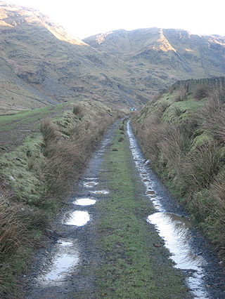
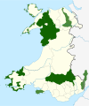
This is a list of Sites of Special Scientific Interest (SSSIs) in the Carmarthenshire Area of Search (AoS). [1]
This is a list of Sites of Special Scientific Interest (SSSIs) in the Carmarthenshire Area of Search (AoS). [1]
This Area of Search was formed from the entirety of the previous AoS of Carmarthen & Dinefwr , as well as having a few sites from the previous AoSs of West Glamorgan, Preseli & South Pembrokeshire and Brecknock.
The Croesor Tramway was a Welsh, 2 ft narrow gauge railway line built to carry slate from the Croesor slate mines to Porthmadog. It was built in 1864 without an Act of Parliament and was operated using horse power.

The Blaen y Cwm quarry was a slate quarry located east of Blaenau Ffestiniog in Wales. It was first worked in some time between 1813 and 1818 and sporadically after that until 1914. The quarry was connected to the Ffestiniog Railway at Duffws Station via the Rhiwbach Tramway.
Mawr is a community in south Wales.
The bedrock geology of Carmarthenshire in west Wales consists largely of Palaeozoic age sedimentary rocks. Unconsolidated deposits of Quaternary age in Carmarthenshire include a dissected cover of glacial till, valley floor alluvium and some scattered peat deposits in both upland and lowland settings. There are extensive beach and tidal flat deposits along the Carmarthenshire coast. The exploitation of the county's mineral riches, particularly coal and limestone, was a key part of the local economy through much of the nineteenth and twentieth centuries.
| Principal settlements |  | ||
|---|---|---|---|
| Towns and villages |
| ||
| Buildings and structures |
| ||
| Rivers | |||
| Topics | |||
| National parks |
|  | ||
|---|---|---|---|---|
| Areas of Outstanding Natural Beauty |
| |||
| Heritage coasts | ||||
| Nature reserves | ||||
| Site of Special Scientific Interest | ||||
| European designations (–2020) | ||||
| Other designations | ||||