
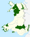
This is a list of the Sites of Special Scientific Interest (SSSIs) in the Blaenau Gwent Area of Search (AoS). [1]
This is a list of the Sites of Special Scientific Interest (SSSIs) in the Blaenau Gwent Area of Search (AoS). [1]
This Area of Search was mainly formed from parts of the previous AoS of Gwent as well as part of Brecknock.
Mynydd Llangynidr is a mountain in the Brecon Beacons National Park largely in the county of Powys, south Wales. Its southern slopes extend into the northernmost parts of the county borough of Blaenau Gwent. It is named from the village of Llangynidr which sits in the valley of the River Usk to the north of it. It is essentially an undulating plateau rising in the west to a height of 557m at Garn Fawr at OS grid ref SO 123151. A secondary high point is achieved at a point marked by a trig point at SO 147159. To the north the hill overlooks the valleys of Dyffryn Crawnon and Cwm Claisfer, themselves tributary valleys of the Usk. The shallow upper valley of the Ebbw River reaches into the plateau in the southeast whilst the upper reaches of the Sirhowy Valley and its tributary the Nant Trefil define its western margins. A further tributary, the Nant Milgatw, reaches in from the south whilst the sharp edge of Rassau Industrial Estate also defines a part of its southern margin. Passing east across the B4560, the hill merges with Mynydd Llangatwg which has a similar character.
Gwent Wildlife Trust (GWT) is a wildlife trust covering the area between the lower Wye and Rhymney rivers which forms the vice county of Monmouthshire in south-east Wales. It is a registered charity and a member of the Wildlife Trusts Partnership.

Waun-Lwyd or Waunlwyd is a village in the Ebbw Valley in Blaenau Gwent. It belongs in the community of Cwm.
| Principal settlements |  | |
|---|---|---|
| Communities | ||
| Towns and villages | ||
| Topics | ||
| National parks |
|  | ||
|---|---|---|---|---|
| Areas of Outstanding Natural Beauty |
| |||
| Heritage coasts | ||||
| Nature reserves | ||||
| Site of Special Scientific Interest | ||||
| European designations (–2020) | ||||
| Other designations | ||||