Trefil

Last updated

Trefil
Trefil - geograph.org.uk - 670287.jpg
Blaenau Gwent UK location map.svg
Red pog.svg
Trefil
Location within Blaenau Gwent
OS grid reference SO120125
Principal area
Preserved county
Country Wales
Sovereign state United Kingdom
Post town TREDEGAR
Postcode district NP22
Dialling code 01495
Police Gwent
Fire South Wales
Ambulance Welsh
UK Parliament
Senedd Cymru – Welsh Parliament
List of places
UK
Wales
Blaenau Gwent
51°48′17″N3°16′35″W / 51.804841°N 3.276513°W / 51.804841; -3.276513

Trefil is a small village in the county borough of Blaenau Gwent, south Wales. It lies at the top of the Sirhowy Valley, near to Brecon Beacons National Park. It is three miles northwest of Tredegar. With one public house, The Top House, serving homemade food and drinks to local visitors.

Contents

Etymology

The village name may derive from the terms 'tref' and 'mil' signifying the 'farm of the lesser celandine', a plant which might be expected to grow in the stream which flows through the place, the Nant Trefil. [1]

Geography

The village is sited in the bottom of a broad valley which cuts through the moorlands between the Heads of the Valleys Road and the Dyffryn Crawnon valley to the north. At 409 metres (1,342 ft) above sea level, the Ordnance Survey recognise Trefil as the highest village in Wales. [2] Trefil is served by a single cul-de-sac road which leaves the A465 Heads of the Valleys Road 1.5 miles to the south. [3] The boundary of the Brecon Beacons National Park lies one mile to the north of the village. It is described by some as Wales' highest village. [4] .Trefil is the most Northerly Human Settlement in Blaenau Gwent [5]

Trefil is perhaps best known for its limestone quarries – a major one immediately north of the village is operational whilst Cwar yr Ystrad, Cwar yr Hendre and Cwar Blaen-dyffryn to the west and northwest are no longer operational. The Trefil Tramroad and the Sirhowy Tramroad formerly linked the quarries with the heavily industrialised areas to the south, providing limestone for the furnaces. The former Brinore Tramroad connected the quarries at Trefil with the Monmouthshire and Brecon Canal at Talybont in the Usk Valley to the north.

Open moorland rises to east and west of the village, the slopes to the west being known as Trefil Ddu and those to the east as Trefil Las. The moorland of Mynydd Llangynidr to the east undulates considerably and contains a number of caves beneath its surface. Most famous amongst these is Chartist's Cave one mile to the northeast of the village.

Nature

Trefil Quarries and Trefil Ddu are noted birdwatching sites; this area is the last remaining site in Gwent where ring ouzel occurs regularly, and other species present include raven, wheatear, stonechat, whinchat, snipe and red grouse. [6]

Arts and entertainment

The BBC TV series Merlin filmed many episodes at Trefil quarry and the feature film Wrath of the Titans was filmed there in June 2011. The quarry features in many TV series including BBC's His Dark Materials and The Witcher for Netflix. [7]

Sports

The village is the site of Trefile Rugby Welfare Club who play in WRU Division 3C East. Of particular note is the derby between Trefil and Tredegar which is traditionally a strongly contested affair. [8]

Transport

The nearby town of Nantybwch is a 44-minute walk (2 miles (3.2 km)) from the village and is the location of bus services:

Rhymney railway station is 60 minutes from the village by bus from Nantybwch. Nantybwch is the historic site of the now closed Nantybwch railway station.

Politics

The village is represented under the ward of Sirhowy and its councillors are Brian Thomas (Ind, Sirhowy), Malcolm Cross (Lab, Sirhowy), and Tommy Smith (Lab, Sirhowy). [9]

The area is represented in the Senedd by Alun Davies (Labour) [10] and the Member of Parliament is Nick Smith (Labour). [11]

Related Research Articles

<span class="mw-page-title-main">Blaenau Gwent</span> County borough in Wales

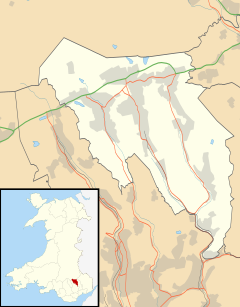
Blaenau Gwent is a county borough in the south-east of Wales. It borders the unitary authority areas of Monmouthshire and Torfaen to the east, Caerphilly to the west and Powys to the north. Its main towns are Abertillery, Brynmawr, Ebbw Vale and Tredegar. Its highest point is Coity Mountain at 1,896 feet (578 m).

<span class="mw-page-title-main">Caerphilly County Borough</span> County borough in Wales

Caerphilly County Borough is a county borough in the south-east of Wales. It is governed by Caerphilly County Borough Council.

<span class="mw-page-title-main">Tredegar</span> Town in Wales

Tredegar is a town and community situated on the banks of the Sirhowy River in the county borough of Blaenau Gwent, in the southeast of Wales. Within the historic boundaries of Monmouthshire, it became an early centre of the Industrial Revolution in Wales. The relevant wards collectively listed the town's population as 15,103 in the UK 2011 census.

<span class="mw-page-title-main">Monmouthshire and Brecon Canal</span> C18-19 canal network in South Wales

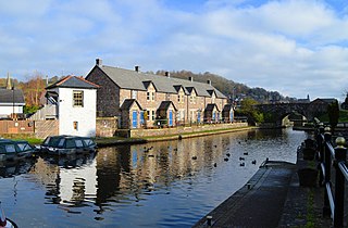
The Monmouthshire and Brecon Canal is a small network of canals in South Wales. For most of its currently (2018) navigable 35-mile (56 km) length it runs through the Brecon Beacons National Park, and its present rural character and tranquillity belies its original purpose as an industrial corridor for coal and iron, which were brought to the canal by a network of tramways and/or railroads, many of which were built and owned by the canal company.

<span class="mw-page-title-main">Talybont-on-Usk</span> Village and community in Powys, Wales

Talybont-on-Usk is a village and community in Powys, Wales, in the historic county of Brecknockshire. It lies on both the Caerfanell river and the Monmouthshire and Brecon Canal, about 1 mile (1.6 km) from the River Usk. In 2001, it had a population of 743, reducing to 719 at the 2011 census. The community includes the settlements of Llansantffraed, Scethrog, Aber Village, and Pencelli.

<span class="mw-page-title-main">Bryn Oer Tramway</span> Horse-worked narrow-gauge railway built in South Wales

The Bryn Oer Tramway was a horse-worked narrow-gauge railway built in South Wales in 1814.

The Sirhowy Valley is an industrialised valley in the eastern part of the Valleys region of Wales. It is named from the Sirhowy River which runs through it. Its upper reaches are occupied by the town of Tredegar within the unitary area of Blaenau Gwent. The valley initially heads south-southeast between the ridges of Cefn Manmoel to the east and Mynydd Bedwellte to the west before turning to a more southerly direction. Its central section is one of the least populated of the Welsh coalfield valleys. The valley enters the unitary area of Caerphilly which contains the towns of Blackwood and Pontllanfraith. It then turns east and joins the valley of the Ebbw River, Ebbw Vale at Crosskeys.

The Merthyr, Tredegar and Abergavenny Railway, also known as the Heads of the Valleys line, was a railway line which operated between 1860 and 1958 between the Monmouthshire town of Abergavenny and the Glamorgan town of Merthyr Tydfil in South East Wales.

<span class="mw-page-title-main">Cefn yr Ystrad</span> Mountain (619m) in Powys, Wales

Cefn yr Ystrad is a mountain in the Brecon Beacons National Park in Wales. It is an outlier of the Central Beacons group.

Mynydd Llangynidr is a mountain in the Brecon Beacons National Park largely in the county of Powys, south Wales. Its southern slopes extend into the northernmost parts of the county borough of Blaenau Gwent. It is named from the village of Llangynidr which sits in the valley of the River Usk to the north of it. It is essentially an undulating plateau rising in the west to a height of 557m at Garn Fawr at OS grid ref SO 123151. A secondary high point is achieved at a point marked by a trig point at SO 147159. To the north the hill overlooks the valleys of Dyffryn Crawnon and Cwm Claisfer, themselves tributary valleys of the Usk. The shallow upper valley of the Ebbw River reaches into the plateau in the southeast whilst the upper reaches of the Sirhowy Valley and its tributary the Nant Trefil define its western margins. A further tributary, the Nant Milgatw, reaches in from the south whilst the sharp edge of Rassau Industrial Estate also defines a part of its southern margin. Passing east across the B4560, the hill merges with Mynydd Llangatwg which has a similar character.

<span class="mw-page-title-main">Afon Crawnon</span> River in Powys, Wales

The Afon Crawnon is a river in the Brecon Beacons National Park in the county of Powys, Wales. The headwaters rise on the hills north of Trefil and flow northeast down a valley known as Dyffryn Crawnon for 7 km to a confluence with the River Usk just west of Llangynidr. The valley is notable for being at the centre of a major green energy initiative known as The Three Green Valleys project and which involves the construction of several micro-hydro schemes. Dyffryn Crawnon is translated from Welsh to mean "Valley of the Garlic River".

The Sirhowy Tramroad was a plateway built to convey the products of ironworks at Tredegar to Newport, South Wales. It opened in 1805 between Tredegar and Nine Mile Point, a location west of Risca, from where the Monmouthshire Canal Company operated a tramroad to Newport. The Sirhowy Tramroad was operated at first by horse traction, but early locomotives were used, and a passenger service was operated.

The Rassa Railroad was a horse-drawn tramroad in south Wales, running between Sirhowy Ironworks and Beaufort Ironworks, with connections also to the Trefil Rail Road and the Ebbw Vale Ironworks. It was later served with a tram engine.

Tafarnaubach is a village situated on the Sirhowy River in the county borough of Blaenau Gwent, in south-east Wales. Located within the historic boundaries of Monmouthshire it lies about two miles from Tredegar town centre.

Trevil Halt railway station was a station on the London and North Western Railway's Heads of the Valleys line serving the village of Trefil in the Welsh county of Monmouthshire.

<span class="mw-page-title-main">Georgetown, Blaenau Gwent</span> Human settlement in Wales

Georgetown is a village in the Sirhowy Valley in Blaenau Gwent. It belongs in the ward of Georgetown.

Llan-dafel is a village in the community of Cwm, in the Ebbw Valley in Blaenau Gwent.

<span class="mw-page-title-main">Sirhowy</span> Human settlement in Wales

Sirhowy is a village in the Sirhowy Valley and the county of Blaenau Gwent.

References

  1. Owen, H.W. & Morgan, R. 2007 'Dictionary of the Place-names of Wales' Gomer Press, Ceredigion
  2. "'Highest village' sign blunder in Bwlchgwyn, Wrexham". BBC. 23 December 2015. Retrieved 30 December 2015.
  3. Ordnance Survey Explorer map OL13 'Brecon Beacons National Park: eastern area'
  4. "Quarryman's Cottage in Wales' Highest Village - Trefil, Nr Tredegar - UPDATED 2019 - Holiday Rental in Tredegar". TripAdvisor. Retrieved 7 October 2019.
  5. https://streetmap.co.uk/map/idld?x=310996&y=212620&z=120&sv=310996,212620&st=4&mapp=map[FS]idld&searchp=ids&dn=567&ax=311996&ay=212620&lm=0
  6. Venables, W. A. et al (2008) The Birds of Gwent ISBN   978-0-7136-7633-4, page 21
  7. Trefil Quarry filming
  8. "Trefil RFC". Trefil RFC. Retrieved 7 October 2019.
  9. "Blaenau Gwent CBC: Councillor Directory". www.blaenau-gwent.gov.uk. Retrieved 7 October 2019.
  10. "Member Profile". National Assembly for Wales. Retrieved 7 October 2019.
  11. "Nick Smith MP, Blaenau Gwent". TheyWorkForYou. Retrieved 7 October 2019.