Buckinghamshire is a county in south-east England, [1] surrounded by Northamptonshire to the north, Bedfordshire and Hertfordshire to the east, Surrey and Berkshire to the south, Greater London to the south-east and Oxfordshire to the west. [2] This ceremonial county has two Unitary Authorities, Buckinghamshire Council and Milton Keynes Council.
In England, Sites of Special Scientific Interest (SSSIs) are designated by Natural England, which is responsible for protecting England's natural environment. Designation as an SSSI gives legal protection to the most important wildlife and geological sites. [3] As of April 2016, there are 65 SSSIs in this Area of Search, 55 of which have been designated for biological interest and 10 for geological interest. [4] Thirty are in the Chilterns Area of Outstanding Natural Beauty, three are in national nature reserves, four are in Special Areas of Conservation, and seventeen are managed by the Berkshire, Buckinghamshire and Oxfordshire Wildlife Trust.
|
|
|
Site name | Photograph | B | G | Area [lower-alpha 1] | Public access | Location [lower-alpha 1] | Other classifications | Map [lower-alpha 2] | Citation [lower-alpha 3] | Description |
---|---|---|---|---|---|---|---|---|---|---|
Ashridge Commons and Woods | 640.1 hectares (1,582 acres) | YES | Ashridge 51°48′42″N0°35′14″W / 51.8116°N 0.5871°W SP975135 | CAONB [5] NT [5] | Map [lower-alpha 4] | Citation | This site is mainly semi-natural vegetation, with has extensive areas of woodland, grass and scrub. There are many species of breeding birds, including some which are rare nationally, such as firecrests. [5] | |||
Aston Clinton Ragpits | 2.9 hectares (7.2 acres) | YES | Aston Clinton 51°47′20″N0°42′50″W / 51.7888°N 0.7140°W SP888108 | BBOWT [6] CAONB [6] | Map | Citation | This grassland site has steeply sloping old pits and spoil heaps, with a rich assembly of shrubs, herbs and invertebrates, including twenty-seven butterfly species. There is some mature woodland with beech, yew, ash and whitebeam, together with a hedge and areas of scrub. [6] | |||
Aston Rowant | 128.5 hectares (318 acres) | YES | Aston Rowant 51°40′08″N0°56′55″W / 51.6689°N 0.9487°W SU728972 | CAONB [7] NCR [8] NNR [7] SAC [9] [10] | Map [lower-alpha 5] | Citation | This site has beech woodland, scrub and chalk grassland. Unusual plants in the ground flora include wood barley, and the orchids Violet and white helleborine. There are several uncommon species of beetles and moths, and fifty breeding bird species. [11] | |||
Aston Rowant Woods | 209.7 hectares (518 acres) | YES | Aston Rowant 51°40′46″N0°55′00″W / 51.6794°N 0.9167°W SU750984 | CAONB [12] NCR [13] NNR [14] SAC [15] [16] | Map [lower-alpha 5] | Citation | The site is described by Natural England as "of national importance as a large, unfragmented area of ancient semi-natural woodland characteristic of the Chilterns scarp". Flora include 52 species indicative of ancient woods, and there are over 100 species of fungi. [17] | |||
Bacombe and Coombe Hills | 76.4 hectares (189 acres) | YES | Upper Bacombe 51°45′12″N0°46′02″W / 51.7534°N 0.7671°W SP852068 | BBOWT [18] CAONB [19] LNR [20] NT [21] | Map | Citation | The site is chalk grassland which has a rich variety of species. including the entire British population of fringed gentian, and there are areas of juniper and mixed scrub. Invertebrates include scarce species, such as chalkhill blue and brown argus butterflies. [22] | |||
Bierton Clay Pit | 0.1 hectares (0.25 acres) | NO | Bierton 51°50′01″N0°47′02″W / 51.8336°N 0.7838°W SP839157 | GCR [23] | Map | Citation | This disused clay pit exposes a section from the late Jurassic Kimmeridgian and Tithonian stages, between about 157 and 145 million years ago. It is the only exposure of the northern end of the Portland Beds, and shows the relationship between the Beds and the Hartwell Clay. [24] | |||
Black Park | 15.3 hectares (38 acres) | YES | Wexham 51°32′51″N0°32′26″W / 51.5476°N 0.5405°W TQ013842 | LNR [25] | Map | Citation | This site has heath, alder carr - both rare in the county - mixed and coniferous woodland and some areas of acid grassland. It has a varied fauna, and insects include the nationally rare Roesel's bush cricket. There are 18 species of butterfly, and birds including hobbies and nightjars. [26] | |||
Bolter End Sand Pit | 0.3 hectares (0.74 acres) | NO | Bolter End 51°37′13″N0°50′50″W / 51.6203°N 0.8473°W SU799919 | GCR [27] | Map | Citation | The site is part of the Reading Beds, and dates to 53 million years ago. It appears to represent riverine layers with sources from much older Lower Cretaceous and Upper Jurassic sequences. [28] | |||
Bradenham Woods, Park Wood and The Coppice | 129.1 hectares (319 acres) | YES | Bradenham 51°40′42″N0°48′14″W / 51.6783°N 0.8039°W SU828984 | CAONB [29] NCR [29] NT [30] SAC [30] SM [31] | Map | Citation | The site is mainly beech woodland, with a rich ground flora including rare species. Twenty-eight species of butterfly have been recorded. There are also areas of chalk grassland. [29] | |||
Bugle Quarry | 0.1 hectares (0.25 acres) | NO | Hartwell 51°48′07″N0°51′05″W / 51.8019°N 0.8514°W SP793121 | GCR [32] [33] | Map | Citation | The site spans the late Jurassic, and the early Cretaceous, 152 to 139 million years ago. [32] Dinosaur teeth include those of Pelorosaurus, which are the only sauropod teeth of Tithonian (late Jurassic) age in Europe. [34] | |||
Burnham Beeches | 374.6 hectares (926 acres) | PP | Farnham Common 51°33′44″N0°37′51″W / 51.5622°N 0.6309°W SU950857 | NNR [35] SAC [36] SM [37] | Map | Citation | This site has diverse habitats, ancient oak and beech pollards, wet heath and bog, alder wood, ponds and a stream. There are dormice, 56 bird species and some very rare beetles. [38] | |||
Buttlers Hangings | 3.9 hectares (9.6 acres) | YES | Bradenham 51°39′31″N0°49′13″W / 51.6587°N 0.8203°W SU817962 | CAONB [39] | Map | Citation Archived 2016-03-01 at the Wayback Machine | The site is steeply sloping grassland and scrub which has a wide variety of plant species. There are many rabbit burrows and a badger sett. Invertebrates include colonies of chalkland butterflies and four endangered Red Book spiders. [39] | |||
Dancersend | 81.3 hectares (201 acres) | YES | Wendover 51°46′34″N0°41′49″W / 51.7760°N 0.6969°W SP900094 | BBOWT [40] CAONB [41] FC [41] | Map | Citation | This reserve has woodland plantations, unimproved chalk grassland and scrub. The woods have few mature trees as most were felled during the 1940s, but a rich ground flora includes plants associated with ancient woodland, such as hairy brome and wood melick. [41] | |||
Dancersend Waterworks | 4.0 hectares (9.9 acres) | NO | Hastoe 51°46′21″N0°41′18″W / 51.7724°N 0.6883°W SP906090 | CAONB [42] LB [43] | Map | Citation | The site is an area of artificial banks, basins and plateaux in a chalk valley bottom, which has an unusually wide variety of herbs, grasses and shrubs. There is a badger sett and a range of butterfly and bird species. [42] | |||
Ellesborough and Kimble Warrens | 68.9 hectares (170 acres) | YES | Ellesborough 51°44′41″N0°47′52″W / 51.7447°N 0.7978°W SP831058 | CAONB [44] SM [45] | Map | Citation | This is one of the most important sites in the Chilterns for natural box woodlands, and it also has grasslands with rare plant species. There is a wide range of invertebrates and breeding birds. [44] [46] | |||
Fayland Chalk Bank | 0.6 hectares (1.5 acres) | NO | Parmoor 51°35′30″N0°51′55″W / 51.5917°N 0.8653°W SU787887 | CAONB [47] | Map | Citation | The site is chalk grassland which has a diverse flora. Orchids include the common spotted and pyramidal, and the profusion of chalk flowers and its south facing location make the site important for bees, grasshoppers and butterflies. [47] | |||
Fern House Gravel Pit | 1.3 hectares (3.2 acres) | NO | Bourne End 51°35′18″N0°43′36″W / 51.5884°N 0.7268°W SU883885 | GCR [48] | Map | Citation | This site may help to elucidate the history of the River Thames between glacial Anglian stage, around 450,000 years ago, when the river was diverted south to its present course, and the warm Ipswichian around 120,000 years ago. Fossils include straight-tusked elephants and mammoths. [49] [50] | |||
Finemere Wood | 45.7 hectares (113 acres) | YES | Quainton 51°53′24″N0°57′29″W / 51.8901°N 0.9581°W SP718218 | BBOWT [51] | Map | Citation | Most of the site is ancient pedunculate oak forest, which has butterflies including the rare wood white and black hairstreak. There is also an area of rough grassland and scrub which is crossed by the River Ray. [52] [51] | |||
Foxcote Reservoir and Wood | 48.3 hectares (119 acres) | Akeley 52°01′17″N0°57′55″W / 52.0215°N 0.9653°W SP711364 | BBOWT [53] | Map | Citation | The reservoir is important for wintering wildfowl, especially shoveler ducks and Bewick's swans. The area around the reservoir has woodland, meadows and ponds. Plants include the greater butterfly orchid and the herb Paris quadrifolia. [54] | ||||
Frieth Meadows | 2.5 hectares (6.2 acres) | NO | Frieth 51°36′28″N0°50′51″W / 51.6077°N 0.8476°W SU799905 | Map | Citation | The site consists of traditionally managed and unimproved meadows on neutral to acid soils. Plants include quaking grass, green-winged orchid, lousewort and devil's bit scabious. Grassland and hedgerows have a wide range of invertebrates. [55] | ||||
Froghall Brickworks | 0.7 hectares (1.7 acres) | NO | Chalfont St Giles 51°38′14″N0°35′23″W / 51.6372°N 0.5896°W SU977941 | Map | Citation | The site is Pleistocene gravel above Reading beds. The gravel was deposited by the proto-River Thames, before it was diverted south by the Anglian Ice Age around 450,000 years ago. [56] | ||||
Frogmore Meadows | 4.6 hectares (11 acres) | YES | Chenies 51°40′47″N0°31′29″W / 51.6796°N 0.5247°W TQ021989 | CAONB [57] | Map [lower-alpha 4] | Citation | The site has marshy areas and fens next to the river, damp grassland and drier, more acidic areas. The river bank has water voles, and damp areas are dominated by meadow foxtail and Yorkshire fog, with some marsh marigold and marsh bedstraw. [58] [59] | |||
Gomm Valley | 4.1 hectares (10 acres) | YES | Micklefield 51°37′17″N0°42′21″W / 51.6215°N 0.7057°W SU897922 | BBOWT [60] CAONB [61] | Map | Citation | The site is chalk grassland which is reverting to scrub. It has a rich variety of herbs and of invertebrates, and is notable for reptiles and overwintering birds, particularly thrushes. Over 30 species of butterflies and 180 of moths have been recorded. [62] [60] | |||
Grangelands and Pulpit Hill | 25.5 hectares (63 acres) | YES | Cadsden 51°44′15″N0°48′03″W / 51.7376°N 0.8009°W SP829050 | BBOWT [63] CAONB [63] NT [63] | Map | Citation | The site has grassland and scrub, which support interesting breeding birds and invertebrates, such as glow-worms and marbled white and chalk hill blue butterflies. There are areas of mature beech woodland, with a sparse shrub layer of holly and elder. [63] | |||
Grendon and Doddershall Woods | 67.1 hectares (166 acres) | YES | Grendon Underwood 51°52′53″N0°59′09″W / 51.8814°N 0.9859°W SP699208 | Map | Citation | The site is broadleaved oak woodland on north Buckinghamshire clay, with an understorey of hazel and blackthorn. Herbs include primrose and wood anemone, and small streams and wide rides provide additional habitats. The woods have 35 butterfly species, including the rare black hairstreak. [64] | ||||
Ham Home-cum-Hamgreen Woods | 23.2 hectares (57 acres) | YES | Grendon Underwood 51°51′55″N0°59′32″W / 51.8653°N 0.9921°W SP695190 | Map | Citation | The site is ancient woodland on clay, with a varied structure, and a rich variety of flora and invertebrates. The site has the largest British breeding colony of the nationally rare black hairstreak butterfly. [65] | ||||
Hodgemoor Wood | 102.6 hectares (254 acres) | YES | Chalfont St Giles 51°37′55″N0°36′10″W / 51.6320°N 0.6028°W SU968935 | CAONB [66] FC [66] | Map | Citation | The site is a large area of semi-natural broad-leaved woodland on unusually varied soil types of mottled clays, sands and gravels, and trees include ancient coppiced oak, beech and hornbeam. Butterflies include white admirals, and the nationally rare jewel beetle Agrilus pannonicus has been recorded. [66] | |||
Hollowhill and Pullingshill Woods | 23.0 hectares (57 acres) | YES | Marlow 51°34′07″N0°48′55″W / 51.5687°N 0.8154°W SU822862 | BBOWT [67] CAONB [68] WT [67] | Map | Citation | A large part of the site is mature beech woodland, the result of neglected coppicing. Much of the ground below the trees is bare, but there are some unusual plants, including the nationally rare ghost orchid. There is heather in more open areas. [68] | |||
Homefield Wood | 6.1 hectares (15 acres) | YES | Hambleden 51°34′24″N0°49′42″W / 51.5733°N 0.8283°W SU813867 | BBOWT [69] CAONB [70] FC [70] | Map | Citation | The site has young beech plantations, with some conifers and many native trees. There are rides and glades with varied herb-rich chalk grassland, and a variety of orchids. The rich invertebrate fauna includes thirty species of butterfly and over four hundred of moth. [70] [69] | |||
Howe Park Wood | 21.4 hectares (53 acres) | YES | Tattenhoe 52°00′06″N0°47′17″W / 52.0018°N 0.7880°W SP833344 | MKPT | Map | Citation | The site is ancient semi-natural woodland on poorly drained clay, causing seasonal waterlogging, with some areas which are drier. There is a wide variety of trees and shrubs, and almost three hundred species of moths have been recorded. Butterflies include the nationally rare black hairstreak. [71] | |||
Ivinghoe Hills | 212.3 hectares (525 acres) | YES | Ivinghoe 51°50′00″N0°36′14″W / 51.8334°N 0.6038°W SP963159 | CAONB [72] NCR [72] NT [72] SM [72] | Map | Citation | The site is biologically rich, and it has varied habitats including unimproved chalk grassland, which has some nationally rare species, semi-natural woodland and scrub. There are two areas of ancient woodland. [72] | |||
Kingcup Meadows and Oldhouse Wood | 13.2 hectares (33 acres) | YES | Denham 51°33′19″N0°30′57″W / 51.5554°N 0.5157°W TQ030851 | Map | Citation | This is a mosaic of different habitats next to the River Alder Bourne, including unimproved pasture and woodland. The meadows have dry and wet grassland, swamp and fen. Oldhouse Wood has ash and field maple on upper slopes and oak and birch on lower ones. [73] | ||||
Kings and Bakers Woods and Heaths | 212.8 hectares (526 acres) | YES | Great Brickhill 51°57′23″N0°39′19″W / 51.9563°N 0.6553°W | NCR [74] NNR [75] WTBCN [76] | Map [lower-alpha 6] | Citation | The site has the largest remaining area of woodland in Bedfordshire, together with lowland heath, acidic grassland and some small ponds. There are a number of rare plant species, including great woodrush, wood vetch and saw-wort. [74] There are also abundant birds and insects, including white admiral butterflies and tree pipits. [76] | |||
Littleworth Common | 15.8 hectares (39 acres) | YES | Farnham Common 51°34′01″N0°39′09″W / 51.5669°N 0.6524°W SU935862 | Map | Citation | The site was formerly open heathland, most of which has developed into birch and oak woodland. Some remnants of acid heathland survive, and marshy areas and two large ponds have uncommon communities, including the nationally rare starfruit. [77] | ||||
Lodge Hill | 31.8 hectares (79 acres) | YES | Bledlow Ridge 51°41′38″N0°51′09″W / 51.6940°N 0.8526°W SP794001 | CAONB [78] SM [79] | Map | Citation | The site is chalk grassland and scrub which is notable for its invertebrates, including butterflies. It has a rare snail, Abide secale, and populations of badgers and slowworms. [78] There is also a Bronze Age Bowl barrow. [79] | |||
Long Herdon Meadow | 4.5 hectares (11 acres) | YES | Marsh Gibbon 51°52′36″N1°03′36″W / 51.8766°N 1.0601°W SP648202 | BBOWT [80] | Map | Citation | The site is an alluvial meadow next to the River Ray in the Vale of Aylesbury. It has clay soil and is liable to flooding. A regime of a hay cut followed by cattle grazing, without the use of artificial fertilisers, has resulted in a diverse grassland habitat now rare in England. [81] | |||
Mid Colne Valley | 132.0 hectares (326 acres) | YES | Denham 51°35′44″N0°29′44″W / 51.5956°N 0.4956°W TQ043896 | Map [lower-alpha 7] | Citation | The valley has over 70 woodland and wetland breeding bird species, and 80 wintering wildfowl. It also has one of the few surviving areas of unimproved chalk grassland in Greater London, and woodland of pedunculate oak and ash. [82] | ||||
Millfield Wood | 9.5 hectares (23 acres) | YES | High Wycombe 51°39′03″N0°44′38″W / 51.6507°N 0.7439°W SU870954 | BBOWT [83] CAONB [84] | Map | Citation | this is semi-natural beech woodland on chalk, which is an unusual habitat, and it also has considerable wych elm. Its rich ground flora includes some ancient woodland and nationally restricted species, and many wild flowers, which is unusual in beech woodland. [84] [83] | |||
Moorend Common | 28.0 hectares (69 acres) | YES | Lane End 51°36′27″N0°50′36″W / 51.6076°N 0.8433°W SU802905 | CAONB [85] | Map | Citation | The site is on London Clay, which is unusual for the Chilterns, and the soil is acid and sometimes waterlogged. Habitats are grassland, heath, woodland, marsh and scrub. Marshy areas have heath spotted orchid and bog mosses. [85] | |||
Muswell Hill | 0.3 hectares (0.74 acres) | YES | Brill 51°49′58″N1°04′21″W / 51.8327°N 1.0726°W SP640153 | GCR [86] | Map | Citation | This site has sandstones and sandy ironstones. It is problematic as their precise age and the circumstances of deposition are uncertain, but they are thought to be early Cretaceous, with late Jurassic underlying layers. [87] | |||
Naphill Common | 71.7 hectares (177 acres) | YES | Naphill 51°40′02″N0°47′12″W / 51.6673°N 0.7868°W SU840972 | CAONB [88] NCR [88] | Map | Citation | This oak and beech wood has diverse trees and shrubs, areas of acid heath, wet rides and ponds. Many of the oaks and beech trees are ancient pollards. Heathland clearings have some species which are uncommon in the county, such as heath bedstraw and the heather Calluna vulgaris. [88] | |||
Old Rectory Meadows | 7.9 hectares (20 acres) | NO | Denham 51°34′34″N0°30′39″W / 51.5760°N 0.5107°W TQ033874 | Map | Citation | This site on the bank of the River Misbourne has wet alluvial and water meadows, marsh and alder carr woodland. It has plants which are rare in the county such as marsh arrowgrass, and its irregular structure provides a suitable habitat for insects. [89] | ||||
Oxley Mead | 3.7 hectares (9.1 acres) | YES | Milton Keynes 52°00′20″N0°48′30″W / 52.0056°N 0.8083°W SP819348 | MKPT | Map | Citation | The site is an ancient hay meadow which has a nationally rare plant community, due to its traditional management. The main plants are herbs such as great burnet and meadow sweet, and grasses include meadow foxtail and sweet vernal-grass. [90] | |||
Pilch Fields | 11.1 hectares (27 acres) | YES | Great Horwood 51°59′00″N0°54′49″W / 51.9832°N 0.9137°W SP747322 | BBOWT [91] | Map | Citation | The site has two fields called Big Pilch and Little Pilch. The varied habitats in Big Pilch include wetland, fen, scrub, a stream and ridge-and-furrow grassland. The stream continues into Little Pilch, which has spring-fed fen and grassland. Over two hundred flowering plants have been recorded. [92] | |||
Pitstone Hill | 22.9 hectares (57 acres) | YES | Ivinghoe 51°49′16″N0°37′23″W / 51.8211°N 0.6231°W SP950145 | CAONB [93] | Map | Citation | The site is chalk grassland on a steeply sloping hill, with small areas of woodland and scrub. Flowers include the nationally scarce pasque flower and field fleawort. Twenty-six species of butterfly have been recorded, and breeding birds include skylarks, meadow pipits and willow warblers. [93] | |||
Pitstone Quarry | 10.3 hectares (25 acres) | PP | Ivinghoe 51°49′13″N0°38′52″W / 51.8204°N 0.6478°W SP933144 | Map | Citation | The site exposes deposits of the Middle and Late Pleistocene, during the last half-million years. Most sediments date to ice ages, but those from the latest warm period, the Ipswichian around 125,000 years ago, contains hippopotamus fossils. [94] | ||||
Poker's Pond Meadow | 1.9 hectares (4.7 acres) | NO | Soulbury 51°56′37″N0°43′21″W / 51.9436°N 0.7226°W SP879280 | Map | Citation | The site is ancient hay meadow which has been traditionally managed, and has the remains of medieval ridge and furrow ploughing. There is a marshy area, but most of the field is dry grassland, with an unusually wide variety of plants, and over 100 species of grasses, sedges, herbs and rushes have been recorded. [95] | ||||
Rodbed Wood | 2.2 hectares (5.4 acres) | FP | Medmenham 51°32′44″N0°50′31″W / 51.5456°N 0.8420°W SU804836 | CAONB [96] | Map | Citation | The site is wet willow and alder woodland close to the River Thames, fed by a ditch from neighbouring water meadows. The understorey has blackthorn, hawthorn and guelder rose. There is a diverse flora, including the nationally rare summer snowflake. There is a rich invertebrate fauna. [96] | |||
Rushbeds Wood and Railway Cutting | 80.2 hectares (198 acres) | PP | Wotton Underwood 51°50′03″N1°02′00″W / 51.8341°N 1.0334°W SP667155 | BBOWT [97] | Map | Citation | The site is ancient woodland on heavy clay soils which are often waterlogged. The invertebrate fauna are described by Natural England as "exceptional", including over thirty butterfly species, such as the nationally rare black hairstreak and the scarce wood white and purple emperor. [98] | |||
Shabbington Woods Complex | 305.6 hectares (755 acres) | YES | Long Crendon 51°47′39″N1°06′35″W / 51.7943°N 1.1097°W SP615110 | BBOWT [99] FC [100] | Map | Citation Archived 2015-01-01 at the Wayback Machine | The site is the largest remnant of the former Royal Forest of Bernwood. There is a small area of ancient woodland and two unimproved meadows, bounded by mature hedges, and several ponds. The main ecological interest is the rich insect fauna, and over forty species of butterfly have been recorded, including the rare Duke of Burgundy. [100] | |||
Sheephouse Wood | 56.9 hectares (141 acres) | PP | Charndon 51°54′20″N0°58′46″W / 51.9056°N 0.9795°W SP703235 | Map | Citation | The site has ancient pedunculate oak woodland with many small streams and diverse ground flora, typical breeding birds and some uncommon invertebrates. Invertebrates include the rare black hairstreak butterfly and ground-hopper tetrix subulata. [101] | ||||
South Lodge Pit | 0.5 hectares (1.2 acres) | NO | Taplow 51°31′44″N0°41′46″W / 51.5290°N 0.6962°W SU905819 | GCR [102] | Map | Citation | This former chalk quarry dates to the late Cretaceous, around 83 million year ago, when sea levels were much higher, and marine fossils are found in several horizons, including annelids, oysters and bivalves. It is the only British example of a chalk phosphorite deposit, comparable to deposits in the Paris Basin. [103] [104] [105] | |||
Stoke Common | 83.2 hectares (206 acres) | YES | Stoke Poges 51°33′29″N0°34′50″W / 51.5580°N 0.5806°W SU985853 | Map | Citation | The site is a last remnant of a large heath, and is on glacial gravel over London clay, with some parts permanently waterlogged. There is a rich invertebrate fauna, especially moths, and the dusky cockroach and rare bog bush cricket have also been recorded. [106] | ||||
Stone | 0.1 hectares (0.25 acres) | NO | Stone 51°48′24″N0°52′23″W / 51.8066°N 0.8730°W SP778126 | GCR [107] | Map | Citation | This site has undated sands of Lower Cretaceous Wealden deposits. The sand is of northern origin, and includes Carboniferous chert. The site is described by Natural England as important for its bearing on the palaeogeography of the Wealden. [108] | |||
Swain's Wood | 16.2 hectares (40 acres) | NO | Turville 51°37′19″N0°56′02″W / 51.6220°N 0.9339°W SU739920 | BBOWT [109] CAONB [110] CAONB [111] | Map | Citation | The site is in the upper slopes of a valley, with grassland and scrub, flanked by woodland on both sides. The grassland has varied plant and invertebrate species, and around 117 species of spider and over 160 of butterflies and moths have been recorded. [111] | |||
Temple Island Meadows | 14.1 hectares (35 acres) | YES | Henley-on-Thames 51°33′22″N0°53′32″W / 51.5560°N 0.8922°W SU769847 | Map | Citation | The site is composed of several wet meadows which are grazed by sheep. They are seasonally flooded and waterlogged, and have a diverse flora and fauna. Plants include the nationally rare summer snowflake, and marsh and early marsh orchids. [112] | ||||
Tingewick Meadows | 11.1 hectares (27 acres) | YES | Tingewick 51°58′35″N1°03′08″W / 51.9763°N 1.0522°W SP652313 | Map | Citation | The meadows have areas of ancient ridge and furrow, and of marsh and ditches which are fed by springs. The grassland has a rich variety of plant species, some of which are rare in the Vale of Aylesbury, such as the quaking grass briza media and the dwarf thistle cirsium acaule. [113] | ||||
Tring Reservoirs | 106.5 hectares (263 acres) | YES | Tring 51°48′49″N0°40′06″W / 51.8135°N 0.6683°W SP919136 | HMWT [114] | Map [lower-alpha 4] | Citation | These four reservoirs are important for birds, including nationally important numbers of wintering shovellers, and a diverse breeding community. It is also important for invertebrates such as dragonflies. [115] | |||
Turville Hill | 22.4 hectares (55 acres) | YES | High Wycombe 51°36′55″N0°53′27″W / 51.6153°N 0.8907°W SU769913 | CAONB [116] | Map | Citation | This is steeply sloping grazed chalk grassland with a wide variety of plants. Two butterflies are rare, the silver spotted skipper and the Adonis blue. Another scarce invertebrate is the orange clearwing moth. [116] | |||
Warren Farm, Stewkley | 1.5 hectares (3.7 acres) | NO | Stewkley 51°54′35″N0°45′51″W / 51.9098°N 0.7643°W SP851242 | GCR [117] | Map | Citation | This site is the most northern exposure of the Jurassic Portlandian basin, and is important for palaeographic reconstruction. It is described by Natural England as "vital to our understanding of the late Jurassic environments, stratigraphy and palaeogeography. [118] | |||
Weston Turville Reservoir | 18.4 hectares (45 acres) | YES | Weston Turville 51°46′42″N0°45′07″W / 51.7784°N 0.7519°W SP862096 | BBOWT [119] CAONB [120] | Map | Citation | The open water is important for 46 species of overwintering waterfowl, and the site is nationally important for shovelers. The areas around the reservoir have tall fen, reed beds and willow carr, declining habitats in Britain. There are over 300 species of beetle, of which six are rare nationally. [121] | |||
Widdenton Park Wood | 23.5 hectares (58 acres) | YES | High Wycombe 51°36′59″N0°49′17″W / 51.6164°N 0.8214°W SU817915 | CAONB [122] | Map | Citation | This is ancient semi-natural oak-beech woodland, which supports a varied flora including several uncommon species. The most important feature is a number of extensive spring-fed mires, dominated by willow and birch. [122] | |||
Windsor Hill | 61.8 hectares (153 acres) | PP | Princes Risborough 51°37′38″N0°55′20″W / 51.6273°N 0.9222°W SU747926 | BBOWT [109] CAONB [110] NCR [110] | Map | Citation | This site has beech woodland, scrub and chalk grassland. The scrub has an ancient hedge and a colony of juniper, and 23 species of butterfly have been recorded, including brown hairstreaks. [110] | |||
Wormsley Chalk Banks | 14.1 hectares (35 acres) | PP | Turville 51°38′14″N0°55′30″W / 51.6372°N 0.9249°W SU745937 | CAONB [123] | Map [lower-alpha 5] | Citation | The site has chalk grassland which is rich in both plant and invertebrate species which have sharply declined nationally. Flowers include bee and fly orchids, the latter of which is becoming scarce. Invertebrates include a variety of butterflies, harvest spiders and slowworms. [123] | |||
Yardley Chase | 353.1 hectares (873 acres) | PP | Olney 52°10′33″N0°45′14″W / 52.1759°N 0.7540°W SP853538 | Map [lower-alpha 8] | Citation | This Chase has diverse semi-natural habitats, and its value for invertebrates has been enhanced by military use of the site, which has resulted in a long absence of intensive agriculture. There is woodland and unimproved grassland, and 30 breeding butterfly species have been recorded. [124] |
Bernwood Forest is a forest in England. Historically it was one of several forests of the ancient Kingdom of England and was a Royal hunting forest. It is thought to have been set aside as Royal hunting land when the Anglo-Saxon kings had a palace at Brill and church in Oakley, in the 10th century and was a particularly favoured place of Edward the Confessor, who was born in nearby Islip.
The Berkshire, Buckinghamshire and Oxfordshire Wildlife Trust (BBOWT), is a Wildlife Trust covering the counties of Berkshire, Buckinghamshire and Oxfordshire in England.
Bacombe and Coombe Hills is a 76.4-hectare (189-acre) biological Site of Special Scientific Interest in Upper Bacombe in Buckinghamshire. Bacombe Hill was formerly owned by Buckinghamshire County Council, which transferred it to Berkshire, Buckinghamshire and Oxfordshire Wildlife Trust in 2014. Coombe Hill is owned by the National Trust.
Finemere Wood is a 45.7-hectare (113-acre) biological Site of Special Scientific Interest near Quainton in Buckinghamshire. It is managed by the Berkshire, Buckinghamshire and Oxfordshire Wildlife Trust and the planning authorities are Aylesbury Vale District Council and Buckinghamshire County Council.
Gomm Valley is a 4-hectare (9.9-acre) biological Site of Special Scientific Interest in Micklefield, a district of High Wycombe in Buckinghamshire. It is managed by the Berkshire, Buckinghamshire and Oxfordshire Wildlife Trust and is part of the Chilterns Area of Outstanding Natural Beauty. The local planning authority is Wycombe District Council.
Grangelands and Pulpit Hill is a 25.5-hectare (63-acre) biological Site of Special Scientific Interest in Cadsden in Buckinghamshire. It lies within the Chilterns Area of Outstanding Natural Beauty, and the planning authorities are Wycombe District Council and Buckinghamshire County Council.
Hollowhill and Pullingshill Woods is a 23-hectare biological Site of Special Scientific Interest near Marlow in Buckinghamshire. It is in the Chilterns Area of Outstanding Natural Beauty, and the Chilterns Beechwoods Special Area of Conservation. The local planning authorities are Wycombe District Council and Buckinghamshire County Council. Pullingshill Wood is owned by the Woodland Trust, and Hollowhill Wood was formerly owned by Buckinghamshire County Council, but was transferred to the Berkshire, Buckinghamshire and Oxfordshire Wildlife Trust. Since November 2015 the 7.8-hectare site has been managed by the Trust as "Hog and Hollowhill Woods".
Homefield Wood is a 6.1-hectare (15-acre) Site of Special Scientific Interest in Hambleden in Buckinghamshire. It is owned by the Forestry Commission, and managed by the Berkshire, Buckinghamshire and Oxfordshire Wildlife Trust. It is part of the Chilterns Area of Outstanding Natural Beauty.
College Lake is a 65 hectare nature reserve in a former chalk quarry in Pitstone in the Aylesbury Vale district of Buckinghamshire. It is one of the flagship reserves of the Berkshire, Buckinghamshire and Oxfordshire Wildlife Trust, and it has an information centre, education facilities, a café, toilets and a shop. It is in the Chilterns Area of Outstanding Natural Beauty. The area east of the lake is a geological Site of Special Scientific Interest called Pitstone Quarry.
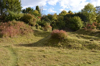
Aston Clinton Ragpits is a 2.9-hectare (7.2-acre) biological Site of Special Scientific Interest in Aston Clinton in Buckinghamshire. It is a former chalk quarry, which is now a nature reserve managed by the Berkshire, Buckinghamshire and Oxfordshire Wildlife Trust. It is in the Chilterns Area of Outstanding Natural Beauty.
Dancersend is an 81.3-hectare (201-acre) Site of Special Scientific Interest (SSSI) south of Aston Clinton in Buckinghamshire. Part of the site is managed by the Forestry Commission and part by the Berkshire, Buckinghamshire and Oxfordshire Wildlife Trust (BBOWT). The BBOWT's 47 hectare nature reserve, called Dancersend with Pavis Woods, extends into fields west of the SSSI. It is in the Chilterns Areas of Outstanding Natural Beauty.
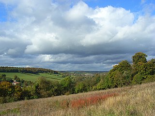
Millfield Wood is a 9.5-hectare (23-acre) biological Site of Special Scientific Interest north of High Wycombe in Buckinghamshire. It is owned and managed by the Berkshire, Buckinghamshire and Oxfordshire Wildlife Trust, and it is in the Chilterns Areas of Outstanding Natural Beauty.
Swain's Wood is a 16.2-hectare (40-acre) biological Site of Special Scientific Interest west of Turville in Buckinghamshire. It is in the Chilterns Area of Outstanding Natural Beauty, and is managed by the Berkshire, Buckinghamshire and Oxfordshire Wildlife Trust.
Weston Turville Reservoir is a 19 hectare biological Site of Special Scientific Interest south of Weston Turville in Buckinghamshire. It is owned by the Canal & River Trust, and the open water is leased to sailing and fishing clubs while the surrounding land is managed by the Berkshire, Buckinghamshire and Oxfordshire Wildlife Trust. The site is in the Chilterns Area of Outstanding Natural Beauty.
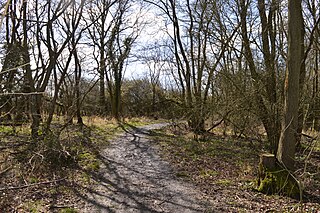
Rushbeds Wood is a 56-hectare (140-acre) nature reserve near Wotton Underwood in Buckinghamshire, managed by the Berkshire, Buckinghamshire and Oxfordshire Wildlife Trust (BBOWT). It is a surviving fragment of the ancient Bernwood Forest. The reserve is part of Rushbeds Wood and Railway Cutting, an 80.2-hectare (198-acre) biological Site of Special Scientific Interest. This includes a section of the Chiltern Main Line railway cutting, which runs along the north-east side of the BBOWT reserve.