
Netherside Stream Outcrops is a 2.9-hectare (7.2-acre) geological Site of Special Scientific Interest north-east of Haslemere in Surrey. It is a Geological Conservation Review site.
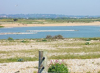
Dungeness, Romney Marsh and Rye Bay is a 10,172.9-hectare (25,138-acre) biological and geological Site of Special Scientific Interest which stretches from New Romney in Kent to Winchelsea in East Sussex. An area of 5,129.5 hectares is a Special Protection Area, an area of 3,141.1 hectares is a Special Area of Conservation, and an area of 6,377.6 hectares is a Ramsar Site, a wetland site designated of international importance under the Ramsar Convention. Part of the site is in the High Weald Area of Outstanding Natural Beauty, parts are Geological Conservation Review sites, part is a Local Nature Reserve, and part is a Royal Society for the Protection of Birds nature reserve, and part is a National Nature Reserve.

Northiam SSSI is a 0.3-hectare (0.74-acre) geological Site of Special Scientific Interest in Northiam in East Sussex. It is a Geological Conservation Review site.

Turners Hill SSSI is a 0.2-hectare (0.49-acre) geological Site of Special Scientific Interest in Turners Hill in West Sussex. It is a Geological Conservation Review site.

West Hoathly SSSI is a 0.7-hectare (1.7-acre) geological Site of Special Scientific Interest in Sharpthorne in West Sussex. It is a Geological Conservation Review site.

Stone Farm Rocks or Stone Hill Rocks is a 0.6-hectare (1.5-acre) geological Site of Special Scientific Interest south of East Grinstead in West Sussex. It is a Geological Conservation Review site.

Harrow Weald SSSI is a 3.7 hectare geological Site of Special Scientific Interest in Harrow Weald in the London Borough of Harrow. It was formerly part of the Stanmore and Harrow Weald Commons and Bentley Priory SSSI. It is a Geological Conservation Review site.
Harefield Pit is a 1.8-hectare geological Site of Special Scientific Interest in Harefield in the London Borough of Hillingdon. It occupies much of a partially filled-in chalk quarry. It has two entries in the Geological Conservation Review database.

Wansunt Pit is a 1.9-hectare (4.7-acre) geological Site of Special Scientific Interest in Dartford Heath between Crayford in the London Borough of Bexley and Dartford in Kent. It is also a Geological Conservation Review site. It is important geologically because it exposes the Dartford Heath Gravel, and the relationship of this exposure to the Swanscombe sequence and the Thames Terraces is a controversial issue in Thames Pleistocene studies. The site is part of Braeburn Park, a nature reserve managed by the London Wildlife Trust.

Moor Mill Quarry, West is a 0.16-hectare (0.40-acre) geological Site of Special Scientific Interest in How Wood in Hertfordshire. The local planning authority is St Albans City and District Council. It was notified in 1992 as representing the former Moor Mill Quarry SSSI, which was lost to landfill operations. It is listed by the Geological Conservation Review.
Muswell Hill is a 0.2-hectare (0.49-acre) geological Site of Special Scientific Interest north-west of Brill in Buckinghamshire. The local planning authorities are Buckinghamshire County Council and Aylesbury Vale District Council. It is listed by the Joint Nature Conservation Committee as a Geological Conservation Review site.

Bierton Clay Pit is a 0.07-hectare (0.17-acre) geological Site of Special Scientific Interest in Bierton in Buckinghamshire. It is listed by the Joint Nature Conservation Committee as a Geological Conservation Review site.

South Lodge Pit is a 0.5-hectare (1.2-acre) geological Site of Special Scientific Interest in Taplow in Buckinghamshire. It is a Geological Conservation Review site.

Folkestone Warren is a 316.3-hectare (782-acre) biological and geological Site of Special Scientific Interest (SSSI) which runs along the coast between Folkestone and Dover in Kent. It is a Nature Conservation Review site and it contains three Geological Conservation Review sites and part of a fourth. An area of 83.6 hectares is a Local Nature Reserve,

Scaynes Hill is a 0.04-hectare (0.099-acre) geological Site of Special Scientific Interest north-west of Newick in East Sussex. It is a Geological Conservation Review site.

Slinfold Stream and Quarry is a 2.3-hectare (5.7-acre) geological Site of Special Scientific Interest west of Horsham in West Sussex. It is a Geological Conservation Review site.

Warnham SSSI is a 28.5-hectare (70-acre) geological Site of Special Scientific Interest north of Horsham in West Sussex. It is a Geological Conservation Review site.

Freshfield Lane is a 17-hectare (42-acre) geological Site of Special Scientific Interest east of Haywards Heath in West Sussex. It is a Geological Conservation Review site.

Philpot's and Hook Quarries is a 2.6-hectare (6.4-acre) geological Site of Special Scientific Interest south-west of Sharpthorne in West Sussex. It is a Geological Conservation Review site.
