Brynamman

Last updated

Brynamman
Carmarthenshire UK location map.svg
Red pog.svg
Brynamman
Location within Carmarthenshire
Population2,608 
Community
Principal area
Preserved county
Country Wales
Sovereign state United Kingdom
Post town AMMANFORD
Postcode district SA18
Dialling code 01269
Police Dyfed-Powys
Fire Mid and West Wales
Ambulance Welsh
UK Parliament
Senedd Cymru – Welsh Parliament
List of places
UK
Wales
Carmarthenshire
51°48′54″N3°52′17″W / 51.81512°N 3.87136°W / 51.81512; -3.87136

Brynamman (Welsh : Brynaman) is a village on the south side of the Black Mountain (Y Mynydd Du), part of the Brecon Beacons National Park (Parc Cenedlaethol Bannau Brycheiniog). The village is split into Upper Brynamman and Lower Brynamman by the River Amman, which is also the boundary between the counties of Carmarthenshire and Neath Port Talbot (in the old county of Glamorganshire). Ruins of stone dwellings (possibly prehistoric), an early type of lime kiln and rectangular medieval buildings found on the mountain show that people have lived in this area for a long time. The population of Brynamman was 2,608 as of 2011; the urban area including Gwaun-Cae-Gurwen was 5,692. [1] [2]

Contents

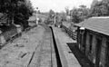
Brynamman was previously known as Y Gwter Fawr (Welsh : "The Big Gutter"); The name was changed when the railway from Ammanford reached the village. George Borrow describes aspects of Gwter Fawr in the mid-19th century in his book Wild Wales published 1862. The current name is derived from "Brynamman House", the home of John Jones, builder of the railway.[ citation needed ]

Brynamman Golf Club (now defunct) first appeared in the mid-1920s. It continued into the 1930s. [3] A feasibility study is being conducted into the reopening of Brynamman Lido, which opened in 1934 and closed in 2010. [4]

Ynys Dawela

Ynys Dawela Nature Park in the snow (January 2010) Ynys Dawela in the snow.JPG
Ynys Dawela Nature Park in the snow (January 2010)

Ynys Dawela Nature Park is situated to the west of Brynamman, in the upper reaches of the Amman Valley. Its northern boundary is the Brecon Beacons National Park, and the river Amman, fringed with ancient oak woodland, forms its southern boundary. The park covers an area of 39 acres (15.8 hectares) and was once a working farm. The meadows dating from this period now support some scarce flowers, such as the Whorled Caraway and Meadow Thistle, and other wildlife, such as the marsh fritillary butterfly and dormice. [5]

The park has a range of important habitats supporting a diverse assemblage of plant and animal life. The wet grasslands, marshy ground and ponds are particularly important to amphibians, like newts, frogs and toads. The site narrowly escaped opencast mining, before Dinefwr Borough Council secured its future by purchasing it from British Coal. Since then the park has been developed for recreational and educational use. The park is managed by Carmarthenshire County Council and supported by volunteers.[ citation needed ]

Tregib Arms

The Tregib Arms in Brynamman was built c.1860. The first-ever union branch to look after the needs of Welsh anthracite miners was started in the public bar in 1891. [6] The original certificate can be viewed in the lounge bar.

During the 1930s Welsh middleweight boxing champion Tommy Davies was a regular customer; his photo can be seen in the main bar. [7]

Notable people

Related Research Articles

<span class="mw-page-title-main">Brecon Beacons</span> Region and national park in south Wales

The Brecon Beacons, or Bannau Brycheiniog ( ), is a mountainous region and national park in Wales. The name 'Brecon Beacons' was originally applied only to the mountain range south of Brecon, Powys, which is now also known as the Central Beacons. The range includes South Wales' highest mountain, Pen y Fan, its twin summit Corn Du, and Craig Gwaun Taf, which are the three highest peaks in the range.

<span class="mw-page-title-main">Ammanford</span> Town and community in Carmarthenshire, Wales

Ammanford is a town and community in Carmarthenshire, Wales, with a population of 5,411 at the 2011 census. It is a former coal mining town. The built-up area had a population of 7,945 with the wider urban area even bigger.

<span class="mw-page-title-main">Llandeilo</span> Town and community in Carmarthenshire, Wales

Llandeilo is a town and community in Carmarthenshire, Wales, situated at the crossing of the River Towy by the A483 on a 19th-century stone bridge. Its population was 1,795 at the 2011 Census. It is adjacent to the westernmost point of the Brecon Beacons National Park. The town is served by Llandeilo railway station on the Heart of Wales Line.

<span class="mw-page-title-main">Llandovery</span> Market town and community in Carmarthenshire, Wales

Llandovery is a market town and community in Carmarthenshire, Wales. It lies on the River Tywi and at the junction of the A40 and A483 roads, about 25 miles (40 km) north-east of Carmarthen, 27 miles (43 km) north of Swansea and 21 miles (34 km) west of Brecon.

<span class="mw-page-title-main">Tonypandy</span> Human settlement in Wales

Tonypandy is a town, community and electoral ward located in the county borough of Rhondda Cynon Taf, within the historic county boundaries of Glamorgan, Wales, lying in the Rhondda Fawr Valley. A former industrial coal mining town, the town was the scene of the 1910 Tonypandy riots.

<span class="mw-page-title-main">Glanamman</span> Village in Carmarthenshire, Wales

Glanamman is a mining village in the valley of the River Amman in Carmarthenshire, Wales. Glanamman has long been a stronghold of the Welsh language; village life is largely conducted in Welsh. Like the neighbouring village of Garnant it experienced a coal-mining boom in the 19th and early 20th centuries, but the last big colliery closed in 1947 and coal has been extracted fitfully since then.

<span class="mw-page-title-main">South Wales</span> Region of Wales

South Wales is a loosely defined region of Wales bordered by England to the east and mid Wales to the north. Generally considered to include the historic counties of Glamorgan and Monmouthshire, south Wales extends westwards to include Carmarthenshire and Pembrokeshire. In the western extent, from Swansea westwards, local people would probably recognise that they lived in both south Wales and west Wales. The Brecon Beacons National Park covers about a third of south Wales, containing Pen y Fan, the highest British mountain south of Cadair Idris in Snowdonia.

<span class="mw-page-title-main">Taff Trail</span> Walking and cycling track in South Wales

The Taff Trail is a popular walking and cycle path that runs for 55 miles (89 km) between Cardiff Bay and Brecon in Wales. It is so named because it follows the course of the River Taff. Along much of its length, it follows the National Cycle Network Route 8 that continues to Holyhead, and is substantially off-road.

<span class="mw-page-title-main">Pen y Fan</span> Welsh mountain peak of the Brecon Beacons, Powys

Pen y Fan is the highest peak in South Wales, situated in Brecon Beacons National Park. At 886 metres (2,907 ft) above sea-level, it is also the highest British peak south of Cadair Idris in Snowdonia. It is the highest point of the historic county of Brecknockshire. The twin summits of Pen y Fan and Corn Du at 873 metres (2,864 ft) were formerly referred to as Cadair Arthur or 'Arthur's Seat'.

<span class="mw-page-title-main">Abercraf</span> Village in Powys, Wales

Abercrâf or Abercrave is a village in Powys, Wales, in the community of Ystradgynlais and within the historic boundaries of the county of Brecknockshire.

<span class="mw-page-title-main">Garnant</span> Village in Carmarthenshire, Wales

Garnant is a mining village in the valley of the River Amman in Carmarthenshire, Wales, north of Swansea. Like the neighbouring village of Glanamman it experienced a coal-mining boom in the 19th and early 20th centuries, but the last big colliery closed in 1936 and coal has been extracted fitfully since then. The village has the only Commissioners' church built in southwest Wales, traditionally a Methodist region.

<span class="mw-page-title-main">Black Mountain (range)</span> Mountain range, west of Brecon Beacons, Wales

The Black Mountain is a mountain range in South, Mid and West Wales, straddling the county boundary between Carmarthenshire and Powys and forming the westernmost range of the Brecon Beacons National Park. Its highest point is Fan Brycheiniog at 802 metres or 2,631 ft. The Black Mountain also forms a part of the Fforest Fawr Geopark.

<span class="mw-page-title-main">Pontyberem</span> Village and community in Carmarthenshire, Wales

Pontyberem is a village and community situated in the Gwendraeth Valley halfway between Carmarthen and Llanelli in Carmarthenshire, Wales. As of the 2001 Census, the population was recorded as 2,829, reducing to 2,768 at the 2011 Census.

Trimsaran is a community and former mining village which lies on the B4308 between Llanelli and Kidwelly, in the Welsh county of Carmarthenshire.

<span class="mw-page-title-main">Govilon</span> Village in Monmouthshire, Wales

Govilon is a small Welsh village located between Llanfoist and Gilwern near Abergavenny in north Monmouthshire. It is part of the community of Llanfoist Fawr. the population was 1,447 in 2011.

<span class="mw-page-title-main">Beacons Way</span> Long distance path in mid wales

The Beacons Way is a waymarked long distance footpath in the Brecon Beacons National Park, Wales. It is a linear route which runs for 99 miles (159 km) east to west through the National Park, and passes many of the most important landmarks and mountain peaks in the mountain range. It also includes a few of the towns in the park as well as popular attractions such as Carreg Cennen Castle near Llandeilo at the western end of the path.

<span class="mw-page-title-main">Tumble, Carmarthenshire</span> Village in Carmarthenshire, Wales


Tumble, is a village situated south of Cross Hands near the towns of Carmarthen and Llanelli in Carmarthenshire, Wales. Tumble, along with Cross Hands is part of the community of Llannon. The population, including Drefach was 4,302.

<span class="mw-page-title-main">Gwynfe</span> Village in Carmarthenshire, Wales

Gwynfe or Capel Gwynfe is a small village inside the portion of Brecon Beacons National Park that is in Carmarthenshire, a county of southwestern Wales. This village is situated between Trichrug and the western slopes of the Black Mountain, to the west of the A4069 road about halfway between Llangadog and Brynamman. The village comprises a scattered collection of mostly nineteenth and twentieth-century housing that developed around several chapels. The area around the village is mainly farmland and the village was 2004 'Village of the Year for Carmarthenshire'. The village has a grade-two listed phone box now used as an information centre and a modern community hall built in 2001. The community association have erected 2 large woodcarvings of three red kites.

The bedrock geology of Carmarthenshire in west Wales consists largely of Palaeozoic age sedimentary rocks. Unconsolidated deposits of Quaternary age in Carmarthenshire include a dissected cover of glacial till, valley floor alluvium and some scattered peat deposits in both upland and lowland settings. There are extensive beach and tidal flat deposits along the Carmarthenshire coast. The exploitation of the county's mineral riches, particularly coal and limestone, was a key part of the local economy through much of the nineteenth and twentieth centuries.

References

  1. "Custom report - Nomis - Official Labour Market Statistics".
  2. "Custom report - Nomis - Official Labour Market Statistics".
  3. "Brynamman Golf Club", "Golf’s Missing Links".
  4. Harries, Robert (16 October 2022). "The historic Welsh lido left in ruin that may finally get its chance to shine once more". Wales Online. Retrieved 16 October 2022.
  5. "Carmarthenshire Biodiversity Partnership - 2016 Achievements" (PDF). Carmarthenshire County Council. p. 6. Retrieved 27 December 2019.
  6. The Society for the Protection of the Anthracite Miners Archived July 5, 2008, at the Wayback Machine
  7. "Tommy Davies". Britishboxing.net. Archived from the original on 11 July 2012. Retrieved 17 January 2014.