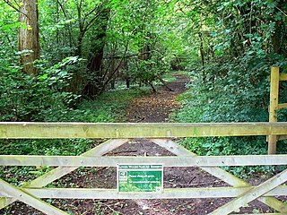
Trellech is a village and parish in Monmouthshire, south-east Wales. Located 5 miles (8 km) south of Monmouth and 4 miles (6.4 km) north-north-west of Tintern, Trellech lies on a plateau above the Wye Valley on the southern fringes of 320 acres (130 ha) of woodland in an Area of Outstanding Natural Beauty. Three Bronze Age standing stones are situated in the village, known as Harold's Stones, which overlook the historic church of St Nicholas, a Grade I listed building.

Monmouthshire is a county in the south east of Wales. It borders Powys to the north; the English counties of Herefordshire and Gloucestershire to the north and east; the Severn Estuary to the south, and Torfaen, Newport and Blaenau Gwent to the west. The largest town is Abergavenny, and the administrative centre is Usk.

Magor is a large village in Monmouthshire, south east Wales, about 9 miles (14 km) west of Chepstow and about 9 miles (14 km) east of Newport. It lies on the Caldicot Levels beside the Severn Estuary, and is in the community of Magor with Undy. Magor lies close to the M4 motorway.

Lower Woods is a 280.1-hectare (692-acre) biological and geological Site of Special Scientific Interest near the village of Wickwar, South Gloucestershire, notified in 1966 and renotified in 1985. The site area has increased at last revision in 1974 to a 284.1-hectare (702-acre) site. The site is a nature reserve managed by the Gloucestershire Wildlife Trust.

The Caldicot and Wentloog Levels are two areas of low-lying estuarine alluvial wetland and intertidal mudflats adjoining the north bank of the Severn Estuary, either side of the River Usk estuary near Newport in south east Wales. They are also known collectively as the Monmouthshire Levels or Gwent Levels, and the name Wentloog is sometimes spelled Wentlooge in official publications.

Midger is a 65.7-hectare (162-acre) biological Site of Special Scientific Interest straddling the border of Gloucestershire and South Gloucestershire, notified in 1966 and renotified in 1984. Since the last revision in 1974, the size has been reduced to a 56-hectare (140-acre) site. It lies east of Hillesley, Gloucestershire and north of Hawkesbury Upton, South Gloucestershire. It is at the head of the Kilcott Valley.

The Wye Valley is a valley in Wales and England. The River Wye is the fourth-longest river in the United Kingdom.

Penallt is a village in Monmouthshire, Wales, situated high on a hill 4 kilometres south of Monmouth. In the centre of the village, by the village green, stands the 17th-century village pub, the Bush Inn.
Southern Monmouthshire was a parliamentary constituency in Monmouthshire, Wales. It returned one Member of Parliament (MP) to the House of Commons of the Parliament of the United Kingdom.
Croes Robert Wood is a nature reserve and Site of Special Scientific Interest (SSSI), noted for its biological characteristics, in Monmouthshire, south east Wales. Gwent Wildlife Trust, the owners of the site, manage the woodland through methods of coppicing and charcoal burning to encourage its notable flora and fauna.

Gaer Wood is a Site of Special Scientific Interest (SSSI), noted for its biological characteristics, in Monmouthshire, south east Wales.

Graig Wood is a Site of Special Scientific Interest (SSSI), noted for its biological characteristics, in Monmouthshire, south east Wales. It forms part of the wider Hael Woods complex.

Lydart is a dispersed hamlet within the community of Mitchel Troy, Monmouthshire, Wales. It is located about 3 miles (4.8 km) south-west of Monmouth, 3 miles (4.8 km) north of Trellech, and 1 mile (1.6 km) south-east of Mitchel Troy village, on the top of an escarpment which slopes steeply down to the valley of the River Trothy. The B4293 road passes through the area.

Lower Hael Wood is a semi-ancient woodland and Site of Special Scientific Interest (SSSI), noted for its biological characteristics, in Monmouthshire, south east Wales. It is part of the wider Hael Woods complex. The wood is on the side of the River Wye which is the border between Wales and England.

Pentwyn Farm Grasslands is a nature reserve, and a series of agricultural fields, in Monmouthshire, southeast Wales. It was designated a Site of Special Scientific Interest (SSSI) in 1993, noted for its biological characteristics.

Upper Wye Gorge is a Site of Special Scientific Interest (SSSI), noted for its biological and geological characteristics, around Symonds Yat in the Wye Valley on the Wales–England border. The site is listed in the "Forest of Dean Local Plan Review" as a Key Wildlife Site (KWS).

Salmonsbury Meadows is an 18-hectare (44-acre) biological and geological Site of Special Scientific Interest in Gloucestershire, notified in 1985. The site is listed in the 'Cotswold District' Local Plan 2001-2011 as a Key Wildlife Site (KWS).

Magor Marsh is a 36-hectare (90-acre) wetland reserve, located on the Welsh side of the Severn Estuary. It is managed by the Gwent Wildlife Trust. It has a great variety of habitats, including damp hay meadows, sedge fen, reed bed, scrub and wet woodland. There are also numerous reens and a large pond.


