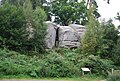
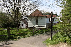
Sussex Wildlife Trust

Last updated

Sussex Wildlife Trust
Formation1961
Headquarters Woods Mill
Location
  • Sussex
Membership
33,000
Website Sussex Wildlife Trust

The Sussex Wildlife Trust (SWT) is a conservation charity which aims to protect natural life in Sussex. It was founded in 1961 and is one of 46 wildlife trusts across the UK and the Isle of Man and Alderney. As of 2019, it has 33,000 members and manages 2,000 hectares (5,000 acres) of land for nature. [1] It is a registered charity [2] and in the year to 31 March 2019 it had an income of £5.7 million and expenditure of £4 million, resulting in net income of £1.7 million. [3]

Contents

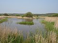
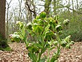
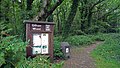
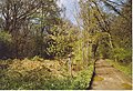
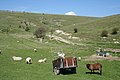
The SWT manages twenty-six nature reserves in the county. [lower-alpha 1] Nineteen are Sites of Special Scientific Interest, one is a national nature reserve, eleven are local nature reserves, eight are Special Areas of Conservation, three are Special Protection Areas, three are Ramsar sites and seven are Nature Conservation Review sites. Its headquarters at Woods Mill, south of Henfield, is also a nature reserve with a lake, woodland and meadows. [5]

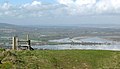
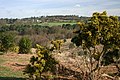
The historic county of Sussex is divided into the administrative counties of East Sussex and West Sussex. The South Downs stretches across the county from west to east. This area is chalk and to the north is the Weald, which is composed of heavy clays and sand. The coast has a succession of holiday towns such as Brighton, Eastbourne, Bognor Regis and Worthing. [6]

Map all coordinates using: OpenStreetMap

Key

Sites

SitePhotographArea [lower-alpha 2] Location [lower-alpha 2] Public accessDesignationsDescription
Amberley Wildbrooks [14] Amberley Wild Brooks - geograph.org.uk - 361203.jpg 80 hectares
(200 acres)
Amberley
50°54′47″N0°32′10″W / 50.913°N 0.536°W / 50.913; -0.536 (Amberley Wildbrooks)
TQ030136
FP NCR [15] Ramsar [16] SAC [17] SPA [18] SSSI [15] This site has wet grassland, peat bog and man-made ditches. It has more than half the aquatic plants found in Britain and diverse invertebrates, some of which are internationally rare. The site is also important for waders, which breed there, and for wintering wildfowl. [19]
Brickfield Meadow [20] Brickfield Meadow (geograph 5560851).jpg 1.4 hectares
(3.5 acres)
Uckfield
51°01′08″N0°05′49″E / 51.019°N 0.097°E / 51.019; 0.097 (Brickfield Meadow)
TQ472265
YESThis wildflower rich meadow has been traditionally managed for many years by cutting in the summer and grazing later in the year. Flowering plants include Dyer’s greenweed, devil's-bit scabious, bitter-vetch and zigzag clover. It is one of the best places in the county for the chimney sweeper moth. [20]
Burton and Chingford Ponds [21] Burton Mill Pond - geograph.org.uk - 1260268.jpg 56 hectares
(140 acres)
Petworth
50°57′11″N0°36′32″W / 50.953°N 0.609°W / 50.953; -0.609 (Burton and Chingford Ponds)
SU978180
YES LNR [22] SSSI [23] This site has ponds, carr woodland, bog, wet heath and marshy grassland. There is a diverse range of invertebrates including three nationally rare species, the snail Omphiscola glabra and the craneflies Erioptera meijerei and Tipula marginata . The site is also important for its breeding water birds, such as water rails and great crested grebes. [24]
Cooksbridge Meadow [25] Cooksbridge Meadow (3).jpg 9 hectares
(22 acres)
Fernhurst
51°02′06″N0°43′30″W / 51.035°N 0.725°W / 51.035; -0.725 (Cooksbridge Meadow)
SU895270
YESMost of this site is grassland but there is also a narrow strip of woodland and a stream. The meadows are grazed by sheep in order to keep the grass down and ensure a good display of flowers in the spring. Woodland flowers include sanicle, yellow archangel and purslane. [25]
Ditchling Beacon [26] Ditchling Beacon Nature Reserve - geograph.org.uk - 1455948.jpg 24 hectares
(59 acres)
Hassocks
50°54′00″N0°06′25″W / 50.900°N 0.107°W / 50.900; -0.107 (Ditchling Beacon)
TQ332129
YES SSSI [27] This is one of the highest points of the South Downs and it has a 360-degree view across the Weald and the Sussex coast. It is herb-rich chalk grassland which provides food for a variety of insects, including butterflies such as the chalkhill blue and the uncommon silver-spotted skipper. [28]
Ebernoe Common [29] Path through Ebernoe Common - geograph.org.uk - 1162481.jpg 157 hectares
(390 acres)
Petworth
51°02′28″N0°36′40″W / 51.041°N 0.611°W / 51.041; -0.611 (Ebernoe Common)
SU975278
YES NCR [30] NNR [31] SAC [32] SSSI [33] This site consists of several blocks of ancient woodland. It is nationally important for lichens, with over 100 species, and for fungi, with seven Red Data Book species. It is also nationally important for woodland breeding birds and for bats, especially barbastelles and Bechstein’s. [34]
Eridge Rocks [35] Eridge Rocks - geograph.org.uk - 1492841.jpg 44 hectares
(110 acres)
Tunbridge Wells
51°05′53″N0°13′05″E / 51.098°N 0.218°E / 51.098; 0.218 (Eridge Rocks)
TQ554355
YES SSSI [36] This is ancient woodland on clay with outcrops of sandstone which form cliffs up to ten metres high. Flora on the rocks include Tunbridge filmy fern, the mosses Dicranum scottianum and Orthodontium gracile and the liverworts Scapania umbrosa , Scapania gracilis and Harpanthus scutatus . [37]
Filsham Reedbed [38] Nature Reserve Nr Bulverhythe East Sussex - geograph.org.uk - 167871.jpg 19 hectares
(47 acres)
Hastings
50°51′04″N0°31′12″E / 50.851°N 0.520°E / 50.851; 0.520 (Filsham Reedbed)
TQ775088
YES LNR [39] SSSI [40] This is one of the largest reedbeds in the county and it also has areas of grazing marsh, swamp and ancient woodland. There is a wide variety of plants and over 1000 species of invertebrates have been recorded. The bird life is important and diverse, with species such as Cetti's warbler, reed bunting, sedge warbler, purple heron, red-backed shrike and water rail. [38]
Flatropers Wood [41] Stinking hellebore, Flatropers Wood (geograph 5266981).jpg 38 hectares
(94 acres)
Rye
50°58′48″N0°39′04″E / 50.980°N 0.651°E / 50.980; 0.651 (Flatropers Wood)
TQ862234
YESThe wood is mainly oak and birch, but there are also areas of sweet chestnut and former plantations of Scots pine and beech. The site is notable for its invertebrates, with almost 500 species of moths recorded and the rare oak mining-bee. [42]
Gillham Wood [43] Gillham Wood, Bexhill.jpg 3 hectares
(7.4 acres)
Bexhill-on-Sea
50°50′10″N0°26′13″E / 50.836°N 0.437°E / 50.836; 0.437 (Gillham Woods)
TQ717069
PPThe wood is mainly oak with an understorey of hazel, birch and holly. An old bomb crater is now a pond which provides a habitat for a variety of fauna and flora. Part of the site is closed to the public so as to provide a sanctuary for foxes and other wildlife. [44]
Graffham Common [45] Bowl Barrow Graffham Nature Reserve.jpg 38 hectares
(94 acres)
Petworth
50°58′05″N0°40′26″W / 50.968°N 0.674°W / 50.968; -0.674 (Graffham Common)
SU932196
YESThis former pine plantation is being restored back to heath and grassland by the clearance of pine trees and rhododendrons. Drainage ditches have been blocked to allow the natural restoration of wet heath. Wet seepages provide a habitat for cross-leaved heath, hare’s-tail cottongrass and purple moor-grass. [46]
Iping and Stedham Commons [47] Iping Common.JPG 125 hectares
(310 acres)
Midhurst
50°59′28″N0°47′13″W / 50.991°N 0.787°W / 50.991; -0.787 (Iping and Stedham Commons)
SU852220
YES LNR [48] NCR [49] SSSI [50] This is described by Natural England as one of the richest areas of heath in the county. Most of it is dry but there are also areas of wet heath, two ponds, woodland, scrub and grassland. It has a rich invertebrate fauna, and breeding heathland birds include nightjars and stonechats. [51]
Levin Down [52] Beef cattle, Levin Down - geograph.org.uk - 1498569.jpg 28 hectares
(69 acres)
Chichester
50°54′36″N0°44′24″W / 50.910°N 0.740°W / 50.910; -0.740 (Levin Down)
SU887130
YES SSSI [53] This is an area of chalk grassland and heath on the slope of the South Downs. The chalk turf has a rich variety of flora, such as autumn gentian, salad burnet, round-headed rampion, autumn lady’s tresses, eyebright, glaucous sedge and quaking grass. [54]
Malling Down [55] Malling Down Nature Reserve (geograph 2742190).jpg 85 hectares
(210 acres)
Lewes
50°52′59″N0°01′19″E / 50.883°N 0.022°E / 50.883; 0.022 (Malling Down)
TQ423112
YES NCR [56] SAC [57] SSSI [58] This South Downs site is chalk grassland, which is one of Britain's richest habitats for flowers. There are many orchids including the widespread common spotted and fragrant and rarer ones such as the musk and frog orchid. [59]
Marline Valley [60] Path in Marline Wood - geograph.org.uk - 419833.jpg 43 hectares
(110 acres)
Hastings
50°52′55″N0°32′06″E / 50.882°N 0.535°E / 50.882; 0.535 (Marline Valley)
TQ784122
YES LNR [61] SSSI [62] This site has ancient woodland and species rich unimproved grassland. The wood has coppice of hornbeam, hazel and sweet chestnut and standards of pedunculate oak. [lower-alpha 3] A stream runs along a steep sided valley which has 61 species of mosses and liverworts, including some uncommon species. [64]
The Mens [65] Bridleway through The Mens, Strood Green. - geograph.org.uk - 172305.jpg 166 hectares
(410 acres)
Petworth
51°00′11″N0°32′35″W / 51.003°N 0.543°W / 51.003; -0.543 (The Mens)
TQ023236
YES NCR [66] SAC [67] SSSI [68] This large area of woodland has diverse breeding birds and rich lichen and fungal floras. There are many rare beetles and a fly which is under threat of extinction, Chelostoma curvinervis . All three British species of woodpecker breed on the site, together with other woodland species such as nightingales, woodcocks and wood warblers. [69]
Old Lodge [70] The Old Lodge, Ashdown Forest - geograph.org.uk - 6238.jpg 74 hectares
(180 acres)
Uckfield
51°03′22″N0°05′42″E / 51.056°N 0.095°E / 51.056; 0.095 (Old Lodge)
TQ469306
YES LNR [71] NCR [72] SAC [73] SPA [74] SSSI [75] This highland site is mainly grassland and heather, with areas of gorse and scattered birch and oak trees. There are also small Scots pine plantations. Birds include common redstart and common crossbills and there are large nests of red wood ants. [70]
Pevensey Marshes [76] Footbridge over Pevensey Haven - geograph.org.uk - 210023.jpg 150 hectares
(370 acres)
Pevensey
50°50′06″N0°21′11″E / 50.835°N 0.353°E / 50.835; 0.353 (Pevensey Marshes)
TQ658066
NO NCR [77] Ramsar [78] SAC [79] SSSI [80] This wetland site has a network of pools, scrapes and ditches. There are many plants which are only found in high quality water, such as flowering-rush, water-violet, tubular water-dropwort. Ditches have nationally important populations of some rare aquatic molluscs such as Segmentina nitida and Anisus vorticulus . [81]
Rye Harbour [82] Beach at Rye Harbour - geograph.org.uk - 1329567.jpg 465 hectares
(1,150 acres)
Rye
50°56′13″N0°45′47″E / 50.937°N 0.763°E / 50.937; 0.763 (Rye Harbour)
TQ942189
YES LNR [83] Ramsar [84] SAC [85] SPA [86] SSSI [87] This large reserve has diverse coastal habitats, including saltmarsh, shingle, reedbeds, saline lagoons, grazing marsh and flooded gravel pits. [82] More than 280 species of birds have been recorded, out of which 90 breed on the site. There are more than 450 flowering plant species, including 27 which are scarce and two of which are endangered, least lettuce and stinking hawksbeard. [82]
Seaford Head [88] Cuckmere Haven - geograph.org.uk - 620406.jpg 83 hectares
(210 acres)
Seaford
50°45′43″N0°07′52″E / 50.762°N 0.131°E / 50.762; 0.131 (Seaford Head)
TV504980
YES LNR [89] NCR [90] SSSI [91] The site has diverse habitats with chalk grassland, chalk cliffs, scrub, vegetated shingle, wet grassland, saltmarsh and rockpools. Grassland flora include kidney vetch, squinancywort, moon carrot and clustered bellflower. There are butterflies such as silver-spotted skipper, chalkhill blue and adonis blue. [92]
Selwyns Wood [93] Selwyns Wood Car Park (geograph 5786442).jpg 11 hectares
(27 acres)
Heathfield
50°57′47″N0°12′25″E / 50.963°N 0.207°E / 50.963; 0.207 (Selwyns Wood)
TQ551205
YESThis reserve has woodland with extensive sweet chestnut, a stream in a narrow valley and an area of heather. Breeding woodland birds include willow warblers, chiffchaffs, nuthatches and marsh tits. [94]
Southerham Farm [95] Oxteddle Bottom - geograph.org.uk - 157258.jpg 131 hectares
(320 acres)
Lewes
50°51′40″N0°04′01″E / 50.861°N 0.067°E / 50.861; 0.067 (Southerham Farm)
TQ456089
YESThe thin and infertile soils on this chalk site result in a floristically very rich grassland. Plants which flower in the summer include horseshoe vetch, kidney vetch, mouse-ear hawkweed, field scabious, dropwort and salad burnet. [96]
Waltham Brooks [97] Old Canal, Waltham Brooks - geograph.org.uk - 297310.jpg 42 hectares
(100 acres)
Pulborough
50°57′11″N0°32′31″W / 50.953°N 0.542°W / 50.953; -0.542 (Waltham Brooks)
TQ025181
FP SSSI [98] This is one of the few remaining areas of grazing marsh in the county and it has a rich variety of aquatic flora, including one nationally rare species, the small water-pepper. Many bird species winter at the site, including three in nationally important numbers, Bewick’s swan, teal and shoveler. [99]
West Dean Woods [100] Bridleway enters West Dean Woods - geograph.org.uk - 1747657.jpg 17 hectares
(42 acres)
Chichester
50°55′55″N0°47′56″W / 50.932°N 0.799°W / 50.932; -0.799 (West Dean Woods)
SU845154
NO SSSI [101] These woods have records dating back to the sixteenth century. The ground layer is rich in flowering plants, including white helleborine, fly orchid and around two million wild daffodils. Thirty five species of bryophyte have been recorded and invertebrates include two rare hoverflies which live on dead wood, Cheilosa carbonaria and Cheilosa nigripes . [102] [100]
Withdean Woods [103] Diverging paths in Withdean Stadium Woods (geograph 3822886).jpg 1 hectare
(2.5 acres)
Brighton
50°51′11″N0°09′50″W / 50.853°N 0.164°W / 50.853; -0.164 (Withdean Woods)
TQ293075
PP LNR [104] Many of the mature trees on this site were destroyed by the Great Storm of 1987, but it still has a range of mammals including foxes, badgers and common pipistrelle bats, while there are birds such as great spotted woodpecker and firecrests. [103]
Woods Mill [5] Meadowsweet Filipendula ulmaria at Woods Mill, Sussex Wildlife Trust, England.jpg 19 hectares
(47 acres)
Henfield
50°54′36″N0°16′08″W / 50.910°N 0.269°W / 50.910; -0.269 (Woods Mill)
TQ218137
YESThis is the headquarters of the trust and an environmental education centre. [5] The main feature of the nature reserve is a lake, which has many damselflies and dragonflies, such as the scarce chaser and downy emerald. There is also a large area of ancient woodland, with oak, silver birch and coppiced hazel. [105]

See also

Notes

  1. This is the number of reserves which are listed separately on the SWT website. No details are given of other small reserves. [4]
  2. 1 2 The area and location are taken from the Wildlife Trust page for each site.
  3. Coppicing with standards was a form of forestry management widely used until the late nineteenth century. Most of the trees were regularly coppiced, that is cut down to near ground level, resulting in a stool which provides a base for new growth. Scattered trees were standards which were not coppiced but left to grow. [63]

Related Research Articles

<span class="mw-page-title-main">Norfolk Wildlife Trust</span> British nature reserve

The Norfolk Wildlife Trust (NWT) is one of 46 wildlife trusts covering Great Britain, Northern Ireland, Isle of Man and Alderney. Founded in 1926, it is the oldest of all the trusts. It has over 35,500 members and eight local groups and it manages more than fifty nature reserves and other protected sites. It also gives conservation advice to individuals and organisations, provides educational services to young people on field trips and organises entertainment and information events at nature reserves. The NWT reserves include twenty-six Sites of Special Scientific Interests, nine national nature reserves, twelve Nature Conservation Review sites, sixteen Special Areas of Conservation, twelve Special Protection Areas, eleven Ramsar sites, two local nature reserves, four Geological Conservation Review sites and five which are in Areas of Outstanding Natural Beauty.

<span class="mw-page-title-main">Kent Wildlife Trust</span> Conservation charity in the UK

Kent Wildlife Trust (KWT) is a conservation charity in the United Kingdom that was founded in 1958, previously known as the Kent Trust for Nature Conservation. It aims to "work with people to restore, save and improve our natural spaces" and to "ensure that 30% of Kent and Medway – land and sea – is managed to create a healthy place for wildlife to flourish". In 2023, they have reported over 30,000 members and an annual income of £8 million. KWT manages over ninety nature reserves in Kent, of which thirty-seven are Sites of Special Scientific Interest, three are national nature reserves, five are Special Areas of Conservation, four are Special Protection Areas, six are local nature reserves, thirty-eight are in Areas of Outstanding Natural Beauty and one is a scheduled monument.

<span class="mw-page-title-main">Surrey Wildlife Trust</span>

Surrey Wildlife Trust (SWT) was founded in 1959 as Surrey Naturalists' Trust and it is one of forty-six wildlife trusts covering Great Britain, Northern Ireland, Isle of Man and Alderney. SWT carries out conservation activities on a considerable area of Surrey County Council's large countryside estate and also manages land on behalf of the Ministry of Defence estate. As of 2022 the SWT manages more than 6,000 hectares of land for wildlife and employs more than 100 staff. It had an income of £5.1 million and expenditure of £5.7 million.

<span class="mw-page-title-main">Berkshire, Buckinghamshire and Oxfordshire Wildlife Trust</span> Wildlife conservation charity

The Berkshire, Buckinghamshire and Oxfordshire Wildlife Trust (BBOWT), is a wildlife trust covering the counties of Berkshire, Buckinghamshire and Oxfordshire in England.

<span class="mw-page-title-main">Pevensey Levels</span> Site of Special Scientific Interest in East Sussex

Pevensey Levels is a 3,603.2-hectare (8,904-acre) biological Site of Special Scientific Interest between Bexhill-on-Sea and Hailsham in East Sussex. It is a Nature Conservation Review site, Grade I, a Ramsar site and a Special Area of Conservation. An area of 183.5 hectares is a national nature reserve and an area of 150 hectares is a nature reserve called Pevensey Marshes which is managed by the Sussex Wildlife Trust.

<span class="mw-page-title-main">Lewes Downs</span>

Lewes Downs is a 165-hectare (410-acre) biological Site of Special Scientific Interest east of Lewes in East Sussex. It is a Nature Conservation Review site, Grade I and a Special Area of Conservation. Part of it is a national nature reserve, part is Malling Down nature reserve, which is managed by the Sussex Wildlife Trust, and part is Mount Caburn, an Iron Age hill fort which is a Scheduled Monument.

<span class="mw-page-title-main">Ebernoe Common</span>

Ebernoe Common is a 233.9-hectare (578-acre) biological Site of Special Scientific Interest in Ebernoe, north of Petworth in West Sussex. It is a Nature Conservation Review site, Grade I, a national nature reserve and a Special Area of Conservation. It is managed by the Sussex Wildlife Trust

<span class="mw-page-title-main">Old Lodge</span>

Old Lodge is a 103.1-hectare (255-acre) Local Nature Reserve west of Crowborough in East Sussex. It is privately owned. It is managed by Sussex Wildlife Trust. It is part of Ashdown Forest, which is a Nature Conservation Review site, Grade I, a Special Area of Conservation, a Special Protection Area and a Site of Special Scientific Interest.

References

  1. "About us". Sussex Wildlife Trust. Archived from the original on 10 April 2019. Retrieved 29 August 2019.
  2. "Sussex Wildlife Trust: Accounts for the Year to 31 March 2019". Charity Commission. Retrieved 30 January 2020.
  3. "Sussex Wildlife Trust Report and Annual Accounts 2018–19" (PDF). Sussex Wildlife Trust. p. 16. Retrieved 9 September 2019.
  4. "Find a nature reserve near you". Sussex Wildlife Trust. Archived from the original on 27 July 2019. Retrieved 29 August 2019.
  5. 1 2 3 "Woods Mill". Sussex Wildlife Trust. Archived from the original on 21 December 2018. Retrieved 20 December 2018.
  6. "Sussex". Encyclopaedia Britannica. Archived from the original on 25 July 2019. Retrieved 13 October 2019.
  7. "Local Nature Reserves (England)". Natural England. Retrieved 2 February 2020.
  8. Ratcliffe, Derek, ed. (1977). A Nature Conservation Review. Vol. 1. Cambridge, UK: Cambridge University Press. ISBN   978-0-521-21403-2.
  9. "National Nature Reserves in England". Natural England. Archived from the original on 21 September 2015. Retrieved 2 February 2020.
  10. "Wetlands of International Importance (Ramsar sites)". The Ramsar Convention Secretariat. Archived from the original on 18 June 2019. Retrieved 2 February 2020.
  11. "Special Areas of Conservation (England)". Natural England. Retrieved 2 February 2020.
  12. "Special Protection Areas (England)". Natural England. Retrieved 2 February 2020.
  13. "Sites of Special Scientific Interest - Managing Your Land". Natural England. Archived from the original on 14 January 2020. Retrieved 2 February 2020.
  14. "Amberley Wildbrooks". Sussex Wildlife Trust. Archived from the original on 21 December 2018. Retrieved 20 December 2018.
  15. 1 2 "Designated Sites View: Amberley Wild Brooks". Sites of Special Scientific Interest. Natural England. Retrieved 11 April 2019.
  16. "Designated Sites View: Arun Valley". Ramsar Site. Natural England. Retrieved 5 April 2019.
  17. "Designated Sites View: Arun Valley". Special Areas of Conservation. Natural England. Retrieved 5 April 2019.
  18. "Designated Sites View: Arun Valley". Special Protection Areas. Natural England. Retrieved 5 April 2019.
  19. "Amberley Wildbrooks Reserve Profile". Sussex Wildlife Trust. Archived from the original on 11 April 2019. Retrieved 31 July 2019.
  20. 1 2 "Brickfield Meadow". Sussex Wildlife Trust. Archived from the original on 21 December 2018. Retrieved 20 December 2018.
  21. "Burton and Chingford Ponds". Sussex Wildlife Trust. Archived from the original on 21 December 2018. Retrieved 20 December 2018.
  22. "Designated Sites View: Burton and Chingford Ponds". Local Nature Reserves. Natural England. Archived from the original on 27 March 2019. Retrieved 6 April 2019.
  23. "Designated Sites View: Burton Park". Sites of Special Scientific Interest. Natural England. Retrieved 6 April 2019.
  24. "Burton Park citation" (PDF). Sites of Special Scientific Interest. Natural England. Retrieved 19 April 2019.
  25. 1 2 "Cooksbridge Meadow". Sussex Wildlife Trust. Archived from the original on 21 December 2018. Retrieved 20 December 2018.
  26. "Ditchling Beacon". Sussex Wildlife Trust. Archived from the original on 21 December 2018. Retrieved 20 December 2018.
  27. "Designated Sites View: Clayton to Offham Escarpment". Sites of Special Scientific Interest. Natural England. Retrieved 8 April 2019.
  28. "Ditchling Beacon Reserve Profile". Sussex Wildlife Trust. Archived from the original on 21 March 2019. Retrieved 13 August 2019.
  29. "Ebernoe Common". Sussex Wildlife Trust. Archived from the original on 21 December 2018. Retrieved 20 December 2018.
  30. Ratcliffe, p. 48
  31. "Designated Sites View: Ebernoe Common". National Nature Reserves. Natural England. Retrieved 6 April 2019.
  32. "Designated Sites View: Ebernoe Common". Special Areas of Conservation. Natural England. Retrieved 6 April 2019.
  33. "Designated Sites View: Ebernoe Common". Sites of Special Scientific Interest. Natural England. Retrieved 11 April 2019.
  34. "Ebernoe Common citation" (PDF). Sites of Special Scientific Interest. Natural England. Retrieved 24 April 2019.
  35. "Eridge Rocks". Sussex Wildlife Trust. Archived from the original on 21 December 2018. Retrieved 20 December 2018.
  36. "Designated Sites View: Eridge Green". Sites of Special Scientific Interest. Natural England. Retrieved 10 January 2019.
  37. "Eridge Green citation" (PDF). Sites of Special Scientific Interest. Natural England. Archived (PDF) from the original on 19 December 2018. Retrieved 13 January 2019.
  38. 1 2 "Filsham Reedbed". Sussex Wildlife Trust. Archived from the original on 21 December 2018. Retrieved 20 December 2018.
  39. "Designated Sites View: Filsham Reed Beds". Local Nature Reserves. Natural England. Retrieved 10 January 2019.
  40. "Designated Sites View: Combe Haven". Sites of Special Scientific Interest. Natural England. Archived from the original on 12 February 2019. Retrieved 10 January 2019.
  41. "Flatropers Wood". Sussex Wildlife Trust. Archived from the original on 21 December 2018. Retrieved 20 December 2018.
  42. "Flatropers Wood Reserve Profile". Sussex Wildlife Trust. Archived from the original on 14 August 2019. Retrieved 14 August 2019.
  43. "Gillham Woods". Sussex Wildlife Trust. Archived from the original on 21 December 2018. Retrieved 20 December 2018.
  44. "Gillham Wood Reserve Profile". Sussex Wildlife Trust. Archived from the original on 14 August 2019. Retrieved 14 August 2019.
  45. "Graffham Common". Sussex Wildlife Trust. Archived from the original on 21 December 2018. Retrieved 20 December 2018.
  46. "Graffham Common Reserve Profile". Sussex Wildlife Trust. Archived from the original on 14 August 2019. Retrieved 14 August 2019.
  47. "Iping and Stedham Commons". Sussex Wildlife Trust. Archived from the original on 1 April 2019. Retrieved 20 December 2018.
  48. "Designated Sites View: Iping Common". Local Nature Reserves. Natural England. Archived from the original on 27 March 2019. Retrieved 6 April 2019.
  49. Ratcliffe, p. 119
  50. "Designated Sites View: Iping Common". Sites of Special Scientific Interest. Natural England. Retrieved 7 April 2019.
  51. "Iping Common citation" (PDF). Sites of Special Scientific Interest. Natural England. Archived (PDF) from the original on 21 March 2019. Retrieved 1 May 2019.
  52. "Levin Down". Sussex Wildlife Trust. Archived from the original on 21 December 2018. Retrieved 20 December 2018.
  53. "Designated Sites View: Levin Down". Sites of Special Scientific Interest. Natural England. Retrieved 2 May 2019.
  54. "Levin Down citation" (PDF). Sites of Special Scientific Interest. Natural England. Archived (PDF) from the original on 21 March 2019. Retrieved 2 May 2019.
  55. "Malling Down". Sussex Wildlife Trust. Archived from the original on 21 December 2018. Retrieved 20 December 2018.
  56. Ratcliffe, pp. 116–17
  57. "Designated Sites View: Lewes Downs". Special Areas of Conservation. Natural England. Retrieved 10 January 2019.
  58. "Designated Sites View: Lewes Downs". Sites of Special Scientific Interest. Natural England. Retrieved 16 January 2019.
  59. "Malling Down Reserve Profile". Sussex Wildlife Trust. Archived from the original on 15 August 2019. Retrieved 15 August 2019.
  60. "Marline Valley". Sussex Wildlife Trust. Archived from the original on 21 December 2018. Retrieved 20 December 2018.
  61. "Designated Sites View: Marline Wood". Local Nature Reserves. Natural England. Archived from the original on 20 December 2018. Retrieved 10 January 2019.
  62. "Designated Sites View: Marline Valley Woods". Sites of Special Scientific Interest. Natural England. Retrieved 10 January 2019.
  63. Short, Ian; Camion, Jerry (Summer 2014). "Coppice–with–standards: An old silvicultural system with new potential?". Forestry & Energy Review. 1 (4): 42. Retrieved 30 January 2020.
  64. "Marline Valley Woods citation" (PDF). Sites of Special Scientific Interest. Natural England. Archived (PDF) from the original on 19 December 2018. Retrieved 17 January 2019.
  65. "The Mens". Sussex Wildlife Trust. Archived from the original on 21 December 2018. Retrieved 20 December 2018.
  66. Ratcliffe, pp. 48–49
  67. "Designated Sites View: The Mens". Special Areas of Conservation. Natural England. Retrieved 6 April 2019.
  68. "Designated Sites View: The Mens". Sites of Special Scientific Interest. Natural England. Retrieved 2 May 2019.
  69. "The Mens citation" (PDF). Sites of Special Scientific Interest. Natural England. Archived (PDF) from the original on 21 March 2019. Retrieved 2 May 2019.
  70. 1 2 "Old Lodge". Sussex Wildlife Trust. Archived from the original on 21 December 2018. Retrieved 20 December 2018.
  71. "Designated Sites View: Old Lodge, Nutley". Local Nature Reserves. Natural England. Archived from the original on 21 December 2018. Retrieved 10 January 2019.
  72. Ratcliffe, p. 115
  73. "Designated Sites View: Ashdown Forest". Special Areas of Conservation. Natural England. Archived from the original on 14 February 2019. Retrieved 10 January 2019.
  74. "Designated Sites View: Ashdown Forest". Special Protection Areas. Natural England. Archived from the original on 14 February 2019. Retrieved 10 January 2019.
  75. "Designated Sites View: Ashdown Forest". Sites of Special Scientific Interest. Natural England. Archived from the original on 14 February 2019. Retrieved 10 January 2019.
  76. "Pevensey Marshes". Sussex Wildlife Trust. Archived from the original on 21 December 2018. Retrieved 20 December 2018.
  77. Ratcliffe, p. 166
  78. "Designated Sites View: Pevensey Levels". Ramsar Site. Natural England. Retrieved 10 January 2019.
  79. "Designated Sites View: Pevensey Levels". Special Areas of Conservation. Natural England. Retrieved 10 January 2019.
  80. "Designated Sites View: Pevensey Levels". Sites of Special Scientific Interest. Natural England. Retrieved 10 January 2019.
  81. "Pevensey Marshes Reserve Profile". Sussex Wildlife Trust. Archived from the original on 15 August 2019. Retrieved 15 August 2019.
  82. 1 2 3 "Rye Harbour". Sussex Wildlife Trust. Archived from the original on 21 December 2018. Retrieved 20 December 2018.
  83. "Designated Sites View: Rye Harbour". Local Nature Reserves. Natural England. Archived from the original on 20 December 2018. Retrieved 10 January 2019.
  84. "Designated Sites View: Dungeness, Romney Marsh and Rye Bay". Ramsar Site. Natural England. Archived from the original on 16 July 2018. Retrieved 16 January 2018.
  85. "Designated Sites View: Dungeness". Special Area of Conservation. Natural England. Archived from the original on 18 February 2019. Retrieved 16 January 2018.
  86. "Designated Sites View: Dungeness, Romney Marsh and Rye Bay". Special Protection Area. Natural England. Archived from the original on 18 February 2019. Retrieved 16 January 2018.
  87. "Designated Sites View: Dungeness, Romney Marsh and Rye Bay". Sites of Special Scientific Interest. Natural England. Archived from the original on 18 February 2019. Retrieved 10 January 2019.
  88. "Seaford Head". Sussex Wildlife Trust. Archived from the original on 21 December 2018. Retrieved 20 December 2018.
  89. "Designated Sites View: Seaford Head". Local Nature Reserves. Natural England. Archived from the original on 21 December 2018. Retrieved 10 January 2019.
  90. Ratcliffe, p. 1
  91. "Designated Sites View: Seaford to Beachy Head". Sites of Special Scientific Interest. Natural England. Archived from the original on 20 February 2019. Retrieved 10 January 2019.
  92. "Seaford Head Local Nature Reserve Guide" (PDF). Sussex Wildlife Trust. Archived (PDF) from the original on 20 February 2019. Retrieved 19 February 2019.
  93. "Selwyns Wood". Sussex Wildlife Trust. Archived from the original on 21 December 2018. Retrieved 20 December 2018.
  94. "Selwyns Wood Reserve Profile". Sussex Wildlife Trust. Archived from the original on 16 August 2019. Retrieved 16 August 2019.
  95. "Southerham Farm". Sussex Wildlife Trust. Archived from the original on 21 December 2018. Retrieved 20 December 2018.
  96. "Southerham Farm Reserve Profile". Sussex Wildlife Trust. Archived from the original on 16 August 2019. Retrieved 16 August 2019.
  97. "Waltham Brooks". Sussex Wildlife Trust. Archived from the original on 21 December 2018. Retrieved 20 December 2018.
  98. "Designated Sites View: Waltham Brooks". Sites of Special Scientific Interest. Natural England. Retrieved 23 May 2019.
  99. "Waltham Brooks citation" (PDF). Sites of Special Scientific Interest. Natural England. Archived (PDF) from the original on 23 May 2019. Retrieved 23 May 2019.
  100. 1 2 "West Dean Woods". Sussex Wildlife Trust. Archived from the original on 21 December 2018. Retrieved 20 December 2018.
  101. "Designated Sites View: West Dean Woods". Sites of Special Scientific Interest. Natural England. Retrieved 10 January 2019.
  102. "West Dean Woods citation" (PDF). Sites of Special Scientific Interest. Natural England. Archived (PDF) from the original on 21 March 2019. Retrieved 24 May 2019.
  103. 1 2 "Withdean Woods". Sussex Wildlife Trust. Archived from the original on 21 December 2018. Retrieved 20 December 2018.
  104. "Designated Sites View: Withdean & Westdene Woods". Local Nature Reserves. Natural England. Archived from the original on 20 December 2018. Retrieved 10 January 2019.
  105. "Woods Mill Reserve Profile". Sussex Wildlife Trust. Archived from the original on 23 September 2015. Retrieved 16 August 2019.

Sources

51°N0°E / 51°N 0°E / 51; 0