Leicestershire and Rutland Wildlife Trust

Last updated

Drystone wall and rocky outcrop in Altar Stones Altar Stones 10.jpg
Drystone wall and rocky outcrop in Altar Stones

The Leicestershire and Rutland Wildlife Trust (LRWT) is one of 46 wildlife trusts across the United Kingdom. It manages nature reserves in Leicestershire and Rutland, and was founded in 1956 as the Leicestershire and Rutland Trust for Nature Conservation. As of January 2018, it has over 16,000 members, [lower-alpha 1] a staff of about 25 and more than 500 volunteers. It is based in Leicester, and is managed by a Council of Trustees which is elected by the members. [2] It is a charity which covers all aspects of nature conservation, and works to protect wild places and wildlife. [3]

Contents

Leicestershire has an area of 833 square miles (2,160 km2), [4] and a population according to the 2011 census of 980,000. [5] Leicester City Council is a unitary authority, [6] and the rest of the county is administered by Leicestershire County Council at the top level, with seven district councils in the second tier, Blaby, Charnwood, Harborough, Hinckley and Bosworth, Melton, North West Leicestershire and Oadby and Wigston. [7] Rutland is mainly rural, but has two market towns, Oakham, the county town, and Uppingham. [8] [9] [10] The county has an area of 151.5 square miles (392 square kilometres), and the 2011 census showed a population of 37,400. [11]

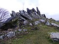
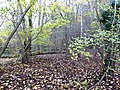
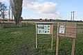
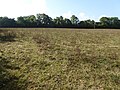
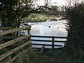
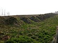
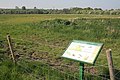
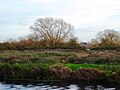
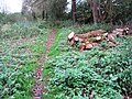
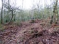
LRWT manages thirty-three reserves covering almost 1,200 hectares (3,000 acres). [12] Nineteen are designated Sites of Special Scientific Interest, two are national nature reserves, one is a Ramsar internationally important wetland site, one is a Special Protection Area under the European Union Directive on the Conservation of Wild Birds, two are Nature Conservation Review sites, three contain Geological Conservation Review sites, one contains a scheduled monument, one is a local nature reserve and two are owned by the National Trust. The largest is Rutland Water at 393 hectares (970 acres), a major wetland area which is one of the richest reservoirs for wintering wildfowl in the country. [13] The smallest is Bloody Oaks Quarry at 1.3 hectares (3.2 acres), which has species-rich grassland on Jurassic limestone. [14]

Map all coordinates using: OpenStreetMap

Sites

SitePhotographArea [lower-alpha 2] Location [lower-alpha 2] Public accessClassificationsDescription
Altar Stones [15] Altar Stones 9.jpg 3.7 hectares
(9.1 acres)
Leicester
52°41′31″N1°17′02″W / 52.692°N 1.284°W / 52.692; -1.284 (Altar Stones)
SK 485107
YESThis site has outcrops of Precambrian volcanic rocks, which have uncommon lichens growing on them. The main habitat is heath grassland, and there are the remains of drystone walls and an old mill. [15]
Bloody Oaks Quarry [14] Bloody Oaks Quarry - geograph.org.uk - 166460.jpg 1.3 hectares
(3.2 acres)
Stamford
52°41′10″N0°33′58″W / 52.686°N 0.566°W / 52.686; -0.566 (Bloody Oaks Quarry)
SK 970108
YES SSSI [16] This site has species-rich grassland on Jurassic limestone. The dominant grasses are tor-grass and upright brome and flora include rock-rose, salad burnet, yellow-wort and autumn gentian. [17]
Charley Woods [18] Fallen tree at Charley Woods - geograph.org.uk - 350255.jpg 26.8 hectares
(66 acres)
Loughborough
52°43′44″N1°17′49″W / 52.729°N 1.297°W / 52.729; -1.297 (Charley Woods)
SK 476148
YESThese ancient woods are dominated by pedunculate oak, with sparse ground flora. There is a considerable amount of dead wood, which attracts a variety of birds, including all three native species of woodpecker. [18]
Charnwood Lodge [19] The Bomb Rocks, Charnwood Lodge SSSI, Charnwood Forest.jpg 193.5 hectares
(478 acres)
Coalville
52°44′06″N1°19′23″W / 52.735°N 1.323°W / 52.735; -1.323 (Charnwood Lodge)
SK 458155
PP GCR, [20] [21] NNR, [22] SSSI [23] This is the largest area of moorland in the East Midlands, and it is mainly covered by bracken on dry hills, while wet heath is dominated by purple moor-grass. The site is geologically important for the 'bomb' rocks, volcanic blocks dating the Ediacaran period around 600 million years ago. [19] [24]
Cloud Wood [25] Cloud Wood 2.jpg 33 hectares
(82 acres)
Loughborough
52°47′20″N1°22′59″W / 52.789°N 1.383°W / 52.789; -1.383 (Cloud Wood)
SK 417214
PP SSSI [26] Cloud Wood is an ancient semi-natural wood on clay. The dominant trees are ash and pedunculate oak, and ground flora is very diverse, including pendulous sedge, yellow archangel and giant bellflower. [27]
Cossington Meadows [28] Cossington Meadows - geograph.org.uk - 132171.jpg 88.9 hectares
(220 acres)
Leicester
52°42′40″N1°07′05″W / 52.711°N 1.118°W / 52.711; -1.118 (Cossington Meadows)
SK 597130
YESFlora on this wetland site include flowering rush, purple loosestrife and blue water-speedwell. There are several pools which attract wildfowl, such as gadwall and tufted duck, which breed on the site. [28]
Cribb's Meadow [29] Cribb's Meadow 1.jpg 5 hectares
(12 acres)
Grantham
52°45′32″N0°40′08″W / 52.759°N 0.669°W / 52.759; -0.669 (Cribb's Meadow)
SK 899188
YES NCR, [30] NNR, [22] SSSI [31] The embankment of a disused railway runs through this ridge and furrow neutral meadow on boulder clay. The diverse flora includes adder's tongue fern, pepper saxifrage, hayrattle and green-winged orchid. [32]
Croft Pasture [33] Stile into water. - geograph.org.uk - 1136395.jpg 5.8 hectares
(14 acres)
Leicester
52°35′17″N1°15′04″W / 52.588°N 1.251°W / 52.588; -1.251 (Croft Pasture)
SP 509958
YES SSSI [34] The River Soar runs through this unimproved grazed meadow, which is dominated by common bent and crested dog's-tail. A knoll in the north of the site has uncommon flora such as meadow saxifrage, common stork's-bill and subterranean clover. [33] [35]
Dimminsdale [36] Dimminsdale Nature Reserve - geograph.org.uk - 331478.jpg 23.5 hectares
(58 acres)
Coalville
52°47′35″N1°26′38″W / 52.793°N 1.444°W / 52.793; -1.444 (Dimminsdale)
SK 376219 [lower-alpha 3]
PP GCR, [37] SSSI [38] Dimminsdale has semi-natural woodland and one of the largest areas of unimproved acidic grassland in the county. Earl Ferrers' lead mine, which is located on the site, has a unique and complex mixture of minerals such as galena and zinc blende. [39]
Great Merrible Wood [40] Great Merrible Wood 7.jpg 12 hectares
(30 acres)
Uppingham
52°33′25″N0°46′16″W / 52.557°N 0.771°W / 52.557; -0.771 (Great Merrible Wood)
SP 834962
YES SSSI [41] This is a surviving fragment of the medieval Leighfield Forest. [42] It is semi-natural ancient woodland with several unusual herbs, such as broadleaved helleborine, herb paris and violet helleborine. It is thought to have the most diverse fungi of any wood in the county. [40]
Holwell Reserves [43] Brown's Hill Quarry - geograph.org.uk - 1183115.jpg 16.4 hectares
(41 acres)
Melton Mowbray
52°48′11″N0°54′07″W / 52.803°N 0.902°W / 52.803; -0.902 (Holwell Reserves)
SK 741234
YESFormer quarries on this site have soil which is low in nutrients and lime-rich, creating conditions for many species of wildflower to flourish. Old mine tunnels are used by Natterer's, Daubenton's, brown long-eared and pipistrelle bats. [43]
Kelham Bridge [44] Kelham Bridge Nature Reserve - geograph.org.uk - 1571161.jpg 8.1 hectares
(20 acres)
Coalville
52°42′14″N1°23′56″W / 52.704°N 1.399°W / 52.704; -1.399 (Kelham Bridge)
SK 407120
YESThe conversion of this former sewage disposal site to a nature reserve was completed in 2002. The River Sence has been diverted to create meanders, extending flooded areas and reedbeds; 101 bird, 19 butterfly and 16 dragonfly species have been recorded. [44]
Ketton Quarry [45] Hummocks at Ketton Quarry, Rutland.jpg 27.5 hectares
(68 acres)
Stamford
52°38′13″N0°33′29″W / 52.637°N 0.558°W / 52.637; -0.558 (Ketton Quarry)
SK 977053
YES SSSI [46] Calcareous grassland on this site provides a habitat for rare moths, grizzled and dingy skipper butterflies, common lizards and adders. There are also areas of woodland, which have the only yellow bird's-nest plants in the county, and scrub, which is valuable for birds such as the turtle dove. [45]
Launde Woods [47] Launde Big Wood, with derelict cottage - geograph.org.uk - 168431.jpg 99 hectares
(240 acres)
Leicester
52°37′26″N0°50′31″W / 52.624°N 0.842°W / 52.624; -0.842 (Launde Woods)
SK 785036
YES SSSI [48] This site is in two separate areas. Launde Big Wood is ancient semi-natural woodland with a rich ground flora, including wood anemone, wood forget-me-not and sweet woodruff. Most of Launde Park Wood has been planted with conifers, but the northern third has the same range of plants as the Big Wood. [47]
Lea Meadows [49] Lea Meadows 9.jpg 12 hectares
(30 acres)
Leicester
52°41′56″N1°15′11″W / 52.699°N 1.253°W / 52.699; -1.253 (Lea Meadows)
SK 506115
YES SM, [50] SSSI [51] Over 240 species of plants have been recorded on these unimproved marshy meadows, and there is a stream which has white-clawed crayfish and brook lampreys, both of which are legally protected. Part of the site is surrounded by a medieval moat. [49]
Loughborough Big Meadow [52] Loughborough Big Meadow - geograph.org.uk - 422808.jpg 35.3 hectares
(87 acres)
Loughborough
52°47′28″N1°12′14″W / 52.791°N 1.204°W / 52.791; -1.204 (Loughborough Big Meadow)
SK 538218
YES SSSI [53] Summerpool Brook runs through this unimproved hay meadow, which is periodically flooded. It has diverse herbs, including great burnet, meadow saxifrage, yellow rattle, common bird's-foot trefoil, pepper-saxifrage and the nationally uncommon narrow-leaved water-dropwort. [52]
Lucas Marsh [54] Lucas Marsh 4.jpg 1.5 hectares
(3.7 acres)
Oadby
52°35′31″N1°05′06″W / 52.592°N 1.085°W / 52.592; -1.085 (Lucas Marsh)
SP 621998
YES LNR [55] The marsh is dominated by greater willowherb and common reed, while there are also areas of rough grassland, a hedge, trees and scrub. Butterflies include small tortoiseshell, speckled wood, peacock and orange tip. [54]
Merry's Meadows [56] Merry's Meadows 3.jpg 12.6 hectares
(31 acres)
Oakham
52°43′52″N0°36′43″W / 52.731°N 0.612°W / 52.731; -0.612 (Merry's Meadows)
SK 938157
YES SSSI [57] These ridge and furrow meadows are the only known location in the county for the frog orchid. The soil is on boulder clay, and grasses include crested dog's-tail, sweet vernal-grass, upright brome, downy oat-grass and quaking grass. There are four ponds with common and great crested newts. [58]
Mountsorrel Meadows [59] Mountsorrel Meadows 2.jpg 12.6 hectares
(31 acres)
Leicester
52°43′12″N1°07′41″W / 52.720°N 1.128°W / 52.720; -1.128 (Mountsorrel Meadows)
SK 590140
PPThis site on the bank of the River Soar was farmland until 2006, but is now managed for wildlife. Areas of wet woodland have been created by a combination of planting and natural regeneration. Other parts of the site are now wet grassland and wet scrapes. [59]
Narborough Bog [60] Narborough Bog 1.jpg 9.2 hectares
(23 acres)
Leicester
52°34′34″N1°11′28″W / 52.576°N 1.191°W / 52.576; -1.191 (Narborough Bog)
SP 549979
YES SSSI [61] This site has a large area of common reed on peat, and there is also wet woodland, dominated by crack willow. Both areas have diverse butterflies and moths, including several locally uncommon species. In the south of the site there are two wet grazed meadows and more woodland. [62] [60]
Prior's Coppice [63] Part of Prior's Coppice SSSI - geograph.org.uk - 348339.jpg 29 hectares
(72 acres)
Oakham
52°38′13″N0°46′19″W / 52.637°N 0.772°W / 52.637; -0.772 (Prior's Coppice)
SK 832051
YES SSSI [64] This wood is on poorly drained soils derived from Jurassic Upper Lias clay and glacial boulder clay. The dominant trees are ash and oak, with field maple and hazel in the shrub layer. There is a diverse ground flora typical of ancient clay woods. [65]
Rocky Plantation [66] Rocky Plantation 3.jpg 3.4 hectares
(8.4 acres)
Leicester
52°42′07″N1°16′19″W / 52.702°N 1.272°W / 52.702; -1.272 (Rocky Plantation)
SK 493118
YES NT [66] This site has mixed woodland, including some mature sessile oaks, and rocky outcrops. There is a variety of fungi and birds, including great spotted woodpeckers and nuthatches. [66]
Rutland Water [67] Barnsdale Creek, Rutland Water - geograph.org.uk - 42213.jpg 393 hectares
(970 acres)
Oakham
52°39′14″N0°39′43″W / 52.654°N 0.662°W / 52.654; -0.662 (Rutland Water)
SK 906071
YES NCR, [68] Ramsar, [69] SPA, [70] SSSI [71] This site has four-man-made lagoons, with islands which provide a safe area for nesting birds. There are also wildflower meadows with species rich hedgerows, mature woods and plantations dating to the 1970s. [67]
Stonesby Quarry [72] Stonesby Quarry Nature Reserve - geograph.org.uk - 592884.jpg 4 hectares
(9.9 acres)
Melton Mowbray
52°48′58″N0°47′42″W / 52.816°N 0.795°W / 52.816; -0.795 (Stonesby Quarry)
SK 813250
YES SSSI [73] This site on Jurassic Lincolnshire Limestone has grassland with diverse herb species, such as autumn gentian, cowslip, dwarf thistle, small scabious, pyramidal orchid and clustered bellflower. [74]
Tilton Railway Cutting [75] Tilton Cutting (SSSI) - geograph.org.uk - 423638.jpg 3.1 hectares
(7.7 acres)
Leicester
52°38′31″N0°52′37″W / 52.642°N 0.877°W / 52.642; -0.877 (Tilton Railway Cutting)
SK 761055
YES GCR, [76] SSSI [77] This is the best site in the East Midlands which exposes the sequence of rocks in the Lower Jurassic around 180 million years ago. There are many fossils, including Tiltoniceras acutum , an age-diagnostic ammonite. [78] The site has rich flora and diverse common birds. [75]
Ulverscroft [79] Ulverscroft Nature Reserve 5.jpg 56 hectares
(140 acres)
Leicester
52°42′25″N1°16′34″W / 52.707°N 1.276°W / 52.707; -1.276 (Ulverscroft)
SK 490124
YES NT, [79] SSSI [51] The site has diverse habitats with woodland, heath, wet grassland, a pond, a meadow, marshes and sphagnum bog. The meadow has a rich flora, including fragrant orchid, devil's-bit scabious and bitter vetch. [79]
Wanlip Meadows [80] Wanlip Meadows 3.jpg 16.2 hectares
(40 acres)
Leicester
52°41′17″N1°06′32″W / 52.688°N 1.109°W / 52.688; -1.109 (Wanlip Meadows)
SK 603104
YESThese meadows, which are sometimes flooded by the River Soar, are grazed by cattle. There are many birds, including the uncommon Temminck's stint and wood sandpiper. Invertebartes include grass snakes, frogs and toads. [80]
Wymeswold Meadows [81] Wymeswold Meadows 3.jpg 4.5 hectares
(11 acres)
Loughborough
52°48′07″N1°11′28″W / 52.802°N 1.191°W / 52.802; -1.191 (Wymeswold Meadows)
SK 614231
YESThe River Mantle runs through steeply sloping banks in this grassland site, which has diverse flora and invertebrates. Butterflies include orange tips, small coppers, common blues and small heaths. [81]
Wymondham Rough [82] Former canal, Wymondham Rough SSSI - geograph.org.uk - 179301.jpg 12.5 hectares
(31 acres)
Melton Mowbray
52°44′53″N0°46′12″W / 52.748°N 0.770°W / 52.748; -0.770 (Wymondham Rough)
SK 831174
YES SSSI [83] This site has grassland, woodland, a stretch of disused canal, a marsh and ponds. [82] The clay grassland has a rich flora, dominated by common bent, Yorkshire fog, false oat-grass and cock's foot. A poorly drained area has plants such as water avens, and there are drier soils in the west of the site. [84]

See also

Notes

  1. Members receive a reserves guide, a magazine three times a year and a discount on an annual permit to Rutland Water. [1]
  2. 1 2 The area and location are taken from the Wildlife Trust page for each site.
  3. Dimminsdale is partly in Derbyshire.

Related Research Articles

<span class="mw-page-title-main">Charnwood Forest</span> Upland area in Leicestershire, England

Charnwood Forest is a hilly tract in north-western Leicestershire, England, bounded by Leicester, Loughborough and Coalville. The area is undulating, rocky and picturesque, with barren areas. It also has some extensive tracts of woodland; its elevation is generally 600 feet (180 m) and upwards, the area exceeding this height being about 6,100 acres (25 km2). The highest point, Bardon Hill, is 912 feet (278 m). On its western flank lies an abandoned coalfield, with Coalville and other former mining villages, now being regenerated and replanted as part of the National Forest. The M1 motorway, between junctions 22 and 23, cuts through Charnwood Forest.

<span class="mw-page-title-main">Suffolk Wildlife Trust</span>

Suffolk Wildlife Trust (SWT) describes itself as the county's "nature charity – the only organisation dedicated wholly to safeguarding Suffolk's wildlife and countryside." It is a registered charity, and its headquarters is at Brooke House in Ashbocking, near Ipswich. It was founded in 1961, and is one of 46 wildlife trusts covering the Great Britain and Northern Ireland. As of March 2017, it has 13,200 members, and it manages 3,120 hectares of land in 60 nature reserves, most of which are open to the public. It had an income of £3.9 million in the year to 31 March 2017.

<span class="mw-page-title-main">Berkshire, Buckinghamshire and Oxfordshire Wildlife Trust</span> Wildlife conservation charity

The Berkshire, Buckinghamshire and Oxfordshire Wildlife Trust (BBOWT), is a Wildlife Trust covering the counties of Berkshire, Buckinghamshire and Oxfordshire in England.

<span class="mw-page-title-main">Charnwood Lodge</span>

Charnwood Lodge is a 134.2-hectare (332-acre) biological and geological Site of Special Scientific Interest in Charnwood Forest, east of Coalville in Leicestershire. It is a national nature reserve, and contains two Geological Conservation Review sites. It is managed by the Leicestershire and Rutland Wildlife Trust.

<span class="mw-page-title-main">Dimminsdale</span>

Dimminsdale is a 37 hectare geological biological and Site of Special Scientific Interest partly in Derbyshire and partly in Leicestershire. It is located east of Calke in Derbyshire. It is a Geological Conservation Review site, and a area of 23.5 hectares is owned by Severn Trent Water and managed by the Leicestershire and Rutland Wildlife Trust.

<span class="mw-page-title-main">Ketton Quarries</span>

Ketton Quarries is a 115.6-hectare (286-acre) biological and geological Site of Special Scientific Interest east of Ketton in Rutland. It is a Geological Conservation Review site, and an area of 27.5 hectares is managed by the Leicestershire and Rutland Wildlife Trust.

<span class="mw-page-title-main">Loughborough Meadows</span>

Loughborough Meadows is a 60.5 hectares biological Site of Special Scientific Interest on the northern outskirts of Loughborough in Leicestershire, England. An area of 35.3 hectares is managed as a nature reserve by the Leicestershire and Rutland Wildlife Trust.

<span class="mw-page-title-main">Cribb's Meadow</span>

Cribb's Meadow is a 4.2-hectare (10-acre) nature reserve east of Wymondham in Leicestershire. It is owned and managed by the Leicestershire and Rutland Wildlife Trust, and is designated a biological Site of Special Scientific Interest under the name Cribb's Lodge Meadows. It is also a National Nature Reserve and a Nature Conservation Review site, Grade 2.

<span class="mw-page-title-main">Stonesby Quarry</span>

Stonesby Quarry is a 3.2 hectares biological Site of Special Scientific Interest between Stonesby and Waltham on the Wolds in Leicestershire. It is part of a 4 hectare nature reserve managed by the Leicestershire and Rutland Wildlife Trust.

<span class="mw-page-title-main">Breedon Cloud Wood and Quarry</span>

Breedon Cloud Wood and Quarry is a 63.3 hectares biological and geological Site of Special Scientific Interest north-east of Worthington in Leicestershire. It is a Geological Conservation Review site. An area of 33 hectares is managed as a nature reserve by the Leicestershire and Rutland Wildlife Trust.

<span class="mw-page-title-main">Ulverscroft Valley</span>

Ulverscroft Valley is a 110.8 hectares biological Site of Special Scientific Interest north-west of Markfield in Leicestershire. The site is in five separate blocks, and two areas are nature reserves managed by the Leicestershire and Rutland Wildlife Trust (LRWT). Lea Meadows is owned by the LRWT and it is also a scheduled monument. Part of Ulverscroft Nature Reserve is owned by the LRWT and part is owned by the National Trust and leased to the LRWT.

References

  1. "Become a member". Leicestershire and Rutland Wildlife Trust. Retrieved 28 January 2018.
  2. "Organisation". Leicestershire and Rutland Wildlife Trust. Archived from the original on 18 August 2017. Retrieved 23 January 2018.
  3. "Vision". Leicestershire and Rutland Wildlife Trust. Archived from the original on 18 August 2017. Retrieved 23 January 2018.
  4. "Leicestershire". Encyclopædia Britannica. Archived from the original on 24 October 2017. Retrieved 18 December 2017.
  5. "Our Population". Leicester and Leicestershire Enterprise Partnership. Archived from the original on 18 December 2017. Retrieved 18 December 2017.
  6. "About us". Leicester City Council. Archived from the original on 2 June 2017. Retrieved 18 December 2017.
  7. "Find your local council". Leicestershire County Council. Archived from the original on 24 April 2016. Retrieved 18 December 2017.
  8. "Rutland". East Midlands Oral History Archive. University of Leicester. Archived from the original on 19 September 2015. Retrieved 20 November 2017.
  9. "Oakham". Discover Rutland. Retrieved 20 November 2017.
  10. "About us". Rutland County Council. Archived from the original on 11 December 2017. Retrieved 11 December 2017.
  11. "Rutland Key Statistical Data". Rutland County Council. November 2016. pp. 6, 39.
  12. "Nature Reserves". Leicestershire and Rutland Wildlife Trust. Archived from the original on 18 August 2017. Retrieved 23 January 2018.
  13. "Rutland Water citation" (PDF). Sites of Special Scientific Interest. Natural England. Archived from the original (PDF) on 11 August 2017. Retrieved 11 August 2017.
  14. 1 2 "Bloody Oaks Quarry". Leicestershire and Rutland Wildlife Trust. Archived from the original on 11 August 2017. Retrieved 11 August 2017.
  15. 1 2 "Altar Stones". Leicestershire and Rutland Wildlife Trust. Archived from the original on 12 August 2017. Retrieved 11 August 2017.
  16. "Designated Sites View: Bloody Oaks Quarry". Sites of Special Scientific Interest. Natural England. Retrieved 11 August 2017.
  17. "Bloody Oaks Quarry citation" (PDF). Sites of Special Scientific Interest. Natural England. Archived (PDF) from the original on 4 March 2016. Retrieved 10 August 2017.
  18. 1 2 "Charley Woods". Leicestershire and Rutland Wildlife Trust. Archived from the original on 11 August 2017. Retrieved 11 August 2017.
  19. 1 2 "Charnwood Lodge". Leicestershire and Rutland Wildlife Trust. Archived from the original on 9 August 2017. Retrieved 11 August 2017.
  20. "Charnwood Lodge (Precambrian of England & Wales)". Geological Conservation Review. Joint Nature Conservation Committee. Archived from the original on 9 August 2017. Retrieved 8 August 2017.
  21. "Charnwood Lodge & Warren Hills (Precambrian of England & Wales)". Geological Conservation Review. Joint Nature Conservation Committee. Archived from the original on 9 August 2017. Retrieved 8 August 2017.
  22. 1 2 "Leicestershire's National Nature Reserves". Natural England. 31 October 2008. Archived from the original on 9 August 2017. Retrieved 8 August 2017.
  23. "Designated Sites View: Charnwood Lodge". Sites of Special Scientific Interest. Natural England. Retrieved 11 August 2017.
  24. "Charnwood Lodge citation" (PDF). Sites of Special Scientific Interest. Natural England. Archived (PDF) from the original on 4 March 2016. Retrieved 22 September 2017.
  25. "Cloud Wood". Leicestershire and Rutland Wildlife Trust. Archived from the original on 11 August 2017. Retrieved 11 August 2017.
  26. "Designated Sites View: Breedon Cloud Wood and Quarry". Sites of Special Scientific Interest. Natural England. Archived from the original on 24 January 2018. Retrieved 11 August 2017.
  27. "Breedon Cloud Wood and Quarry citation" (PDF). Sites of Special Scientific Interest. Natural England. Archived (PDF) from the original on 3 March 2016. Retrieved 19 November 2017.
  28. 1 2 "Cossington Meadows". Leicestershire and Rutland Wildlife Trust. Archived from the original on 11 August 2017. Retrieved 11 August 2017.
  29. "Cribb's Meadow". Leicestershire and Rutland Wildlife Trust. Archived from the original on 9 August 2017. Retrieved 11 August 2017.
  30. Ratcliffe, Derek, ed. (1977). A Nature Conservation Review. Vol. 2. Cambridge, UK: Cambridge University Press. p. 158. ISBN   0521-21403-3.
  31. "Designated Sites View: Cribb's Lodge Meadows". Sites of Special Scientific Interest. Natural England. Archived from the original on 4 September 2017. Retrieved 11 August 2017.
  32. "Cribb's Lodge Meadows citation" (PDF). Sites of Special Scientific Interest. Natural England. Archived (PDF) from the original on 4 March 2016. Retrieved 4 September 2017.
  33. 1 2 "Croft Pasture". Leicestershire and Rutland Wildlife Trust. Archived from the original on 9 August 2017. Retrieved 11 August 2017.
  34. "Designated Sites View: Croft Pasture". Sites of Special Scientific Interest. Natural England. Archived from the original on 10 November 2017. Retrieved 11 August 2017.
  35. "Croft Pasture citation" (PDF). Sites of Special Scientific Interest. Natural England. Archived (PDF) from the original on 4 March 2016. Retrieved 9 November 2017.
  36. "Dimminsdale". Leicestershire and Rutland Wildlife Trust. Archived from the original on 9 August 2017. Retrieved 11 August 2017.
  37. "Earl Ferrers' Lead Mine (Mineralogy of Peak District, Leicestershire, Cheshire & Shropshire)". Geological Conservation Review. Joint Nature Conservation Committee. Archived from the original on 11 November 2017. Retrieved 11 November 2017.
  38. "Designated Sites View: Dimminsdale". Sites of Special Scientific Interest. Natural England. Archived from the original on 24 January 2018. Retrieved 11 August 2017.
  39. "Dimminsdale citation" (PDF). Sites of Special Scientific Interest. Natural England. Archived (PDF) from the original on 4 March 2016. Retrieved 11 November 2017.
  40. 1 2 "Great Merrible Wood". Leicestershire and Rutland Wildlife Trust. Archived from the original on 9 August 2017. Retrieved 11 August 2017.
  41. "Designated Sites View: Eye Brook Valley Woods". Sites of Special Scientific Interest. Natural England. Retrieved 11 August 2017.
  42. "Eye Brook Valley Woods citation" (PDF). Sites of Special Scientific Interest. Natural England. Archived (PDF) from the original on 4 March 2016. Retrieved 2 October 2017.
  43. 1 2 "Holwell Reserves". Leicestershire and Rutland Wildlife Trust. Archived from the original on 12 August 2017. Retrieved 11 August 2017.
  44. 1 2 "Kelham Bridge". Leicestershire and Rutland Wildlife Trust. Archived from the original on 11 August 2017. Retrieved 11 August 2017.
  45. 1 2 "Ketton Quarry". Leicestershire and Rutland Wildlife Trust. Archived from the original on 11 August 2017. Retrieved 11 August 2017.
  46. "Designated Sites View: Ketton Quarries". Sites of Special Scientific Interest. Natural England. Archived from the original on 24 January 2018. Retrieved 11 August 2017.
  47. 1 2 "Launde Woods". Leicestershire and Rutland Wildlife Trust. Archived from the original on 9 August 2017. Retrieved 11 August 2017.
  48. "Designated Sites View: Launde Big Wood". Sites of Special Scientific Interest. Natural England. Retrieved 11 August 2017.
  49. 1 2 "Lea Meadows". Leicestershire and Rutland Wildlife Trust. Archived from the original on 12 August 2017. Retrieved 11 August 2017.
  50. "Moat at Lea Meadows". Historic England. Archived from the original on 12 August 2017. Retrieved 11 August 2017.
  51. 1 2 "Designated Sites View: Ulverscroft Valley". Sites of Special Scientific Interest. Natural England. Archived from the original on 1 January 2018. Retrieved 11 August 2017.
  52. 1 2 "Loughborough Big Meadow". Leicestershire and Rutland Wildlife Trust. Archived from the original on 9 August 2017. Retrieved 11 August 2017.
  53. "Designated Sites View: Loughborough Meadows". Sites of Special Scientific Interest. Natural England. Archived from the original on 24 January 2018. Retrieved 11 August 2017.
  54. 1 2 "Lucas' Marsh". Leicestershire and Rutland Wildlife Trust. Archived from the original on 11 August 2017. Retrieved 11 August 2017.
  55. "Lucas Marsh". Local Nature Reserves. Natural England. 11 September 2013. Archived from the original on 10 August 2017. Retrieved 11 August 2017.
  56. "Merry's Meadows". Leicestershire and Rutland Wildlife Trust. Archived from the original on 11 August 2017. Retrieved 11 August 2017.
  57. "Designated Sites View: Greetham Meadows". Sites of Special Scientific Interest. Natural England. Archived from the original on 4 September 2017. Retrieved 11 August 2017.
  58. "Greetham Meadowscitation" (PDF). Sites of Special Scientific Interest. Natural England. Archived (PDF) from the original on 4 March 2016. Retrieved 4 September 2017.
  59. 1 2 "Mountsorrel Meadows". Leicestershire and Rutland Wildlife Trust. Archived from the original on 11 August 2017. Retrieved 11 August 2017.
  60. 1 2 "Narborough Bog". Leicestershire and Rutland Wildlife Trust. Archived from the original on 9 August 2017. Retrieved 11 August 2017.
  61. "Designated Sites View: Narborough Bog". Sites of Special Scientific Interest. Natural England. Retrieved 11 August 2017.
  62. "Narborough Bog citation". Sites of Special Scientific Interest. Natural England. Archived from the original on 9 August 2017. Retrieved 24 October 2017.
  63. "Prior's Coppice". Leicestershire and Rutland Wildlife Trust. Archived from the original on 11 August 2017. Retrieved 11 August 2017.
  64. "Designated Sites View: Prior's Coppice". Sites of Special Scientific Interest. Natural England. Archived from the original on 14 September 2017. Retrieved 11 August 2017.
  65. "Prior's Coppice citation" (PDF). Sites of Special Scientific Interest. Natural England. Archived (PDF) from the original on 4 March 2016. Retrieved 13 September 2017.
  66. 1 2 3 "Rocky Plantation". Leicestershire and Rutland Wildlife Trust. Archived from the original on 11 August 2017. Retrieved 11 August 2017.
  67. 1 2 "Rutland Water". Leicestershire and Rutland Wildlife Trust. Archived from the original on 11 August 2017. Retrieved 11 August 2017.
  68. "Rutland Water citation" (PDF). Sites of Special Scientific Interest. Natural England. Archived from the original (PDF) on 11 August 2017. Retrieved 11 August 2017.
  69. "Designated Sites View: Rutland Water". Ramsar Site. Natural England. Retrieved 11 August 2017.
  70. "Designated Sites View: Rutland Water". Special Protection Area. Natural England. Retrieved 11 August 2017.
  71. "Designated Sites View: Rutland Water". Sites of Special Scientific Interest. Natural England. Archived from the original on 20 November 2017. Retrieved 11 August 2017.
  72. "Stonesby Quarry". Leicestershire and Rutland Wildlife Trust. Archived from the original on 9 August 2017. Retrieved 11 August 2017.
  73. "Designated Sites View: Stonesby Quarry". Sites of Special Scientific Interest. Natural England. Retrieved 11 August 2017.
  74. "Stonesby Quarry citation" (PDF). Sites of Special Scientific Interest. Natural England. Archived (PDF) from the original on 4 March 2016. Retrieved 16 November 2017.
  75. 1 2 "Tilton Railway Cutting". Leicestershire and Rutland Wildlife Trust. Archived from the original on 9 August 2017. Retrieved 11 August 2017.
  76. "Tilton Railway Cutting (Hettangian, Sinemurian and Pliensbachian)". Geological Conservation Review. Joint Nature Conservation Committee. Retrieved 8 August 2017.
  77. "Designated Sites View: Tilton Cutting". Sites of Special Scientific Interest. Natural England. Retrieved 11 August 2017.
  78. "Tilton Cutting citation" (PDF). Sites of Special Scientific Interest. Natural England. Archived (PDF) from the original on 4 March 2016. Retrieved 21 November 2017.
  79. 1 2 3 "Ulverscroft". Leicestershire and Rutland Wildlife Trust. Archived from the original on 9 August 2017. Retrieved 11 August 2017.
  80. 1 2 "Wanlip Meadows". Leicestershire and Rutland Wildlife Trust. Archived from the original on 12 August 2017. Retrieved 11 August 2017.
  81. 1 2 "Wymeswold Meadows". Leicestershire and Rutland Wildlife Trust. Archived from the original on 11 August 2017. Retrieved 11 August 2017.
  82. 1 2 "Wymondham Rough". Leicestershire and Rutland Wildlife Trust. Archived from the original on 9 August 2017. Retrieved 11 August 2017.
  83. "Designated Sites View: Wymondham Rough". Sites of Special Scientific Interest. Natural England. Retrieved 11 August 2017.
  84. "Wymondham Rough citation". Sites of Special Scientific Interest. Natural England. Archived from the original on 9 August 2017. Retrieved 24 November 2017.

52°33′39″N1°10′35″W / 52.560699°N 1.176274°W / 52.560699; -1.176274