The district was created on 1 April 1974 under the Local Government Act 1972, covering the area of two former districts, which were both abolished at the same time:[2]
The government initially named the new district "Bosworth".[3] The shadow council elected to oversee the transition to the new system requested a change to "Hinckley and Bosworth", which was agreed by the government on 20 November 1973, before the new district formally came into being.[4] The new district was awarded borough status from its creation, allowing the chair of the council to take the title of mayor.[5]
The council has been under Liberal Democrat majority control since 2019.
The first election to the council was held in 1973, initially operating as a shadow authority alongside the outgoing authorities until coming into its powers on 1 April 1974. Since 1974 political control of the council has been as follows:[10]
The role of mayor is largely ceremonial in Hinckley and Bosworth. Political leadership is instead provided by the leader of the council. The leaders since 2003 have been:[11]
Since the last boundary changes in 2003 the council has comprised 34 councillors, representing 16 wards, with each ward electing one, two or three councillors. Elections are held every four years.[23]
Former Council Offices, Argents Mead, Hinckley: demolished 2014.
The council is based at the Hinckley Hub on Rugby Road in Hinckley. The building was completed in 2013.[24] Prior to 2013 the council was based at the Council Offices at Argents Mead, which had been built in 1968 for the old Hinckley Urban District Council.[25]
There are a number of geographical features which shape the landscape of Hinckley & Bosworth.
Two large neighbouring urban areas lie to the south of the borough: Hinckley and Burbage and Barwell and Earl Shilton. A narrow green wedge separates the two conurbations, which is increasingly being occupied by leisure facilities such as the Marston's Stadium and a new leisure centre.[26] To the east of the wedge lies Burbage Common and Woods, a large popular green recreational area.
The west of the borough is largely flat in nature, dominated by the River Sence flood plain. This area of the borough is largely rural, consisting of a number of very small villages and hamlets.
At the northern and eastern edges of the borough lie several settlements (including Bagworth, Desford, Groby, Markfield, Ratby and Thornton) which largely relate to Leicester; in particular the most northern villages have little to do with the main administrative centre of Hinckley. The northern area of the borough also forms part of Charnwood Forest.
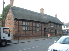
Stoke Golding, is home to the medieval Church of St. Margaret's.
The site of the Battle of Bosworth, administered by Leicestershire County Council, includes an interpretation centre at Ambion Hill, where Richard III encamped the night before the battle. St. James's Church at Dadlington is the place where many of the dead were buried and where a chantry was founded on their behalf.
The Battlefield Line is a preserved railway which runs over part of the alignment of the former railway from Nuneaton to Ashby-de-la-Zouch. It is home to the Shackerstone Diesel Group.[28]
Twycross Zoo is notable for having the largest collection of primates in the world.
Thornton Reservoir is a former 75-acre (300,000m2) drinking water reservoir that is no longer in use.
The only railway station in the borough on the National Rail network is Hinckley railway station on the South Leicestershire Line opened by the LNWR between 1862 and 1864. Currently there are direct services to Birmingham New Street and Leicester only with additional services to/from Cambridge and Stansted Airport in the peak.
There was also a branch line serving the market town of Market Bosworth which connected both Nuneaton and Hinckley to both Coalville and Ashby. The line closed to regular traffic in 1970 and is now part of the Battlefield Line. There was also a small stub to Hinckley but was never opened or used. There was also a stub to Nuneaton via Stoke Golding.
The last line that runs through part the borough is the Leicester to Burton Line which had a station in Desford, the station closed in 1964 but the line remains open for traffic. The station also served as a junction for the branch line to Leicester West Bridge on the now defunct Swannington and Leicester Railway. Although the section from Desford to Swannington remains open for freight traffic.
Demography
Hinckley and Bosworth is the second largest borough by population in Leicestershire[29] and has seen significant population growth over recent decades; a trend forecast to continue at least into the short-medium term.
Most of the borough is covered by civil parishes. The pre-1974 Hinckley Urban District became an unparished area on the borough's creation in 1974, but four new parishes have since been created from parts of that area: Burbage, Stoke Golding (both created 1986),[33] Earl Shilton (1995)[34] and Barwell (2007),[35] leaving just the central part of Hinckley itself as unparished. The parish council for Earl Shilton has declared its parish to be a town, allowing it to take the style "town council". (Whilst often referred to as a town, Market Bosworth Parish Council has not formally declared that parish to be a town.)[36]
On a wreath of the colours a dragon Gules preying on a boar passant Argent.
Escutcheon
Per pale indented Argent and Gules on a chief Or three torteaux that in the centre charged with a pierced cinquefoil Ermine the others each charged with a mascle Or.
↑ "Compositions Calculator". The Elections Centre. University of Exeter. Retrieved 21 May 2025. (Put "Hinckley & Bosworth" in search box to see specific results.)
↑ "Council minutes". Hinckley and Bosworth Borough Council. Retrieved 18 August 2022.
This page is based on this Wikipedia article Text is available under the CC BY-SA 4.0 license; additional terms may apply. Images, videos and audio are available under their respective licenses.